 Arctic SDI catalogue
Boundary
Type of resources
Available actions
Topics
Keywords
Contact for the resource
Provided by
Formats
Representation types
Update frequencies
status
Scale
-

Boundary of the urban perimeters of the City of Rouyn-Noranda **This third party metadata element was translated using an automated translation tool (Amazon Translate).**
-

Graphic representation (linear element) of streets on which speed is regulated (L-12036). According to the last adoption of the regulation in 2014**This third party metadata element was translated using an automated translation tool (Amazon Translate).**
-

Ministry of Transportation Regional Boundary is an exclusive geographic area within the province that the Ministry organizational unit is responsible for. Each Ministry Region is partitioned into one or more non-overlapping Ministry Districts that cover the entire Ministry Region
-
Delimitation of the electoral districts of the last municipal elections. Each district is represented by a municipal councillor elected by the district's voters.**This third party metadata element was translated using an automated translation tool (Amazon Translate).**
-
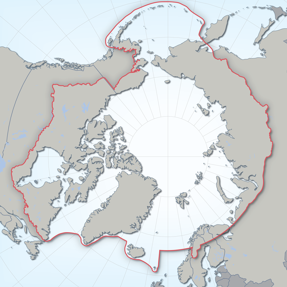
Defines the area covered by the the Conservation of Arctic Flora and Fauna (CAFF) working group of the Arctic Council. Each Arctic Council country was responsible for defining their Arctic boundary.
-
Ministry of Transportation District Boundary is an exclusive area within a region that the Ministry organizational unit is responsible for. Each Ministry District is partitioned into one or more non-overlapping Contract Areas that cover the entire Ministry District
-

Polygons representing the land boundaries of Montreal Island. **This third party metadata element was translated using an automated translation tool (Amazon Translate).**
-
This data contains the current caribou subpopulation (herd) boundaries. Herd boundaries are derived from the best available science and expert knowledge. A caribou subpopulation (herd) boundary is the area required to be managed to achieve a self-sustaining population. Subpopulation boundaries do not overlap even though some caribou subpopulations share portions of their annual range. *This dataset is the focal point of the Caribou in British Columbia - Web Application.
-

Provinces and Territories of Canada, April 2022 Forest Management in Canada Web App: 2017 and 2020 (French)
-
Delimitation of the polling divisions of each of the electoral districts of the last municipal elections**This third party metadata element was translated using an automated translation tool (Amazon Translate).**