 Arctic SDI catalogue
Distribution
Type of resources
Available actions
Topics
Keywords
Contact for the resource
Provided by
Years
Formats
Representation types
Update frequencies
status
Service types
-

Ichthyoplankton surveys were conducted in the Strait of Georgia (British Columbia) during 1979-1981 to ascertain the onset of fish spawning, and to explore distributional pattern and estimate total biomass of fish species. Oblique tows were made using 0.25m2 Bongos equipped with 351 micron Nitex nets of modified SCOR design. All sampling gear was black to minimize potential avoidance and resulting catch bias. The tow procedure generally followed that established by CALCOFI. This dataset contains a compilation of corrected catches of juvenile fishes, fish eggs and fish larvae by station.
-

Description: Spatial information on ecologically important species is needed to support marine spatial planning initiatives in British Columbia’s (BC) marine environment. For data deficient taxa, such as shark species, species distribution models that integrate presence-absence data from different sources can be used to predict their coastwide distributions. Here we provide spatial estimates of the distribution of Blue Shark (Prionace glauca), Salmon Shark (Lamna ditropis), Pacific Sleeper Shark (Somniosus pacificus) and Bluntnose Sixgill Shark (Hexanchus griseus). These estimates were generated using spatial generalized linear mixed effects models and are based on data from two scientific surveys and the commercial hook and line, midwater trawl and bottom trawl fisheries. For each species, we provide predicted probability of occurrence and prediction uncertainty at a 3 km resolution for the British Columbia coast, and parameter estimates for model covariates (depth, slope, year, data source). Results show variable predicted distributions across species, with Blue Shark and Pacific Sleeper Shark showing higher probability of presence along the continental slope, while Salmon Shark show low probability of occurrence coastwide and Bluntnose Sixgill Shark show the highest probability of occurrence in the Strait of Georgia. The results from this study can support ongoing marine spatial planning initiatives in the BC and support the conservation and management of these important species. Methods: Data Sources The species distribution models (SDMs) are based on data from two fishery independent scientific surveys and from the commercial hook and line fishery, which are all conducted within Canadian Pacific waters. The scientific surveys include the Fisheries and Oceans Canada (DFO) hard bottom longline surveys and the International Pacific Halibut Commission (IPHC) fishery-independent setline survey. The study area is bound by the outer convex hull of these three data sources. Other DFO research surveys, such as the groundfish synoptic bottom trawl surveys, midwater trawl surveys and sablefish trap surveys were investigated as potential data sources, but were found to have insufficient presence observations for the species of interest to warrant their inclusion in the analysis. For more information on the details of the source data please refer to Proudfoot et al. 2024. Modelling Approach and Comparison For each species, we fit a suite of generalized linear mixed effects models (GLMMs) using the sdmTMB package (Anderson et al. 2022). For each species, we fit four models, each with a different set of fixed effects/environmental predictors. Additionally, we compared the predictive power of four models for each species, with each model having a different combination of environmental predictors (i.e., slope, depth, slope + depth, none). A summary of the candidate models is provided in Table 2 of Proudfoot et al. 2024. For each species, we selected the model with the highest predictive accuracy (assessed using the predicted log likelihood based on the cross-validation) as the best fit. Spatial Species Distribution Predictions We made predictions of species occurrence using the selected model and a 3 km resolution spatial prediction grid. Our predictions were made for the entire BC coast, and species distribution predictions were made using models fit to the full dataset, as opposed to models fit using cross-validation. We made predictions with year set to 2014 (the approximate midpoint of the dataset) and type set to IPHC (the dataset with the most even spatial distribution of data points). Uncertainties: Because limited survey and commercial catch data exists for deep areas off the continental shelf, predictions in these areas are likely more uncertain than predictions on the shelf. To illustrate this, uncertainty (standard deviation derived from the 500 simulated values from the joint precision matrix of selected models) was mapped across the full study area for each species. Additionally, because these models are based on data that likely do not span the full spatiotemporal extent of the species’ habitat (i.e., mid depths, surface waters, and data across all seasons may not be captured), these results illustrate a snapshot of occurrence but do not account for more complex migration and movement patterns undertaken by these species.
-

This dataset contains point distribution occurrences for fish species found in marine waters of Arctic Canada. It was used to create the distribution maps in the book Marine Fishes of Arctic Canada, edited by B.W. Coad and J.D. Reist (2018) and the DFO Data Report of Fisheries and Aquatic Sciences Distributional Records for Marine Fishes of Arctic Canada (Alfonso et al. 2018). The database includes literature (Coad and Reist 2016) and museum records, anecdotal reports, personal communications and data from fisheries surveys and exploratory cruises. Development of the database began in 1998 and data entry ceased in 2016, although the database will be updated periodically. Consult the book (Coad and Reist 2018) and the Data Report (Alfonso et al. 2018) for further details in regards to the specific sources for each data point by species especially those from sources other than published literature.
-

Spatial distribution of the relative occurrence of Atlantic Wolffish in the annual DFO groundfish research surveys conducted by the Québec (1978-2008) and Gulf (1971-2008) regions. Catch and effort data were aggregated by 100 km² cells. The probability of catching an Atlantic Wolffish in a set and within a cell (relative occurrence) was calculated as the ratio of the number of sets in which a species was recorded and the total number of sets made. This method allows the mapping of catch and effort for numerous time series based on data from different programs in both the whole study area (research surveys and Sentinel Fisheries using bottom trawls and a random stratified design) or in specific areas within the Gulf. Source: Dutil, J.-D., S. Proulx, S. Hurtubise, and J. Gauthier 2011. Recent findings on the life history and catches of wolffish (Anarhichas sp.) in research surveys and in the Sentinel Fisheries and Observer Program for the Estuary and Gulf of St-Lawrence. DFO Can. Sci. Advis. Sec. Res. Doc. 2010/126: x + 71 pages. Associated publication: Dutil, J.-D., Proulx, S., Chouinard, P.-M., and Borcard, D. 2011. A hierarchical classification of the seabed based on physiographic and oceanographic features in the St. Lawrence. Can. Tech. Rep. Fish. Aquat. Sci. 2916: vii + 72 pages. http:/ / www.dfo-mpo.gc.ca/ Library/ 342703.pdf.
-

Identification of significant concentrations of sea pens in the Gulf of St. Lawrence biogeographic unit using Kernel density estimation (KDE). This method was applied to create a modelled biomass surface for each taxa and an aerial expansion method was permitted to identify significant concentrations. Only geo-referenced biomass data have been used to identify the “hot spots”. The borders of the areas were refined using knowledge of null catches and species distribution models. Predictive models were produced using a random forest machine-learning technique. For more details, please refer to this report: Kenchington, E., L. Beazley, C. Lirette, F.J. Murillo, J. Guijarro, V. Wareham, K. Gilkinson, M. Koen Alonso, H. Benoît, H. Bourdages, B. Sainte-Marie, M. Treble, and T. Siferd. 2016. Delineation of Coral and Sponge Significant Benthic Areas in Eastern Canada Using Kernel Density Analyses and Species Distribution Models. DFO Can. Sci. Advis. Sec. Res. Doc. 2016/093. vi + 178 p. http://waves-vagues.dfo-mpo.gc.ca/Library/40577806.pdf The present layer only contains the analysis results for sea pens. Purpose: As part of the Canada's commitment to the identification and protection of sensitive benthic marine ecosystems, maps of the location of significant concentrations of corals and sponges on the east coast of Canada were produced through quantitative analyses of research vessel trawl survey data, supplemented with other data sources where available. The taxa analyzed are sponges (Porifera), large and small gorgonian corals (Alcyonacea), and sea pens (Pennatulacea). However, only the sponges (Porifera) and sea pens (Pennatulacea) have been considered in the analysis concerning the Gulf of St. Lawrence biogeographic unit.
-
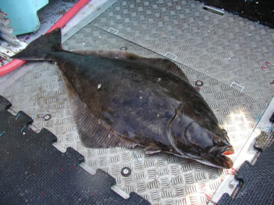
Since 2017, industry-supported scientific surveys targeting Atlantic halibut (Hippoglossus hippoglossus) have been conducted in the Gulf of St. Lawrence and parts of the estuary. The primary objective of the project is to gather data on the species' abundance, distribution, and biological characteristics. To achieve this, a stratified random longline survey is carried out, during which Atlantic halibut of all sizes are measured and tagged using two spaghetti tags. Beginning in 2024, tissue samples from the pelvic fin of each individual were also collected for genetic analysis. Atlantic halibut are captured using longlines equipped with 500 circle hooks. While the length of the leaders varies among vessels, the spacing between leaders ranges from 3.6 to 5.5 meters. Fork length is measured for each individual of commercial species caught - such as Atlantic halibut, cod, redfish, and Greenland halibut (turbot). Measurements are also occasionally taken for non-commercial species. This publication includes the file Donnees_Releve_Fletan_Halibut_Survey_Data, which provides information associated with each sampled station. It also contains the number of Atlantic halibut, cod, redfish and Greenland halibut (turbot) caught at each station. It is important to note that only beginning in 2019 were all commercial species systematically measured. The "NA" values in 2017–2018 do not indicate that no individuals were caught, but rather that they were not measured systematically. Note: There are missing data in various columns of the dataset - use data with caution - if you have any questions please contact the data management team gddaiss-dmsaisb@dfo-mpo.gc.ca.
-

Spatial distribution of the relative occurrence of northern wolffish in the annual DFO groundfish research surveys conducted by the Québec (1978-2008) and Gulf (1971-2008) regions. Catch and effort data were aggregated by 100 km² cells. The probability of catching an northern wolffish in a set and within a cell (relative occurrence) was calculated as the ratio of the number of sets in which a species was recorded and the total number of sets made. This method allows the mapping of catch and effort for numerous time series based on data from different programs in both the whole study area (research surveys and Sentinel Fisheries using bottom trawls and a random stratified design) or in specific areas within the Gulf. Source: Dutil, J.-D., S. Proulx, S. Hurtubise, and J. Gauthier 2011. Recent findings on the life history and catches of wolffish (Anarhichas sp.) in research surveys and in the Sentinel Fisheries and Observer Program for the Estuary and Gulf of St-Lawrence. DFO Can. Sci. Advis. Sec. Res. Doc. 2010/126: x + 71 pages. Associated publication: Dutil, J.-D., Proulx, S., Chouinard, P.-M., and Borcard, D. 2011. A hierarchical classification of the seabed based on physiographic and oceanographic features in the St. Lawrence. Can. Tech. Rep. Fish. Aquat. Sci. 2916: vii + 72 pages. http:/ / www.dfo-mpo.gc.ca/ Library/ 342703.pdf.
-

The layer presents the information on the distribution of eelgrass (Zostera marina) beds in James Bay, Chaleur Bay, Estuary and Gulf of St. Lawrence according to a literature review of documents produced between 1987 and 2009. Additional Information Eelgrass's inventory was produced according to a literature review of the following documents: Calderón, I. 1996. Caractérisation de la végétation et de la faune ichtyenne de la baie de Sept-Îles. Document réalisé par la Corporation de protection de l'environnement de Sept-Îles pour Pêches et Océans Canada. 26p. + 5 annexes. Comité côtier Les Escoumins à la Rivière Betsiamites. 2004. Inventaire de localisation des bancs de zostère marine dans la zone côtière Les Escoumins à la rivière Betsiamites. 9 p. Comité ZIP Côte-Nord du Golfe. 2001. Inventaire du potentiel côtier et marin de la Basse-Côte-Nord. Version préliminaire de rapport sous forme de CD-ROM, Sept-Îles, mars 2001. Comité ZIP de la rive nord de l’estuaire. 2008. Guide d’intervention en matière de protection et de mise en valeur des habitats littoraux d’intérêt de la rive nord de l’estuaire maritime (fiches 14 à 20). 8 p. + 7 fiches + annexe. Conseil Régional de l’Environnement Gaspésie et des Îles-de-la-Madeleine (2004). Inventaire et étude des bancs de zostère marine sur le territoire couvert par les comités de gestion intégrée de la zone côtière de l’Est du Québec. CONSORTIUM GAUTHIER & GUILLEMETTE - G.R.E.B.E. 1992. Description et cartographie des habitats côtiers de la Baie de Hannah jusqu'à la rivière au Castor. Rapport présenté à Hydro-Québec, Complexe Nottaway-Broadback-Rupert (NBR), Vol. 2, Annexe cartographique. Giguère, M., C. Duluc, S. Brulotte, F. Hazel, S. Pereira et M. Gaudet. 2006. Inventaire d’une population d'huître américaine (Crassostrea virginica) dans le Bassin aux Huîtres aux Îles-de-la-Madeleine en 2005. Rapport manuscrit. vi + 21 p. Grant, C. et L. Provencher, 2007. Caractérisation de l’habitat et de la faune des herbiers de Zostera marina (L.) de la péninsule de Manicouagan (Québec). Rapp. tech. can. sci. halieut. aquat. 2772 : viii + 65 p. Groupe Environnement Littoral. 1992. Complexe NBR. La zostère marine. Rapport présenté à la vice-présidence Environnement d'Hydro-Québec. 9 p. + 2 cartes. Harvey, C. et D. Brouard. 1992. Étude exploratoire du barachois de Chandler: aspects biophysiques et contamination. Rapport présenté à Environnement Canada, Direction de la protection de l'environnement région du Québec. 39 p. et annexes. Hazel, François, 2002. Données de terrain prises par F. Hazel, Septembre 2002. Ellefsen, H.-F. 2009. Communication personnelle de Hans-Frédéric Ellefsen (MPO). Jacquaz et coll. 1990. Étude biophysique de l'habitat du poisson de quatre barachois de la baie des Chaleurs. Kedney, G. et P. Kaltenback. 1996. Acquisition de connaissances et mise en valeur des habitats du banc de Portneuf. Document réalisé par la firme Pro Faune pour le Comité touristique de Rivière-Portneuf. 50 pages et 5 annexes. Lalumière, R. 1987. Répartition de la zostère marine (Zostera marina) sur la côte est de la baie James; été 1987. Rapport produit par Gilles Shooner et Associés inc. pour la Société d’énergie de la Baie James. 30 p. et annexes. Lalumière, R., L. Belzile et C. Lemieux. 1992. Étude de la zostère marine le long de la côte nord-est de la baie James (été 1991). Rapport présenté au Service écologie de la SEBJ. 31 p. + carte. Leblanc, J. 2002. Communication personnelle de Judith Leblanc (MPO). Lemieux, C. 1995. Acquisition de connaissances des habitats côtiers dans la région de Rimouski (1995). Rapport du Groupe-Conseil GENIVAR présenté au Ministère des Pêches et des Océans du Canada, Division de la Gestion de l’Habitat du Poisson, 52 pages + 2 annexes. Lemieux, C. et R. Lalumière. 1995. Acquisition de connaissances des habitats côtiers du barachois de Saint-Omer. Rap. du Groupe conseil Genivar inc. pour la DGHP, MPO, 44 pages + 3 ann. Martel, Marie-Claude, Lizon Provencher, Cindy Grant, Hans-Frédéric Ellefsen et Selma Pereira, 2009. Distribution and description of eelgrass beds in Québec. Fisheries and Oceans Canada, Canadian Science Advisory Secretariat, Research Document 2009/050. 45p. Morin, D. 2009. Communication personnelle de Danièle Morin (MRNF). Naturam Environnement. 1999. Caractérisation biophysique, socio-économique et détermination des enjeux dans un secteur potentiel pour l’identification d’une zone de protection marine pilote: portion ouest de la MRC Manicouagan. Baie-Comeau. 311 p. Pelletier, Claudel. 2003. Communication personnelle de Claudel Pelletier, FAPAQ, lettre en date du 24 février 2003. Pereira, S. 2009. Communication personnelle de Selma Pereira (MPO). Vaillancourt, M.-A. et C. Lafontaine. 1999. Caractérisation de la Baie Mitis. Jardins de Métis et Pêches et Océans Canada. Grand-Métis. 185 p.
-

Spatial distribution of the Winter Skate relative occurrence based on the annual Department of Fisheries and Oceans (DFO) groundfish research surveys realised between 2004 and 2010. The probability of catching a Winter Skate in a set and within a cell (relative occurrence) was calculated as the ratio of the number of sets in which a species was recorded and the total number of sets made. Catch and set data were aggregated using a grid made up of 100 km² cells. They are derived from processed data used for the production of: Chouinard, P-M., J-D. Dutil, S. Proulx, D. Borcard and J. Crocker. 2014. A spatial approach to matching marine fish diversity and abundance with habitat features. Hydrobiologia. Volume 734, Issue 1: 39-55. Associated publication: Dutil, J.-D., Proulx, S., Chouinard, P.-M., and Borcard, D. 2011. A hierarchical classification of the seabed based on physiographic and oceanographic features in the St. Lawrence. Can. Tech. Rep. Fish. Aquat. Sci. 2916: vii + 72 pages. Purpose Since 1990, the Department of Fisheries and Oceans has been conducting an annual multidisciplinary survey in the Estuary and northern Gulf of St. Lawrence using a standardized protocol. In the southern Gulf of St. Lawrence, these bottom trawl surveys has been carrying out each September since 1971. These missions are an important source of information about the status of the marine ressources. The objectives of the surveys are multiple: to estimate the abundance and biomass of groundfish and invertebrates, to identify the spatial distribution and biological characteristics of these species, to monitor the biodiversity of the Estuary and Gulf and finally, to describe the environmental conditions observed in the area at the moment of the sampling. The southern Gulf surveys are realized using the following standardized protocol: Hurlbut,T. and D.Clay (eds) 1990. Protocols for Research Vessel Cruises within the Gulf Region (Demersal Fish) (1970-1987). Can. MS Rep. Fish. Aquat. Sci. No. 2082: 143p. The sampling protocols used for the Estuary and northern Gulf surveys are described in details in the following publications: Bourdages, H., Archambault, D., Bernier, B., Fréchet, A., Gauthier, J., Grégoire, F., Lambert, J., et Savard, L. 2010. Résultats préliminaires du relevé multidisciplinaire de poissons de fond et de crevette d’août 2009 dans le nord du golfe du Saint-Laurent. Rapp. stat. can. sci. halieut. aquat. 1226 : xii+ 72 p. Bourdages, H., Archambault, D., Morin, B., Fréchet, A., Savard, L., Grégoire, F., et Bérubé, M. 2003. Résultats préliminaires du relevé multidisciplinaire de poissons de fond et de crevette d’août 2003 dans le nord du golfe du Saint-Laurent. Secr. can. consult. sci. du MPO. Doc. rech. 2003/078. vi + 68 p. Annual reports are available at the Canadian Science Advisory Secretariat (CSAS), (http://www.dfo-mpo.gc.ca/csas-sccs/index-eng.htm).
-

This dataset is a contribution to the development of a kelp distribution vector dataset. Bull kelp (Nereocystis leutkeana) and giant kelp (Macrocystis pyrifera) are important canopy-forming kelp species found in marine nearshore habitats on the West coast of Canada. Often referred to as a foundation species, beds of kelp form structural underwater forests that offer habitat for fishes and invertebrates. Despite its far-ranging importance, kelp has experienced a decline in the west coast of North America. The losses have been in response to direct harvest, increase in herbivores through the removal of predators by fisheries or diseases, increase in water turbidity from shoreline development as well as sea temperature change, ocean acidification, and increased storm activates. Understanding these impacts and the level of resilience of different kelp populations requires spatiotemporal baselines of kelp distribution. The area covered by this dataset includes the BC coast and extends to portions of the Washington and Alaska coasts. This dataset was created using 137 British Admiralty (BA) charts, including insets, with scales ranging from 1:6,080 to 1:500,000, created between 1858 and 1956. All surveys were based on triangulation, in which a sextant or theodolite was used to determine latitude and angles, while a chronometer was used to help determine longitude. First, each BA chart was scanned by the Canadian Hydrographic Service (CHS) using the CHS Colortrac large format scanner, and saved as a Tagged Image Format at 200 DPI, which was deemed sufficient resolution to properly visualize all the features of interest. Subsequently, the scanned charts were imported into ESRI ArcMap and georeferenced directly to WGS84 using CHS georeferencing standards and principles (charts.gc.ca). In order to minimize error, a hierarchy of control points was used, ranging from high survey order control points to comparing conspicuous stable rock features apparent in satellite imagery. The georeferencing result was further validated against satellite imagery, CHS charts and fieldsheets, the CHS-Pacific High Water Line (charts.gc.ca), and adjacent and overlapping BA charts. Finally, the kelp features were digitized, and corresponding chart information (scale, chart number, title, survey start year, survey end year, and comments) was added as attributes to each feature. Given the observed differences in kelp feature representation at different scales, when digitizing kelp features, polygons were used to represent the discrete observations, and as such, they represent presence of kelp and not kelp area. Polygons were created by tracing around the kelp feature, aiming to keep the outline close to the stipe and blades. The accuracy of the location of the digitized kelp features was defined using a reliability criterion, which considers the location of the digitized kelp feature (polygon) in relation to the local depth in which the feature occurs. For this, we defined a depth threshold of 40 m to represent a low likelihood of kelp habitat in areas deeper than the threshold. An accuracy assessment of the digitized kelp features concluded that 99% of the kelp features occurred in expected areas within a depth of less than 40 m, and only about 1% of the features occurred completely outside of this depth.