 Arctic SDI catalogue
Scotian Shelf
Type of resources
Topics
Keywords
Contact for the resource
Provided by
Years
Formats
Representation types
Update frequencies
status
Service types
-

Polygons denoting concentrations of sea pens, small and large gorgonian corals and sponges on the east coast of Canada have been identified through spatial analysis of research vessel survey by-catch data following an approach used by the Northwest Atlantic Fisheries Organization (NAFO) in the Regulatory Area (NRA) on Flemish Cap and southeast Grand Banks. Kernel density analysis was used to identify high concentrations and the area occupied by successive catch weight thresholds was used to identify aggregations. These analyses were performed for each of the five biogeographic zones of eastern Canada. The largest sea pen fields were found in the Laurentian Channel as it cuts through the Gulf of St. Lawrence, while large gorgonian coral forests were found in the Eastern Arctic and on the northern Labrador continental slope. Large ball-shaped Geodia spp. sponges were located along the continental slopes north of the Grand Banks, while on the Scotian Shelf a unique population of the large barrel-shaped sponge Vazella pourtalesi was identified. The latitude and longitude marking the positions of all tows which form these and other dense aggregations are provided along with the positions of all tows which captured black coral, a non-aggregating taxon which is long-lived and vulnerable to fishing pressures. These polygons identify large gorgonian coral fields from the broader distribution of large gorgonian corals in the region as sampled by Western II A trawl gear in the Scotian Shelf biogeographic zone. A 0.5 kg minimum threshold for the large gorgonian coral catch was identified as the weight that separated the large gorgonian field habitat from the broader distribution of large gorgonian corals with these research vessel tow data and gear type.
-

A coastal surficial substrate layer for the coastal Scotian Shelf and Bay of Fundy. To create the layer, previous geological characterizations from NRCan were translated into consistent substrate and habitat characterizations; including surficial grain size and primary habitat type. In areas where no geological description was available, data including digital elevation models and substrate samples from NRCan, CHS and DFO Science were interpreted to produce a regional scale substrate and habitat characterization. Each characterization in the layer was given a ranking of confidence and original data resolution to ensure that decision makers are informed of the quality and scale of data that went into each interpretation. Cite this data as: Greenlaw, M., Harvey, C. Data of: A substrate classification for the Inshore Scotian Shelf and Bay of Fundy, Maritimes Region. Published: March 2022. Coastal Ecosystems Science Division, Fisheries and Oceans Canada, St. Andrews, N.B. https://open.canada.ca/data/en/dataset/f2c493e4-ceaa-11eb-be59-1860247f53e3
-

The lobster recruitment project is run by the Fishermen and Scientist Research Society (FSRS) through DFO funding. Fishermen participating in the lobster recruitment project collect information about lobster in their fishing area by fishing 2-5 scientific project traps (SPTs) (fished in fixed locations) within the regular commercial season. The SPTs used in all fishing areas are smaller than commercial traps and designed to primarily catch juvenile lobsters below the legal-size limit. These traps are additional to the vessel's legal number of commercial traps. The lobster recruitment project has more than 120 fishers participating from all LFAs along the Atlantic coast of Nova Scotia from LFA 27 in Cape Breton to LFA 35 in the Bay of Fundy (excluding LFA 28, who have not participated to-date). The number of fishermen per LFA and number of SPTs per fisherman are decided on by the LFA Advisory Committees. This decision considers how much additional effort they were comfortable having in the LFA (i.e. number of SPTs) and from how many traps each fisher could be reasonably expected to collect data. It is also important to have fishers dispersed enough to maximize study footprint. DFO Science consults on project design. SAMPLING METHODS: The fishers record the number, sex and length of lobsters captured in each SPT, as well as presence of eggs, tags or v-notch. Bottom temperatures are monitored by placing a temperature recorder in one of their SPTs for the entire lobster season. Cite this data as: Tibbets-Scott, S., Zisserson, B. Data of: Fishermen and Scientist Research Society (FSRS) Lobster Recruitment Trap Project. Published: November 2020. Population Ecology Division, Fisheries and Oceans Canada, Dartmouth, N.S. https://open.canada.ca/data/en/dataset/a88f9b4d-b59a-44f6-ae7e-d36550266940
-

Polygons denoting concentrations of sea pens, small and large gorgonian corals and sponges on the east coast of Canada have been identified through spatial analysis of research vessel survey by-catch data following an approach used by the Northwest Atlantic Fisheries Organization (NAFO) in the Regulatory Area (NRA) on Flemish Cap and southeast Grand Banks. Kernel density analysis was used to identify high concentrations and the area occupied by successive catch weight thresholds was used to identify aggregations. These analyses were performed for each of the five biogeographic zones of eastern Canada. The largest sea pen fields were found in the Laurentian Channel as it cuts through the Gulf of St. Lawrence, while large gorgonian coral forests were found in the Eastern Arctic and on the northern Labrador continental slope. Large ball-shaped Geodia spp. sponges were located along the continental slopes north of the Grand Banks, while on the Scotian Shelf a unique population of the large barrel-shaped sponge Vazella pourtalesi was identified. The latitude and longitude marking the positions of all tows which form these and other dense aggregations are provided along with the positions of all tows which captured black coral, a non-aggregating taxon which is long-lived and vulnerable to fishing pressures. These polygons identify sea pen fields from the broader distribution of sea pens in the region as sampled by Western II A trawl gear in the Scotian Shelf biogeographic zone. A 0.1 kg minimum threshold for the sea pen catch was identified as the weight that separated the sea pen field habitat from the broader distribution of sea pens with these research vessel tow data and gear type.
-

Polygons denoting concentrations of sea pens, small and large gorgonian corals and sponges on the east coast of Canada have been identified through spatial analysis of research vessel survey by-catch data following an approach used by the Northwest Atlantic Fisheries Organization (NAFO) in the Regulatory Area (NRA) on Flemish Cap and southeast Grand Banks. Kernel density analysis was used to identify high concentrations and the area occupied by successive catch weight thresholds was used to identify aggregations. These analyses were performed for each of the five biogeographic zones of eastern Canada. The largest sea pen fields were found in the Laurentian Channel as it cuts through the Gulf of St. Lawrence, while large gorgonian coral forests were found in the Eastern Arctic and on the northern Labrador continental slope. Large ball-shaped Geodia spp. sponges were located along the continental slopes north of the Grand Banks, while on the Scotian Shelf a unique population of the large barrel-shaped sponge Vazella pourtalesi was identified. The latitude and longitude marking the positions of all tows which form these and other dense aggregations are provided along with the positions of all tows which captured black coral, a non-aggregating taxon which is long-lived and vulnerable to fishing pressures. These polygons identify sponge grounds from the broader distribution of sponges in the region as sampled by Western II A trawl gear in the Scotian Shelf biogeographic zone. A 2 kg minimum threshold for the sponge catch was identified as the weight that separated the sponge ground habitat from the broader distribution of sponges with these research vessel tow data and gear type.
-
Concentrations of sea pens, small and large gorgonian corals and sponges on the east coast of Canada have been identified through spatial analysis of research vessel survey by-catch data following an approach used by the Northwest Atlantic Fisheries Organization (NAFO) in the Regulatory Area (NRA) on Flemish Cap and southeast Grand Banks. Kernel density analysis was used to identify high concentrations. These analyses were performed for each of the five biogeographic zones of eastern Canada. The largest sea pen fields were found in the Laurentian Channel as it cuts through the Gulf of St. Lawrence, while large gorgonian coral forests were found in the Eastern Arctic and on the northern Labrador continental slope. Largeball-shaped Geodia spp. sponges were located along the continental slopes north of the Grand Banks, while on the Scotian Shelf a unique population of the large barrel-shaped sponge Vazella pourtalesi was identified. The latitude and longitude marking the positions of all tows which form these and other dense aggregations are provided along with the positions of all tows which captured black coral, a non-aggregating taxon which is long-lived and vulnerable to fishing pressures.
-
Integrating Gut Microbiota and Population Genomics in White Hake (Urophycis tenuis): Supporting Data
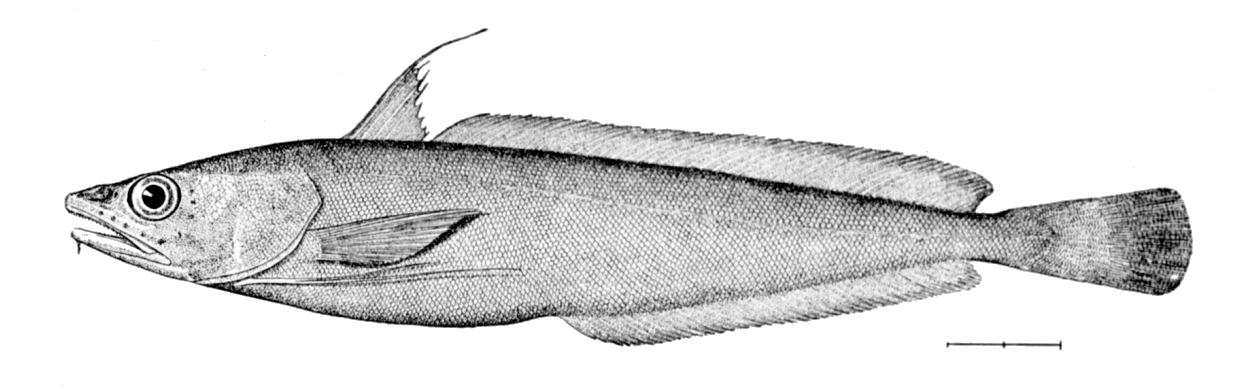
PURPOSE: The purpose of this work was to determine (1) how the population genomic structure relates to gut microbiota composition of White Hake (Urophycis tenuis), and (2) whether microbiota community variation provides complementary insights into population structure of this species in eastern Canada. DESCRIPTION: Integrating host-associated microbiota with genomic approaches offers an opportunity to better understand the multiple biological dimensions shaping population structure in marine fishes. A clear understanding of population structure and dynamics is essential for informed fisheries management and conservation decisions; however, while genomic approaches have greatly improved our ability to delineate biological populations, they provide only a partial representation of biological structure, as patterns of differentiation reflect both historical divergence and contemporary ecological conditions. Host-associated microbiota can influence population-level ecological processes by contributing functional, potentially heritable variation that shapes host phenotype and fitness. In this study, we combined genotyping-by-sequencing with 16S rRNA gene amplicon sequencing to examine how population genomic structure relates to gut microbiota composition and to evaluate whether microbiota community variation provides complementary insights into population structure in White Hake (Urophycis tenuis) in eastern Canada. Genomic analyses identified two populations with greater spatial overlap than previously reported. Variation partitioning revealed that host genetics explained a negligible proportion of microbiota variation compared to environmental factors and fish length, suggesting that ontogenetic shifts in habitat use and resource acquisition influence gut microbiota composition. Several taxa were differentially abundant among fish length categories used as a proxy for diet, including taxa with chitin-degrading potential such as Photobacterium and Lachnospirales, which were enriched in smaller fish known to consume a crustacean-dominated diet. Together, these results indicate that gut microbiota composition in White Hake primarily reflects ecological and life-history processes rather than host population structure. PARAMETERS COLLECTED: Environmental parameters were also collected at most sampling sites, including depth, water temperature, oxygen and salinity levels. PHYSICAL SAMPLE DETAILS: Fin samples were collected to characterize the fish genotypes. Intestine (rectum) samples were collected to study fish gut microbiome. SAMPLING METHODS: In 2022 and 2023, White Hake were sampled during Fisheries and Oceans Canada (DFO) annual bottom trawl ecosystem monitoring surveys. USE LIMITATION: To ensure scientific integrity and appropriate use of the data, we would encourage you to contact the data custodian.
-
Exposure to wind-driven waves forms a key physical gradient in nearshore environments influencing both ecological communities and human activities. We calculated a relative exposure index (REI) for wind-driven waves covering the coastal zone of the Scotian Shelf-Bay of Fundy bioregion. We derived REI and two other fetch-based indices (sum fetch, minimum fetch) from two formulations of wind fetch (unweighted and effective fetch) for input points in an evenly spaced fishnet grid (50-m resolution) covering a buffered area within 5 km from the coastline and shallower than 50 m depth. We calculated unweighted fetch lengths (m) for 32 compass headings per input point (11.25° intervals), and effective fetch lengths for 8 headings per point (45° intervals). Unweighted fetch is the distance along a given heading from a point in coastal waters to land. Effective fetch is a directionally weighted average of multiple fetch measures around a given heading that reduces the influence of irregular coastline shape on exposure estimates. For fetch calculations, we used land features at a 1:50,000 scale for Canadian administrative boundaries (NrCan 2017), and unknown resolution for St. Pierre and Miquelon, and US states bordering the Gulf of Maine (GADM 2012). The summed and minimum unweighted fetch lengths for each point provide coarse summaries of wave exposure and distance to land, respectively. The relative exposure index (REI) gives a more accurate metric of exposure by combining effective fetch with modelled wind speeds (m s-1) and frequency data. We provide the original calculations of unweighted fetch, effective fetch, and other fetch-based indices (i.e., sum, minimum) in csv format along with the REI layer (GeoTIFF format) resampled to 35-m resolution. With broad spatial coverage and high resolution, these indices can support regional-scale distribution modelling of species and biological assemblages in the coastal zone as well as marine spatial planning activities. When using data please cite following: O'Brien JM, Wong MC, Stanley RRE (2022) A relative wave exposure index for the coastal zone of the Scotian Shelf-Bay of Fundy Bioregion. figshare. Collection. https://doi.org/10.6084/m9.figshare.c.5433567 References GADM database of Global Administrative Areas (2012). Global Administrative Areas, version 2.0. (accessed 2 December 2020). www.gadm.org Natural Resources Canada (2017) Administrative Boundaries in Canada - CanVec Series - Administrative Features - Open Government Portal. (accessed 2 December 2020). https://open.canada.ca/data/en/dataset/306e5004-534b-4110-9feb-58e3a5c3fd97.
-

Exposure to wind-driven waves manifests an important physical gradient in the coastal zone that influences a variety of physical and biological processes (i.e., species distribution). Fetch, the unobstructed distance over which wind-driven waves can build, is a popular proxy for wave exposure at a given location commonly used for site-specific evaluations. Here, we provide two measures of fetch (unweighted fetch, effective fetch) and three fetch-derived indices of wave exposure (sum fetch, minimum fetch, and a relative exposure index) covering the coastal zones of two Canadian bioregions (Scotian Shelf-Bay of Fundy, Newfoundland-Labrador Shelves). For each region, we calculated fetch and exposure indices for input points in an evenly spaced fishnet grid (see linked records below for datasets by region). We provide unweighted fetch lengths (m) for 32 compass headings per input point (11.25° intervals), and effective fetch lengths for 8 headings per point (45° intervals). Effective fetch is a weighted average of multiple fetch measures around a given heading that reduces the influence of irregular coastline shape on exposure estimates. We also include calculations of the summed and minimum unweighted fetch lengths for each point that provide coarse proxies of exposure and distance to land, respectively. The relative exposure index (REI), provided as regional spatial layers in raster format, provides a more accurate metric of exposure by combining effective fetch with modelled wind speeds (m s-1) and frequency data. Users may also use fetch calculations to derive their own exposure layers using alternative sources of wind data, indices, or formulations. Detailed methodology on the calculations for fetch, effective fetch and REI are outlined in the Supplementary Information below. Citation information and differences in data pre-processing methods and spatial resolution of the regional analyses are described in their respective data records. The broad spatial coverage and high resolution offered by these indices are suitable to support regional-scale modelling and planning exercises. In particular, these indices will be of value to ongoing Marine Spatial Planning efforts, which includes regional conservation planning, that seek to evaluate the distribution of coastal species and overlap with human activities.
-
Concentrations of sea pens, small and large gorgonian corals and sponges on the east coast of Canada have been identified through spatial analysis of research vessel survey by-catch data following an approach used by the Northwest Atlantic Fisheries Organization (NAFO) in the Regulatory Area (NRA) on Flemish Cap and southeast Grand Banks. Kernel density analysis was used to identify high concentrations. These analyses were performed for each of the five biogeographic zones of eastern Canada. The largest sea pen fields were found in the Laurentian Channel as it cuts through the Gulf of St. Lawrence, while large gorgonian coral forests were found in the Eastern Arctic and on the northern Labrador continental slope. Large ball-shaped Geodia spp. sponges were located along the continental slopes north of the Grand Banks, while on the Scotian Shelf a unique population of the large barrel-shaped sponge Vazella pourtalesi was identified. The latitude and longitude marking the positions of all tows which form these and other dense aggregations are provided along with the positions of all tows which captured black coral, a non-aggregating taxon which is long-lived and vulnerable to fishing pressures.