 Arctic SDI catalogue
TAB
Type of resources
Topics
Keywords
Contact for the resource
Provided by
Formats
Representation types
Update frequencies
status
-

The national agricultural ecumene includes all dissemination areas with 'significant' agricultural activity. Agricultural indicators, such as the ratio of agricultural land on census farms relative to total land area, and total economic value of agricultural production, are used. Regional variations are also taken into account. The ecumene is generalized for small-scale mapping. A new version of the agricultural ecumene is generated every census years (in vector format) since 1986. This file was produced by Statistics Canada, Agriculture Division, Ottawa.
-

Natural Resources Canada’s Major Projects Inventory published annually, provides a snapshot of major natural resource projects in Canada that are either currently under construction or are planned within the next 10 years. The inventory includes major projects that increase, extend or improve natural resource production in Canada, including new extraction projects, infrastructure projects, major processing facilities and large expansion projects. In addition, the inventory includes information on the value, timing and geographic location of projects. To be included in the inventory, projects in the energy and mining sectors must meet a minimum capital worth threshold of $50 million and electricity and forest sector projects must meet a threshold of $20 million. Also included in the inventory are clean energy and clean technology projects, which must meet a minimum capital worth threshold of $10 million. DISCLAIMER: Data is sourced from federal, provincial, and territorial databases, publicly accessible websites, and other sources, including CANOILS. Data and maps are for illustrative purposes only. Users understand that, although all efforts have been made to accurately and exhaustively compile, locate and classify projects, the authors do not guarantee the accuracy and/or the comprehensiveness of the data and assume no responsibility for errors or omissions. The routes of the proposed transmission lines and pipelines are approximations, often using only start and end points. In support of this initiative, proponents and partners are encouraged to contact Natural Resources Canada should they identify any significant errors or omissions.
-

The national agricultural ecumene includes all dissemination areas with 'significant' agricultural activity. Agricultural indicators, such as the ratio of agricultural land on census farms relative to total land area, and total economic value of agricultural production, are used. Regional variations are also taken into account. The ecumene is generalized for small-scale mapping. A new version of the agricultural ecumene is generated every census years (in vector format) since 1986. This file was produced by Statistics Canada, Agriculture Division, Ottawa.
-
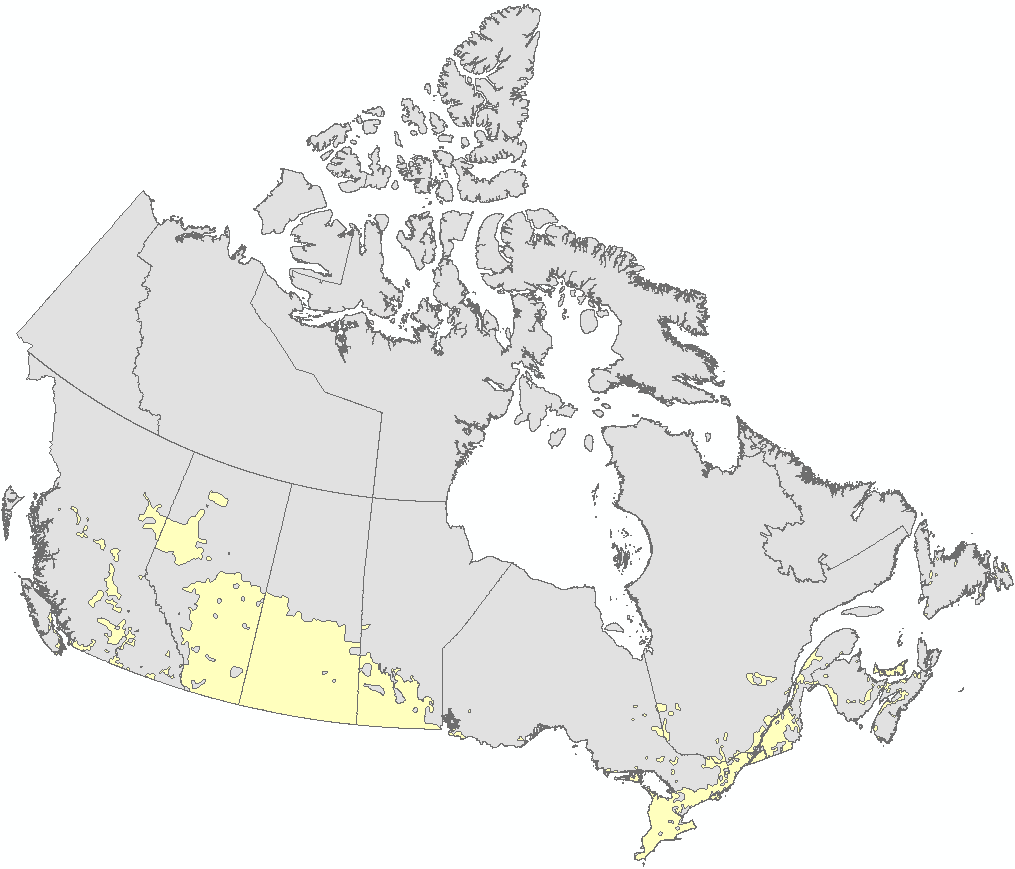
The national agricultural ecumene includes all dissemination areas with 'significant' agricultural activity. Agricultural indicators, such as the ratio of agricultural land on census farms relative to total land area, and total economic value of agricultural production, are used. Regional variations are also taken into account. The ecumene is generalized for small-scale mapping. A new version of the agricultural ecumene is generated every census years (in vector format) since 1986. This file was produced by Statistics Canada, Agriculture Division, Remote Sensing and Geospatial Analysis section, 2017, Ottawa.
-

Adresses Quebec is a road geobase that covers all of Quebec. It offers a complete road network including official names, addresses by slices and points, information for route management, postal codes (MOs) and a cartographic context. The user guide is available at ** [next link] (https://diffusion.mern.gouv.qc.ca/diffusion/RGQ/Vectoriel/Documentation/AdressesQuebec/guide_utilisateurs.pdf) **. For more information on the full range of products, refer to the ** [directory of web services and geographic data] (https://mrnf.gouv.qc.ca/ministere/cartes-information-geographique/repertoire-services-web-donnees-geographiques/) ** of the MRNF.**This third party metadata element was translated using an automated translation tool (Amazon Translate).**
-
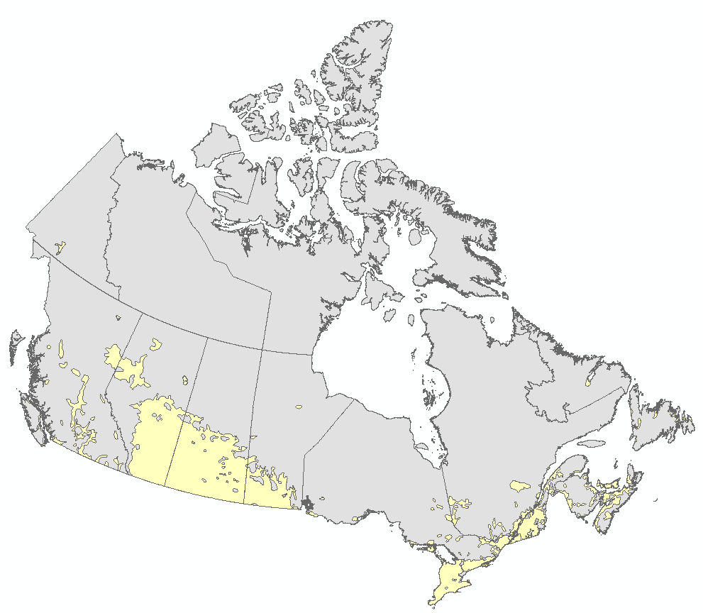
The national agricultural ecumene includes all dissemination areas with 'significant' agricultural activity. Agricultural indicators, such as the ratio of agricultural land on census farms relative to total land area, and total economic value of agricultural production, are used. Regional variations are also taken into account. The ecumene is generalized for small-scale mapping. A new version of the agricultural ecumene is generated every census years (in vector format) since 1986. This file was produced by Statistics Canada, Agriculture Division, Remote Sensing and Geospatial Analysis section, 2017, Ottawa.
-

The national agricultural ecumene includes all dissemination areas with 'significant' agricultural activity. Agricultural indicators, such as the ratio of agricultural land on census farms relative to total land area, and total economic value of agricultural production, are used. Regional variations are also taken into account. The ecumene is generalized for small-scale mapping. A new version of the agricultural ecumene is generated every census year (in vector format) since 1986. This file was produced by Statistics Canada, Agriculture Division, Remote Sensing and Geospatial Analysis section, 2022, Ottawa.
-
Location of public schools (French-speaking, English-speaking and special status) as well as private and governmental schools for preschool, primary, secondary, vocational training and adult education. In addition, the location of educational institutions in the college and university networks is also available.**This third party metadata element was translated using an automated translation tool (Amazon Translate).**