 Arctic SDI catalogue
Endangered species
Type of resources
Topics
Keywords
Contact for the resource
Provided by
Years
Formats
Representation types
Update frequencies
status
Service types
-

Survey data depicting the presence of the endangered Rocky Mountain Ridged Mussel (Gonidea angulata) from 2008-2011. Surveys were conducted by different researchers at different locations.
-

Survey for Physella wright - the hotwater physa, at Liard River Hotsprings Provincial Park, August 2006. Description of activity: The research is a survey of the Hotwater physa, Physella wrighti, to estimate population distribution and abundance, in order to monitor the population of this freshwater snail found in a single hot spring site in Canada. Researchers will gather data regarding the density of snail populations and the characteristics of the habitat it utilizes in order to provide an updated assessment of its status. The proposed methodology allows accurate, monitoring of this population. Estimates of snail density per square meter will be calculated based on repeated sweeps of vegetation to dislodge snails. Where snails are found on open substrate, counts are done by quadrat. Attempts will be made to document egg case deposition. Population density estimates and ecosystem data will be sampled for every meter of stream where P. wrighti is known to occur. Each sample site will be georeferenced and documented using digital photography.
-

This dataset was developed to document the procedures for acquiring underwater images in the Banc-des-Américains Marine Protected Area (MPA). Its primary objective is to provide a comprehensive inventory of metadata linked to imagery campaigns that allowed us to conduct a basic characterization of the area, and now that are used for ecological monitoring of the benthic habitats within the MPA. Metadata were collected during imagery surveys conducted since 2012, using three main methods: drop cameras on the crest, baited drop stereoscopic cameras on both the crest and plains, and towed cameras on the plains. For each operation are shared the type of gear used, sampling method, date, geographic coordinates, and acquisition depth. The released dataset contains only descriptive information related to the acquisition of images : file identifier, location, sampling methodology, depth, and technical imaging parameters. It does not include image files themselves, visual content, or the results of image analyses. A systematic quality control is applied to ensure completeness and consistency of the metadata: field format standardization, validation of GPS coordinates, verification of dates and recorded depths. Clear instructions guide the recording of metadata to guarantee their reliability for management and scientific monitoring purposes.
-

The Quebec Natural Heritage Data Center (CDPNQ) is the most comprehensive information management system on species in a precarious situation in Quebec. It broadcasts more than 6,700 occurrences of floristic species for 506 species in a precarious situation. This information is the source data used to generate ranges. By definition, a range is a generalized geographic area where a species occurs without taking into account its particular habitat needs. This information is particularly useful for planning inventories or supporting the planning of conservation projects. The creation of ranges for all species in precarious situations in Quebec is an exercise that can be particularly complex, due in particular to the number of species involved, the evolutionary nature of the geomatic information available and the natural spatial distribution of species. The project for the automated creation of distribution areas was developed in order to avoid the problems raised previously. This approach makes it possible to provide, for all plant species in precarious situations in Quebec, a product that is standardized, reliable, easily reproducible and much easier to maintain. Each range has up to three “zones”: “presence,” “historical,” and “possible presence.” These three zones are defined according to the viability ratings and the level of precision of the occurrences of the species present in each ecological district.**This third party metadata element was translated using an automated translation tool (Amazon Translate).**
-
This layer represents all the flora and fauna occurrences (1) in a precarious situation in the [Quebec Natural Heritage Data Center (CDPNQ)] (https://www.quebec.ca/gouvernement/gouvernement-ouvert/transparence-performance/indicateurs-statistiques/donnees-especes-situation-precaire). The purpose of publishing these data is to improve their accessibility for customers, to promote the consideration of species in land use projects and, finally, to facilitate the exchange of information with users. # #Des data adapted to the sensitivity of the species to promote their protection In order to prevent the dissemination of data from causing harm to certain species or their habitat, the CDPNQ has chosen to hide information. This choice is based on an analysis of the sensitivity of species to the dissemination of information concerning them. Generalized occurrences, i.e. those whose information is hidden, make it possible, despite the absence of precise information, to distinguish the territories for which the CDPNQ holds data on these species from those where it does not. It should also be noted that the absence of occurrences does not mean the absence of species in a precarious situation on a territory. # #Des valuable data for the conservation of biodiversity The CDPNQ disseminates data relating to species in a precarious situation for scientific, conservation or management purposes. This data is important for: * Assess conservation priorities in order to make designation recommendations under the Act Respecting Threatened or Vulnerable Species or to apply protection measures for species in a precarious situation; * Develop or analyze conservation and land use projects carried out by municipalities, developers or various conservation stakeholders; * Document or analyze requests for ministerial authorizations and environmental impact studies; * Identify threats and conservation measures useful to inform the preparation of recovery plans for species in a precarious situation; * Contribute to conservation research projects; * Revise laws and regulations; * Ensure sustainable planning for the planning and development of Quebec territory, whether in terms of forestry, agriculture, municipal or other areas; * Contribute to the monitoring of the state of biodiversity and support discussions leading to the development of government guidelines in this area. The data is kept up to date thanks to field surveys, carried out in particular by the provincial and federal governments and several of their partners, but also thanks to the contribution of citizens. (1) An occurrence refers to a territory that hosts or has sheltered an element of biodiversity. When talking about a species, the occurrence generally corresponds to the habitat occupied by a local population of the species in question. **This third party metadata element was translated using an automated translation tool (Amazon Translate).**
-
Critical habitat polygons and lines were assembled by SARA regional biologists and recovery teams. They are designed to support the protection and recovery of species listed as Endangered or Threatened under the Species at Risk Act. They are also described and displayed in species’ Recovery Documents and Action Plans. For the complete extent and view of a species' Critical Habitat both Lines and Polygons must be displayed simultaneously. Please note: there are different types of Critical Habitat descriptors. This dataset may use a “bounding box” or "parcel" approach that delineates an area or extent in which the species may be found. Descriptors (such as bounding box coordinates are not included in this dataset).
-
The Canada Nature Fund for Aquatic Species at Risk (CNFASAR) is a contribution program that focuses on providing funding for recovery and threat mitigation activities in nine priority places and to address two marine threats to aquatic species at risk. The Priority Places and Marine Threats layer supports CNFASAR by delineating the location of the places and threats. The Canada Nature Fund for Aquatic Species at Risk (CNFASAR) supports applicants in the design and delivery of stewardship projects. These projects support the recovery and protection of aquatic species at risk. DFO has identified 2 priority marine threats and 9 priority places as the focus for projects funded by CNFASAR, these areas are included in this dataset.
-
Critical habitat polygons and lines were assembled by SARA regional biologists and recovery teams. They are designed to support the protection and recovery of species listed as Endangered or Threatened under the Species at Risk Act. They are also described and displayed in species’ Recovery Documents and Action Plans. For the complete extent and view of a species' Critical Habitat both Lines and Polygons must be displayed simultaneously. Please note: there are different types of Critical Habitat descriptors. This dataset may use a “bounding box” or "parcel" approach that delineates an area or extent in which the species may be found. Descriptors (such as bounding box coordinates are not included in this dataset).
-

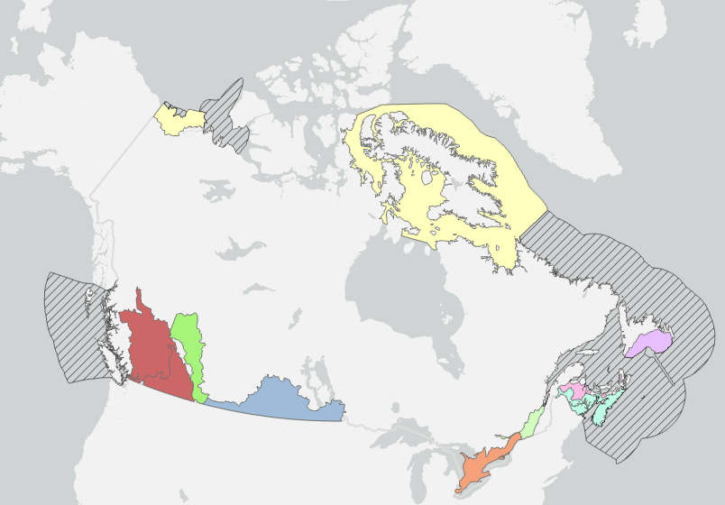
As part of the Pan-Canadian approach to transforming Species at Risk conservation in Canada, a total of 11 Priority Places were affirmed by federal, provincial, and territorial governments in December 2018. One additional priority place was affirmed in 2024. The places selected have significant biodiversity, concentrations of species at risk, and opportunities to advance conservation efforts. In each Priority Place, the federal and provincial or territorial governments are working with Indigenous Peoples, partners, and stakeholders to develop conservation action implementation plans. Using a defined planning approach (such as the Open Standards for the Practice of Conservation), these implementation plans identify key actions to address the greatest threats to species. Conservation implementation plans provide the foundation for collaborative action on the ground. The federal government, in collaboration with the provinces and territories, has agreed to the implementation of the Pan-Canadian Approach to Transforming Species at Risk Conservation in Canada. This new approach shifts from a single-species approach to conservation to one that focuses on multiple species and ecosystems. This enables conservation partners to work together to achieve better outcomes for Species at Risk. These 12 Priority Places are complemented by a suite of Community-Nominated Priority Places (CNPP), identified through an open call for applications. To learn more about the Priority Places initiative and the work undertaken by our partners to recover Species at Risk within these Priority Places, please visit our interactive website https://environmental-maps.canada.ca/CWS_Storylines/index-ca-en.html#/en/priority_places-lieux_prioritaires