 Arctic SDI catalogue
Géomatique
Type of resources
Available actions
Keywords
Contact for the resource
Provided by
Years
Formats
Representation types
Update frequencies
status
Service types
Scale
-

This project was carried out thanks to the financial support of component 2.2 of the MAMAH Regions and Rurality Fund (FRR). The updates were made using orthophotos from spring 2020. The project covers the territory of the MRCs of Haut-Saint-Laurent, Haute-Yamaska, Haute-Yamaska, Roussillon, Rouville, Vaudreuil-Soulanges as well as the agglomeration of Longueuil.**This third party metadata element was translated using an automated translation tool (Amazon Translate).**
-

In 2015, the Earth Observation Team of the Science and Technology Branch (STB) at Agriculture and Agri-Food Canada (AAFC) repeated the process of generating annual crop inventory digital maps using satellite imagery to for all of Canada, in support of a national crop inventory. A Decision Tree (DT) based methodology was applied using optical (Landsat-8) and radar (RADARSAT-2) based satellite images, and having a final spatial resolution of 30m. In conjunction with satellite acquisitions, ground-truth information was provided by provincial crop insurance companies and point observations from the BC Ministry of Agriculture and our regional AAFC colleagues.
-
The 1 cm resolution vegetation digital height model was extracted using a bare earth model and digital surface model (DSM) derived from unmanned aerial vehicle (UAV) imagery acquired from a single day survey on July 28th 2016, in Cambridge Bay, Nunavut. The mapping product covers 525m2 and was produced by Canada Centre for Remote Sensing /Canada Centre for Mapping and Earth Observation. The UAV survey was completed in collaboration with the Canadian High Arctic Research Station (CHARS) for northern vegetation monitoring research. For more information, refer to our current Arctic vegetation research: Fraser et al; "UAV photogrammetry for mapping vegetation in the low-Arctic" Arctic Science, 2016, 2(3): 79-102. http://www.nrcresearchpress.com/doi/abs/10.1139/AS-2016-0008
-

The 1 cm resolution digital surface model (DSM) was created from unmanned aerial vehicle (UAV) imagery acquired from a single day survey, July 28th 2016, in Cambridge Bay, Nunavut. Five control points taken from a Global Differential Positioning System were positioned in the corners and the center of the vegetation survey. The DSM covering 525m2 was produced by Canada Centre for Remote Sensing /Canada Centre for Mapping and Earth Observation. The UAV survey was completed in collaboration with the Canadian High Arctic Research Station (CHARS) for northern vegetation monitoring research. For more information, refer to our current Arctic vegetation research: Fraser et al; "UAV photogrammetry for mapping vegetation in the low-Arctic" Arctic Science, 2016, 2(3): 79-102. http://www.nrcresearchpress.com/doi/abs/10.1139/AS-2016-0008
-

This is a legacy product that is no longer supported. It may not meet current government standards. Canada3D is a digital elevation model (DEM) produced by the Canadian Forestry Service, Ontario region. The DEM consists of an ordered array of ground elevations providing coverage of the Canadian landmass. It has been derived from the cells of the Canadian Digital Elevation Data (CDED) at the 1:250 000 scale. Canada3D is available in two levels of detail: grids regularly spaced at 30 or 300 arc seconds. Canada3D 30 and 300 are recorded separately in ASCII format. The elevation values are expressed in metres with respect to mean sea level (MSL), in accordance with the North American Datum of 1983 (NAD83).
-
La donnée a été créée ou dérivée à partir d'images de véhicules aériens non habités (UAV) acquises à partir d'une enquête d'une journée, le 28 juillet 2016, à Cambridge Bay, au Nunavut. Cinq points de contrôle provenant d'un système de positionnement différentiel global ont été positionnés dans les coins et au centre de l'étude de la végétation. Les jeux de données suivants couvrent une superficie de 525m2 et ont été produits par le Centre canadien de télédétection / Centre canadien de cartographie et d'observation de la Terre: - UAV modèle d'hauteur de la végétation, Cambridge Bay, Nunavut - UAV modèle numérique de surface (MNS) dans Cambridge Bay, Nunavut - Parcelle de végétation - UAV orthomosaïque de Cambridge Bay, Nunavut - Parcelle de végétation L'enquête sur les UAV a été menée en collaboration avec La Station canadienne de recherche dans l’Extrême-Arctique (SCREA) pour la recherche sur la surveillance de la végétation nordique. Pour plus de renseignement, consultez nos travaux de recherche actuels: Fraser et al; ""UAV photogrammetry for mapping vegetation in the low-Arctic"" Arctic Science, 2016, 2(3): 79-102, 10.1139/as-2016-0008 http://www.nrcresearchpress.com/doi/abs/10.1139/AS-2016-0008
-

Mapping of neighborhoods in Quebec City.**This third party metadata element was translated using an automated translation tool (Amazon Translate).**
-

In 2009 the Earth Observation Team of the Science and Technology Branch (STB) at Agriculture and Agri-Food Canada (AAFC) began the process of generating annual crop inventory digital maps using satellite imagery. Focusing on the Prairie Provinces, a Decision Tree (DT) based methodology was applied using both optical (AWiFS, Landsat-5) and radar (RADARSAT-2) based satellite imagery, and having a final spatial resolution of 56m. Methods were also developed to enhance the optical classification with RADARSAT-2 imagery, addressing issues associated with cloud cover. In conjunction with satellite acquisitions, ground-truth information was provided by provincial crop insurance companies and point observations from our regional AAFC colleagues. The overall process for Crop Inventory Map includes: satellite data acquisition; field data acquisition for classification training and accuracy assessment; and, operational implementation of the classification methodology. The initial methodology was developed in partnership with AAFC Research Branch, and supported in part by the Canadian Space Agency. The long-term objective of this endeavour is to expand from the Prairies and produce an annual crop inventory of the entire agricultural extent of Canada.
-
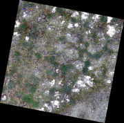
The 0.34 cm resolution orthomosaic was created from unmanned aerial vehicle (UAV) imagery acquired from a single day survey, July 28th 2016, in Cambridge Bay, Nunavut. Five control points taken from a Global Differential Positioning System were positioned in the corners and the center of the vegetation survey. The orthomosaic covering 525m2 was produced by Canada Centre for Remote Sensing /Canada Centre for Mapping and Earth Observation. The UAV survey was completed in collaboration with the Canadian High Arctic Research Station (CHARS) for northern vegetation monitoring research. For more information, refer to our current Arctic vegetation research: Fraser et al; "UAV photogrammetry for mapping vegetation in the low-Arctic" Arctic Science, 2016, 2(3): 79-102. http://www.nrcresearchpress.com/doi/abs/10.1139/AS-2016-0008.
-

Canada Center for Mapping and Earth Observation (CCMEO)'s basemap is essential in supporting the Government of Canada’s priorities in areas such as open government, climate change mitigation, Indigenous reconciliation, emergency management, disaster preparedness and response, sustainable natural resource management, infrastructure planning, economy/labour and more. It reinforces CCMEO’s commitment to improving the accessibility, interoperability and integration of geospatial data across Canada. CCMEO currently offers multiple basemap types which include the following found in this series: - Transportation basemap (CBMT) in raster tile format - Transportation basemap (CBMT) in vector tile format EPSG: 3857 (WGS84 Pseudo-Mercator) - Transportation basemap (CBMT) in vector tile format EPSG: 3978 (NAD83 Canada Atlas Lambert) - Digital Elevation Model (DEM) - hillshade basemap (CBME) - Simple grey basemap - Provinces/Territories basemap - Grids (Lat/Long, NTS and UTM) basemap