 Arctic SDI catalogue
Observations
Type of resources
Categories
Topics
Keywords
Contact for the resource
Provided by
Formats
Representation types
Update frequencies
status
Scale
-

Locations are indicated based on the information available. If coordinates were not available, the approximate location is indicated using the description associated with the record. Note that effort is not accounted for in this dataset, nor is effort equally distributed throughout the area captured. Data derived from satellite or acoustic tagging are not included in this dataset. Note that not all records are confirmed. DFO Science reviews records and reports and classifies them as either confirmed or unconfirmed, based on the available information (e.g., pictures, videos, descriptions).
-
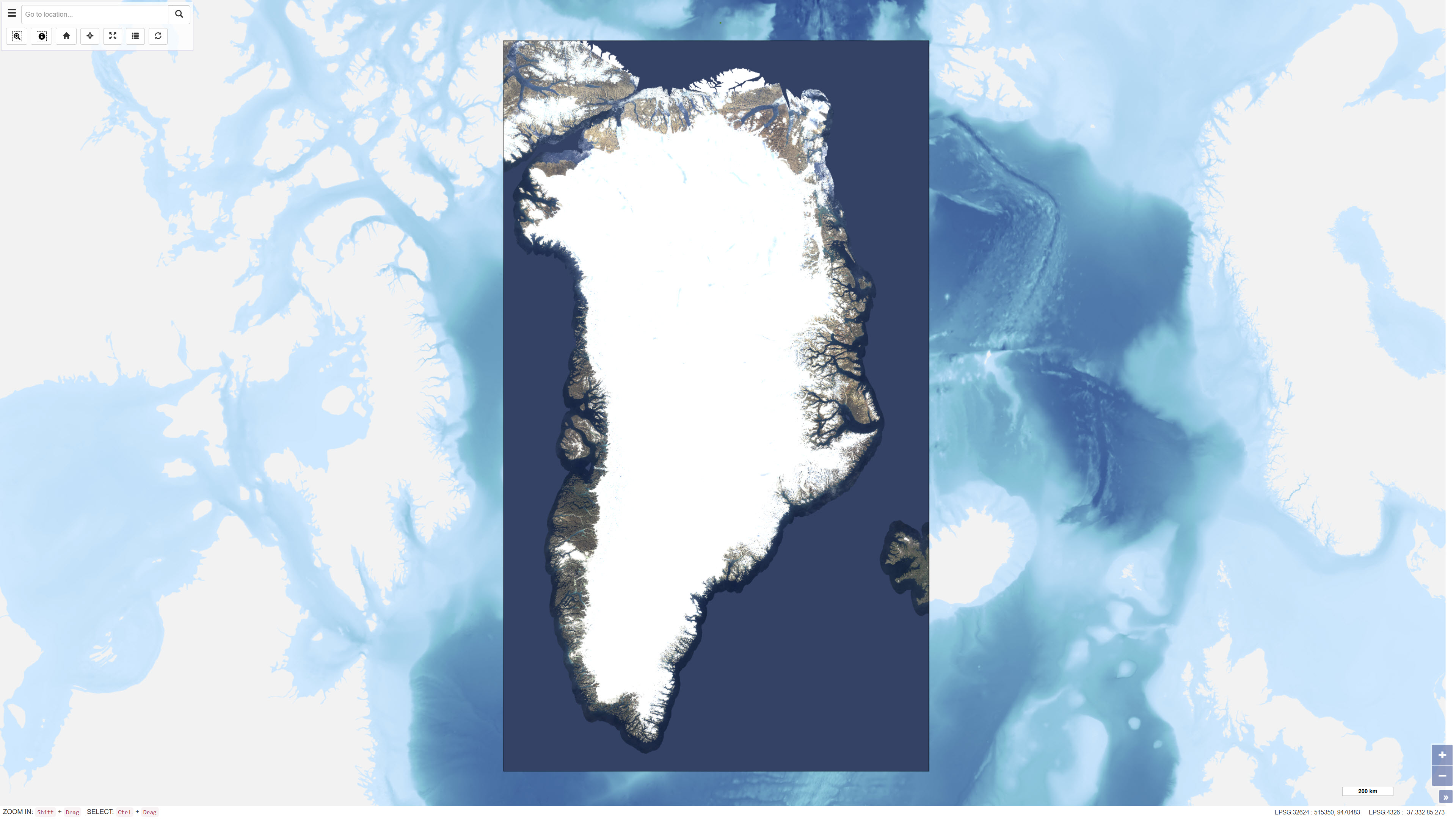
EOxCloudless is a global satellite imagery dataset consisting of near-cloudless mosaics derived from Copernicus Sentinel-2 multispectral satellite data. The dataset is produced by EOX IT Services GmbH and is designed to provide consistent, high-resolution surface imagery for mapping, analysis, and visualization purposes. The mosaics are generated by combining a large number of Sentinel-2 Level-1C observations acquired over defined time periods. Advanced pixel selection algorithms and thematic masks (including clouds, cloud shadows, and water) are applied to reduce cloud contamination. For each pixel location, the most representative observation is selected based on statistical criteria and temporal analysis, resulting in near-cloudless composite images. The dataset provides global land coverage and is typically delivered at a spatial resolution of 10 metres for the utilised spectral bands (blue, green, red, and near-infrared). EOxCloudless is suitable for use as a basemap as well as for environmental monitoring, land analysis, spatial planning, and other geoscientific applications.
-

The Strait of Belle Isle connects the Labrador Shelf and Gulf of St. Lawrence. Few observations of currents in the Strait of Belle Isle exist despite its important contribution to the heat, salt, and mass budgets of the Gulf of St. Lawrence. This is because the deployment of instruments is complicated by the Strait’s remote location, its strong currents, and the presence of thick winter sea ice and icebergs. The present data set aims to provide a long-term time series of currents in the Strait of Belle Isle. Data were collected using a moored Teledyne RDI Workhorse 300 KHz acoustic Doppler current profiler (ADCP). The ADCP was mounted on a subsurface buoy anchored 5 m from the sea floor, in water approximately 70 m deep near the north shore of the Strait (56° 37.2 W, 51° 34.7 N). This instrument provides three-dimensional current profiles every 30 minutes at a vertical resolution of 4 m. Backscatter intensity is also collected at the same resolution. Raw data were processed using the Magtogoek software (https://github.com/iml-gddaiss/magtogoek), developed by the Department of Fisheries and Oceans Canada. Quality flags have been assigned to the data based on beam sidelobe contamination and required thresholds for extreme velocities, beam correlation and percentage of good four-beam transformations. The ancillary data used to apply this quality control are included in the data set. Reference : Shaw, J.-L., & Galbraith, P. S. (2023). Climatology of transport in the Strait of Belle Isle. Journal of Geophysical Research: Oceans, 128, e2022JC019084. https://doi.org/10.1029/2022JC019084
-

Harbour seals (Phoca vitulina) are found along temperate and Arctic marine coastlines of the Northern Hemisphere. They are found in coastal waters of the northern Atlantic and Pacific Oceans, as well as those of the Baltic and North Seas. In Canada, they may be found off the coastal waters of British Columbia, Nunavut, Manitoba, Ontario, Quebec, New Brunswick, Prince Edward Island, Nova Scotia, and Newfoundland and Labrador. Population trends and abundance of harbour seals in British Columbia are assessed based on aerial surveys conducted during 1966-2019. Based on counts conducted in Index Areas distributed throughout the province, the trend observed in the Strait of Georgia appears to be generally indicative of harbour seal populations throughout British Columbia. Total abundance of harbour seals on the B.C. coast in 2008 was estimated to be on the order of about 105,000 (95% confidence interval of 90,900 to 118,900) seals. Total abundance was re-estimated in 2022 (estimate and CI pending completion of CSAS process). Historic reconstructions indicate the population was depleted by a period of commercial harvesting during 1879-1914, and subsequently maintained below natural levels by predator control programs until the early 1960s. Already depleted, the population could not sustain a second period of intense commercial harvesting during 1962-1968 and was further depleted, but now appears to have fully recovered.