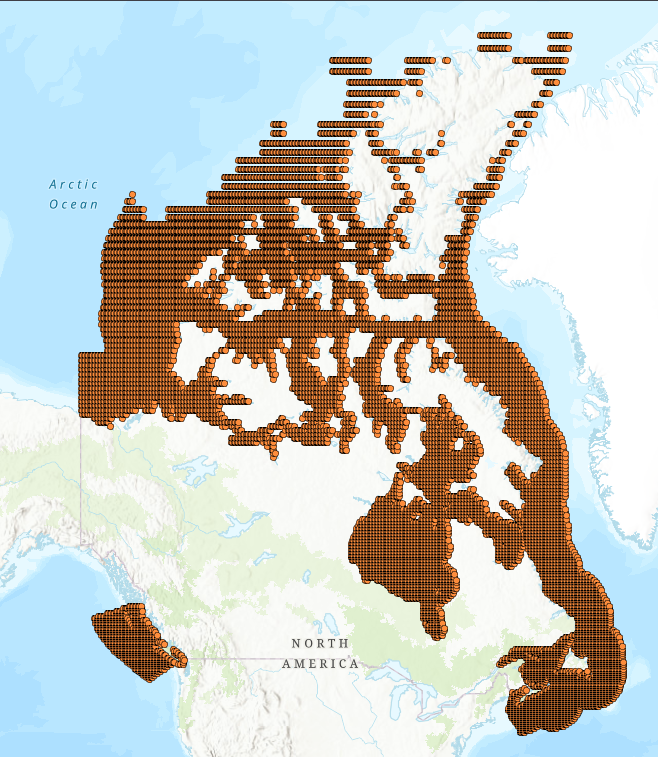
 Arctic SDI catalogue
Protected species
Type of resources
Topics
Keywords
Contact for the resource
Provided by
Years
Formats
Representation types
Update frequencies
status
Service types
-

This layer represents all the flora and fauna occurrences (1) in a precarious situation in the [Quebec Natural Heritage Data Center (CDPNQ)] (https://www.quebec.ca/gouvernement/gouvernement-ouvert/transparence-performance/indicateurs-statistiques/donnees-especes-situation-precaire). The purpose of publishing these data is to improve their accessibility for customers, to promote the consideration of species in land use projects and, finally, to facilitate the exchange of information with users. # #Des data adapted to the sensitivity of the species to promote their protection In order to prevent the dissemination of data from causing harm to certain species or their habitat, the CDPNQ has chosen to hide information. This choice is based on an analysis of the sensitivity of species to the dissemination of information concerning them. Generalized occurrences, i.e. those whose information is hidden, make it possible, despite the absence of precise information, to distinguish the territories for which the CDPNQ holds data on these species from those where it does not. It should also be noted that the absence of occurrences does not mean the absence of species in a precarious situation on a territory. # #Des valuable data for the conservation of biodiversity The CDPNQ disseminates data relating to species in a precarious situation for scientific, conservation or management purposes. This data is important for: * Assess conservation priorities in order to make designation recommendations under the Act Respecting Threatened or Vulnerable Species or to apply protection measures for species in a precarious situation; * Develop or analyze conservation and land use projects carried out by municipalities, developers or various conservation stakeholders; * Document or analyze requests for ministerial authorizations and environmental impact studies; * Identify threats and conservation measures useful to inform the preparation of recovery plans for species in a precarious situation; * Contribute to conservation research projects; * Revise laws and regulations; * Ensure sustainable planning for the planning and development of Quebec territory, whether in terms of forestry, agriculture, municipal or other areas; * Contribute to the monitoring of the state of biodiversity and support discussions leading to the development of government guidelines in this area. The data is kept up to date thanks to field surveys, carried out in particular by the provincial and federal governments and several of their partners, but also thanks to the contribution of citizens. (1) An occurrence refers to a territory that hosts or has sheltered an element of biodiversity. When talking about a species, the occurrence generally corresponds to the habitat occupied by a local population of the species in question. **This third party metadata element was translated using an automated translation tool (Amazon Translate).**
-
Significant climate change impacts are highly likely in all Canadian marine and freshwater basins, with effects increasing over time (DFO 2012). Climate models project that ecosystems and fisheries across Canada will be disrupted into the foreseeable future (Lotze et al. 2019; Bryndum-Buchholz et al. 2020; Tittensor et al. 2021; Boyce et al. 2024). Despite its imminence, climate change is infrequently factored into Canada’s primary marine conservation strategies, such as spatial planning (O’Regan et al. 2021) or fisheries management (Boyce et al. 2021; Pepin et al. 2022). The Climate Risk Index for Biodiversity (CRIB) was developed to assess climate risk for marine species in a quantitative, spatially explicit, and scalable manner, supporting climate-informed decision-making. It has been used to evaluate climate risks for marine life globally (Boyce et al. 2022), regionally (Lewis et al. 2023; Boyce et al. 2024; Keen et al. 2023), for fisheries (Boyce et al. 2024), and in support of spatial conservation planning (Keen et al. 2023). This dataset contains climate vulnerability and risk estimates from the CRIB framework adapted to consider warming at both the sea surface and its bottom for 145 marine species of conservation or fisheries interest across Canada’s marine territory. Climate risk is available at a 0.25-degree resolution under two contrasting emission scenarios to 2100. For each species, location, and scenario, 12 climate indexes, three vulnerability dimensions, and an overall vulnerability and risk score are provided. The accompanying report describes the data, methods, and workflow used to calculate risk. This report also guides the interpretation of these data to inform and support climate-informed decision-making in Canada.
-
Critical habitat polygons and lines were assembled by SARA regional biologists and recovery teams. They are designed to support the protection and recovery of species listed as Endangered or Threatened under the Species at Risk Act. They are also described and displayed in species’ Recovery Documents and Action Plans. For the complete extent and view of a species' Critical Habitat both Lines and Polygons must be displayed simultaneously. Please note: there are different types of Critical Habitat descriptors. This dataset may use a “bounding box” or "parcel" approach that delineates an area or extent in which the species may be found. Descriptors (such as bounding box coordinates are not included in this dataset).
-

The Species at Risk (SAR) Program is responsible for carrying out DFO’s mandate under the Species at Risk Act (SARA) to protect, recover and conserve all listed aquatic SAR in Canada. As part of this mandate, this spatial database has been developed to identify areas in which aquatic species listed under SARA may be found. Distribution and range information are identified for species listed as Endangered, Threatened or Special Concern under SARA. Distribution (range) polygons and lines were assembled by regional SARA biologists using the best available information, including COSEWIC status reports, recovery potential assessments, academic literature, and expert opinion. These spatial data support the protection, recovery and conservation of species listed as Endangered, Threatened or Special Concern under SARA. Species distributions are also described and displayed in Recovery Strategies, Action Plans and/or Management Plans. Discrepancies may exist between the distribution data shown in a species’ SARA recovery document and the current spatial data. Please contact DFO for more information on any data discrepancies.
-

The Species at Risk (SAR) Program is responsible for carrying out DFO’s mandate under the Species at Risk Act (SARA) to protect, recover and conserve all listed aquatic SAR in Canada. Critical habitat is identified for species listed as Endangered or Threatened under the Species at Risk Act (SARA). This mapping tool is for general guidance only. “Mapped” representations of waterbodies and watercourses are based on authoritative provincial geospatial products, guidance and standards. Due to the nature of dynamic systems and the resolution/accuracy of these data sets, areas within which critical habitat is found as displayed on the mapping tool may not align exactly with natural watercourses. If discrepancies occur, refer to the relevant species recovery strategy and/or action plan for additional information on critical habitat. If additional guidance is required, please contact the Fish and Fish Habitat Protection Program: https://www.dfo-mpo.gc.ca/pnw-ppe/contact-eng.html Critical habitat is defined under section 2 of SARA as: "the habitat that is necessary for the survival or recovery of a listed wildlife species and that is identified as the species' critical habitat in the recovery strategy or in an action plan for the species". Section 49(1)(a) of SARA requires that a species' Recovery Strategy/Action Plan include an identification of the species' critical habitat to the extent possible, based on the best available information, including information provided by the Committee on the Status of Endangered Wildlife in Canada (COSEWIC). SARA makes it illegal to destroy any part of the critical habitat of SAR and may impose restrictions on development and construction. Critical habitats were assembled by SARA regional biologists and recovery teams. They are designed to support the protection and recovery of species listed as Endangered or Threatened under the Species at Risk Act. They are also described and displayed in species' Recovery Documents and Action Plans.
-
This habitat quality model shows the probability of the presence of short-eared owls in southern Quebec during the nesting season. It is based on species presence data and a modeling of several environmental variables of interest to the species during the nesting period. The model is based on 64 ha analysis units, i.e. cells with a side length of 800 meters. For more details, for example on the study area, the data used and the modeling carried out, consult the following report [“Habitat quality model for the short-eared owl (Asio flammeus) in southern Quebec”] (https://cdn-contenu.quebec.ca/cdn-contenu/faune/documents/habitats/modele-qualite-habitat-hibou-marais.pdf). ### What is an MQH? A habitat quality model (HQM) is a “rough representation” of the preferred habitat of a wildlife species. For general information, see the [“Habitat Quality Assessment”] page (https://www.quebec.ca/agriculture-environnement-et-ressources-naturelles/faune/gestion-faune-habitats-fauniques/habitats-fauniques/evaluation-qualite-habitats). ### WARNING The MQH was developed primarily in order to determine the sectors with the best potential to shelter the target species, in order to prioritize inventories. The models developed have limitations and therefore cannot be used to confirm the absence of a species at a given location. Consult the [“The benefits and limitations of habitat quality models”] section (https://www.quebec.ca/agriculture-environnement-et-ressources-naturelles/faune/gestion-faune-habitats-fauniques/habitats-fauniques/evaluation-qualite-habitats#c159177) on the “Habitat Quality Assessment” page for general information or the [report] (https://cdn-contenu.quebec.ca/cdn-contenu/faune/documents/habitats/RA_modele-qualite-habitat_hibou_marais.pdf) for information specific to the short-eared owl MQH.**This third party metadata element was translated using an automated translation tool (Amazon Translate).**
-
Critical habitat polygons and lines were assembled by SARA regional biologists and recovery teams. They are designed to support the protection and recovery of species listed as Endangered or Threatened under the Species at Risk Act. They are also described and displayed in species’ Recovery Documents and Action Plans. For the complete extent and view of a species' Critical Habitat both Lines and Polygons must be displayed simultaneously. Please note: there are different types of Critical Habitat descriptors. This dataset may use a “bounding box” or "parcel" approach that delineates an area or extent in which the species may be found. Descriptors (such as bounding box coordinates are not included in this dataset).
-

This dataset displays the geographic areas within which critical habitat (CH) for terrestrial species at risk, listed on Schedule 1 of the federal Species at Risk Act (SARA), occurs in Canada. Note that this includes only terrestrial species and species for which Environment and Climate Change Canada (ECCC) and Parks Canada Agency (PCA) lead. Under SARA, critical habitat is “the habitat that is necessary for the survival or recovery of a listed wildlife species and that is identified as the species’ critical habitat in the recovery strategy or action plan for the species.” To precisely define what constitutes critical habitat for a particular species it is essential that this geospatial information be considered in conjunction with complementary information provided in a species’ recovery document. Recovery documents are available from the Species at Risk (SAR) Public Registry (https://www.canada.ca/en/environment-climate-change/services/species-risk-public-registry.html) for two posting stages (proposed and final posting). The recovery documents contain important information about the interpretation of the geospatial information, especially regarding the biological and environmental features (“biophysical attributes”) that complete the definition of a species’ critical habitat. Within any defined critical habitat geospatial boundary, not all of the area is necessarily critical habitat. It is important to note that recovery planning documents (and, therefore, critical habitat) may be amended from time to time as new information becomes available, which may occur after a document has been posted as proposed or final on the SAR Public Registry. The SAR Public Registry should always be considered as the main source for critical habitat information. In cases where the data are sensitive, the geographic area within which critical habitat occurs may be represented as grids. These are coarse grids (1, 10, 50 or 100 square kilometres) that serve as indicators to locate critical habitat in the recovery planning document. More detailed information on critical habitat may be made available on a need-to-know basis by contacting Environment and Climate Change Canada – Canadian Wildlife Service at ec.planificationduretablissement-recoveryplanning.ec@canada.ca. The data is current as of the date of the most recent revision.
-
The Bicknell's Thrush (*Catharus bicknelli*) is a bird species that is endangered in Canada and vulnerable internationally. The range of this species is one of the most restricted in North America: more than 75% of the species' numbers are believed to be found in Quebec. There are a few models for mapping Bicknell's Thrush habitat. On the other hand, the latter come from low-resolution geospatial data and, for most of them, the variation explained in the presence of the species is mainly explained by altitude and latitude and little by habitat characteristics, which makes it difficult to precisely identify places with high potential for the species. Following the arrival of lidar data, new methods for characterizing forest structure make it possible to better characterize the habitat of the Bicknell's Thrush. The distribution model, shared here, shows the probabilities of occurrence of Bicknell's Thrush using lidar data. It was calibrated with 139 occurrences (spatial accuracy of 10 m), each associated with 10 random locations in a buffer zone of 523 to 1,569 m, and then validated using an independent dataset of 3,928 listening points. This model is calibrated and validated using two independent Bicknell's Thrush inventory datasets conducted between 2011 and 2021. Based on the results of the model, two statistical thresholds were applied to guide decision making. The probability of the species being present was highest in dense balsam fir stands at high altitudes. The top-ranked model also incorporated forest succession, with canopy height adjustment to account for tree growth since lidar data was acquired. For more details, for example on the study area, the data used and the modeling carried out, consult the scientific article by Tremblay et al. (2025) [“Assessing *Catharus bicknelli* (Bicknell's Thrush) habitat dynamics: A high-resolution model based on LiDAR metrics”] (https://academic.oup.com/condor/article/127/4/1/8168976) (Open Source article). ## #Qu Is it an MRE? ### A species distribution model (MRE) aims to predict the range of a species or its probability of presence. For general information, see the [“Habitat Quality Assessment”] page (https://www.quebec.ca/agriculture-environnement-et-ressources-naturelles/faune/gestion-faune-habitats-fauniques/habitats-fauniques/evaluation-qualite-habitats). For a comparison of the different types of models, consult the document [“Difference between habitat quality score or key, habitat quality index and species distribution model”] (https://cdn-contenu.quebec.ca/cdn-contenu/faune/documents/habitats/difference-cote-cle-indice-qualite-habitat-modele-repartition-espece.pdf). ## #MISES ON GUARD ### * ** __The article by Tremblay et al. (2025) should be cited when using this model (see “Documentation” section) __ . ** * This model is linked to the [“*Compendium of standardized protocols for inventorying Bicknell's thrush and its habitat in the context of wind projects in Québec*”] (https://www.quebec.ca/agriculture-environnement-et-ressources-naturelles/biodiversite/collecte-donnees-especes-protocoles-standardises) () from the Government of Quebec. Consult the compendium to find out how to apply the model to the Bicknell's thrush inventories required in the wind energy context. ## #Documentation ### TREMBLAY, J.A., F. LESSARD, M. LESSARD, M. RIOPEL, M. RIOPEL, Y. AUBRY and A. DESROCHERS (2025). [Assessing *Catharus bicknelli* (Bicknell's Thrush) habitat dynamics: A high-resolution model based on LiDAR metrics] (https://academic.oup.com/condor/article/127/4/1/8168976), *Ornithological Applications*, 127: duaf040. MINISTRY OF THE ENVIRONMENT, CLIMATE CHANGE, WILDLIFE AND PARKS (2026). [Compendium of standardized inventory protocols for Bicknell's thrush and its habitat in the context of wind energy projects in Quebec] (https://www.quebec.ca/agriculture-environnement-et-ressources-naturelles/biodiversite/collecte-donnees-especes-protocoles-standardises), Government of Quebec, Quebec, Quebec, 23 p. + appendices.**This third party metadata element was translated using an automated translation tool (Amazon Translate).**