 Arctic SDI catalogue
canal
Type of resources
Available actions
Topics
Keywords
Contact for the resource
Provided by
Years
Formats
Representation types
Update frequencies
status
Service types
Scale
-

Nova Scotia Topographic DataBase - Water Features Public Nova Scotia Topographic DataBase - Water FeaturesLands, Forests and Wildlife View Data Part of the Nova Scotia Topographic Database the Nova Scotia Hydrographic Network (Water Features) is updated and maintained from aerial photography. Lakes, Rivers, Islands and many other features are collected and networked into a seamless relation data base. Toponyms are included in the attribute table for named hydrographic features. Hydrographic feature codes and their descriptions are provided with the download in a NSTDB feature code table. Data download also available via GeoNova: https://nsgi.novascotia.ca/WSF_DDS/DDS.svc/DownloadFile?tkey=fhrTtdnDvfytwLz6&id=18 Map service view also available via GeoNova: https://nsgiwa.novascotia.ca/arcgis/rest/services/BASE/BASE_NSTDB_10k_Water_UT83/MapServer?f=jsapi
-
Part of the Nova Scotia Topographic Database the Nova Scotia Hydrographic Network (Water Features) is updated and maintained from aerial photography. Lakes, Rivers, Islands and many other features are collected and networked into a seamless relation data base. Toponyms are included in the attribute table for named hydrographic features. Hydrographic feature codes and their descriptions are provided with the download in a NSTDB feature code table. Data download also available via GeoNova: https://nsgi.novascotia.ca/WSF_DDS/DDS.svc/DownloadFile?tkey=fhrTtdnDvfytwLz6&id=18 Map service view also available via GeoNova: https://nsgiwa.novascotia.ca/arcgis/rest/services/BASE/BASE_NSTDB_10k_Water_UT83/MapServer?f=jsapi
-

EU-Hydro is a dataset for all EEA38 countries and United Kingdom providing photo-interpreted river network, consistent of surface interpretation of water bodies (lakes and wide rivers), and a drainage model (also called Drainage Network), derived from EU-DEM, with catchments and drainage lines and nodes. This metadata refers to the EU-Hydro coastline, which is disseminated as one shapefile merged for all 35 basins. The coastline is also included for each basin in the EU-Hydro River Network Database. The production of EU-Hydro and the derived layers was coordinated by the European Environment Agency in the frame of the EU Copernicus programme.
-
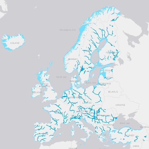
EU-Hydro is a dataset for all EEA38 countries and the United Kingdom providing photo-interpreted river network, consistent of surface interpretation of water bodies (lakes and wide rivers), and a drainage model (also called Drainage Network), derived from EU-DEM, with catchments and drainage lines and nodes. The EU-Hydro dataset is distributed in separate files (river network and drainage network) for each of the 35 major basins of the EEA38 + UK area, in GDB and GPKG formats. The production of EU-Hydro and the derived layers was coordinated by the European Environment Agency in the frame of the EU Copernicus programme.
-

Point locations of water and weather monitoring stations used by the [Surface Water Monitoring Centre](http://www.ontario.ca/page/surface-water-monitoring-centre) to assess flood and drought conditions across Ontario. Monitoring station types include: * streamflow gauge stations * Environment and Climate Change Canada climate stations * Ministry of Transportation road weather stations * Ministry of Natural Resources (MNR) fire weather stations * MNR snow network stations (wildlife) * MNR snow survey stations (weather) * Ontario Power Generation snow survey stations (weather)
-
The USGS National Hydrography Dataset (NHD) service from The National Map (TNM) is a comprehensive set of digital spatial data that encodes information about naturally occurring and constructed bodies of surface water (lakes, ponds, and reservoirs), paths through which water flows (canals, ditches, streams, and rivers), and related entities such as point features (springs, wells, stream gages, and dams). The information encoded about these features includes classification and other characteristics, delineation, geographic name, position and related measures, a "reach code" through which other information can be related to the NHD, and the direction of water flow. The network of reach codes delineating water and transported material flow allows users to trace movement in upstream and downstream directions. In addition to this geographic information, the dataset contains metadata that supports the exchange of future updates and improvements to the data. The NHD is available nationwide in two seamless datasets, one based on 1:24,000-scale maps and referred to as high resolution NHD, and the other based on 1:100,000-scale maps and referred to as medium resolution NHD. Additional selected areas in the United States are available based on larger scales, such as 1:5,000-scale or greater, and referred to as local resolution NHD. The NHD from The National Map supports many applications, such as making maps, geocoding observations, flow modeling, data maintenance, and stewardship. For additional information on the NHD, go to http://nhd.usgs.gov/index.html. The Watershed Boundary Dataset (WBD) is a companion dataset to the NHD. It defines the perimeter of drainage areas formed by the terrain and other landscape characteristics. The drainage areas are nested within each other so that a large drainage area, such as the Upper Mississippi River, will be composed of multiple smaller drainage areas, such as the Wisconsin River. Each of these smaller areas can further be subdivided into smaller and smaller drainage areas. The WBD uses six different levels in this hierarchy, with the smallest averaging about 30,000 acres. The WBD is made up of polygons nested into six levels of data respectively defined by Regions, Subregions, Basins, Subbasins, Watersheds, and Subwatersheds. For additional information on the WBD, go to http://nhd.usgs.gov/wbd.html. The National Map hydrography data is commonly combined with other data themes, such as boundaries, elevation, structures, and transportation, to produce general reference base maps. The National Map download client allows free downloads of public domain NHD and WBD data in either Esri File Geodatabase or Shapefile formats.
-
The USGS National Hydrography Dataset (NHD) service from The National Map (TNM) is a comprehensive set of digital spatial data that encodes information about naturally occurring and constructed bodies of surface water (lakes, ponds, and reservoirs), paths through which water flows (canals, ditches, streams, and rivers), and related entities such as point features (springs, wells, stream gages, and dams). The information encoded about these features includes classification and other characteristics, delineation, geographic name, position and related measures, a "reach code" through which other information can be related to the NHD, and the direction of water flow. The network of reach codes delineating water and transported material flow allows users to trace movement in upstream and downstream directions. In addition to this geographic information, the dataset contains metadata that supports the exchange of future updates and improvements to the data. The NHD is available nationwide in two seamless datasets, one based on 1:24,000-scale maps and referred to as high resolution NHD, and the other based on 1:100,000-scale maps and referred to as medium resolution NHD. Additional selected areas in the United States are available based on larger scales, such as 1:5,000-scale or greater, and referred to as local resolution NHD. The NHD from The National Map supports many applications, such as making maps, geocoding observations, flow modeling, data maintenance, and stewardship. For additional information on the NHD, go to http://nhd.usgs.gov/index.html. The Watershed Boundary Dataset (WBD) is a companion dataset to the NHD. It defines the perimeter of drainage areas formed by the terrain and other landscape characteristics. The drainage areas are nested within each other so that a large drainage area, such as the Upper Mississippi River, will be composed of multiple smaller drainage areas, such as the Wisconsin River. Each of these smaller areas can further be subdivided into smaller and smaller drainage areas. The WBD uses six different levels in this hierarchy, with the smallest averaging about 30,000 acres. The WBD is made up of polygons nested into six levels of data respectively defined by Regions, Subregions, Basins, Subbasins, Watersheds, and Subwatersheds. For additional information on the WBD, go to http://nhd.usgs.gov/wbd.html. The National Map hydrography data is commonly combined with other data themes, such as boundaries, elevation, structures, and transportation, to produce general reference base maps. The National Map viewer allows free downloads of public domain NHD and WBD data in either Esri File or Personal Geodatabase, or Shapefile formats.
-
The Watershed Boundary Dataset (WBD) from The National Map (TNM) defines the perimeter of drainage areas formed by the terrain and other landscape characteristics. The drainage areas are nested within each other so that a large drainage area, such as the Upper Mississippi River, will be composed of multiple smaller drainage areas, such as the Wisconsin River. Each of these smaller areas can further be subdivided into smaller and smaller drainage areas. The WBD uses six different levels in this hierarchy, with the smallest averaging about 30,000 acres. The WBD is made up of polygons nested into six levels of data respectively defined by Regions, Subregions, Basins, Subbasins, Watersheds, and Subwatersheds. For additional information on the WBD, go to http://nhd.usgs.gov/wbd.html. The USGS National Hydrography Dataset (NHD) service is a companion dataset to the WBD. The NHD is a comprehensive set of digital spatial data that encodes information about naturally occurring and constructed bodies of surface water (lakes, ponds, and reservoirs), paths through which water flows (canals, ditches, streams, and rivers), and related entities such as point features (springs, wells, stream gages, and dams). The information encoded about these features includes classification and other characteristics, delineation, geographic name, position and related measures, a "reach code" through which other information can be related to the NHD, and the direction of water flow. The network of reach codes delineating water and transported material flow allows users to trace movement in upstream and downstream directions. In addition to this geographic information, the dataset contains metadata that supports the exchange of future updates and improvements to the data. The NHD is available nationwide in two seamless datasets, one based on 1:24,000-scale maps and referred to as high resolution NHD, and the other based on 1:100,000-scale maps and referred to as medium resolution NHD. Additional selected areas in the United States are available based on larger scales, such as 1:5,000-scale or greater, and referred to as local resolution NHD. For more information on the NHD, go to http://nhd.usgs.gov/index.html. Hydrography data from The National Map supports many applications, such as making maps, geocoding observations, flow modeling, data maintenance, and stewardship. Hydrography data is commonly combined with other data themes, such as boundaries, elevation, structures, and transportation, to produce general reference base maps. The National Map viewer allows free downloads of public domain WBD and NHD data in either Esri File or Personal Geodatabase, or Shapefile formats.