 Arctic SDI catalogue
Agreements
Type of resources
Available actions
Topics
Keywords
Contact for the resource
Provided by
Formats
Representation types
Update frequencies
status
-

Study Area defined in the Agreement to Conduct a Regional Assessment of Offshore Wind Development in Nova Scotia. The study area was created by the Impact Assessment Agency of Canada in collaboration with Natural Resources Canada and the province of Nova Scotia.
-

The Indigenous Mining Agreements dataset provides information on the Indigenous communities signatory to agreements, the types of agreements negotiated, exploration projects and producing mines.
-

The Indigenous agreements dataset contains geographic boundaries as well as basic attribute data representing arrangements between the Government of Canada, provinces and territories, and Indigenous organizations and communities. These arrangements address Indigenous and northern affairs, such as education, economic development, child and family services, health, and housing, that have not been addressed by treaties or through other means. However, this dataset only contains the Indigenous agreements that have a geographic boundary. The Indigenous agreements dataset includes: 1) Self-government agreements which represents the Indigenous groups that govern their internal affairs and assume greater responsibility and control over the decision making that affects their communities. Self-government agreements address the structure and accountability of Indigenous governments, their law-making powers, financial arrangements and their responsibilities for providing programs and services to their members. Self-government enables Indigenous governments to work in partnership with other governments and the private sector to promote economic development and improve social conditions. These boundaries usually represent the surveyed boundaries of the Indigenous group’s Indian reserve. 2) Consultation agreements (Consultation protocol) which represents an agreement signed between the Indigenous group and one or more parties that establish a consultation process. It sets out an orderly process through which the federal and/or provincial governments can consult with an Indigenous group regarding a contemplated project or activity that may have adverse impacts on established or asserted Aboriginal or Treaty rights. These agreements include Federal Bilateral agreement, Federal Tripartite agreement and other agreements. These boundaries are usually not surveyed but help to delineate the geographic extent of the agreement. 3) Other Agreements is the catch-all category for any remaining geographies of signed agreements between the Indigenous group and other parties, that do not fit within the aforementioned categories. These boundaries are usually not surveyed but help to delineate the geographic extent of the agreement. The Indigenous agreements dataset is one of multiple datasets representing treaties and agreements between the Crown and Indigenous peoples. The Crown-Indigenous treaties and agreements geospatial datasets represent the geographic boundaries of the solemn agreements between the Crown and Indigenous peoples that set out promises, obligations and benefits for parties. The following datasets are also available: 1) The Historic treaties (formerly known as Pre-1975 treaties) dataset, which represents most signed treaties that were negotiated between Indigenous peoples and the Crown between 1725 and 1929. 2) The Modern treaties (formerly known as the Post-1975 treaties) dataset, which represents the areas of Canada where Indigenous land rights and title have not been addressed by preceding treaties or through other legal means. The Indigenous agreements dataset is Crown-Indigenous Relations and Northern Affairs Canada (CIRNAC) and Indigenous Services Canada (ISC)’s primary source for Indigenous agreements geographic boundaries on maps. This dataset can also be viewed in the Aboriginal and Treaty Rights Information System (ATRIS). This web-based system provides access to information to inform governments, industry and other interested parties in determining their consultation obligations and in carrying out their consultation research. For more information, visit https://www.rcaanc-cirnac.gc.ca/eng/1100100014686/1609421785838.
-
The Modern treaties (formerly known as the Post-1975 treaties) dataset contains geographic boundaries as well as basic attribute data representing signed agreements that were negotiated between Indigenous groups, the Government of Canada, and provincial and territorial governments after 1975. These boundaries represent the areas of Canada where Indigenous land rights and title have not been addressed by treaty or through other legal means. These boundaries represent the final result of a negotiated First Nation’s claimed area. These boundaries are usually not surveyed but help to delineate the geographic extent of the rights of Indigenous beneficiaries defined within the agreement. The Modern treaties dataset includes: 1) Overall Treaty Area (OTA) which is the broad area to which the agreement applies, often composed of the sum of the specific geographies defined within the treaty. 2) Treaty Settlement Lands that is wholly Indigenous-owned and forms part of the “land and cash” settlements that are integral to the treaty. This category belongs to the Department of Natural Resources Canada and can be found on the Open data website as ‘‘Aboriginal Lands’’ classified as ‘‘Land Claim’’. 3) Treaty-Specified Rights Areas which category pertains to areas (lands or waters) where specific rights, activities or responsibilities apply pursuant to the treaty. 4) Other Treaty-related Geography is the catch-all category for any remaining geographies that do not fit within the aforementioned categories but do form part of the OTA, such as lands or marine areas designated for conservation or for specific projects. For more information about Modern treaties, visit https://www.rcaanc-cirnac.gc.ca/eng/1100100028574/1529354437231#chp4. The Modern treaties dataset is one of multiple datasets representing treaties and agreements between the Crown and Indigenous peoples. The Crown-Indigenous treaties and agreements geospatial datasets represent the geographic boundaries of the solemn agreements between the Crown and Indigenous peoples that set out promises, obligations and benefits for parties. The following datasets are also available: 1) The Historic treaties (formerly known as the Pre-1975 treaties) dataset, which represents most signed treaties that were negotiated between Indigenous peoples and the Crown between 1725 and 1929. 2) The Indigenous agreements dataset, which represents established protocols in place for consultation processes, self-government agreements, and other signed agreements between Indigenous groups and the Crown which do not fall into the aforementioned categories. The Modern treaties dataset is Crown-Indigenous Relations and Northern Affairs Canada (CIRNAC) and Indigenous Services Canada (ISC)’s primary source for Modern treaties geographic boundaries on maps. This dataset can also be viewed in the Aboriginal and Treaty Rights Information System (ATRIS). This web-based system provides access to information to inform governments, industry and other interested parties in determining their consultation obligations and in carrying out their consultation research. For more information, visit https://www.rcaanc-cirnac.gc.ca/eng/1100100014686/1609421785838.
-

This polygon dataset shows Crown land parcels covered by formal flood compensation and other settlement agreements with specified First Nations. The purpose of this dataset is to show Crown land parcels contained within formal flood compensation and other settlement agreements with specified First Nations (does not include Treaty Land Entitlement sites). The Crown lands are not intended for transfer to Government of Canada to be set apart as Reserve land. It is intended that the parcels will be held in fee simple, meaning a certificate of title to the land will be issued to a First Nation corporation.Best efforts have been taken to reasonably illustrate the parcels within the dataset as set out in the respective agreements. All boundaries are to be considered approximate and for illustrative purposes only. The mapped parcels are not removed (or regularly updated) following the survey or transfer of any Crown (Manitoba) land to Canada to be set apart as Reserve for the respective First Nation.For more information on individual agreements, please visit the Manitoba government website: https://www.gov.mb.ca/inr/settlements-and-other-agreements/index.htmlFields included [Alias (Field Name): Field description]OBJECTID (OBJECTID): Sequential unique whole numbers that are automatically generatedID Number (ID): A unique number identifying the land parcelFirst Nation Group (FIRST_NATION): Name of the First Nation part of the land claimSite Name (SITE_NAME): Name of the land parcelSite Type (SITE_TYPE): Site type descriptionArea in Square Meters (AREA): Land parcel area in square metresArea in Hectares (HECTARES): Land parcel area in hectaresArea in Acres (ACREAGE): Land parcel area in acresAgreement Name (AGREEMENT): Name of the settlement agreement under which the land parcel is administeredDate of Agreement (AGREE_DATE): Date of the settlement agreement under which the land parcel is administered
-
This polygon dataset shows Crown land selections by First Nations as outlined by the Treaty Land Entitlement (TLE) Agreements in Manitoba, pursuant to the Crown Lands Act 5(1)(d). The purpose of this dataset is to show Crown land selection boundaries and information as outlined by the Treaty Land Entitlement (TLE) Agreements in Manitoba, pursuant to the Crown Lands Act 5(1)(d). This is a dynamic dataset — data can change daily.Site selections are generally identified and submitted on hard copy 1:50,000 National Topographic System (NTS) maps by the applicable First Nations. Selections are digitized using, where possible, 1:50,000 NTS map sheet base mapping, satellite or aerial imagery in the background. The method used is dependent on the location of the selection and the availability of digital base mapping in the area. A record may contain multiple polygons that have been combined to form one record.Best efforts have been taken to reasonably illustrate the parcels. All boundaries are to be considered approximate and for illustrative purposes only.For more information on Treaty Land Entitlement (TLE) Agreements, please visit the Manitoba government website: https://www.gov.mb.ca/inr/treaty-land-entitlement/index.htmlFields included [Alias (Field Name): Field description]OBJECTID (OBJECTID): Sequential unique whole numbers that are automatically generatedSite ID (SITE_ID): Site ID number of the selected siteArea in Square Metres (AREA): Area in square metresArea in Acres (ACREAGE): Area in acresBand Council Resolution Number (BCR_NO): Band Council Resolution numberName of the First Nation Making the Land Selection (BAND_NAME): Name of the First Nation making the land selectionSite Number (SITE_NO): Site number of the selected siteSelection Name (SELECTION): Name of the selected siteStatus Description (STATUS_DES): Land selection status description
-

The Historic treaties (formerly known as the Pre-1975 treaties) dataset contains geographic boundaries as well as basic attribute data representing signed treaties that were negotiated between Indigenous peoples and the Crown between 1725 and 1929. However, the Treaties of Peace and Neutrality, signed between 1701 and 1760, are not represented in this dataset because they do not have geographic boundaries that can be represented on a map. Apart from the Peace and Friendship Treaties, these boundaries represent the historic treaties signed after 1763, which provided large areas of First Nations land, to the Crown (transferring their Aboriginal title to the Crown) in exchange for reserve lands and other benefits. The Government of Canada recognizes 70 historic treaties in Canada signed between 1701 and 1923. These treaties include: • Treaties of Peace and Neutrality (1701-1760) • Peace and Friendship Treaties (1725-1779) • Upper Canada Land Surrenders and the Williams Treaties (1764-1862/1923) • Robinson Treaties and Douglas Treaties (1850-1854) • The Numbered Treaties (1871-1921) These boundaries are usually not surveyed but help to delineate the broad area described within the treaty. The boundaries are composed of the sum of specific geographies such as lakes, rivers, townships, mountains, administrative boundaries or height of land as mentioned in the treaties transcript. These boundaries are estimated based on written descriptions and should be used for informational and representational purposes only. If there is no geographic description included in the treaty, illustrative polygons may be used to represent locations where the signatory nations, as modern-day collectives, assert and/or exercise Section 35 rights. For more information about Historic treaties, visit https://www.rcaanc-cirnac.gc.ca/eng/1100100028574/1529354437231#chp3. The Historic treaties dataset is one of multiple datasets representing treaties and agreements between the Crown and Indigenous peoples. The Crown-Indigenous treaties and agreements geospatial datasets represent the geographic boundaries of the solemn agreements between the Crown and Indigenous peoples that set out promises, obligations and benefits for parties. The following datasets are also available: 1) The Modern treaties (formerly known as the Post-1975 treaties) dataset, which represents the areas of Canada where Indigenous land rights and title have not been addressed by preceding treaties or through other legal means. 2) The Indigenous agreements dataset, which represents established protocols in place for consultation processes, self-government agreements, and other signed agreements between Indigenous groups and the Crown which do not fall into the aforementioned categories. The Historic treaties dataset is Crown-Indigenous Relations and Northern Affairs Canada (CIRNAC) and Indigenous Services Canada (ISC)’s primary source for Historic treaties geographic boundaries on maps. This dataset can also be viewed in the Aboriginal and Treaty Rights Information System (ATRIS). This web-based system provides access to information to inform governments, industry and other interested parties in determining their consultation obligations and in carrying out their consultation research. For more information, visit https://www.rcaanc-cirnac.gc.ca/eng/1100100014686/1609421785838.
-
This polygon dataset shows Crown land parcels covered by formal flood compensation and other settlement agreements with specified First Nations. It does not include Treaty Land Entitlement (TLE) sites. The purpose of this dataset is to show Crown land parcels contained within formal flood compensation and other settlement agreements with specified First Nations (does not include Treaty Land Entitlement sites). The Crown lands are intended for transfer to the Government of Canada to be set apart as Reserve land. There are different categories/types of compensation lands noted in the various settlement agreements and every agreement has different provisions. Best efforts have been taken to reasonably illustrate the parcels within the dataset as set out in the respective agreements. All boundaries are to be considered approximate and for illustrative purposes only. The mapped parcels are not removed (or regularly updated) following the survey or transfer of any Crown (Manitoba) land to Canada to be set apart as Reserve for the respective First Nation.For more information on individual agreements please visit the Manitoba government website: https://www.gov.mb.ca/inr/settlements-and-other-agreements/index.htmlFields included [Alias (Field Name): Field description]OBJECTID (OBJECTID): Sequential unique whole numbers that are automatically generatedID Number (ID): A unique number identifying the Community Agreement parcelName of First Nation of Non TLE Agreement (FIRST_NATION): Name of the First Nation covered under the non TLE AgreementSite Name (SITE_NAME): Name of the land parcelSite Type (SITE_TYPE): Site type description. Sites can be designated as: exchange land, proposed relocation land, mines and minerals, additional lands, reversion lands, or returned project lands.Area in Square Metres (AREA): Land parcel area in square metresArea in Hectares (HECTARES): Land parcel area in hectaresArea in Acres (ACREAGE): Land parcel area in acresAgreement Name (AGREEMENT): Name of settlement agreement under which the land parcel is administeredDate of Agreement (AGREE_DATE): Date of settlement agreement under which the land parcel is administered
-

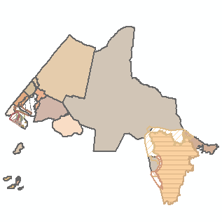
The Inuit Regions, also known as the Inuit Nunangat, dataset contains the geographical boundaries of the 4 Inuit Regions in Canada: Inuvialuit, Nunavut, Nunavik and Nunatsiavut. The boundaries, land only, have been drawn as per information defined in each land claim agreement. The Inuit Regions (Inuit Nunangat) geographical boundaries are approximate and should be used for illustration purposes only. This dataset is Crown-Indigenous Relations and Northern Affairs Canada (CIRNAC) and Indigenous Services Canada (ISC) official source for Inuit regions on maps.
-
This polygon dataset shows First Nation land acquisitions designated as Other Land as outlined by the Treaty Land Entitlement (TLE) Agreements in Manitoba, pursuant to the Crown Lands Act 5(1)(d). The purpose of this dataset is to show geographic boundaries for land acquisitions designated as Other Land, as outlined by the Treaty Land Entitlement (TLE) Agreements in Manitoba, pursuant to the Crown Lands Act 5(1)(d). This is a dynamic dataset - data can change daily.Other Land includes land that has been purchased by the First Nations from private landowners or Surplus Provincial or Surplus Federal land that has been purchased from the Manitoba or Canada governments. The title to the land is privately held by a First Nation corporation until it gets transferred to the Government of Canada, however the mines and minerals and other residual interests may be owned by the Crown (Government of Manitoba) and they are required to be transferred to the Government of Canada (subject to third party interest resolution, if applicable).The sites are generally identified by title with reference to a plan of survey, metes and bounds description. Locations are mapped using existing cadastral or parcel mapping data, or reasonably illustrate the site within the dataset. A record may contain multiple polygons that have been combined to form one record.All boundaries are to be considered approximate and for illustrative purposes only.For more information on Treaty Land Entitlement (TLE) Agreements please visit the Manitoba government website: https://www.gov.mb.ca/inr/treaty-land-entitlement/index.htmlFields included [Alias (Field Name): Field description]OBJECTID (OBJECTID): Sequential unique whole numbers that are automatically generatedSite ID (SITE_ID): Site ID number of the selected siteArea in Square Metres (AREA): Area in square metresArea in Acres (ACREAGE): Area in acresBand Council Resolution Number (BCR_NO): Band Council Resolution numberName of the First Nation Making the Land Selection (BAND_NAME): Name of the First Nation making the land selectionSite Number (SITE_NO): Site number of the selected siteSelection Name (SELECTION): Name of the selected site