 Arctic SDI catalogue
Mineral resources
Type of resources
Available actions
Topics
Keywords
Contact for the resource
Provided by
Years
Formats
Representation types
Update frequencies
status
Scale
Resolution
-
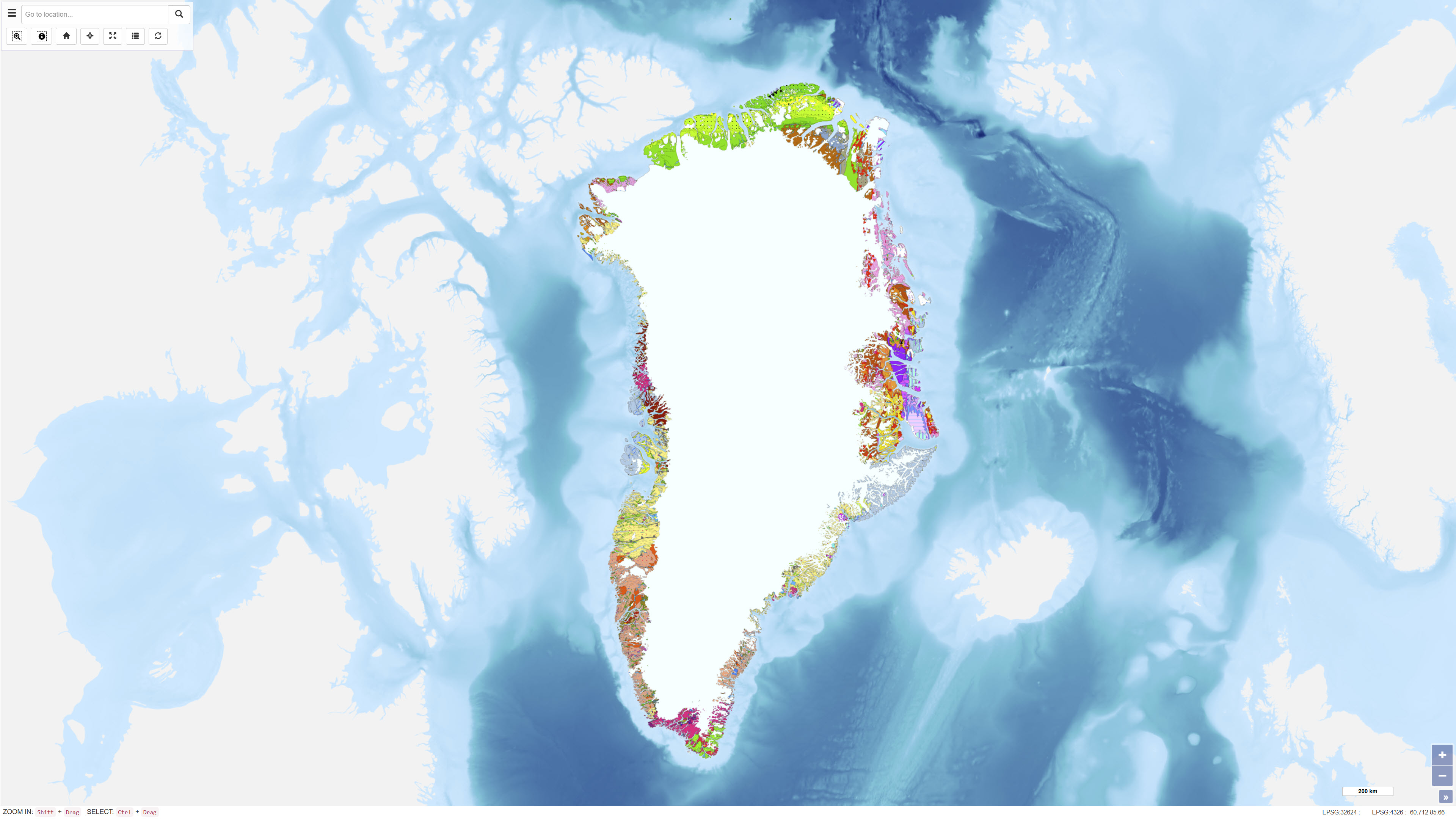
This dataset describes the intrusions and magmatic complexes of Greenland, forming a dedicated information layer within the GEUS GMOMDB2 database, displayed via the Greenland Mineral Occurrence Map (GMOM2). It includes 194 registered intrusions and complexes grouped into 23 magmatic provinces. The data are compiled from GEUS geological maps, published sources, and company reports. The Palaeogene intrusions and complexes of East Greenland (66–75°N) are related to the opening of the North Atlantic and the influence of the ancestral Icelandic mantle plume. The magmatic evolution includes flood basalts, dyke swarms, and intrusive activity from 61 to 13 Ma. Economic mineralisation is documented in several complexes, including the Skaergaard palladium deposit and the Malmbjerg porphyry molybdenum deposit, representing classic examples of rift- and post-rift-related mineral systems. The dataset provides harmonised, quality-controlled geological information to support exploration and research activities in Greenland.
-

Þjónustan inniheldur staðsetningu og upplýsingar um borholur og gryfjur sem eru skráðar hjá Vegagerðinni.
-
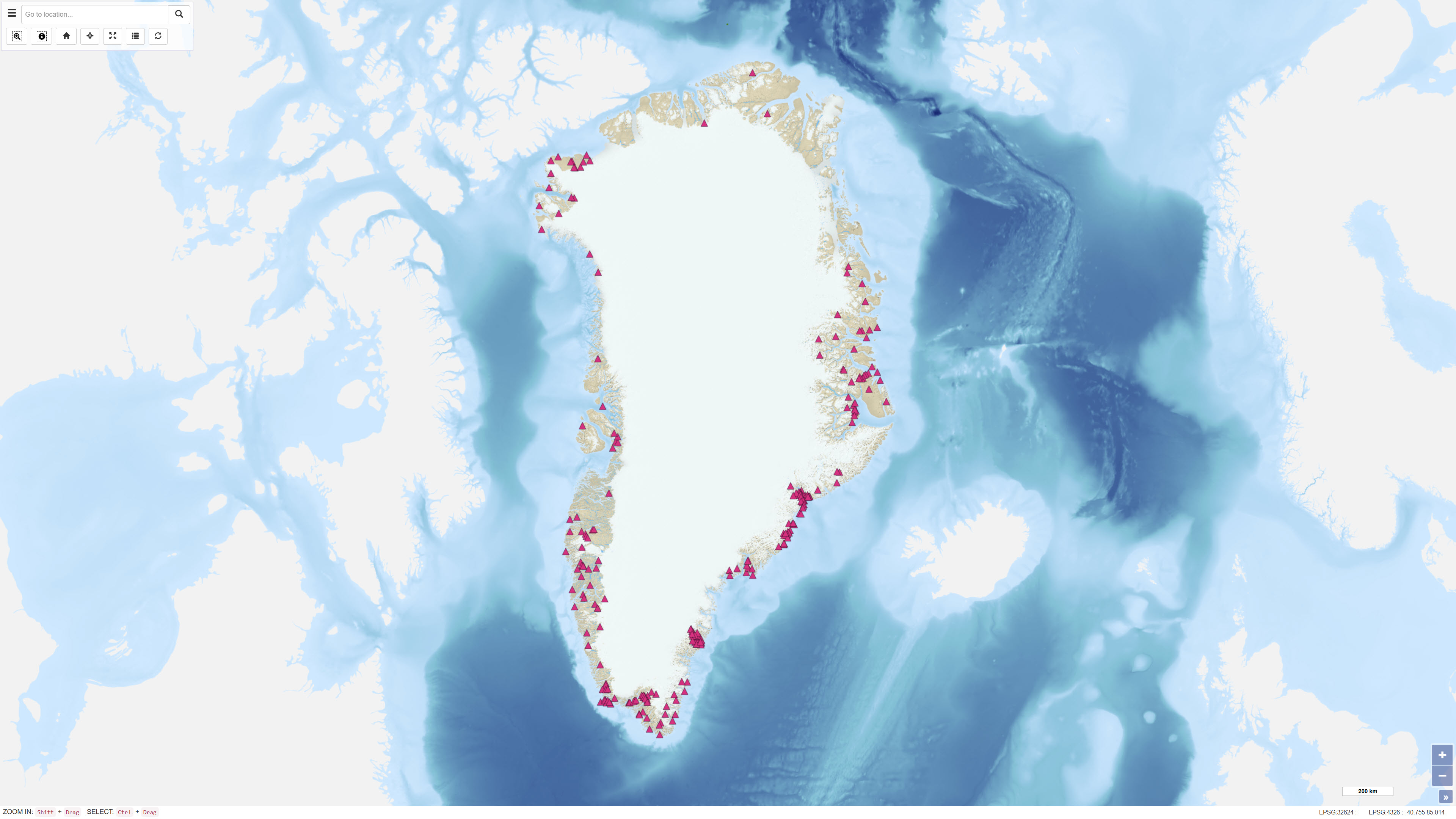
The dataset contains a summary of geological information for known mineral occurrence regions in Greenland. The information includes the geographic location, size, mineral commodities, mineralisation type, exploration history and a geological description of each occurrence or deposit. The data have been collected and compiled from field investigations conducted by geological surveys, academic researchers and mineral exploration companies. The dataset represents a regional synthesis of mineral occurrence information and provides an overview of the spatial distribution and geological context of known mineral resources in Greenland.
-
This dataset contains an overview of all active exploitation licences in Greenland. The data are hosted and maintained by the Ministry of Mineral Resources (MMR), Government of Greenland. GEUS harvests the data through a WFS service provided by MMR and makes them available for visualisation through GEUS map services. The dataset represents the geographic extent of valid exploitation licences and functions as an administrative reference dataset.
-

Ujarassiorit is Greenland’s national mineral hunt, a public competition open to residents of Greenland. The initiative encourages participants to collect and submit rock samples from anywhere in Greenland to the Ministry of Mineral Resources for geological evaluation. Submitted samples are assessed by geologists, and selected participants may be awarded prizes. The purpose of Ujarassiorit is to increase public awareness of Greenland’s mineral resources and to support mineral exploration by identifying areas of geological interest through public participation. The initiative contributes to the collection of geological information and promotes engagement with geoscience among the population.
-
The main geological environments in Greenland and their mineral resources have been described and divided into four main geological environments: infracrustal regions, supracrustal regions, magmatic provinces and sedimentary basin regions. Within the various geological environments, characteristic mineral deposits are outlined. Within the infracrustal environment, relatively few mineral occurrences are recorded in Greenland, but three types are described: gold in gneiss, nickel and copper in mafic intrusions, and olivine in ultramafic rocks. For more detailed information, reference is made to the report Greenland geological environments and mineral resources.