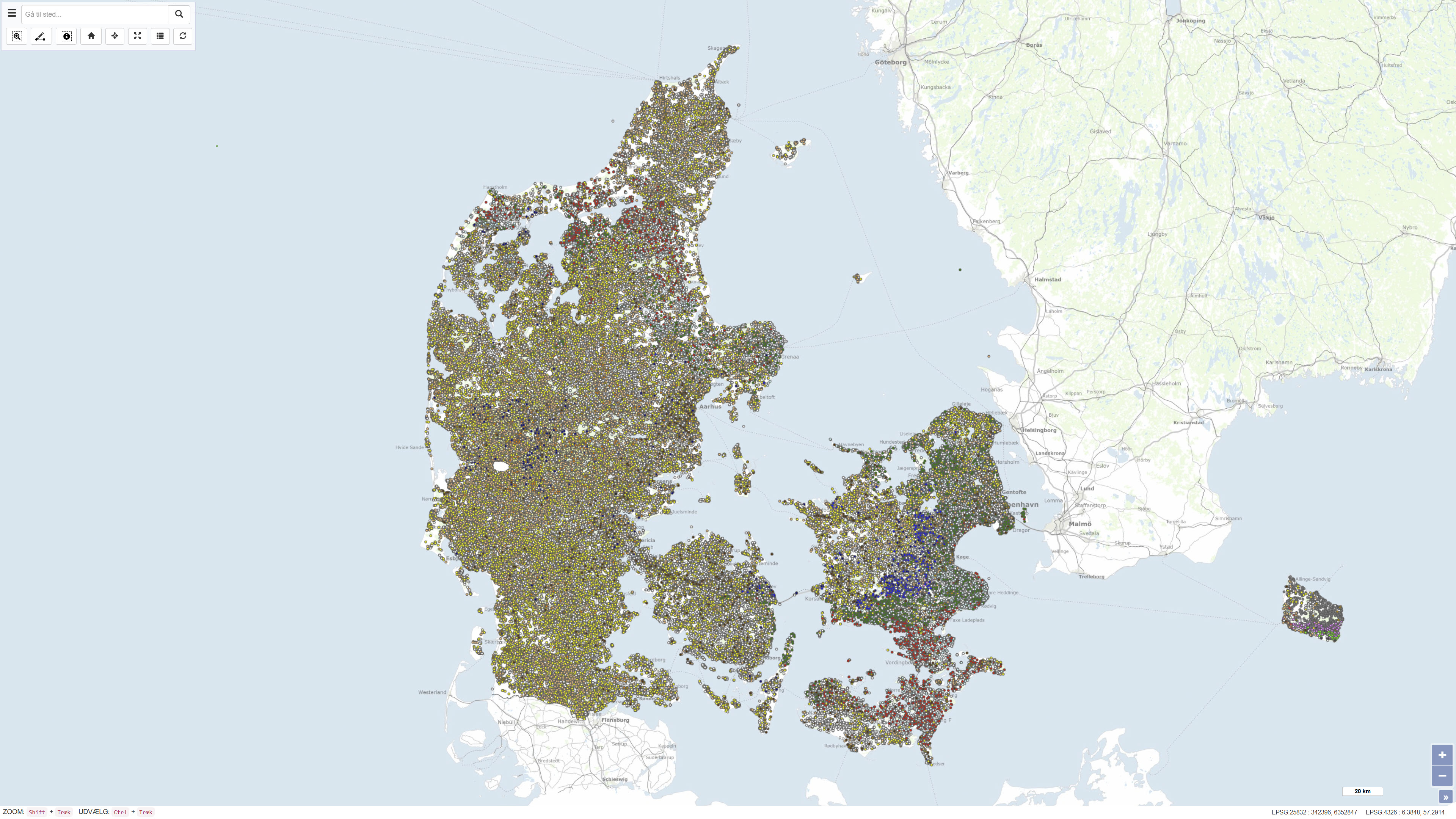
 Arctic SDI catalogue
Database
Type of resources
Available actions
Topics
Keywords
Contact for the resource
Provided by
Formats
Representation types
Update frequencies
status
Scale
-
The National well database (Jupiter) among other things contains water level measurements from Danish wells. The database contains water level measurements from the municipalities, the groundwater-monitoring program, the regions soil pollution investigations and from the establishment of new wells.
-
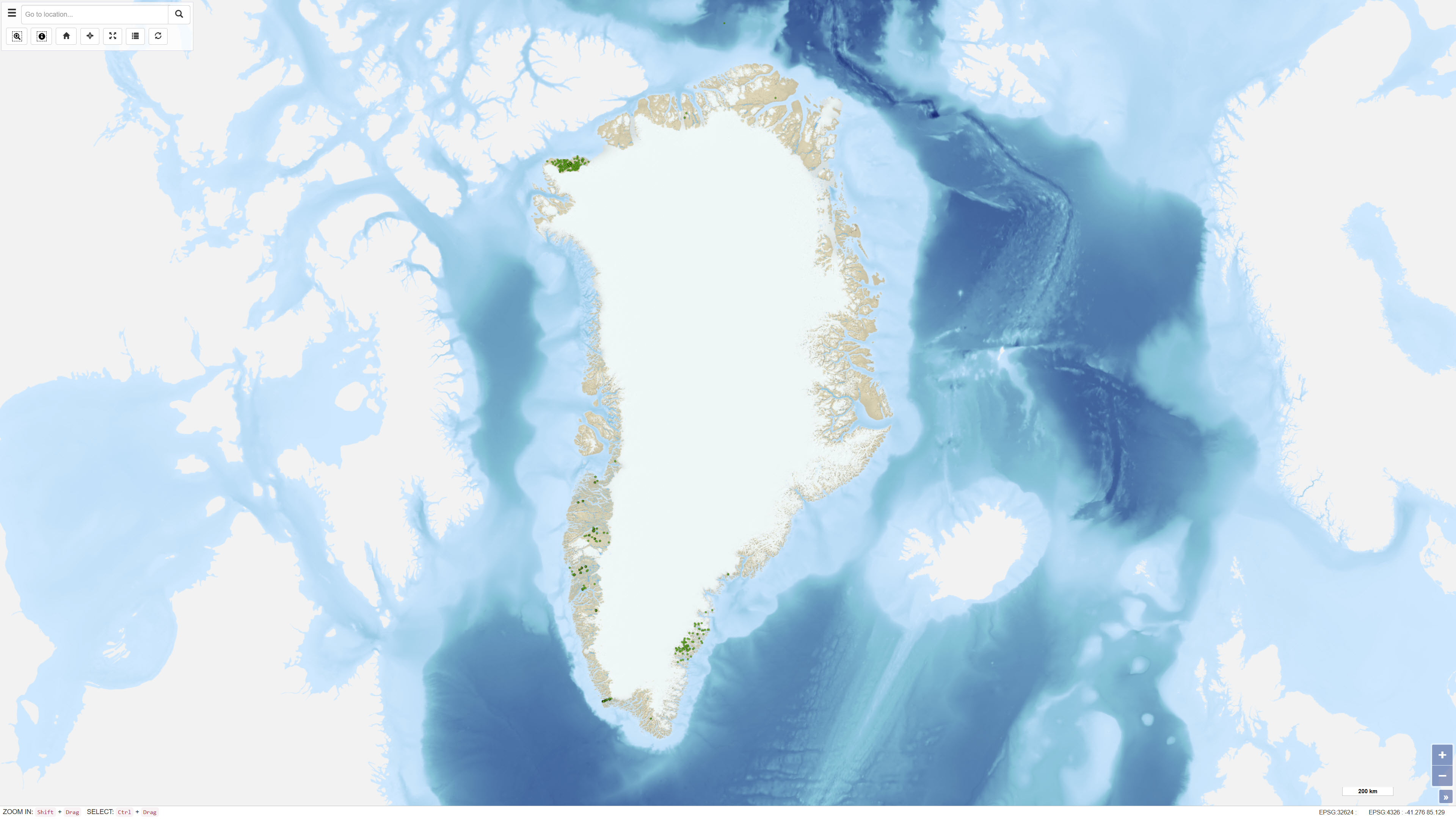
The dataset comprises geochemical analyses of 1,269 soil samples collected in Greenland from 1974 onwards as part of systematic geochemical mapping and mineral exploration programmes. Soil samples were primarily collected in areas lacking developed stream channels where stream sediment sampling was not feasible. The samples represent surface material and have been analysed for major and trace elements using various laboratory methods including X-ray Fluorescence Spectrometry (XRF), Instrumental Neutron Activation Analysis (INA), Inductively Coupled Plasma Emission Spectrometry (ICP), and Atomic Absorption Spectrometry (AAS). The dataset contains the original analytical results as received from the laboratories together with administrative information on sample location and analysed grain-size fraction. The data form part of the analytical basis for the Geochemical Atlas of West and South Greenland.
-
The dataset contains basic information on the location of onshore and offshore drillholes in Greenland established for scientific research as well as mineral, oil and gas exploration. The dataset functions as a geographic reference layer and, where available, includes links to reports or summary sheets representing the original source of information. The dataset covers drillholes established between 1948 and 2019 and is subject to continuous updates as new information becomes available through scientific publications, press releases and company documentation.
-
The dataset contains a summary of geological information for known mineral occurrence regions in Greenland. The information includes the geographic location, size, mineral commodities, mineralisation type, exploration history and a geological description of each occurrence or deposit. The data have been collected and compiled from field investigations conducted by geological surveys, academic researchers and mineral exploration companies. The dataset represents a regional synthesis of mineral occurrence information and provides an overview of the spatial distribution and geological context of known mineral resources in Greenland.
-
The Greenland Geochronology Database is a systematic compilation of published U-Pb geochronological data from Greenland. The dataset integrates age determinations from a wide range of scientific publications and normalises isotopic ratios and uncertainties into a consistent format, with all analytical errors reported at the 1 sigma level. Ratios have been verified against reported ages and corrected where necessary to ensure internal consistency. The database is structured to enable efficient querying and cross-comparison of geochronological information derived using different analytical standards.
-
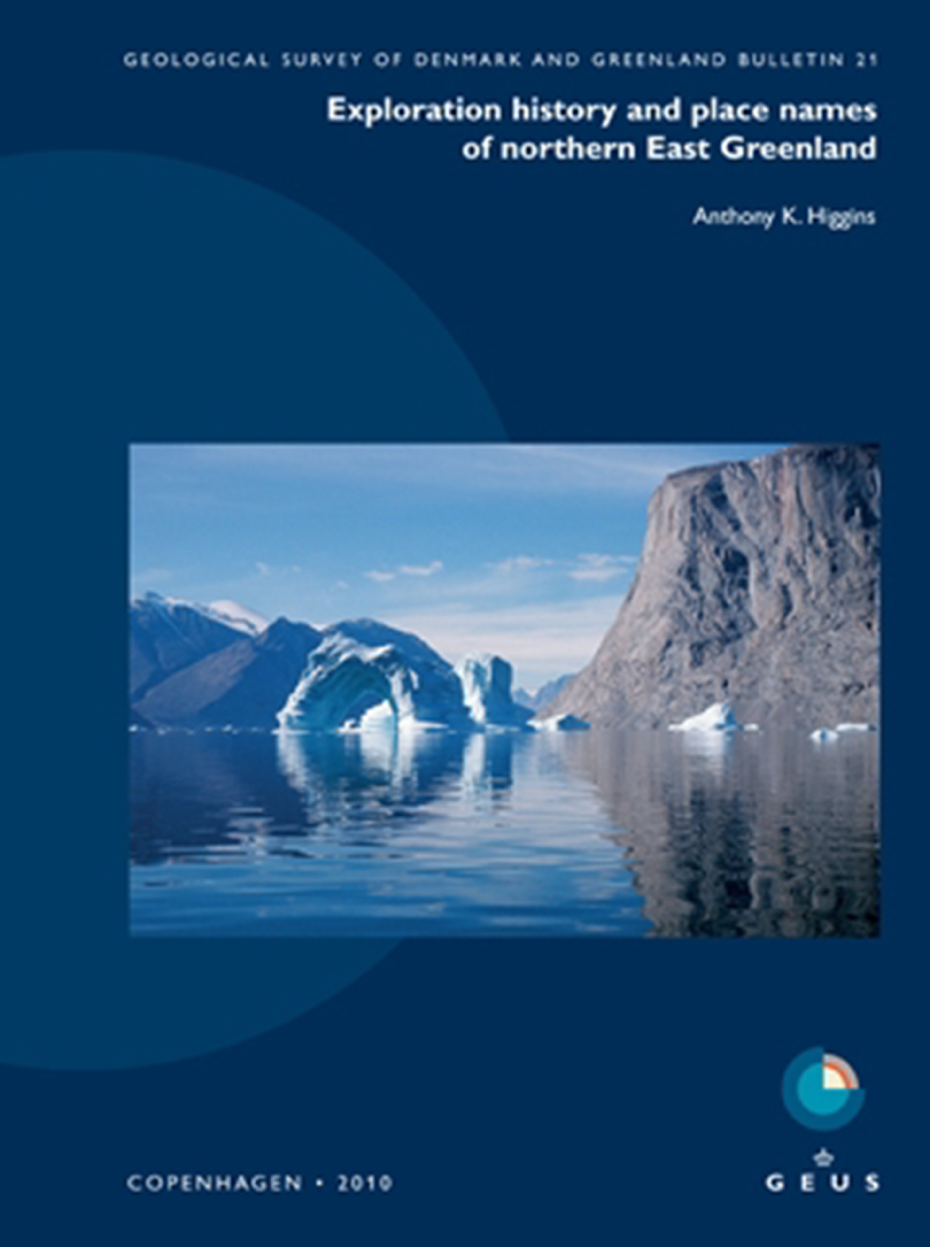
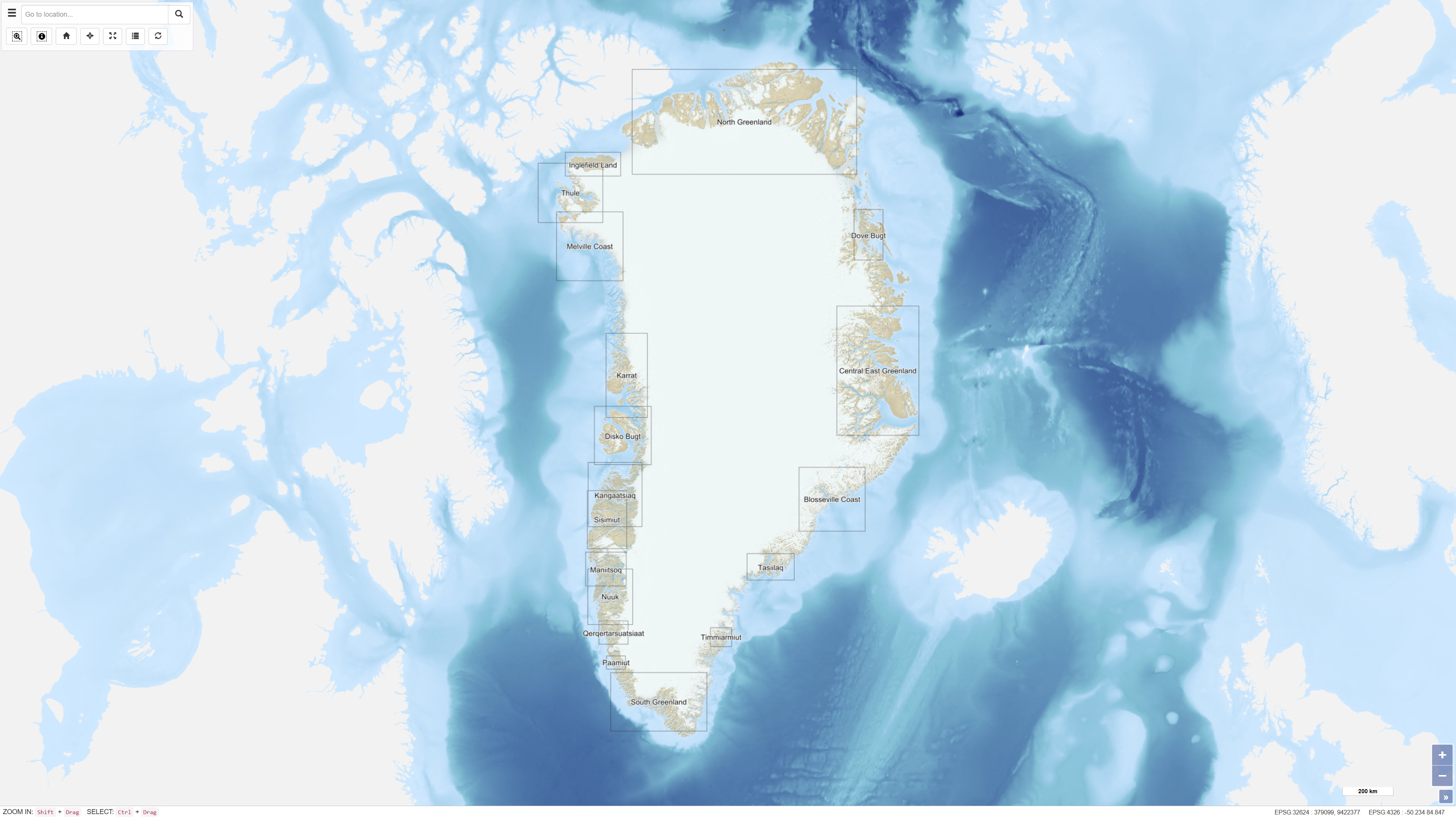
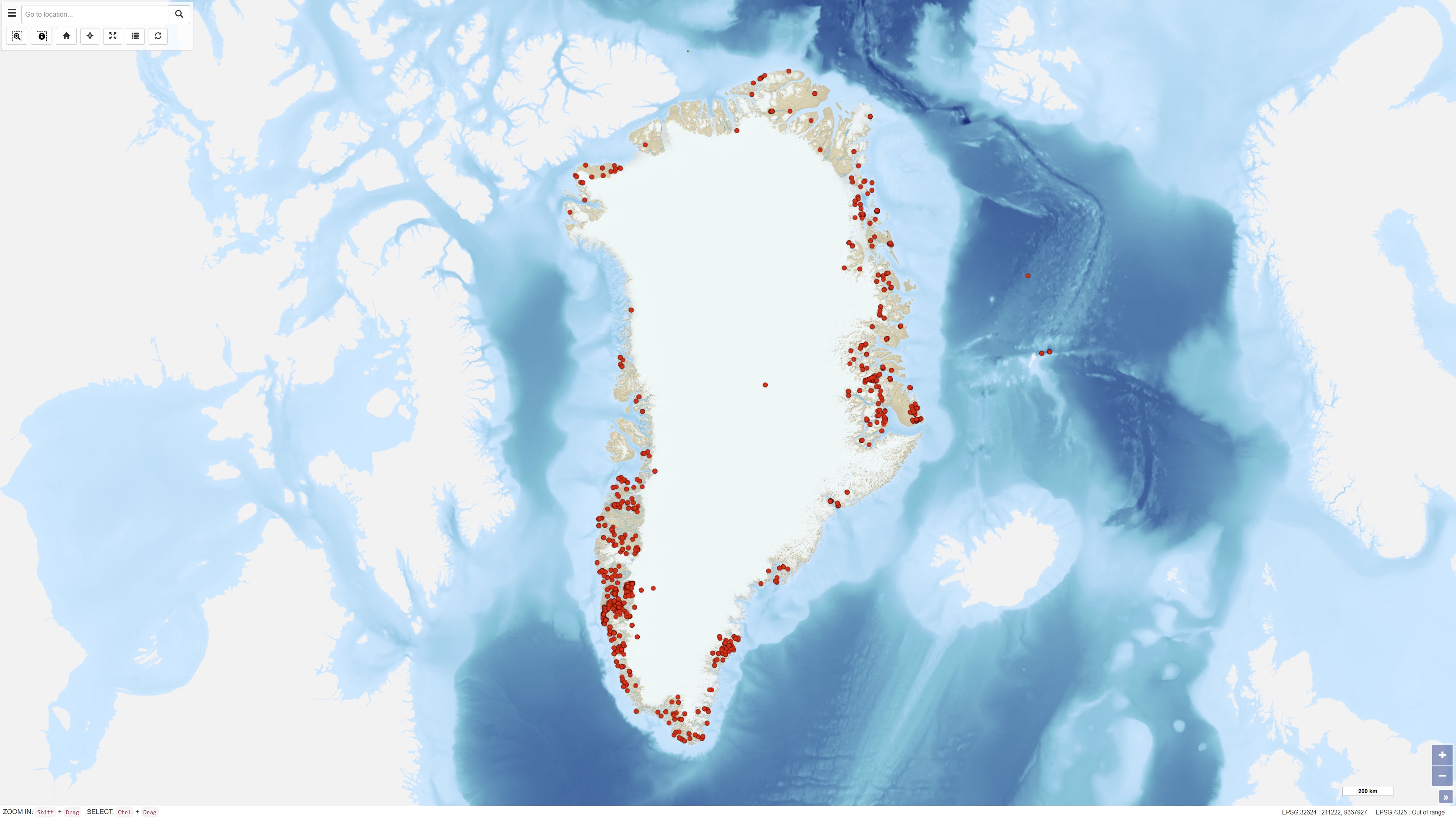
The dataset contains place names and associated historical and explanatory information for Northern East Greenland based on the book Northern East Greenland’s research history and place names by A.K. Higgins, published by GEUS in 2010. The dataset includes geographic locations of place names together with their explanations and historical background. The original maps and place name information have been converted to a web-based GIS format, allowing users to search for place names via free-text search and view their spatial distribution on an interactive map. The dataset forms part of the web-based presentation of Northern East Greenland’s place names and research history.
-
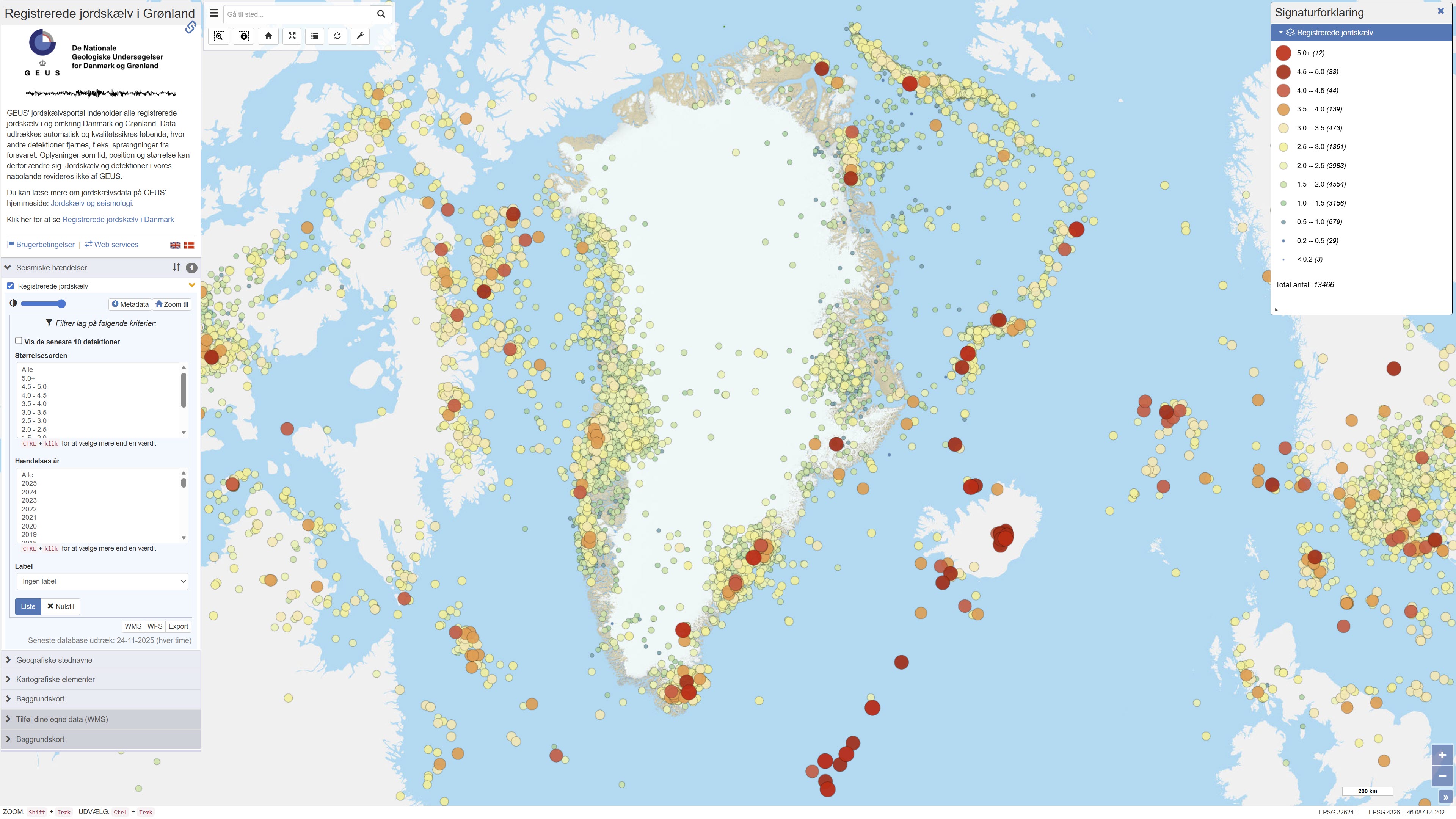
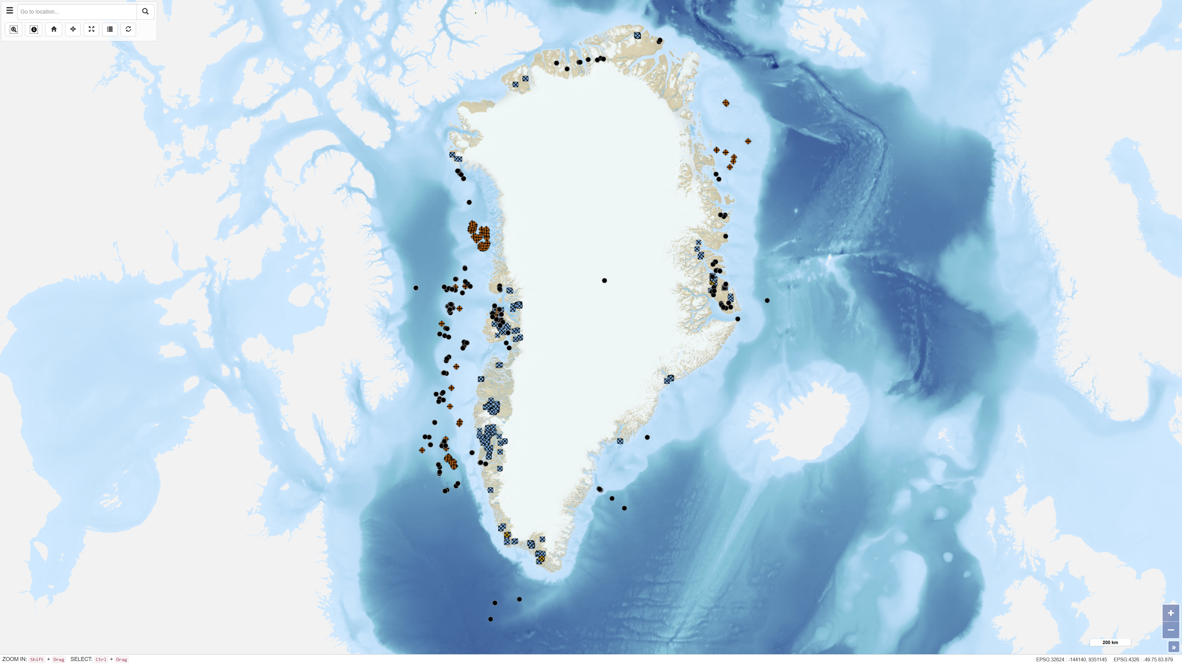
The dataset contains recorded earthquakes and seismic events in Greenland. The data include information on event time, geographic location (epicentre), depth and magnitude for confirmed and suspected earthquakes. The dataset is based on observations from GEUS’ seismic monitoring network and is used for monitoring, research and dissemination of seismic activity in Greenland.
-
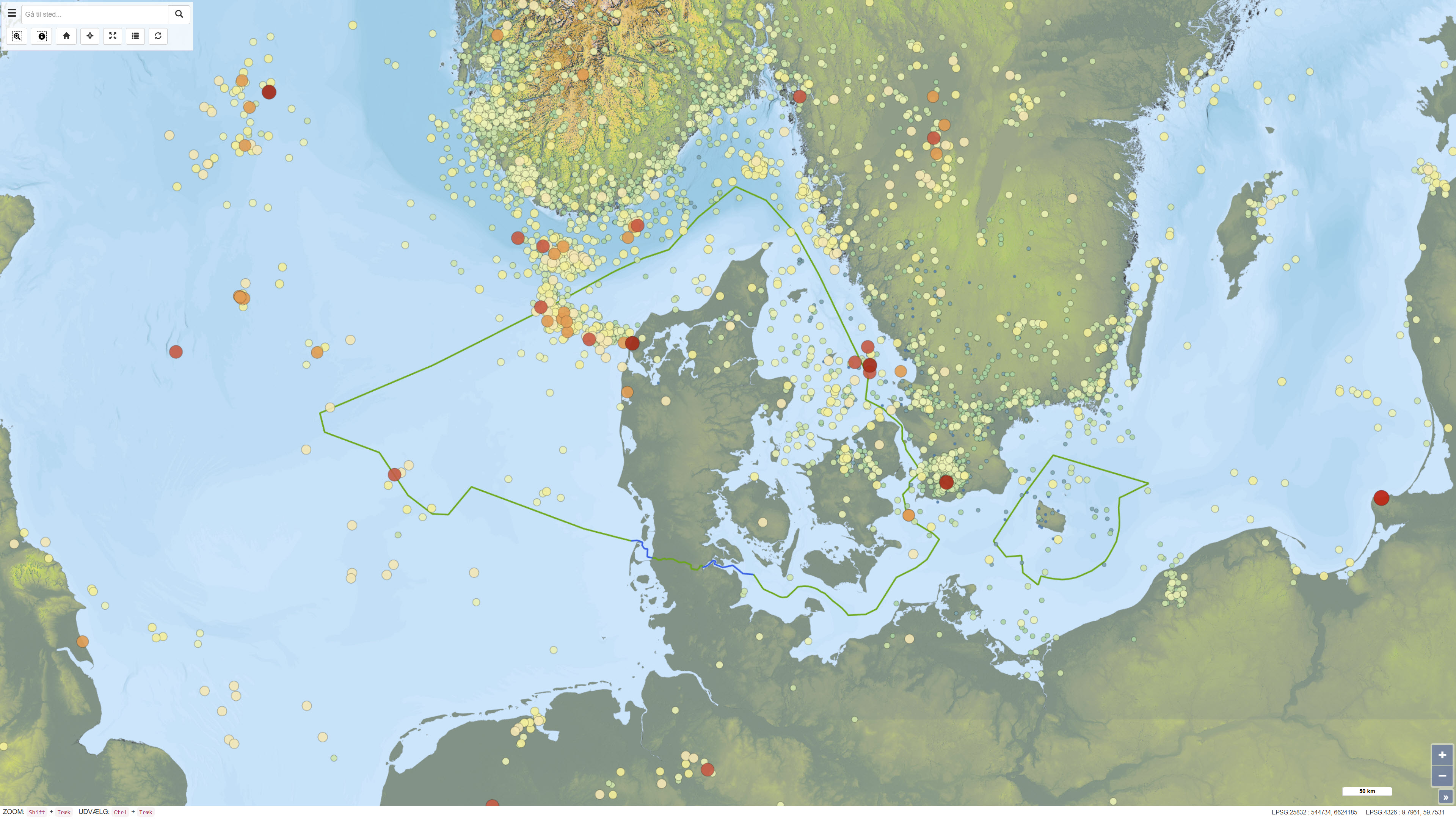
This dataset provides a national overview of all registered earthquakes in Denmark, including time, location, depth and magnitude. The recordings are based on data from GEUS’ national seismic network and comprise both measured earthquakes and subsequently quality-assured observations. The dataset is continuously updated and reflects the best scientific assessment of seismic activity in Denmark, where improved instrumentation and analysis today allow detection of much weaker tremors than historically.
-
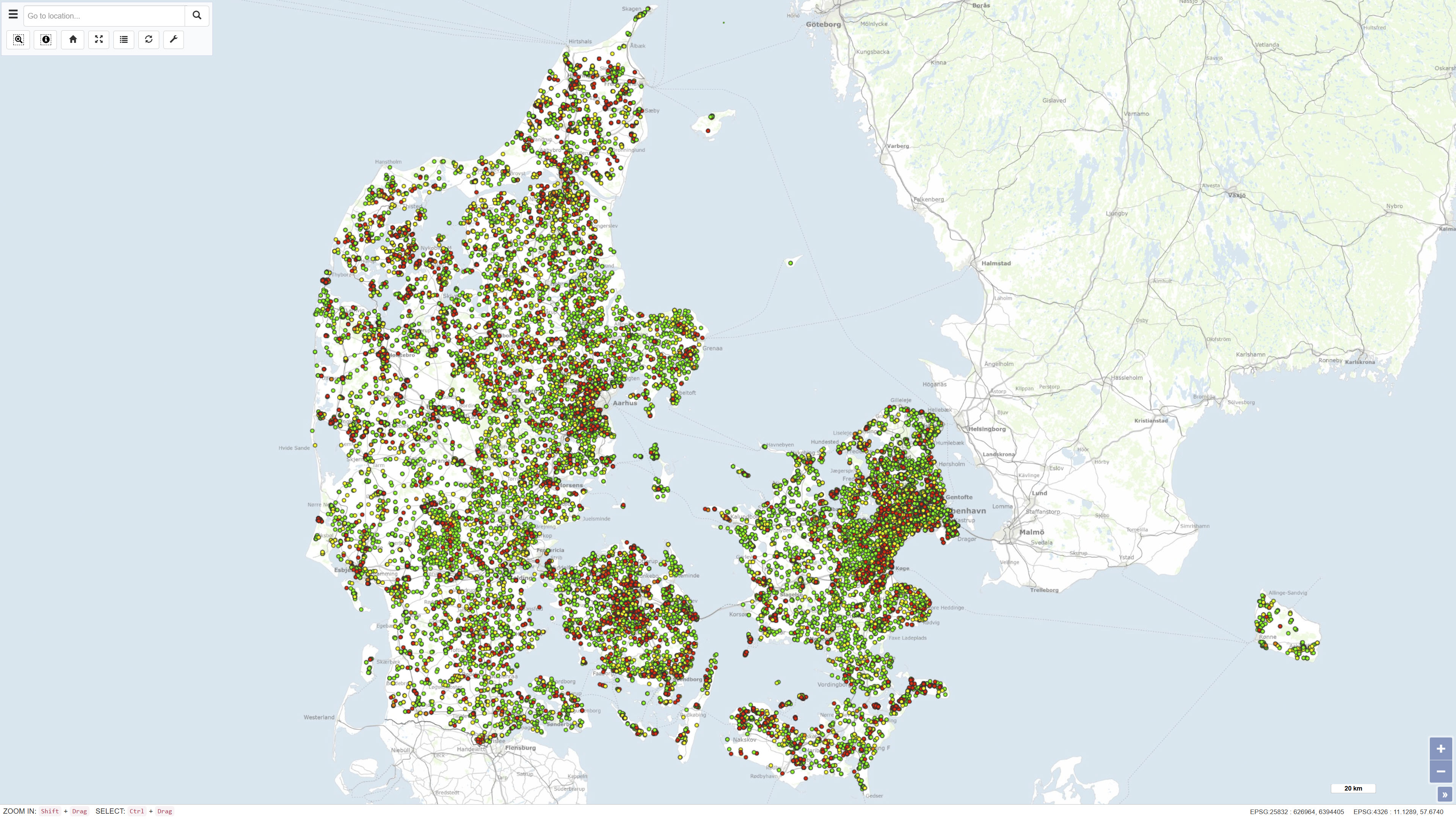
Results from laboratory analyses of related to monitoring the quality of water wells and drinking water taps in household. This dataset is part of GEUS' nation-wide database for shallow boreholes, the common public database and is part of Denmarks Environmental Portal. The database is publicly available and is continually updated.
-
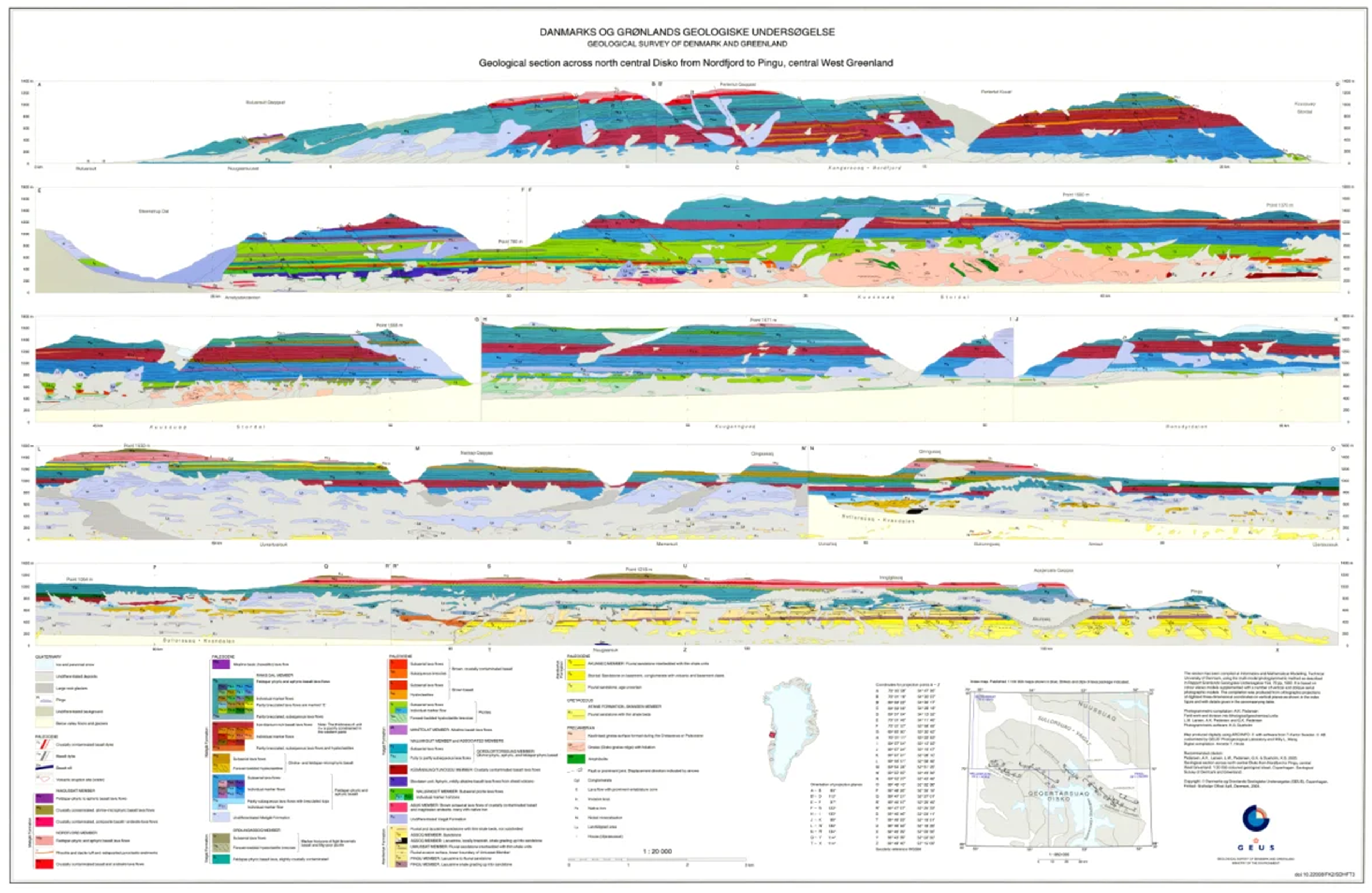
The dataset comprises a collection of geological cross sections from Greenland derived from multiple geological mapping projects and publications. The cross sections represent interpretations of subsurface geological structures and stratigraphy across selected regions and are associated with published geological maps and reports. Profile lines have been georeferenced, and the corresponding cross-section images have been digitised and stored as separate PDF files. Each profile is linked to the geological map or publication from which it originates. Due to the diverse origins of the profiles, the level of detail, scale and geological interpretation vary between individual cross sections.