 Arctic SDI catalogue
Downloadable Data
Type of resources
Available actions
Topics
Keywords
Contact for the resource
Provided by
Years
Formats
Representation types
Update frequencies
status
Service types
Scale
-

Þetta lag sýnir gömlu sýslurnar og er unnið úr IS 50V gögnum. Er byggt á korti frá LMÍ sem kom út árið 1990 (heitir: Hreppa- og sýsluskipting).
-

Corine Land Cover (CLC) 2012 and CLC change 2006-2012 are two of the datasets produced within the frame of the Initial Operations of the Copernicus programme (the European Earth monitoring programme previously known as GMES) on land monitoring.Corine Land Cover (CLC) provides consistent information on land cover and land cover changes across Europe. This inventory was initiated in 1985 (reference year 1990) and established a time series of land cover information with updates in 2000, 2006 and 2012 being the last one. CLC products are based on photointerpretation of satellite images by national teams of participating countries - the EEA member and cooperating countries – following a standard methodology and nomenclature with the following base parameters: 44 classes in the hierarchical three level Corine nomenclature; minimum mapping unit (MMU) for status layers is 25 hectares; minimum width of linear elements is 100 metres; minimum mapping unit (MMU) for Land Cover Changes (LCC) for the change layers is 5 hectares. The resulting national land cover inventories are further integrated into a seamless land cover map of Europe. Land cover and land use (LCLU) information is important not only for land change research, but also more broadly for the monitoring of environmental change, policy support, the creation of environmental indicators and reporting. CLC datasets provide important datasets supporting the implementation of key priority areas of the Environment Action Programmes of the European Union as protecting ecosystems, halting the loss of biological diversity, tracking the impacts of climate change, assessing developments in agriculture and implementing the EU Water Framework Directive, among others.More about the Corine Land Cover (CLC) and Copernicus land monitoring data in general can be found at http://land.copernicus.eu/.
-

The Corine Land Cover datasets CLC2000, CLC2006 and CLC change 2000-2006 areproduced within the frame of the GMES land monitoring project. Corine Land Cover (CLC) provides consistent information on land cover and land cover changes across Europe. This inventory was initiated in 1985 (reference year 1990) and established a time series of land cover information with updates in 2000 and 2006.CLC products are based on photointerpretation of satellite images by national teams of participating countries - the EEA member and cooperating countries – following a standard methodology and nomenclature with the following base parameters: 44 classes in the hierarchical three level Corine nomenclature; minimum mapping unit (MMU) for status layers is 25 hectares; minimum width of linear elements is 100 metres; minimum mapping unit (MMU) for Land Cover Changes (LCC) for the change layers is 5 hectares. The resulting national land cover inventories are further integrated into a seamless land cover map of Europe.Land cover and land use (LCLU) information is important not only for land change research, but also more broadly for the monitoring of environmental change, policy support, the creation of environmental indicators and reporting. CLC datasets provide important datasets supporting the implementation of key priority areas of the Environment Action Programmes of the European Union as protecting ecosystems, halting the loss of biological diversity, tracking the impacts of climate change, assessing developments in agriculture and implementing the EU Water Framework Directive, among others.More about the Corine Land Cover (CLC) and Copernicus land monitoring data in general can be found at http://land.copernicus.eu/.
-

This dataset contains results from an eelgrass classification for Bouctouche Bay, New Brunswick. True colour aerial photography at 57 centimetre resolution was collected on September 2, 2009 by Nortek Resources of Thorburn, Nova Scotia (http://www.nortekresources.com/). Image classification was conducted using eCognition Developer v. 8 Software, which first segments the image into spectrally similar units, which were then classified manually. Additionally, the Department of Fisheries and Oceans (Gulf Region, Moncton, NB) conducted a visual field survey in the same field season at 688 sites. Two-thirds of these sites were used to assist in image classification, while the remainder were used to assess accuracy. Three classes were identified: i. Good Quality Eelgrass: relatively dense, clean, green blades with minimal epiphytes or algal growth. ii. Medium Quality Eelgrass: predominately green blades that may have some epiphyte or algal growth. These stands can be less or equally dense as Good Quality Eelgrass, but the best grasses are certainly not as abundant. iii. Eelgrass Absent/Poor Quality: eelgrass is absent, or if it is present it is typically covered with epiphytes or other algae or dying or dead. Eelgrass was classified correctly 83.7% of the time in a fuzzy accuracy assessment technique, whereby those classes that were ‘off’ by one class, e.g. Good Quality eelgrass classed as Medium Quality, were given half credit towards the overall accuracy. Of 187 sites that were within the classification area, 131 were correct, 51 were "one-off", and 5 were incorrect [(131 + (51/2))/ 187 = 0.837].
-

It has long been understood that eelgrass (Zostera marina) is important to waterfowl such as Atlantic Brant (Branta bernicla hrota), Canada Goose (Branta canadensis), American Black Duck (Anas rubripes), Common Goldeneye (Bucephala clangula) and Barrow's Goldeneye (Bucephala islandica). In New Brunswick, eelgrass can be found along the Gulf of St. Lawrence, in protected harbours such as at Neguac Bay, in the province's northeast (47015’N, 65002’W).This dataset contains results from an eelgrass classification for Neguac Bay, New Brunswick. True colour aerial photography at 57 centimetre resolution was collected on September 2, 2009 by Nortek Resources of Thorburn, Nova Scotia (https://www.nortekresources.com/). Image classification was conducted using eCognition Developer v. 8 Software, which first segments the image into spectrally similar units, which were then classified manually. Additionally, the Department of Fisheries and Oceans (Gulf Region, Moncton, NB) conducted a visual field survey in the same field season at 126 sites. Two-thirds of these sites were used to assist in image classification, while the remainder were used to assess accuracy. Three classes were identified:Good Quality Eelgrass: relatively dense, clean, green blades with minimal epiphytes or algal growth. Medium Quality Eelgrass: predominately green blades that may have some epiphyte or algal growth. These stands can be less or equally dense as Good Quality Eelgrass, but the best grasses are certainly not as abundant. Eelgrass Absent/Poor Quality: eelgrass is absent, or if it is present it is typically covered with epiphytes or other algae or dying or dead. Eelgrass was classified correctly 81% of the time in a fuzzy accuracy assessment technique, whereby those classes that were ‘off’ by one class, e.g. Good Quality eelgrass classed as Medium Quality, were given half credit towards the overall accuracy. Of 39 sites that were within the classification area, 27 were correct, 9 were "one-off", and 3 were incorrect [(27 + (9/2))/ 39 = 0.81].
-

True colour aerial photography at 57 centimetre resolution was collected on August 20th and 24th, 2009 by Nortek Resources of Thorburn, Nova Scotia (http://www.nortekresources.com/). Image classification was conducted using eCognition Developer v. 8 Software, which first segments the image into spectrally similar units, which were then classified manually. Additionally, the Department of Fisheries and Oceans (Gulf Region, Moncton, NB) conducted a visual field survey in the same field season at 103 sites. From these sites 70% were used to assist in image classification, while the remainder were used to assess accuracy. Three classes were identified: i. Good Quality Eelgrass: relatively dense, clean, green blades with minimal epiphytes or algal growth. ii. Medium Quality Eelgrass: predominately green blades that may have some epiphyte or algal growth. These stands can be less or equally dense as Good Quality Eelgrass, but the best grasses are certainly not as abundant. iii. Eelgrass Absent/Poor Quality: eelgrass is absent, or if it is present it is typically covered with epiphytes or other algae or dying or dead. Eelgrass was classified correctly 96.7% of the time (30/31 = 0.967).
-

Yfirborðið er einfaldað flákalag úr CORINE-verkefninu sem sýnir gróin og ógróin svæði, skipulögð svæði og vatnafar (stærstu svæðin sem lenda undir vatni).
-
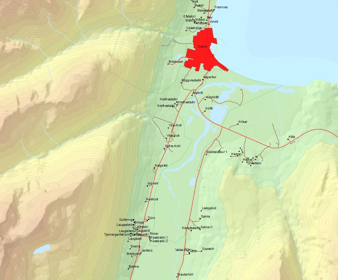
Mannvirki utan þéttbýlis og útlínur þéttbýlisstaða. Mannvirki skiptast í 2 lög, punktalag og flákalag. Punktalagði sýnir mannvirki utan þéttbýlis. Í laginu eru íbúðarhús, sumarhús, skálar, skólar, kirkjur, vitar og veitumannvirki svo eitthvað sé nefnt. Í dálkinum virkni er hægt að sjá hvort það sé búseta eða ekki. Flákalagið sýnir útlínur þéttbýlisstaða og einnig eru íbúatölur sem koma frá Hagstofunni.
-

The Corine Land Cover datasets CLC2000, CLC2006and CLC change 2000-2006areproduced within the frame of the GMES land monitoringproject.Corine Land Cover (CLC) provides consistent information on land cover and land cover changes across Europe. This inventory was initiated in 1985 (reference year 1990) and established a time series of land cover information with updates in 2000 and 2006.CLC products are based on photointerpretation of satellite images by national teams of participating countries - the EEA member and cooperating countries – following a standard methodology and nomenclature with the following base parameters: 44 classes in the hierarchical three level Corine nomenclature; minimum mapping unit (MMU) for status layers is 25 hectares; minimum width of linear elements is 100 metres; minimum mapping unit (MMU) for Land Cover Changes (LCC) for the change layers is 5 hectares. The resulting national land cover inventories are further integrated into a seamless land cover map of Europe.Land cover and land use (LCLU) information is important not only for land change research, but also more broadly for the monitoring of environmental change, policy support, the creation of environmental indicators and reporting. CLC datasets provide important datasets supporting the implementation of key priority areas of the Environment Action Programmes of the European Union as protecting ecosystems, halting the loss of biological diversity, tracking the impacts of climate change, assessing developments in agriculture and implementing the EU Water Framework Directive, among others.More about the Corine Land Cover (CLC) and Copernicus land monitoring data in general can be found at http://land.copernicus.eu/.
-

Strandlínulagið inniheldur bæði línu- og flákalag og er strandlína landsins sýnd auk eyja og skerja.Í fitjuklasanum is50v_strandlina_linur er strandlína landsins, eyja og skerja sýnd. Hægt er að sjá hvort línan tilheyrir eyjum eða skerjum. Í laginu is50v_strandlina_flakar er strandlína landsins, eyja og skerjar sýnd.