 Arctic SDI catalogue
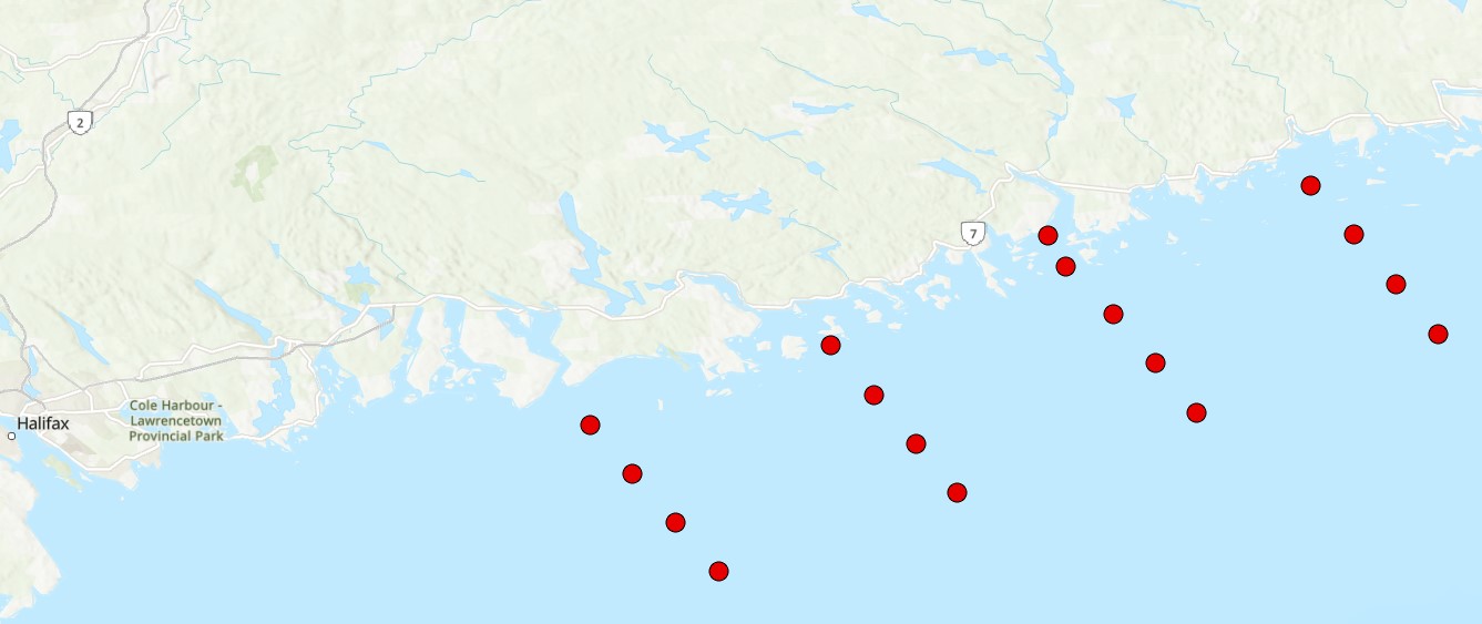
Marine conservation areas
Type of resources
Available actions
Topics
Keywords
Contact for the resource
Provided by
Years
Formats
Representation types
Update frequencies
status
Service types
-
-
-
This dataset contains area-based management measures that qualify as 'other effective area-based conservation measures' ('other measures') according to DFO's Operational Guidance for Identifying ‘Other Effective Area-Based Conservation Measures’ in Canada’s Marine Environment (http://www.dfo-mpo.gc.ca/oceans/publications/oeabcm-amcepz/index-eng.html). It also contains basic information about these ‘other measures’, specifically their names, objectives, and prohibitions. The identification of existing, and establishment of new, 'other measures' is an important element of Canada’s strategy to meet its marine conservation targets to protect 5 percent of Canada’s marine and coastal areas by 2017 and 10 percent by 2020. 'Other measures' will be evaluated regularly, taking the most recent available information into account. In addition new 'other measures' will be identified or established over time. Therefore, this data set may change over time, and is considered current as of its publication date stamp. The boundaries and attributes in this dataset are for information purposes only, and should not be considered legally authoritative.
-
The selection of an Area of Interest marks the beginning of the Oceans Act Marine Protected Area (MPA) establishment process led by Fisheries and Oceans Canada. The process includes completing detailed ecological and socioeconomic assessments, setting conservation objectives, determining boundaries and management measures, and eventually developing the regulations under section 35 of the Oceans Act. Stakeholders are involved in each step of this process. There is considerable scientific evidence that marine protected areas provide a number of ecological benefits, including the enhanced recruitment of fish species, including those of commercial value, through the protection of spawning areas, larval sources, habitats and migration routes. A well-designed MPA network can scale these benefits up to the regional level, and provide benefits that individual marine protected areas cannot provide on their own. For example, strategically placing marine protected areas in a network can protect key stops along a species’ migration route, and protect geographically distinct habitats that serve important life history functions. The United Nations Food and Agricultural Organization has recognized the use of marine protected areas as complementary to conventional fisheries management measures in helping to achieve sustainable fisheries management objectives. ----- Le choix d'un site d'intérêt marque le début du processus de création des zones de protection marines (ZPM) en vertu de la Loi sur les océans placé sous la responsabilité de Pêches et Océans Canada. Le processus comprend la réalisation d'évaluations écologiques et socioéconomiques détaillées, l'établissement d’objectifs de conservation, la détermination de limites et de mesures de gestion, et l'élaboration de règlements en vertu de l'article 35 de la Loi sur les océans. Les parties intéressées prennent part à chaque étape du processus. Les preuves scientifiques des avantages écologiques que présentent les zones de protection marines sont nombreuses. Entre autres, elles accroissent le recrutement des espèces de poisson, y compris de celles qui ont une valeur commerciale, grâce à la protection des frayères, des sources larvaires, des habitats et des routes migratoires. Un réseau de ZPM bien conçu peut décupler les avantages au niveau régional et susciter des bienfaits que les zones de protection marines ne peuvent pas procurer individuellement. Par exemple, la constitution d'un réseau de ZPM dans des zones stratégiques permet de protéger des points clés le long de la route migratoire d'une espèce et de protéger des habitats géographiques distincts qui remplissent des fonctions importantes du cycle biologique. L'Organisation des Nations Unies pour l'alimentation et l'agriculture a reconnu que l'utilisation de zones de protection marines en complément des mesures conventionnelles de gestion des pêches pouvait faciliter l'atteinte des objectifs en matière de gestion durable des pêches.
-
The Eastern Shore Islands Area of Interest (AOI) is a large coastal AOI in the Maritimes Region spanning 2089 km2 and extending along 100 km of coastline. While much of the data that led to the area's designation as an AOI was collected in the nearshore coastal areas (i.e., seagrass and kelp distributions, coastal bird nesting sites, herring spawning areas), there is less information available on the fish and invertebrate community structure in offshore areas of the AOI. Current offshore sampling effort is primarily focused in the Summer multi-species RV survey which covers the Scotian Shelf but does not sample within the depth range covered by the AOI (~ <100m depth). Environmental DNA (eDNA) offers a promising approach for biodiversity monitoring that has been gaining increased attention in the marine realm. Through sampling relatively small volumes of water (~1-5 L), eDNA can capture of millions of fragments of eDNA on filters that can then be sequenced to identify the species composition of an area. eDNA metabarcoding is based on the foundations of DNA barcoding, where species are identified solely by their unique DNA sequences. eDNA metabarcoding relies on a comprehensive reference library of gene sequences from known species to rapidly identify which species are captured in every water sample. This method is relatively simple, efficient (with the ability to characterize both fish and invertebrate diversity), and non-invasive, meaning there is no disruption of sensitive benthic habitats or need to dissect tissue samples from captured fish and invertebrates. eDNA has been shown to be comparable to other biodiversity censusing techniques and has the potential to rapidly conduct biodiversity surveys over a relatively large area, such as the Eastern Shore Islands AOI. Our eDNA sampling in the Eastern Shore Islands targets fish and invertebrates using multiple genetic markers (e.g., 12S and COI) to obtain baseline information on these communities across transects spanning from inshore to offshore in the AOI. Over time, we will investigate changes in species richness and community composition using annual eDNA surveys as an ongoing monitoring tool for this coastal region. Cite this data as: Jeffery, N.W. Environmental DNA Monitoring in the Eastern Shore Islands Area of Interest - Offshore. Published: April 2026. Coastal Ecosystems Science Division, Maritimes Region, Fisheries and Oceans Canada, Dartmouth NS.
-
The selection of an Area of Interest marks the beginning of the Oceans Act Marine Protected Area (MPA) establishment process led by Fisheries and Oceans Canada. The process includes completing detailed ecological and socioeconomic assessments, setting conservation objectives, determining boundaries and management measures, and eventually developing the regulations under section 35 of the Oceans Act. Stakeholders are involved in each step of this process. There is considerable scientific evidence that marine protected areas provide a number of ecological benefits, including the enhanced recruitment of fish species, including those of commercial value, through the protection of spawning areas, larval sources, habitats and migration routes. A well-designed MPA network can scale these benefits up to the regional level, and provide benefits that individual marine protected areas cannot provide on their own. For example, strategically placing marine protected areas in a network can protect key stops along a species’ migration route, and protect geographically distinct habitats that serve important life history functions. The United Nations Food and Agricultural Organization has recognized the use of marine protected areas as complementary to conventional fisheries management measures in helping to achieve sustainable fisheries management objectives. ----- Le choix d'un site d'intérêt marque le début du processus de création des zones de protection marines (ZPM) en vertu de la Loi sur les océans placé sous la responsabilité de Pêches et Océans Canada. Le processus comprend la réalisation d'évaluations écologiques et socioéconomiques détaillées, l'établissement d’objectifs de conservation, la détermination de limites et de mesures de gestion, et l'élaboration de règlements en vertu de l'article 35 de la Loi sur les océans. Les parties intéressées prennent part à chaque étape du processus. Les preuves scientifiques des avantages écologiques que présentent les zones de protection marines sont nombreuses. Entre autres, elles accroissent le recrutement des espèces de poisson, y compris de celles qui ont une valeur commerciale, grâce à la protection des frayères, des sources larvaires, des habitats et des routes migratoires. Un réseau de ZPM bien conçu peut décupler les avantages au niveau régional et susciter des bienfaits que les zones de protection marines ne peuvent pas procurer individuellement. Par exemple, la constitution d'un réseau de ZPM dans des zones stratégiques permet de protéger des points clés le long de la route migratoire d'une espèce et de protéger des habitats géographiques distincts qui remplissent des fonctions importantes du cycle biologique. L'Organisation des Nations Unies pour l'alimentation et l'agriculture a reconnu que l'utilisation de zones de protection marines en complément des mesures conventionnelles de gestion des pêches pouvait faciliter l'atteinte des objectifs en matière de gestion durable des pêches.
-
This dataset contains area-based management measures that qualify as 'other effective area-based conservation measures' ('other measures') according to DFO's Operational Guidance for Identifying ‘Other Effective Area-Based Conservation Measures’ in Canada’s Marine Environment (http://www.dfo-mpo.gc.ca/oceans/publications/oeabcm-amcepz/index-eng.html). It also contains basic information about these ‘other measures’, specifically their names, objectives, and prohibitions. The identification of existing, and establishment of new, 'other measures' is an important element of Canada’s strategy to meet its marine conservation targets to protect 5 percent of Canada’s marine and coastal areas by 2017 and 10 percent by 2020. 'Other measures' will be evaluated regularly, taking the most recent available information into account. In addition new 'other measures' will be identified or established over time. Therefore, this data set may change over time, and is considered current as of its publication date stamp. The boundaries and attributes in this dataset are for information purposes only, and should not be considered legally authoritative.
-

Funded under DFO's Marine Conservation Targets Program, this two-year optical imagery benthic survey captured 41 drift-camera transects in the St. Anns Bank Marine Protected Area (MPA - 4364 km2) and 4 coastal transects west of the MPA, Atlantic Canada from August 15-23, 2023 and August 08-17, 2024. High-resolution still images (n=3605) were taken periodically throughout each transect, while continuous high-definition downward- and forward-facing video (~20 hours of each) was collected simultaneously along with over 14 hours of forward-facing Go-Pro video (only in 2024). Transect and image locations were collected using an acoustic positioning operating system (Kongsberg APOS) acquired in 2024; year-one of the survey relied on the vessel position. Distance travelled and distance between still images (m) was calculated using ArcGIS tools. Field of view (FOV) was estimated by measuring the length and width of a subset of still images from year-one of the survey (n=500) in ImageJ2, using 10-cm lasers for scale. FOV was standardized for each reported altitude. Transects ranged from 319 m to 2.8 km in length (~47 km surveyed in total), collecting imagery for 12 minutes to just over 1 hour at a time, surveying depths from 17 to 144 m below chart datum. Transect locations were selected based on unique bathymetric features and benthoscapes as well as areas previously surveyed from 2009-2015. Cite this data as: Lawton P, Teed L. Near-seafloor drift transect video imagery and high-resolution digital still images from a two-year survey in support of Marine Protected Area monitoring of St. Anns Bank, Atlantic Canada. Published January 2025. Coastal Ecosystems Science Division, Fisheries and Oceans Canada, St. Andrews, N.B.
-

The Marine Biodiversity Observation Network Pole to Pole (MBON P2P) effort seeks to develop a framework for the collection, use and sharing of marine biodiversity data in a coordinated, standardized manner leveraging on existing infrastructure managed by the Global Ocean Observing System (GOOS; IOC-UNESCO), the GEO Biodiversity Observation Network (GEO BON), and the Ocean Biogeographic Information System (OBIS). The MBON Pole to Pole aims to become a key resource for decision-making and management of living resource across countries in the Americas for reporting requirements under the Intergovernmental Science-Policy Platform on Biodiversity and Ecosystem Services (IPBES), Aichi Targets of the Convention of Biological Diversity (CBD), and the UN 2030 Agenda for Sustainable Development Goals (SDGs). This collection corresponds to the species registered on sandy beaches of the Musquash Harbour, Mispec Bay, and New River Beach, New Brunswick, Canada, using the MBON P2P sampling protocol for sandy beaches, with funding from the Government of Canada's Coastal Environmental Baseline Program. Citation: Reinhart B, Jonah L (2025). MBON POLE TO POLE: SANDY BEACH BIODIVERSITY OF SOUTHWEST NEW BRUNSWICK, CANADA. Version 1.7. Caribbean OBIS Node. Samplingevent dataset. https://ipt.iobis.org/mbon/resource?r=sandybeachesbayoffundynb&v=1.7
-

A derivative of DFO's benthic imagery surveys for the Marine Conservation Targets Program in the St. Anns Bank Marine Protected Area (https://open.canada.ca/data/en/dataset/2a55e2b4-cbb6-4fea-b17e-a16f5e99e68f), occurrence records in this analysis represent presence/absence and density of a biogenic habitat-forming species in five drift-camera transects in the southeast corner of the MPA, off the coast of Cape Breton, Nova Scotia, Canada. Presence/absence and count data of the unstalked crinoid (Heliometra glacialis) were derived from the use of high-resolution Nikon D850 still images (n=428, see link to parent record for more descriptive survey information and complete imagery dataset) and continuous high-definition video observations (approximately one observation every second using a 1Cam Mk6, SubC Imaging camera; n=8522). Densities were estimated by dividing the crinoid counts by the field of view (calculated from lasers with 10-cm spacing). Substrates were reported for each video observation, documenting the dominant substrate (>50% cover) according to a modified Wentworth scale (i.e., sand, gravel, pebble, cobble, boulder, bedrock; Wentworth 1922). Crinoids were observed in ~44% of the area of the five transects (~4811 m2), forming dense beds along sloped features from 77-119-m depths, predominantly on cobble and pebble substrates, reaching densities of up to 59 ind. m-2 and 139 ind. m-2 in the digital still images and video observations, respectively. Cite this data as: Lawton P, Teed L. Fine-scale observations of high density Heliometra glacialis (Crinoidea) beds from five near-seafloor imagery transects from a two-year survey in the St. Anns Bank Marine Protected Area, Atlantic Canada. Published March 2026. Coastal Ecosystems Science Division, Fisheries and Oceans Canada, St. Andrews, N.B. References: - Wentworth, C.K. 1922. A scale of grade and class terms for clastic sediments. The Journal of Geology 30(5): 377-392.