Natural resources
Type of resources
Available actions
Topics
Keywords
Contact for the resource
Provided by
Years
Formats
Representation types
Update frequencies
status
Service types
Resolution
-
The major projects inventory provides a snapshot of major natural resource projects currently under construction or for which construction is planned to be initiated in the next 10 years. The inventory includes major projects that increase, extend or improve natural resource production in Canada, including extraction and infrastructure projects as well as major processing facilities. Large expansion projects are also included in the inventory.
-

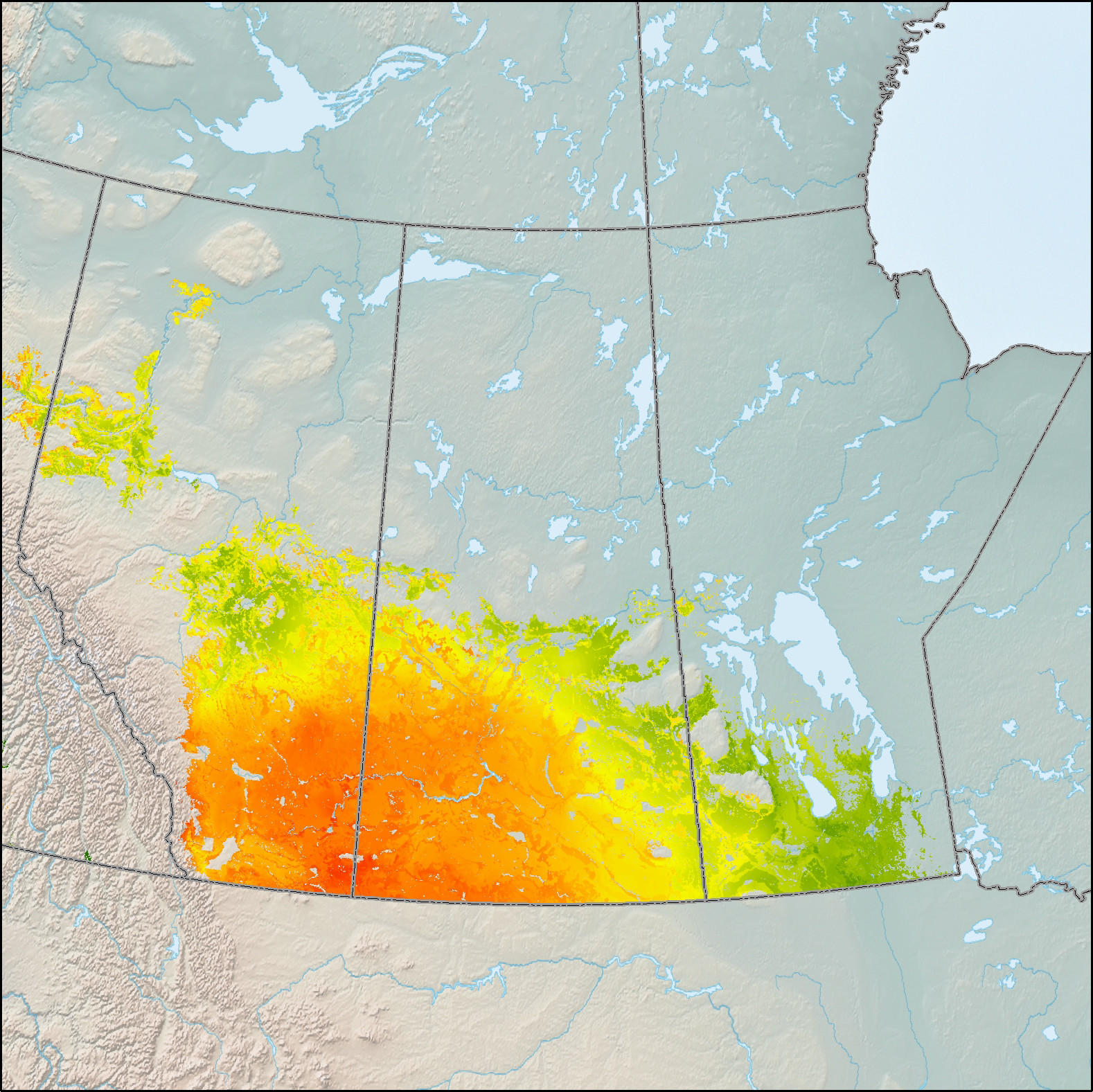
This data depicts site suitability for the establishment of area-based Short Rotation Woody Crops (SRWC) of willow on lands eligible (i.e. non-forested) for afforestation across Canada. Determining the feasibility of a large-scale afforestation program is one approach being investigated by the Government of Canada to increase Canada's potential to sequester carbon from the atmosphere and/or produce bioproducts and bioenergy. Large-scale afforestation, however, requires knowledge of where it is suitable to establish and grow trees. Spatial models based on Boolean logic and/or statistical models within a geographic information system may be used for this purpose, but empirical environmental data are often lacking, and the association of these data to land suitability is most often a subjective process. As a solution to this problem, a fuzzy-logic modeling approach to assess site suitability for afforestation of hybrid poplar (Populus spp.) and willow (Salix spp.) in Canada was developed. Expert knowledge regarding the selection and magnitudes of environmental variables were integrated into fuzzy rule sets from which estimates of site suitability were generated and spatially presented. The environmental variables selected included growing season precipitation, climate moisture index, growing degree days, the Canada Land Inventory capability for agriculture and elevation. Site suitability is generally defined as the fitness of a given type of land for a particular use. For this assessment, site suitability was defined as the fitness of edaphic, climatic and topographic conditions to establish and grow SRWC species at rates 8 times those of native species. Suitability index values range from 1-100, with higher values corresponding to higher suitability. Approximately 246,000 km2, or 38% of the eligible land base within Canada was found to be suitable for afforestation using Short Rotation Woody Crops (SRWC) of hybrid poplar and/or willow.
-

Natural Resources Canada’s Major Projects Inventory published annually, provides a snapshot of major natural resource projects in Canada that are either currently under construction or are planned within the next 10 years. The inventory includes major projects that increase, extend or improve natural resource production in Canada, including new extraction projects, infrastructure projects, major processing facilities and large expansion projects. In addition, the inventory includes information on the value, timing and geographic location of projects. To be included in the inventory, projects in the energy and mining sectors must meet a minimum capital worth threshold of $50 million and electricity and forest sector projects must meet a threshold of $20 million. Also included in the inventory are clean energy and clean technology projects, which must meet a minimum capital worth threshold of $10 million. DISCLAIMER: Data is sourced from federal, provincial, and territorial databases, publicly accessible websites, and other sources, including CANOILS. Data and maps are for illustrative purposes only. Users understand that, although all efforts have been made to accurately and exhaustively compile, locate and classify projects, the authors do not guarantee the accuracy and/or the comprehensiveness of the data and assume no responsibility for errors or omissions. The routes of the proposed transmission lines and pipelines are approximations, often using only start and end points. In support of this initiative, proponents and partners are encouraged to contact Natural Resources Canada should they identify any significant errors or omissions.
-

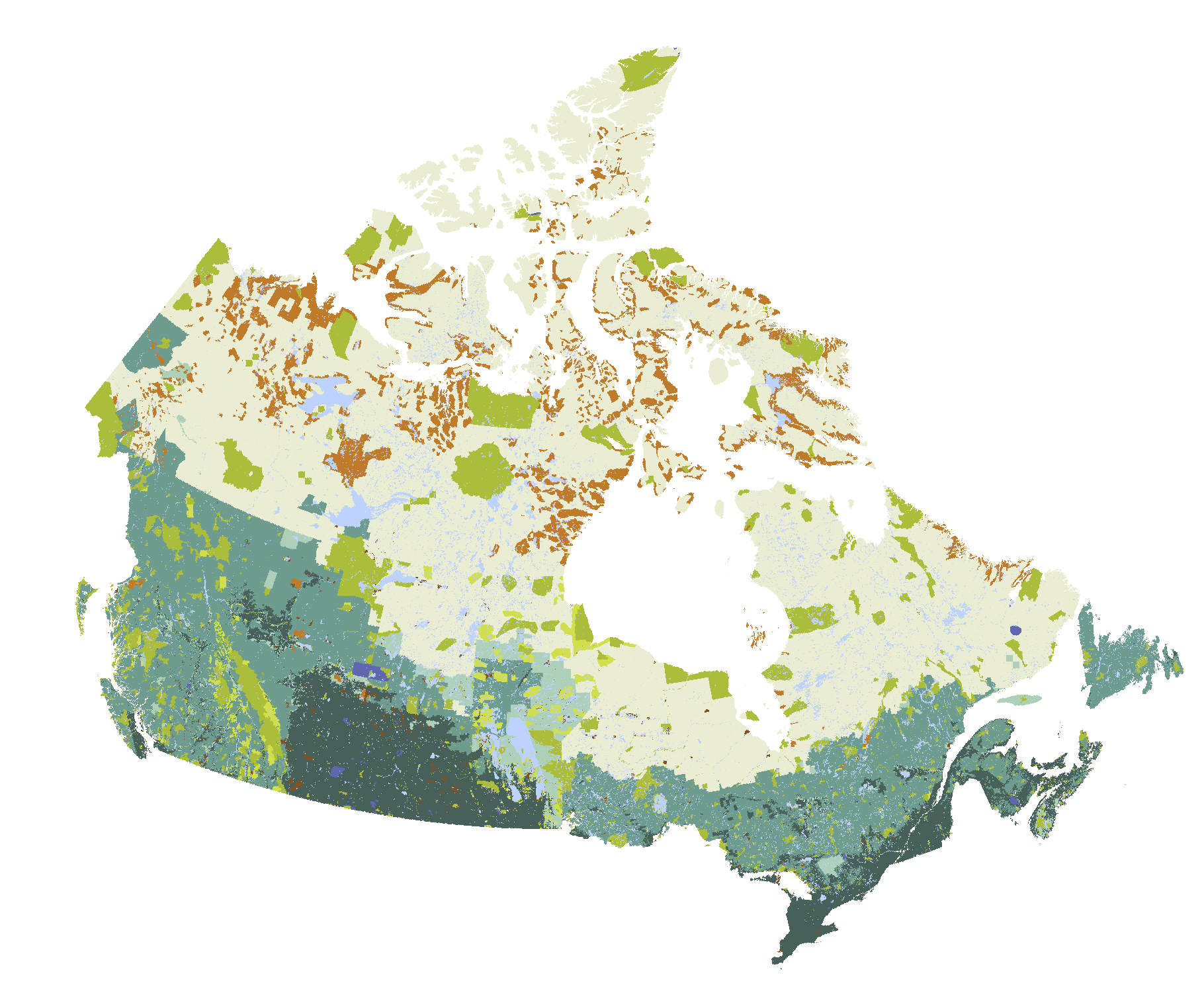
Forests cover large areas of Canada but only some of these forests are actively managed. The Map of Forest Management in Canada provides a generalized classification of forest management in Canada, including: protected areas, Treaty/Settlement Lands (including Treaty Lands identified in Final Agreements, Land Claim Agreements and Settlements), Indian Reserves, other federal reserves (including military training areas), provincial and territorial reserves and restricted use areas, private lands, short- and long-term Crown forest tenure areas and areas with no current Crown timber dispositions. The Managed Forest Map of Canada dataset provides a wall-to-wall classification of lands in Canada. It does not differentiate areas of forest from non-forest. The Managed Forest Map of Canada differs from maps defining the area designated as “managed forest” for greenhouse gas inventory reporting purposes and does not replace those maps. Instead, the Managed Forest Map of Canada shows areas that are currently managed, as of June 2017, and provides generalized management type classification for those areas. Collaborating agencies plan to update the dataset periodically as needed, and remain open to receiving advice from experts concerning refinement priorities for future versions.
-

This data depicts site suitability for the establishment of area-based Short Rotation Woody Crops (SRWC) of hybrid poplar on lands eligible (i.e. non-forested) for afforestation across Canada. Determining the feasibility of a large-scale afforestation program is one approach being investigated by the Government of Canada to increase Canada's potential to sequester carbon from the atmosphere and/or produce bioproducts and bioenergy. Large-scale afforestation, however, requires knowledge of where it is suitable to establish and grow trees. Spatial models based on Boolean logic and/or statistical models within a geographic information system may be used for this purpose, but empirical environmental data are often lacking, and the association of these data to land suitability is most often a subjective process. As a solution to this problem, a fuzzy-logic modeling approach to assess site suitability for afforestation of hybrid poplar (Populus spp.) and willow (Salix spp.) in Canada was developed. Expert knowledge regarding the selection and magnitudes of environmental variables were integrated into fuzzy rule sets from which estimates of site suitability were generated and spatially presented. The environmental variables selected included growing season precipitation, climate moisture index, growing degree days, the Canada Land Inventory capability for agriculture and elevation. Site suitability is generally defined as the fitness of a given type of land for a particular use. For this assessment, site suitability was defined as the fitness of edaphic, climatic and topographic conditions to establish and grow SRWC species at rates 8 times those of native species. Suitability index values range from 1-100, with higher values corresponding to higher suitability. Approximately 246,000 km2, or 38% of the eligible land base within Canada was found to be suitable for afforestation using Short Rotation Woody Crops (SRWC) of hybrid poplar and/or willow.
-
To slow the spread of the Hemlock woolly adelgid to new areas, the Canadian Food Inspection Agency (CFIA) uses measures to control the movement of potentially infested materials. Slowing the spread of HWA will protect Canada's environment and forest resources. It also helps keep international markets open to the forest industry and nurseries in non-regulated parts of Nova Scotia and in non-regulated parts of Canada.
-

This data depicts the locations of Short Rotation Woody Crop (SRWC) research, development and demonstration sites established across Canada by the Canadian Wood Fibre Centre, its partners and/or private land owners. Short Rotation Woody Crops represent enormous potential with respect to future sources of bioenergy and/or sinks for carbon. Since 2002, the Silviculture Innovation Group of the Canadian Wood Fibre Centre has established over 1 000 hectares of "high yield afforestation", “mixedwood afforestation” and "concentrated woody biomass" SRWC systems across Canada. The refinement of the biological and operational components of these systems is ongoing to improve production efficiencies, reduce costs, and enhance site sustainability. Development, assessment and validation of value-chain options for the establishment, recovery, transportation, handling and conditioning phases of these short rotation woody feedstock systems is also being performed. The refinement and demonstration of operational logistics along with the identification of supply and value-chain options will promote the concept of SRWC from basic research and development to the point of commercial uptake.
-
This dataset represents city, county, district, district municipality, municipality, regional municipality, town, township, and united county boundaries for the Emerald Ash Borer regulated areas of Canada.File naming convention:Three-letter Pest's scientific name + Geographic Area Abbreviation + Layer Content Abbreviation + Region. Example: aplCANregr == apl (Agrilus planipennis) + CAN (Canada) + reg (Regulated) + r (Region).
-
The Canadian Food Inspection Agency (CFIA) established a regulated area as part of its efforts to eradicate the Asian longhorned beetle (ALHB). With the regulation of this area, there are restrictions on the movement of nursery stock, trees, logs, lumber, wood, wood chips and bark chips from certain deciduous trees identified as hosts of the ALHB and firewood of all species. These restrictions are necessary to prevent the spread of the ALHB. This protects Canada's environment and forest resources, and also helps keep international markets open to the forest industry and nurseries in non-regulated parts of Ontario and in the rest of Canada.
 Arctic SDI catalogue