 Arctic SDI catalogue
Computational geoscience, informatics and remote sensing
Type of resources
Available actions
Topics
Keywords
Contact for the resource
Provided by
Formats
Representation types
Update frequencies
status
Scale
-
Nationwide geophysical database for environmental and raw material data, also known as GERDA (GEophysical Relational DAtabase). The database contains various types of geophysics, including geoelectrics, electromagnetics, borehole logs and seismic. All data is freely available for download on the GEUS website. The database is updated continuously.
-
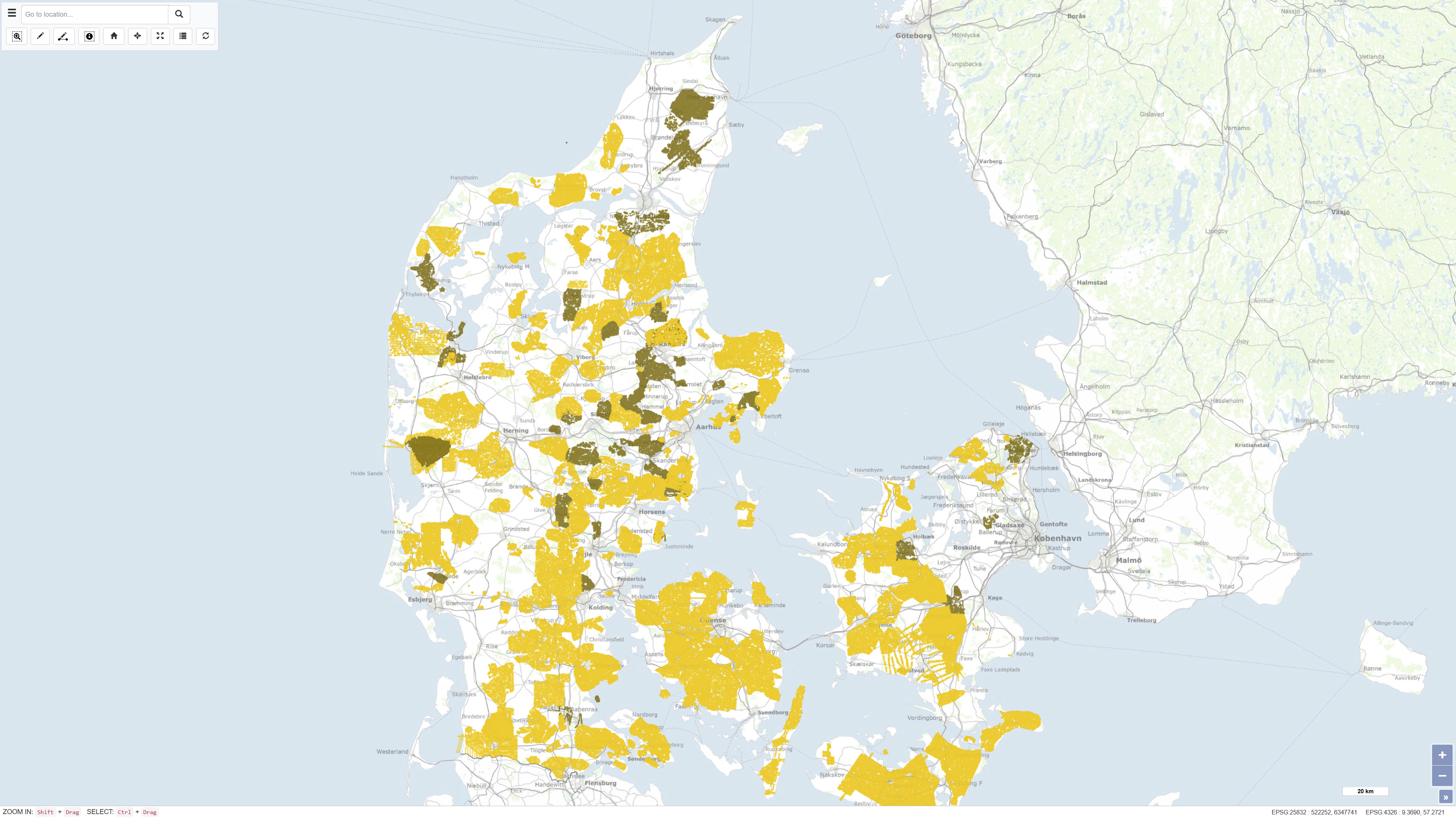
The MARTA database contains shallow seismic and acoustic data, information and geological samples. MATRA shows the distribution of marine sand and gravel resources and gives access to reports on raw material surveys. MARTA shows the distribution of marine sand and gravel resources and gives access to reports on raw material surveys. Data has primarily been acquired by GEUS and our partners., MARTA is the official Danish marine raw material database for data reported in accordance with the Danish Raw Material Act. MARTA is used by the raw materials industry and authorities and as a planning tool in connection with raw material extraction and marine construction projects including beach nourishment.
-
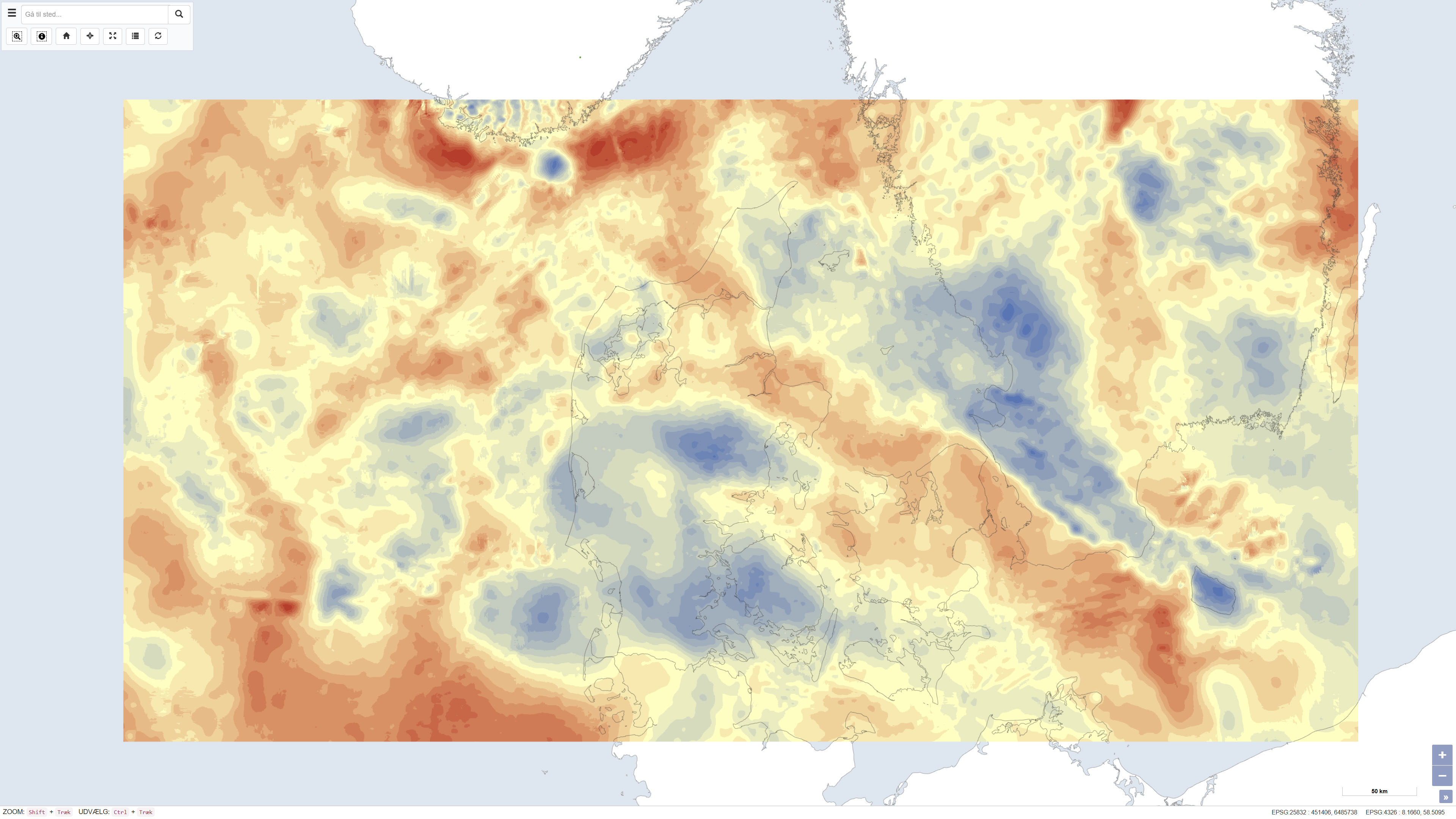
The dataset presents Bouguer gravity anomalies on land and free-air gravity anomalies in Danish marine areas based on gravity measurements from the national gravity database. The Bouguer anomaly is terrain corrected and is used to investigate variations in subsurface mass distribution, while the free-air anomaly at sea reflects variations in the gravity field without full terrain correction. Gravity anomalies are expressed in milligals (mGal). The dataset was produced by DTU Space and represents a consolidated gravimetric foundation for geological and geophysical analyses in Denmark.
-
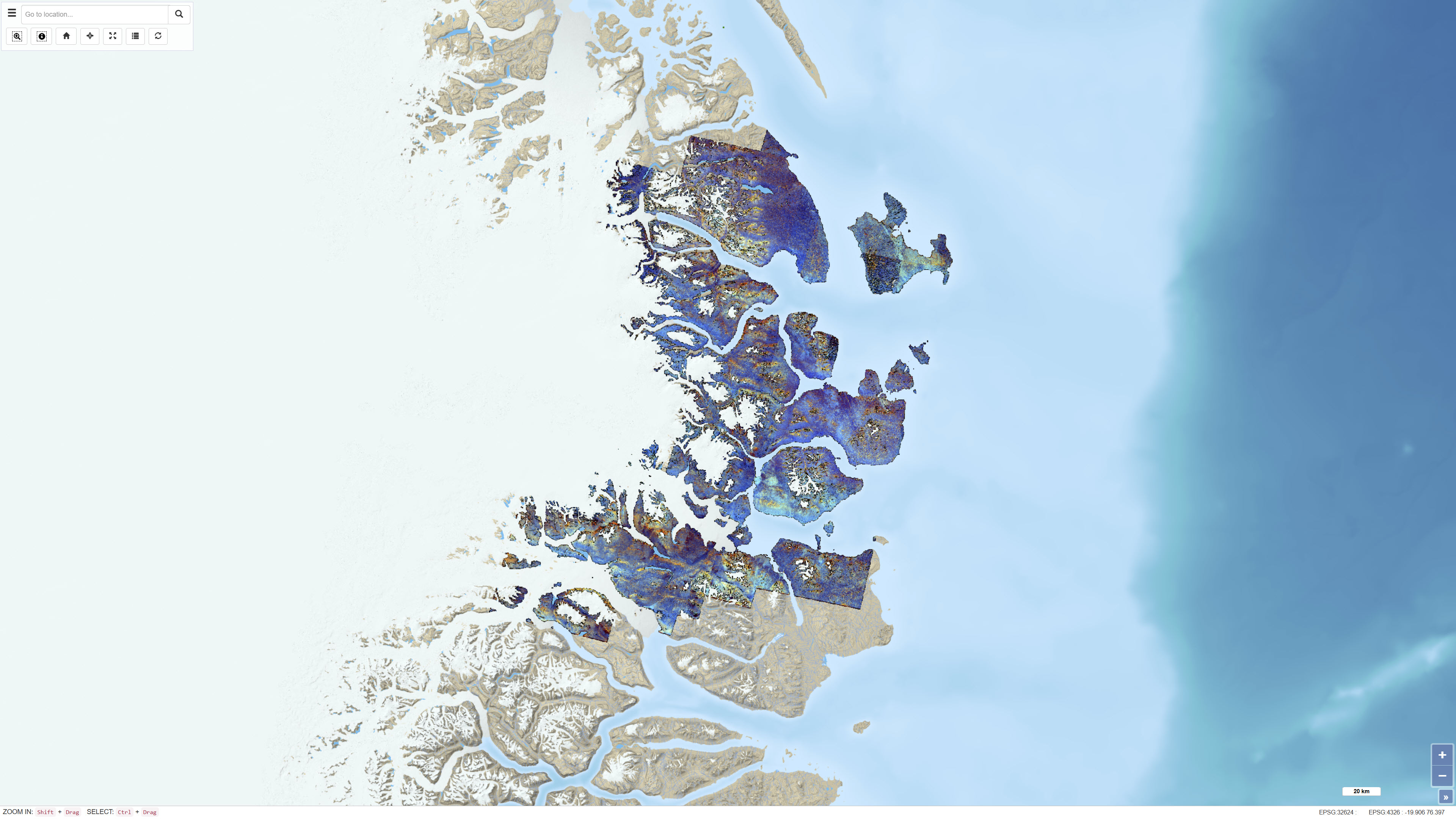
The dataset consists of a series of ASTER band ratios combined into colour composite images designed to highlight mineralogical distributions and lithological variability in Northeast Greenland. The ASTER scenes were preprocessed with atmospheric, radiometric and topographic corrections, including radiative transfer modelling using ATCOR-3 in rugged terrain mode. A surface elevation model was applied to adjust illumination effects. Non-outcrop pixels were masked prior to generating the final mosaic. Calibrated radiance data were converted to apparent surface reflectance; however, further calibration against ground-based reflectance measurements was not feasible. The dataset represents a derived remote sensing product and not primary satellite data.
-
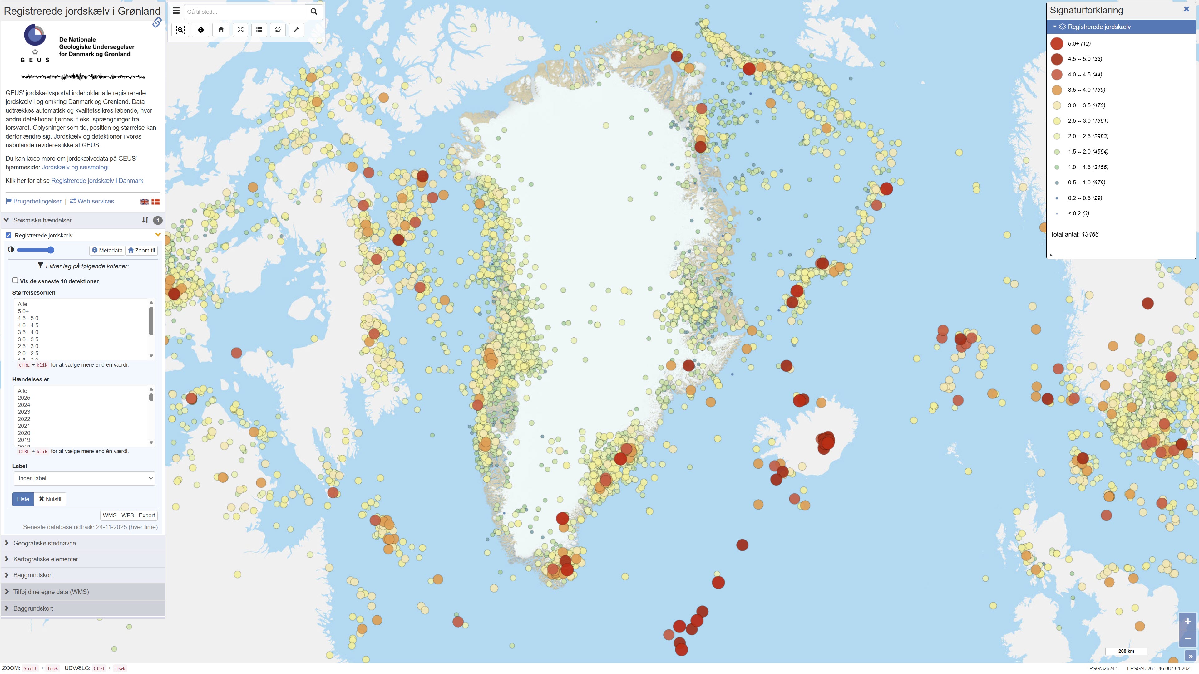
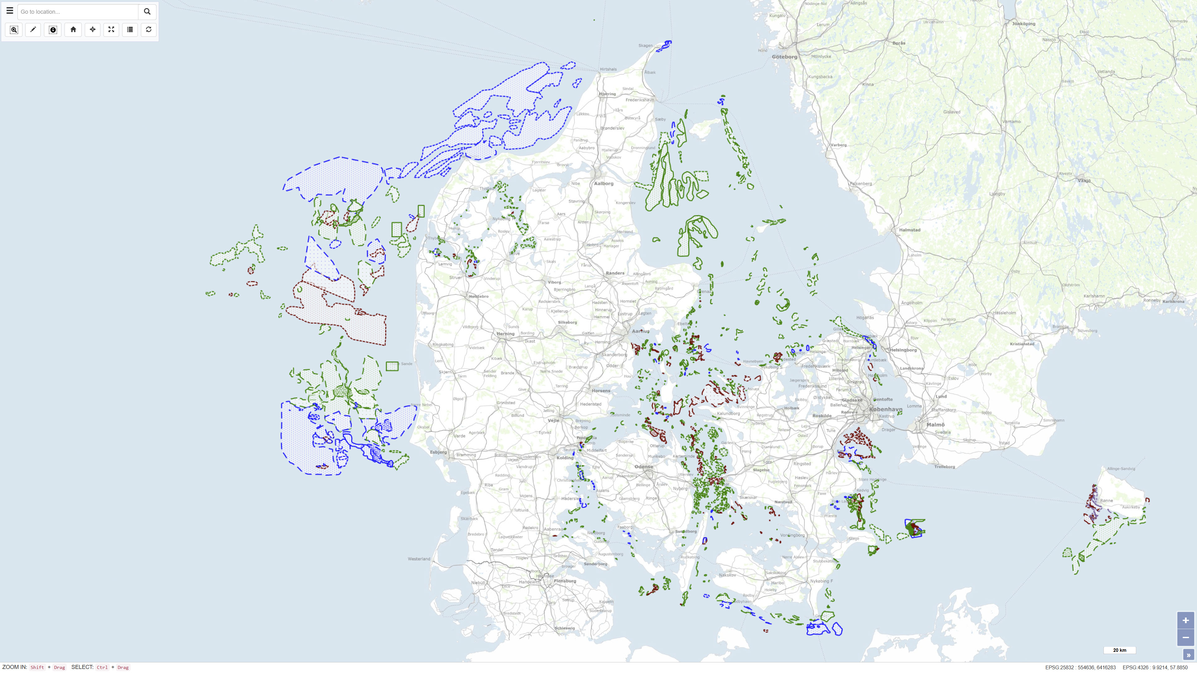
The dataset contains recorded earthquakes and seismic events in Greenland. The data include information on event time, geographic location (epicentre), depth and magnitude for confirmed and suspected earthquakes. The dataset is based on observations from GEUS’ seismic monitoring network and is used for monitoring, research and dissemination of seismic activity in Greenland.
-
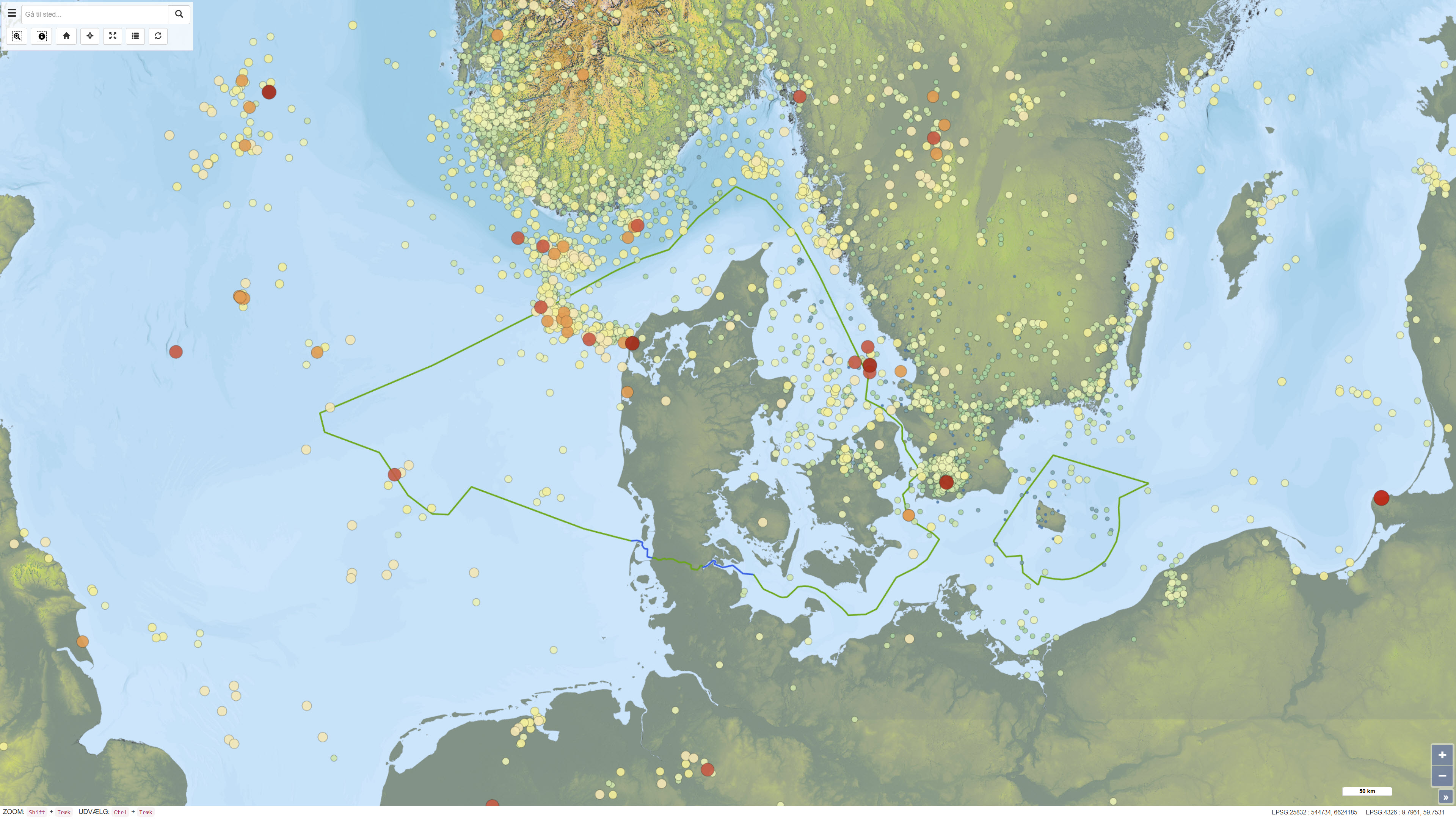
This dataset provides a national overview of all registered earthquakes in Denmark, including time, location, depth and magnitude. The recordings are based on data from GEUS’ national seismic network and comprise both measured earthquakes and subsequently quality-assured observations. The dataset is continuously updated and reflects the best scientific assessment of seismic activity in Denmark, where improved instrumentation and analysis today allow detection of much weaker tremors than historically.
-
%20-%20datas%C3%A6t.jpg)
The dataset contains aeromagnetic measurements acquired during 1993–1996 in East and North-East Greenland as part of the AWI-AEROMAG project conducted by the Alfred Wegener Institute (AWI). The measurements represent regional airborne magnetometry and include total magnetic field intensity corrected for diurnal variations and the main geomagnetic field. The survey was carried out to support geological mapping and tectonic analysis of eastern Greenland. The dataset constitutes an important geophysical reference for studies of crystalline basement rocks, sedimentary basins and structural features in the region.
-
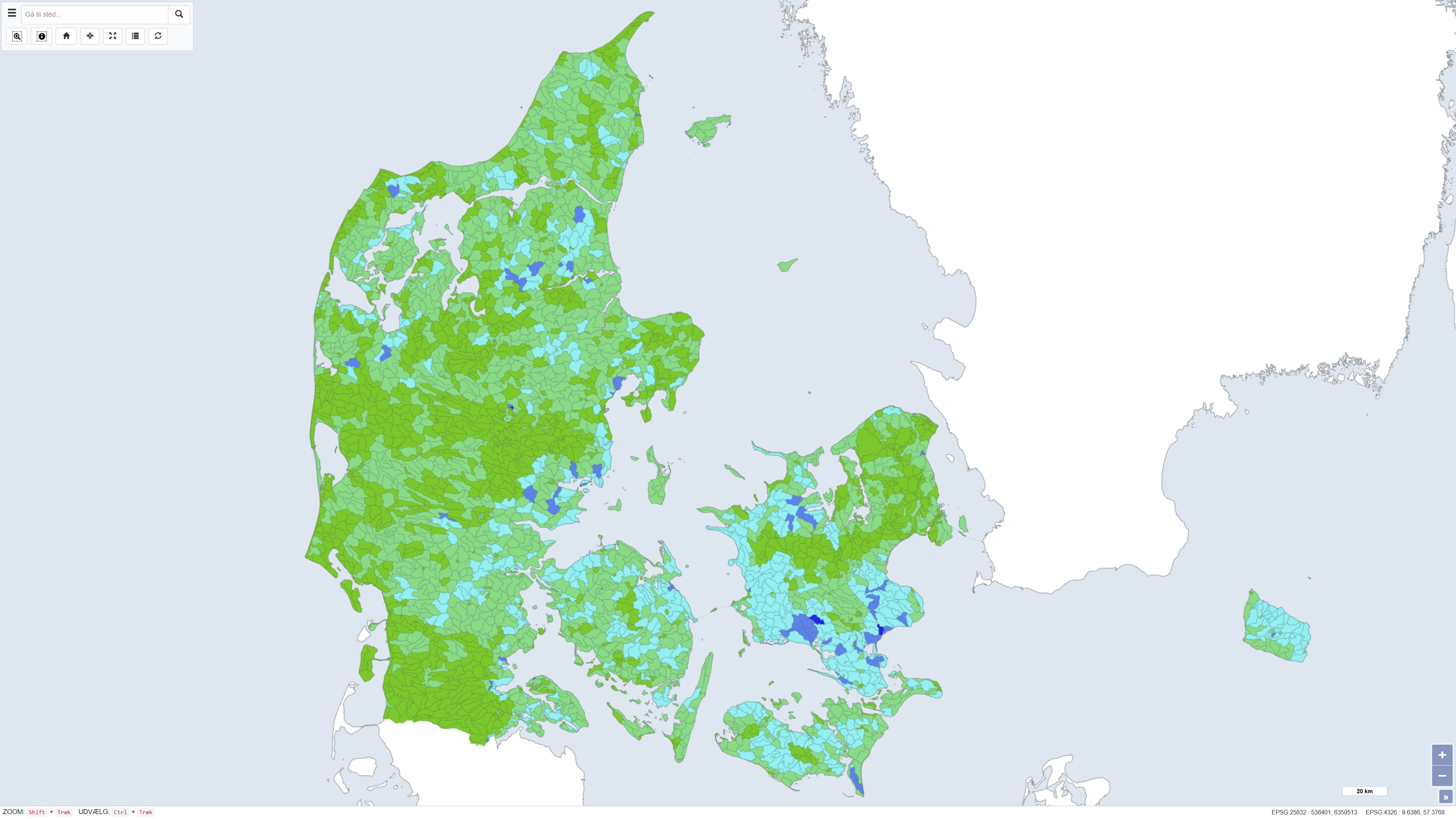
This dataset shows the percentage nitrogen retention in Denmark, i.e. the proportion of nitrogen leached from the root zone that is transformed or retained in the subsurface and surface waters before reaching the coast. Nitrogen retention is calculated using the National Nitrogen Model and represents an average retention for the period 1990–2010. The dataset provides nationwide coverage of spatial variations in nitrogen retention and is used as a basis for assessing nitrogen transport and coastal nutrient loading. The National Nitrogen Model version 2020 is documented in National Nitrogen Model – version 2020, a GEUS special report, including a method report (ISBN 978-87-7871-551-7) and an appendix (ISBN 978-87-7871-552-4), both available from GEUS (in danish).
-
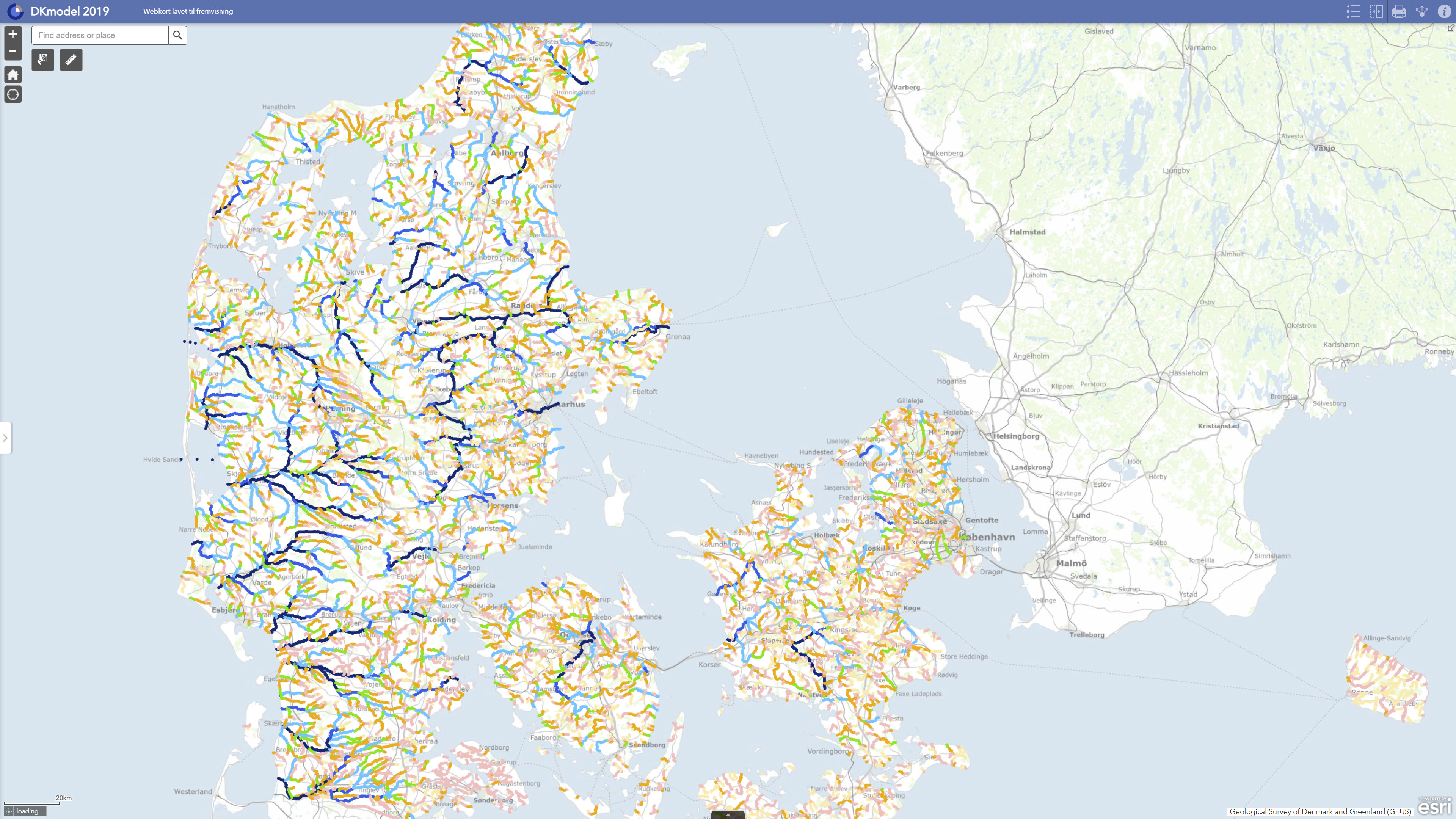
DK model 2019 – Simulation results comprises calculated hydrological results from GEUS’ national hydrological model for Denmark. The dataset contains derived results from model runs with DK model 2019, including calculations of water balance, groundwater recharge, impacts of water abstraction, groundwater drawdown, streamflow impacts and changes in flow-related indicators. The results include, among other outputs, comparisons between scenarios with current abstraction and reference scenarios without abstraction. The dataset is used for regional assessment of hydrological conditions, screening of water resource and impact conditions, and documentation of model-calculated results. The results are model-based and should be used with due consideration of the regional purpose, model uncertainties and limitations of DK model in relation to local-scale applications.
-
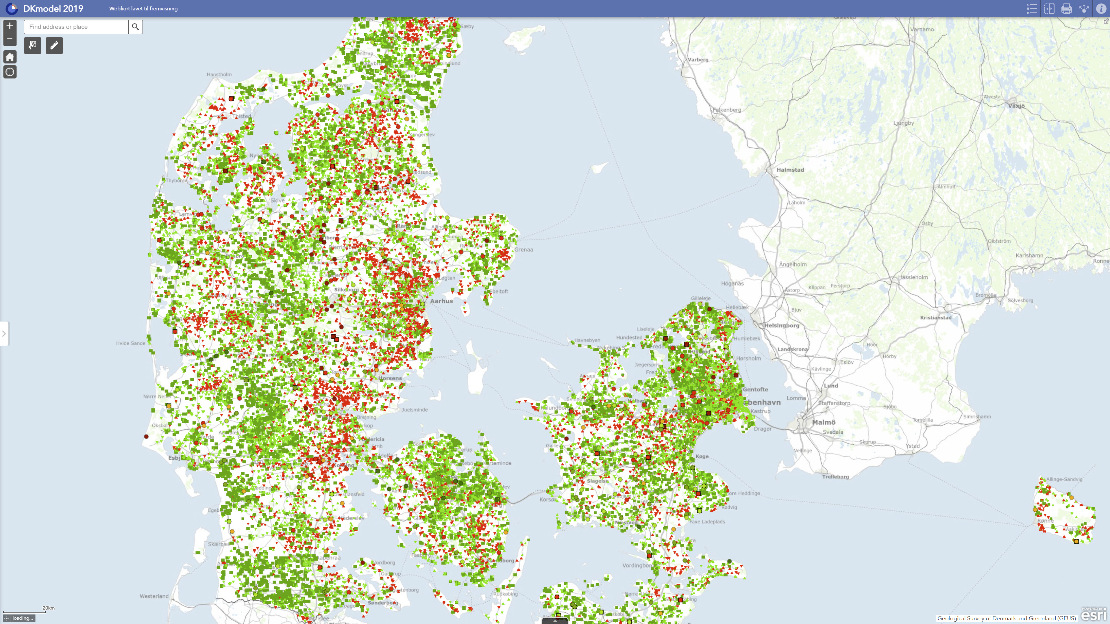
DK model 2019 – Calibration statistics comprises spatial and statistical results from the calibration and evaluation of GEUS’ national hydrological model for Denmark. The dataset documents model performance for groundwater heads and stream discharge, including statistical measures such as RMSE and mean error for groundwater heads as well as WBE, summer WBE and KGE for streamflow simulations. The calibration was carried out using dynamic model runs and inverse parameter estimation with PEST based on observed groundwater heads and daily discharge data for the period 2000–2010. The dataset is intended for assessing the suitability of DK model 2019 for regional analyses, screening and further use. The calibration statistics describe model performance at national and regional scales and should not by themselves be used as documentation of local-scale model accuracy.