 Arctic SDI catalogue
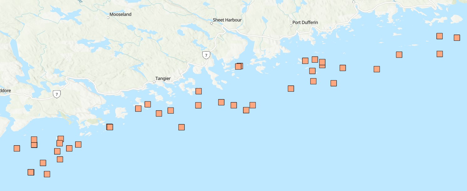
Coastal waters
Type of resources
Available actions
Topics
Keywords
Contact for the resource
Provided by
Formats
Representation types
Update frequencies
status
Resolution
-

Funded under DFO's Marine Conservation Targets Program, this optical imagery benthic survey captured 73 drift-camera transects from September 21, 2022 to October 3, 2024 in the Fundy Isles region of the lower, western Bay of Fundy, New Brunswick, Canada. The survey area includes the 'Head Harbour/West Isles Archipelago/The Passages' Ecologically and Biologically Significant Area (ESBA, ~113 km2), the Wolves Islands and Grand Manan Island. High-resolution still images (n=5081) were taken periodically throughout each transect, while continuous high-definition downward- and forward-facing video (~30 hours of each) was collected simultaneously. Distance travelled and distance between still images (m) was calculated using ArcGIS tools. Field of view (FOV) was estimated by measuring the length and width of a subset of still images (n=863) in ImageJ2, using 10-cm lasers for scale. FOV was standardized for each reported altitude. Transects ranged from 133 m to 2.6 km in length (~47 km surveyed in total), collecting imagery continuously for 3 minutes to more than 1 hour at a time, surveying depths from 15 to 188 m below chart datum. Transect locations were selected based on unique bathymetric features, areas previously predicted to have high habitat suitability for vulnerable marine ecosystem species, as well as proposed areas for inclusion in the regional marine conservation network plan. Additional information and imagery pertaining specifically to the 2022 datasets can be found at the following link in the Open Government Portal: https://open.canada.ca/data/en/dataset/8ea6c28a-3d6c-47ef-8cf7-56790ee0c7f5 Cite this data as: Lawton P, Teed L. Near-seafloor drift transect video and high-resolution digital still imagery from a three-year survey in the Fundy Isles region of the lower, western Bay of Fundy. Published November 2025. Coastal Ecosystems Science Division, Fisheries and Oceans Canada, St. Andrews, N.B.
-
Funded under DFO's Marine Conservation Targets Program in partnership with the Huntsman Marine Science Centre (HMSC), this diver-based imagery and sample collection benthic survey documents the occurrence of sponges at 42 dive sites in the Eastern Shore Islands (ESI) Area of Interest (AOI, ~2089 km2) off the Atlantic coast of Nova Scotia, Canada from dive surveys conducted in summer 2021 and 2022. Water quality, species occurrences and counts, habitat, slope, and substrate characteristics were catalogued through diver log sheets, camera imagery, specimen vouchers, and high-resolution bathymetric data. A total of 54 dives to depths from 11 to 33 m (below sea level), collecting up to 147 still images, one-hour of video, and 17 specimen samples per site, resulted in 220 observations for 27 different sponge taxa. This included three new records for Canada (Hymedesmia stellifera, Plocamionida arndti, Hymedesmia jecusculum) and a range extension for a species new to science (Crellomima mehqisinpekonuta) which was recently described from the Bay of Fundy. There were also four species which may seem to be new to science (Halichondria sp., Hymedesmia sp., Protosuberires sp., and Sphaerotylus sp.). Sponges were found to occupy a diversity of micro-habitats, often several different ones in proximity. A total of eight distinct habitat classes were defined, based on varying abundances and diversity of sponges and associated benthic species. These are likely widely distributed among the many complex submerged seabed features within this AOI. Collected specimens were preserved and are stored at the Atlantic Reference Centre (ARC) in St. Andrew's, New Brunswick. Cite this data as: Goodwin, C., Cooper, J.A., Lawton, P., Teed, L.L. 2025. Sponge occurrence and associated species and habitat descriptions derived from the 2021 and 2022 SCUBA diving surveys in the Eastern Shore Islands Area of Interest, Nova Scotia. Version 1.4. Fisheries and Oceans Canada. Occurrence dataset. https://ipt.iobis.org/obiscanada/resource?r=eastern_shore_islands_sponge_survey_2021_2022&v=1.4
-

This dataset contains the abundance (per m²) and the biomass (mg dry per m²) of macrofauna (≥ 500µm) in eelgrass and adjacent bare soft sediments, collected at sites in the Atlantic of Nova Scotia from 2009 to 2013. Cite this data as: Wong M.C. Data of Benthic invertebrates in seagrass and bare soft sediments in Atlantic Nova Scotia Published May 2020. Coastal Ecosystems Science Division, Fisheries and Oceans Canada, Dartmouth, N.S. https://open.canada.ca/data/en/dataset/05d5f46a-7f19-11ea-8a4e-1860247f53e3 Publications: Wong, M. C., & Dowd, M. (2021). Functional trait complementarity and dominance both determine benthic secondary production in temperate seagrass beds. Ecosphere. 12(11), e03794. https://doi.org/10.1002/ecs2.3794 Wong, M. C. (2018). Secondary Production of Macrobenthic Communities in Seagrass (Zostera marina, Eelgrass) Beds and Bare Soft Sediments Across Differing Environmental Conditions in Atlantic Canada. Estuaries and Coasts, 41, 536–548. https://doi.org/10.1007/s12237-017-0286-2
-

PURPOSE: To quantify impacts of nutrient and sediment loading to plant and animal communities and the environmental conditions that support them in estuaries of the Southern Gulf of St. Lawrence DESCRIPTION: The MEQ monitoring program is being implemented in 35-40 estuaries in the southern Gulf of St. Lawrence (sGSL) to support the development of a MEQ measure (threshold) to promote efforts to address nutrient enrichment in estuaries. The two main indicators included in the monitoring program are dissolved oxygen and eelgrass coverage which are used to assess the trophic status of estuaries within the region. The two factors most important for impacting the trophic status of estuaries are nitrogen loading and water residence time, i.e., water circulation. If water residence time is long and/or nitrogen loading is high, nutrient impacts are likely. A peer-reviewed manuscript has demonstrated that these two factors are predictive of the dissolved oxygen regime in the upper estuary and that publication successfully used dissolved oxygen to ascribe trophic status to estuaries. In a companion paper it was also determined that nitrogen loading was negatively correlated with eelgrass coverage. These two papers form the basis of the MEQ monitoring program (see attached). NOTES ON QUALITY CONTROL: Dissolved oxygen loggers require calibration prior to deployment and are checked for drift after retrieval (though drift isn't anticipated given optical sensor technology). In the event that dissolved oxygen loggers weren't cleared at a frequency sufficient to prevent data errors from occurring these data are removed prior to analysis. Additionally, data must be scrubbed of erroneous measurements which are relatively rare and very apparent. An error code of -888.88 is the primary error for dissolved oxygen loggers. Salinity probes rarely provide erroneous data and when they do it is typically the result of fouling. PHYSICAL SAMPLE DETAILS: Water is sampled bi-weekly to monthly using a Niskin water sampler at a depth of 0.5 m from the water surface, from May-November. Samples are processed in the laboratory in duplicate for chlorophyll a and seston within ~8 hours of being collected. SAMPLING METHODS: For each study estuary, dissolved oxygen is monitored continuously with optical dissolved oxygen loggers in the upper and mid-estuary. Tidal amplitude and salinity (NB and NS only) were also monitored at the upper estuary location only. Depth profiles for other water quality variables are taken at the bi-weekly or monthly scale as well as samples for seston (NB and NS only) and chlorophyll a (a proxy for phytoplankton). These parameters are monitored on a 3-year cycle except for two sites in PE and one site in NB and NS which are monitored annually: West and Wheatley, PE, Cocagne, NB and Pugwash, NS, respectively. Data is collected for eelgrass coverage by a collaborator between June-September, ideally during the same year we collect water quality data. Collaborators include the province of PEI’s Department of Environment, Water and Climate Change and the Southern Gulf of St. Lawrence Coalition on Sustainability. USE LIMITATION: To ensure scientific integrity and appropriate use of the data, we would encourage you to contact the data custodian.
-

Provinces and Territories Basemap - Canada Provinces basemap file created to generate boundary polygons for use in small scale, medium and large scales. Simple Grey Basemap - This basemap is only in simple grey and white to be used as a backdrop in applications or geomatics projects. Line features represent provincial and territorial boundaries, international boundaries, exclusive economic zones, arcs extending to the North Pole, state boundaries, Canadian, USA and foreign countries rivers. Polygon features representing waterbodies in Canada, USA and foreign countries.
-

A derivative of DFO's benthic imagery surveys for the Marine Conservation Targets Program in the St. Anns Bank Marine Protected Area (https://open.canada.ca/data/en/dataset/2a55e2b4-cbb6-4fea-b17e-a16f5e99e68f), occurrence records in this analysis represent presence/absence and density of a biogenic habitat-forming species in five drift-camera transects in the southeast corner of the MPA, off the coast of Cape Breton, Nova Scotia, Canada. Presence/absence and count data of the unstalked crinoid (Heliometra glacialis) were derived from the use of high-resolution Nikon D850 still images (n=428, see link to parent record for more descriptive survey information and complete imagery dataset) and continuous high-definition video observations (approximately one observation every second using a 1Cam Mk6, SubC Imaging camera; n=8522). Densities were estimated by dividing the crinoid counts by the field of view (calculated from lasers with 10-cm spacing). Substrates were reported for each video observation, documenting the dominant substrate (>50% cover) according to a modified Wentworth scale (i.e., sand, gravel, pebble, cobble, boulder, bedrock; Wentworth 1922). Crinoids were observed in ~44% of the area of the five transects (~4811 m2), forming dense beds along sloped features from 77-119-m depths, predominantly on cobble and pebble substrates, reaching densities of up to 59 ind. m-2 and 139 ind. m-2 in the digital still images and video observations, respectively. Cite this data as: Lawton P, Teed L. Fine-scale observations of high density Heliometra glacialis (Crinoidea) beds from five near-seafloor imagery transects from a two-year survey in the St. Anns Bank Marine Protected Area, Atlantic Canada. Published March 2026. Coastal Ecosystems Science Division, Fisheries and Oceans Canada, St. Andrews, N.B. References: - Wentworth, C.K. 1922. A scale of grade and class terms for clastic sediments. The Journal of Geology 30(5): 377-392.
-

Bay-scale empirical demonstrations of how bivalve aquaculture alters plankton composition, and subsequently ecological functioning and higher trophic levels, are lacking. Temporal, inter- and within-bay variation in hydrodynamic, environmental, and aquaculture pressure limit efficient plankton monitoring design to detect bay-scale changes and inform aquaculture ecosystem interactions. Here, we used flow cytometry to investigate spatio-temporal variations in bacteria and phytoplankton (< 20 µm) composition in four bivalve aquaculture embayments. We observed higher abundances of bacteria and phytoplankton in shallow embayments that experienced greater freshwater and nutrient inputs. Depleted nutrient conditions may have led to the dominance of picophytoplankton cells, which showed strong within-bay variation as a function of riverine vs freshwater influence and nutrient availability. Although environmental forcings appeared to be a strong driver of spatio-temporal trends, results showed that bivalve aquaculture may reduce near-lease phytoplankton abundance and favor bacterial growth. We discuss aquaculture pathways of effects such as grazing, benthic-pelagic coupling processes, and microbial biogeochemical cycling. Conclusions provide guidance on optimal sampling considerations using flow cytometry in aquaculture sites based on embayment geomorphology and hydrodynamics. Cite this data as: Sharpe H, Lacoursière-Roussel A, Barrell J (2024). Monitoring bay-scale bivalve aquaculture ecosystem interactions using flow cytometry. Version 1.2. Fisheries and Oceans Canada. Samplingevent dataset. https://ipt.iobis.org/obiscanada/resource?r=monitoring_bay-scale_bivalve_aquaculture_ecosystem_interactions_using_flow_cytometry&v=1.2
-

This data set is a generalized characterization of the offshore and inshore environments of Canada’s Pacific Ocean. Compiled from various sources to depict the biogenic habitats, pelagic habitats, and general bottom types such as offshore and inshore by depth strata.
-

Bivalve aquaculture has direct and indirect effects on plankton communities, which are highly sensitive to short-term (seasonal, interannual) and long-term climate changes, although how these dynamics alter aquaculture ecosystem interactions is poorly understood. Here, we investigate seasonal patterns in plankton abundance and community structure spanning several size fractions from 0.2 µm up to 5 mm, in a deep aquaculture embayment in northeast Newfoundland, Canada. Using flow cytometry and FlowCam imaging, we observed a clear seasonal relationship between fraction sizes driven by water column stratification (freshwater input, nutrient availability, light availability, water temperature). Plankton abundance decreased proportionally with increasing size fraction, aligning with size spectra theory. Within the bay, greater mesozooplankton abundance, and a greater relative abundance of copepods, was observed closest to the aquaculture lease. No significant spatial effect was observed for phytoplankton composition. While the months of August to October showed statistically similar plankton composition and size spectra slopes (i.e., food chain efficiency) and could be used for interannual variability comparisons of plankton composition, sampling for longer periods could capture long-term phenological shifts in plankton abundance and composition related to various processes, including climate change. Conclusions provide guidance on optimal sampling to monitor and assess aquaculture pathways of effects. Cite this data as: Sharpe H, Lacoursière-Roussel A, Gallardi D (2024). Ecological insight of seasonal plankton succession to monitor shellfish aquaculture ecosystem interactions. Version 3.2. Fisheries and Oceans Canada. Sampling event dataset. https://doi.org/10.25607/2ujdvh
-

Funded under DFO's Marine Conservation Targets Program, this two-year optical imagery benthic survey captured 41 drift-camera transects in the St. Anns Bank Marine Protected Area (MPA - 4364 km2) and 4 coastal transects west of the MPA, Atlantic Canada from August 15-23, 2023 and August 08-17, 2024. High-resolution still images (n=3605) were taken periodically throughout each transect, while continuous high-definition downward- and forward-facing video (~20 hours of each) was collected simultaneously along with over 14 hours of forward-facing Go-Pro video (only in 2024). Transect and image locations were collected using an acoustic positioning operating system (Kongsberg APOS) acquired in 2024; year-one of the survey relied on the vessel position. Distance travelled and distance between still images (m) was calculated using ArcGIS tools. Field of view (FOV) was estimated by measuring the length and width of a subset of still images from year-one of the survey (n=500) in ImageJ2, using 10-cm lasers for scale. FOV was standardized for each reported altitude. Transects ranged from 319 m to 2.8 km in length (~47 km surveyed in total), collecting imagery for 12 minutes to just over 1 hour at a time, surveying depths from 17 to 144 m below chart datum. Transect locations were selected based on unique bathymetric features and benthoscapes as well as areas previously surveyed from 2009-2015. Cite this data as: Lawton P, Teed L. Near-seafloor drift transect video imagery and high-resolution digital still images from a two-year survey in support of Marine Protected Area monitoring of St. Anns Bank, Atlantic Canada. Published January 2025. Coastal Ecosystems Science Division, Fisheries and Oceans Canada, St. Andrews, N.B.