 Arctic SDI catalogue
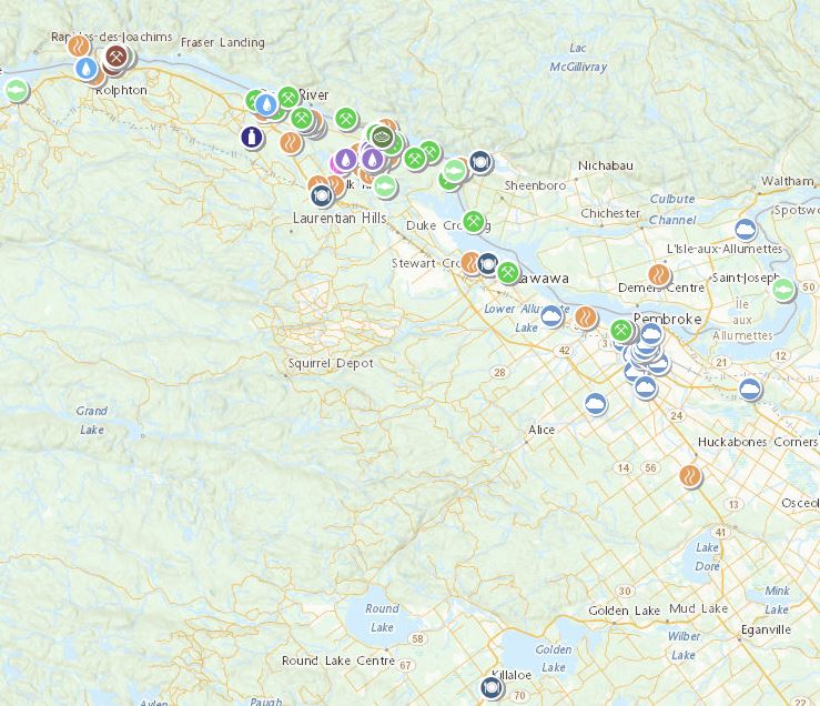
Utilities communication
Type of resources
Available actions
Topics
Keywords
Contact for the resource
Provided by
Years
Formats
Representation types
Update frequencies
status
Scale
-

UTC - Utility and communication networks (utilitiesCommunication) Energy, water and waste systems, and communications infrastructure and services. For example, resources describing hydroelectricity; geothermal, solar, and nuclear sources of energy; water purification and distribution; sewage collection and disposal; electricity and gas distribution; data communication; telecommunication; radio; and communication networks.
-
OR_fraveita er byggt upp af línum (lögnum), punktum (búnaði) og flákum (settjörnum).
-

The Remote Communities Energy Database is a public resource that provides pertinent factual information about the generation and use of electricity and other energy sources for all remote communities in Canada. Communities are identified as remote communities if they are not currently connected to the North-American electrical grid nor to the piped natural gas network; and is a permanent or long-term (5 years or more) settlement with at least 10 dwellings. The Remote Communities Energy Database is the only national data source on energy in remote communities that is publically available on one centralized site. The Remote Communities Energy Database allows users to search and conduct analyses of remote communities and their energy context. Users are also able download the data from the Remote Communities Energy Database dataset in CSV (i.e., excel compatible) format. This data is collected from a number of sources including the remote communities themselves, local utilities, provincial and territorial government’s, Indigenous and Northern Affairs Canada (INAC), Statistics Canada, Natural Resources Canada (NRCan) and various other stakeholders.
-

High voltage electrical transmission lines for distributing power throughout the province. Lines were derived from several data sources representing unique inventories: BC Hydro, Private, Independent Power Producers, and Terrain Resource Information Management (TRIM). Voltage information is not currently available on the public version of this dataset as per publication agreement with BC Hydro.
-

Vefsjá Fjarskiptastofu er hugsuð til upplýsinga fyrir alla sem vilja kynna sér stöðu og þróun fjarskiptauppbyggingar á Íslandi hvort sem um er að ræða tengingar heimila og fyrirtækja við ljósleiðara eða uppbyggingu farneta á landsvísu. Meðal þess sem skoða má í vefsjánni er: - Fjarskiptaaðgengi staðfanga (heimila og fyrirtækja) um fastanet þar sem þekja sýnir staðföng landsins í punktaformi. - Fjarskiptaaðgengi um farnet þar sem sjá má þekju sem sýnir gæði farnetssambands á staðföngum landsins. - Útbreiðsla 2G, 3G, 4G og 5G sem sýnir áætlaða útbreiðslu farnetsmerkis allra fyrirtækja. - Samband á stofnvegum þar sem sjá má alla vegakafla þar sem samband næst frá einhverjum markaðsaðila. - Farnetsmælingagögn úr mælingum á 4G. Hægt að skoða alla mælipunkta á kortinu. - Þá eru í fyrsta sinn birtir mælikvarðar sem Háskóla-, iðnaðar- og nýsköpunarráðuneytið hefur sett fyrir uppbyggingu ljósleiðara í byggð og uppbygging farneta á stofnvegum landsins. Fjarskiptamælikvarði: Þéttbýlisstaðir og byggðarkjarnar landsins sýndir sem flákar á korti. Þeir sem náð hafa 80% ljósleiðaraútbreiðslu eru litaðir grænir og þeir sem ekki hafa náð því markmiði eru litaðir á litaskala eftir stöðu. Fjarskiptamælikvarði: Sýnir stofnvegi landsins sem línur á korti. Þeir kaflar stofnvega sem ekki eru dekkaðir af 10 Mb/s farneti eru litaðir rauðir. Þeir kaflar sem bæst hafa við vegna samnýtingar eru litaðir í einkennandi lit.
-

[IS] Í Rammasjá er hægt að skoða gögn sem tengjast áætlun um vernd og orkunýtingu landsvæða, þ.e.a.s. Rammaáætlun. [EN] The Master Plan for Nature Protection and Energy Utilization Map
-

Þekjan sýnir raforkudreifisvæði fyrir dreififyrirtæki landsins: Veitur, Orkubú Vestfjarða, HS Veitur, Norðurorka og RARIK. Hjá Orkubú Vestfjarða og RARIK er svæðunum einnig skipt upp í dreifbýli, þéttbýli og byggðarkjarna sem endurspeglar skiptingu í gjaldskrá hjá þessum fyrirtækjum.
-
The Canadian Nuclear Safety Commission (CNSC) and Environment and Climate Change Canada (ECCC) are publishing databases with effluent and environmental monitoring results from nuclear facilities located along the Ottawa River watershed as part of the Regional Information and Monitoring Network (RIMNet) for the Ottawa River Watershed Basin initiative. The facilities included are Chalk River Laboratories, Nordion Canada Inc., SRB Technologies Canada Inc., and Nuclear Power Demonstration Waste Facility. The initiative was developed to address questions and concerns expressed by members of the public and Indigenous Nations and communities about the availability of publicly accessible environmental monitoring data in the Ottawa River Watershed Basin. More information about the initiative is available here: https://www.cnsc-ccsn.gc.ca/eng/resources/environmental-protection/rimnet/ This dataset contains effluent and environmental monitoring results from Chalk River Laboratories, Nordion Canada Inc., SRB Technologies Canada Inc., and Nuclear Power Demonstration Waste Facility. All of the effluent and emissions releases to the environment in this dataset are below the CNSC licensed release limits. All of the environmental monitoring results in this dataset are below environmental quality guidelines. More information about CNSC staff’s assessment of these facilities are found in CNSC staff’s regulatory oversight reports: https://www.cnsc-ccsn.gc.ca/eng/resources/publications/reports/regulatory-oversight-reports/
-

EuroRegionalMap is a Pan-European multi-functional topographic vector dataset at scale 1: 250000, that is seamless and harmonized across boundaries. It is produced in cooperation with the National Mapping Agencies of the participating countries using official national databases. The dataset covers 36 countries and is designed for business use. It enables you to process comprehensive spatial analysis. Transport and water networks have full connectivity and administrative boundaries are topologically consistent. The National Database (IS 50V at 1:50 000 was used to update the datasets. There are some natural deviations from ERM topology rules and feature selection criteria for Icelandic ERM data.
-

The Indigenous Community Infrastructure dataset depicts infrastructure projects across Canada that are supported by Indigenous Services Canada (ISC) targeted infrastructure funding. It contains data related to project category, description, status, departmental investment and community. The dataset allows the Department to pinpoint and share information about individual infrastructure projects in Indigenous communities, in a proactive and transparent manner, to: • Showcase where and how investments are carried out • Demonstrate the Government’s commitment to address socio-economic gaps between Indigenous and non-Indigenous communities in Canada and improve access to high-quality services Projects featured in this Indigenous Community Infrastructure dataset are updated on a quarterly basis. Because some projects will benefit more than one community, the number of projects does not match the number of markers on the map or of entries in the dataset. For more information, visit https://www.sac-isc.gc.ca/eng/1526995988708/1526996020578.