ecosystem
Type of resources
Available actions
Topics
Keywords
Contact for the resource
Provided by
Years
Formats
Representation types
Update frequencies
status
Scale
-

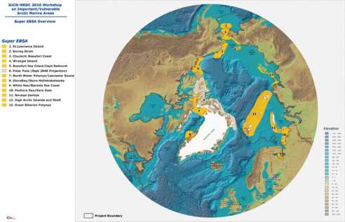
The International Union for the Conservation of Nature (IUCN) and the Natural Resources Defense Council (NRDC) have undertaken a project to explore ways of advancing implementation of ecosystem- based management in the Arctic marine environment through invited expert workshops. The first workshop, held in Washington, D.C. on 16-18 June, 2010, explored possible means to advance policy decisions on ecosystem-based marine management in the Arctic region. Twentynine legal and policy experts from around the region participated in the June workshop. The report and recommendations of the June policy workshop can be found here: <a href="http://cmsdata.iucn.org/downloads/arctic_workshop_report_final.pdf" target="_blank">Workshop report</a> The second workshop, the subject of this report, was held at the Scripps Institution of Oceanography in La Jolla, California on 2-4 November, 2010. The La Jolla workshop utilized criteria developed under auspices of the Convention on Biological Diversity to identify ecologically significant and vulnerable marine areas that should be considered for enhanced protection in any new ecosystem-based management arrangements. A list of participants, the meeting agenda and other relevant documents are attached as appendices to this repor, see: <a href="https://www.nrdc.org/sites/default/files/oce_11042501a.pdf" target="_blank">Workshop report</a>
-

Human activity is expanding in the Arctic marine environment, in part due to warming ocean temperatures and the dramatic loss of summer sea ice. New and expanding human uses include fishing, shipping and offshore oil and gas development. All have the potential to place major additional stress on ocean ecosystems which are already undergoing profound change related to warming, sea ice loss, and alterations in ocean chemistry. Because activities conducted in one nation's waters can affect other parts of the region, effective management of some human uses in the Arctic marine environment will require international cooperation. The United Nations Convention on the Law of the Sea, in conjunction with other international agreements and national laws and regulations, provides a general legal foundation. However, new rules may be necessary to protect the Arctic marine environment. Examples of possible areas of international cooperation include: development of new standards for Arctic marine shipping, regulation of new or expanding Arctic fisheries, rules to protect the environment in the course of natural resource development, stricter regulation of Arctic tourism, mechanisms to assess and manage the cumulative impacts of multiple activities affecting the same ecosystems, and procedures for the establishment of representative networks of protected marine areas. Ecosystem-based management has the potential to provide an organizing framework for these new or enhanced management measures in the Arctic. Such an approach, as generally accepted at the international level, includes defining portions of ocean space for management purposes based on oceanographic and ecological criteria, and the development of management arrangements that address all human uses of that space in an integrated fashion. A central element of ecosystem-based management is the identification of ecologically significant or vulnerable areas that should be considered for protection due to their role in maintaining valued ecosystem functions and resilience. This data was created with the purpose to identify these areas within the Arctic marine environment.
-

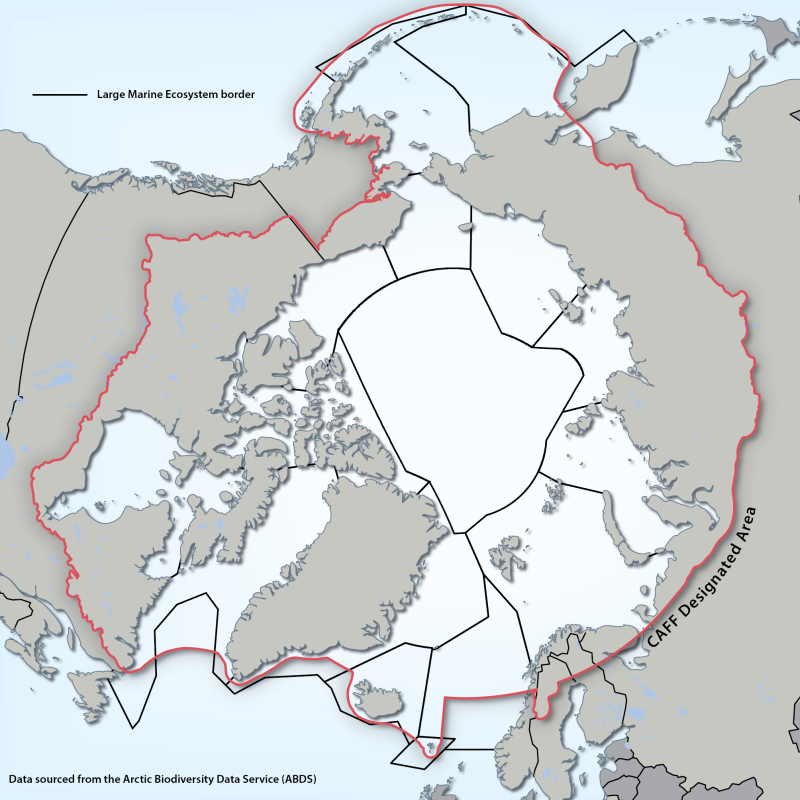
Large Marine Ecosystems (LMEs) are regions of ocean space encompassing coastal areas from river basins and estuaries to the seaward boundary of continental shelves and the seaward margins of coastal current systems. Fifty of them have been identified. They are relatively large regions (200 000 km2 or more) characterized by distinct bathymetry, hydrography, productivity and trophically dependent populations. The LME approach uses five modules: 1. productivity module considers the oceanic variability and its effect on the production of phyto and zooplankton 2. fish and fishery module concerned with the sustainability of individual species and the maintenance of biodiversity 3. pollution and ecosystem health module examines health indices, eutrophication, biotoxins, pathology and emerging diseases 4. socio-economic module integrates assessments of human forcing and the long-term sustainability and associated socio-economic benefits of various management measures, and 5. governance module involves adaptive management and stakeholder participation.” Source: http://www.fao.org/fishery/topic/3440/en Reference: Sherman, K. and Hempel, G. (Editors) 2009. The UNEP Large Marine Ecosystem Report: A perspective on changing conditions in LMEs of the world’s Regional Seas. UNEP Regional Seas Report and Studies No. 182. United Nations Environment Programme. Nairobi, Kenya. Data available from: http://lme.edc.uri.edu/ - LMEs of the world Updated shape file - 2014
-

Broad Ecosystem Units were mapped using predictive modeling methods from various data sources (ranging from 1:50,000 to 1:250,000 in scale) and are referenced to the CanVec digital spatial framework (1:50,000). Broad Ecosystem Units (BEU) are a level in the Yukon bioclimate ecosystem classification system that represents areas with similar broad vegetation communities, terrain type (soils and topography) within bioclimate zones. Broad Ecosystem Units are described in the accompanying report "Regional Ecosystems of West-Central Yukon, Part 1: Ecosystem descriptions ".The intended application for mapped broad ecosystem units is 1:100,000 or smaller (1:100,000 - 1:250,000 scale) - interpretations derived from the map products should not be applied at more detailed scales, even though the resultant 30m raster map allows users to view results at more detailed resolutions. With new information, boundaries and designations of Broad Ecosystem Units can change. Updates to Broad Ecosystem Units occur only periodically. For the most current information, or if you have questions, please contact the Ecological and Landscape Classification Program (ELC@yukon.ca). Distributed from [GeoYukon](https://yukon.ca/geoyukon) by the [Government of Yukon](https://yukon.ca/maps) . Discover more digital map data and interactive maps from Yukon's digital map data collection. For more information: [geomatics.help@yukon.ca](mailto:geomatics.help@yukon.ca)
-

For most recent Ecological Land Classification data, see: https://data.novascotia.ca/d/q6zd-39t3 The Ecological Land Classification (ELC) for Nova Scotia provides a hierarchical mapping of the province's forest ecosystems into ecosections, ecodistricts and ecoregions. It includes interpretation of the dominant natural disturbance regimes and potential climax forests at the ecosection level.
-

The Ecological Land Classification (ELC version 2015) for Nova Scotia provides a hierarchical mapping of the province's forest ecosystems into ecosections, ecodistricts and ecoregions. It includes interpretation of the dominant natural disturbance regimes and potential climax forests at the ecosection level.
-
Territories of ecological interest in the City of Trois-Rivières**This third party metadata element was translated using an automated translation tool (Amazon Translate).**
-

The TEI Data Distribution packages in this folder contain of the full Terrestrial Ecosystem Information (TEI) dataset split into Predictive Ecosystem Mapping (PEM) data and non-PEM data which includes Terrestrial Ecosystem Mapping (TEM), Terrain Mapping (TER), Bioterrain Mapping (TBT) Terrain Stability Mapping (TSM), Sensitive Ecosystems Inventory (SEI), Soil Mapping (SOIL project boundaries only), and Wildlife Habitat Ratings (WHR project boundaries only) by Natural Resource Sector Region (see Index map .pdf). Data includes the Project Boundaries (with project metadata and links to related data such as reports), Long Table (detailed mapping polygons with the full RISC standard attribute table), Short Table (detailed mapping polygons with key and amalgamated (concatenated) attributes derived from Long Table), On-site Symbol features (point, line or polygon terrain features such as landslide tracks, scarps), Sample Sites (field sampling locations), and any user-defined tables. The data dictionary is also available. This data is in file geodatabase format. Current version: v11 (published on 2024-10-03) Previous versions: v10 (published on 2023-11-14), v9 (published on 2023-03-01), v8 (published on 2016-09-01) Note that the Soil Mapping dataset is available from: http://www.env.gov.bc.ca/esd/distdata/ecosystems/Soil_Data/SOIL_DATA_FGDB/
-

Fire maintained ecosystem restoration for the Rocky Mountain Forest District. The data was provided by MOFR/Interior Reforestation and compiled based on the various sources including VRI, BEC, TSR2 Algorithm 2003, etc.
-

Yukon Biophysical Plot locations are derived from the Yukon Biophysical Information System (YBIS) database, which is the Government of Yukon's repository for storing biophysical data . Data contain a combination of site, soil and vegetation information which are collected by multiple agencies to support vegetation inventory, habitat assessment and baseline ecosystem products collected from 1975 - 2018. Data are collected and input into the database using standardized biophysical field forms as per the "Field Manual for Describing Yukon Ecosystems" data collection standards. Data contributors include Government of Yukon, Government of Canada, First Nations Governments, private contractors, academia and the public. Location accuracy of plot data may vary based on the project year and location collection method. YBIS is an active database, which is subject to periodic updates and revisions. Because of this, the onus is on the end-user to ensure that they are using the most current version of the data. Although every effort has been made to ensure the correctness of the data, there still may be errors. Please report errors in the data to the Custodian.Contact Information:Ecological and Landscape Classification (ELC) Coordinator, elc@yukon.ca Ecological and Landscape Classification Program, Fish and Wildlife Branch, Department of Environment Government of Yukon, Box 2703, Whitehorse, Yukon Y1A 2C6 ph. (867) 667-3081 Distributed from [GeoYukon](https://yukon.ca/geoyukon) by the [Government of Yukon](https://yukon.ca/maps) . Discover more digital map data and interactive maps from Yukon's digital map data collection. For more information: [geomatics.help@yukon.ca](mailto:geomatics.help@yukon.ca)
 Arctic SDI catalogue
