 Arctic SDI catalogue
Náttúrufræðistofnun – Natural Science Institute of Iceland
Type of resources
Available actions
Topics
Keywords
Contact for the resource
Provided by
Years
Formats
Service types
Scale
-

Gagnasafn (GDB) NI_J600v_hoggun: Jarðfræðikorti af Íslandi – Höggun – 1:600.000 [Geological Map of Iceland – Tectonics – 1:600.000]. Höggunarkort af Íslandi sýnir jarðfræði landsins á nýstárlegan hátt. Jarðlög eru flokkuð eftir aldri en ekki eftir gerð og samsetningu. Sýnd eru eldstöðvakerfi, þ.e. megineldstöðvar, sprungu- og gangareinar, bæði virkar og útkulnaðar. Einnig eru sýnd helstu brotakerfi landsins og halli jarðlaga. Kortið gefur innsýn í jarðfræðilega byggingu landsins. [The Tectonic Map of Iceland gives a new view of the country's geology. The rocks are classified by age, but not by type or composition. Volcanic systems including central volcanoes, fissures and dyke swarms, both active and extinct, are shown, as are the island's principal fracture zones and the dip of rock layers. The map thus gives a useful insight into the geological structure of the country.]
-
Gagnasafn (GDB) NI_reit_v_LiflandfraedilegSvaedi_sveppir: Líflandfræðileg svæði fyrir sveppi [Bio-geographical provinces for fungi in Iceland]. Reitakerfið er notað til að sýna grófa útbreiðslu sveppa eftir landshlutum og byggir á 10 km reitakerfi NÍ. Fláka- og línulag.
-
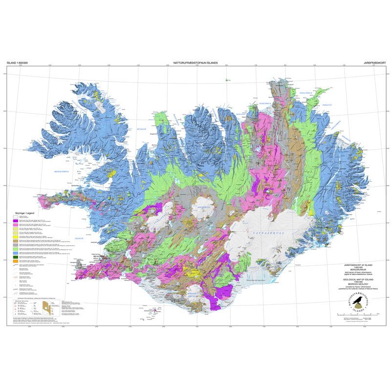
Gagnasafn (GDB) NI_J600v_berg_2.utg: Jarðfræðikorti af Íslandi – Berggrunnur – 1:600.000 [Geological Map of Iceland – Bedrock geology – 1:600.000]. Berggrunnskort af Íslandi sýnir stærstu drættina í jarðfræði landsins. Jarðlög eru flokkuð eftir aldri, gerð og samsetningu. Kortið sýnir vel gosbelti landsins og dreifingu gossstöðva frá nútíma. Nútímahraunum er skipt í forsöguleg og söguleg hraun (yngri en 871 e. Kr. ). [The Geological Map of Iceland shows the main features of the bedrock geology. Formation are classified by age, type, and composition. The map clearly shows the island's volcanic zones and the distribution of the recent eruption sites. Lava fields of the Holocene are shown as pre-historic or historic (younger than AD 871].]
-
Þekja [layer] j100v_vesturgosbelti_jardgrunnur_1utg_fl: Jarðgrunnsgögn af Vesturgosbelti Íslands. [Surface deposits of the Western Volcanic Zone of Iceland.] Laus setlög, svo sem jökulgarðar og árset. [Unconsolidated sediments including glacial morianes and river sediments.]
-
Þekjur (layers) n25v_gigarNutima_li og n25v_gigarNutima_fl: Eldvörp (gígar) og gervigígar sem myndast hafa eftir að jökull hvarf af landinu á síðjökultíma. (Volcanic craters and rootless vents formed after last Iceage [12.000 years ago].) Eldvörp og gervigígar sem myndast hafa eftir að jökull hvarf af landinu á síðjökultíma njóta sérstakrar verndar samkvæmt 61 gr. í lögum um náttúruvernd. Náttúrufræðistofnun Íslands heldur skrá yfir þessi náttúrufyrirbæri og birtir í kortasjá sem jafnframt er viðauki við náttúruminjaskrá. Heimildaskrá fylgir (n25v_gigarOgHraunNutima_heimildir).
-
Þekja [layer] j100v_vesturgosbelti_lindir_1utg_p: Lindir og hverir á Vesturgosbelti Íslands. [Springs and hotsprings of the Western Volcanic Zone of Iceland.] Gögnin sýna laug, hver, lindir, gufu- og leirhver. Gögn eru ekki flokkuð eftir ÍST120:2012 staðlinum. Hér er flokkun eða lýsing nýrra fitjueiginda: 'tegUppsprettuISOR': 2: 10–25°C (Laug) 3: 25–50°C (Laug) 4: 50–75°C (Laug) 5: 75–98°C (Laug) 6: 98–100°C (Hver) 20: Hrúður 30: Leir- og gufuhverir 7212: Lindir 10–100 l/s 7213: Lindir >100 l/s 7214: Lindasvæði 100–1000 l/s 7215: Lindasvæði >1000 l/s 'tegUppsprettuNI': 1: Lindir 4: Laug (10–98°C) 5: Hver (98–100°C) 6: Leir- og gufuhver 'vatnshiti': Hitastig vatnsins við lindina, mælieining: °C. 'gerdiISOR': Grágrýtislind/Grágrýtislindir: Lind/lindir í hrauni eldra en síðasta jökulskeið, Hraunalind/Hraunalindir: Lind/lindir í nútímahrauni, Móbergslind/Móbergslindir: Lind/lindir í móbergi, Sprungulind: Lind í sprungu. [This data includes cold, warm and hot springs, steam and mud springs. The data does not follow the ÍST120:2012 data standard. Explanation and classification of the new feature attributes: 'tegUppsprettuISOR': 2: 10–25°C (Warm spring) 3: 25–50°C (Warm spring) 4: 50–75°C (Warm spring) 5: 75–98°C (Warm spring) 6: 98–100°C (Boiling spring) 20: Hot spring deposits 30: Mud and steam spring 7212: Cold spring 10–100 l/s 7213: Cold spring >100 l/s 7214: Cold spring area 100–1000 l/s 7215: Cold spring area >1000 l/s 'tegUppsprettuNI': 1: Cold spring 4: Warm spring (10–98°C) 5: Boiling spring (98–100°C) 6: Mud and steam spring 'vatnshiti': Temperature of the spring in °C. 'gerdiISOR': Grágrýtislind/Grágrýtislindir: Spring(s) in 'grey basalt' lavas older than the last glacial, Hraunalind/Hraunalindir: Spring(s) in postglacial lavas, Móbergslind/Móbergslindir: Spring(s) in hyaloclastite tuff, Sprungulind: Spring in tectonic fissure.]
-
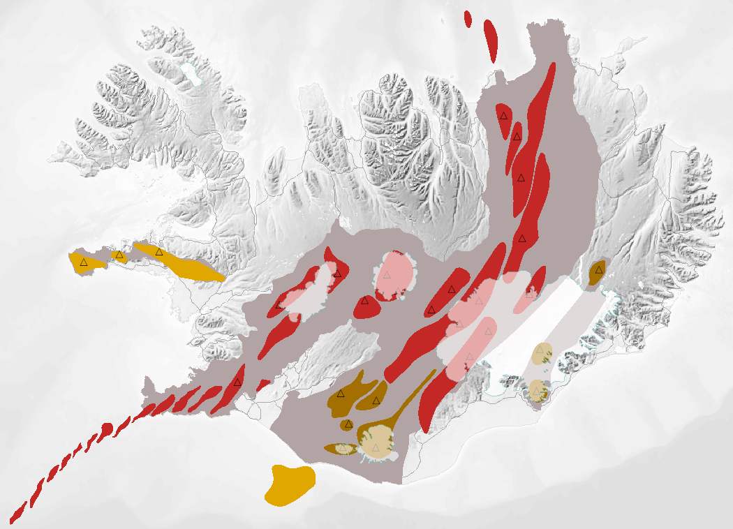
Gagnasafn (GDB) NI_J600v_bergradir_ISN93_1.utg: NI_J600v Bergraðir Íslands – 1:600.000 [NI_J600v Igneous rock series of Iceland – 1:600.000]. Kort af þremur bergröðum Íslands. Kortið sýnir virk gosbelti á Íslandi og landgrunni þess á nútíma og síðjökultíma, virk eldstöðvakerfi á nútíma, útbreiðslu gosstöðva og samsetningu gosbergs (flákalag). Staðsetning megineldstöðva er einnig sýnd (punktalag). Gerður er greinarmunur á þóleiískum, alkalískum og millibergskerfum. [The map of the three igneous rock series of Iceland at a scale of 1:600.000 shows the volcanic zones active in Iceland and its insular shelf during the Holocene and Late Pleistocene, volcanic systems active during the Holocene, the distribution of eruption sites and chemical composition of erupted rocks (polygon layer). The position of central volcanoes is also shown (point layer). Tholeiitic, alkalic and transitional alkalic volcanic systems are differentiated.]
-
Þekja (layer) j100v_austurland_gigar_1utg_fl: Flákar sem sýna gjallgíga í jarðlagastafla Austurlands. [Polygon data of scoria cones in Eastern Iceland.}
-
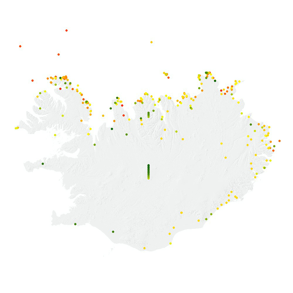
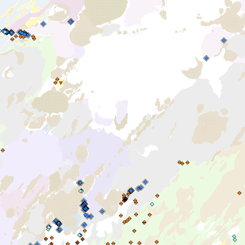
Dreifing hvítabjarna sem sést hafa á Íslandi í mismunandi mælihvarði. Þekja ni_G500v_hvitabjorn, punktalag. [Distribution of polar bear sightings in Iceland in different scales. Point layer ni_G500v_hvitabjorn.] Ekki er hægt að tala um hvítabirni sem íslenska tegund en þó hafa þeir tekið hér land af og til og teljast því til flökkudýra. Upplýsingar eru til um rúmlega 560 hvítabirni sem skráðir hafa verið hérlendis frá upphafi landnáms. Síðast varð vart við hvítabjörn við Höfðaströnd í Jökulfjörðum 2024. Viss ónákvæmni er þarna um að ræða því vafalaust hafa einhver dýr gengið hér á land án þess að menn hafi haft þar vitneskju um eða skráð sérstaklega. [Polar bears are not native to Iceland, although they do occasionally turn up in Iceland and are thus classified as vagrants. Information exists on just over 560 polar bears recorded as having arrived in Iceland from the beginning of human settlement on the island to the present day. This is a somewhat imprecise figure, since polar bears have undoubtedly come ashore without their presence going noticed, while bear sightings and encounters were not always documented in the past. The last polar bear observation was at Höfðaströnd, Jökulfjörður, Westfjords, in 2024. Table entries are in Icelandic.] Nákvæmni tíma [Accuracy of time]: varies depending on the source. If only the year of the sighting is known, you find this year under fitjueigindi 'ártal 1' (artal1). In case there are more details known, there are as well entries for fitjueigindir 'dags hvítabjarnakomur' (dagsHvitabjarnakomur) or 'ártið' (artid). If the year is not quite definit, there is an entry in fitjueigindi 'um' (um). Entries in both fitjueigindir 'ártal 1' and 'ártal 2' (artal1, artal2) define a timespan for the sighting. Nákvæmni staðarins [Accuracy of location]: varies depending on the source. All sightings for Íceland are grouped in the center of Iceland and the value for fitjueiginde 'nákvæmni XY' (nakvaemniXY) is '9000'. Sightings for Norðurland are grouped on Tröllaskagi, sightings for Norðvestur are placed in the center of the Vestfjords, sightings on Melrakki are grouped just off the north coast (nakvaemniXY = 3000 or 2000). If only the area is know, the data is placed in the center of the corresponding 10-km-reit (nakvaemniXY = 1000). If the location is known in detail, t.d. bæ, the entry for 'nakvaemniXY' is '100'. Sometimes the sources do not state the location of the sighting but the farm where the animal was processed [unnin]. And one has to keep in mind that a 'dot' in the data set can also represent an animal that has been in Iceland for a longer period of time and has traveled a longer distance. If there are several sightings for the same place or area, the entries are scatterd using a 1-km-reit system. Entries on age, sex, and size or weight are often missing. Fitjueigindi 'RM númer' (RMnumer) corresponds with the Natural History Collection of Náttúrufræðistofnun. Heimild [Source]: Náttúrurfræðistofnun Íslands and the publication: Rósa Rut Þórisdóttir 2018. Hvítabirnir á Íslandi. Reykjavík: Bókaútgáfan Hólar.
-
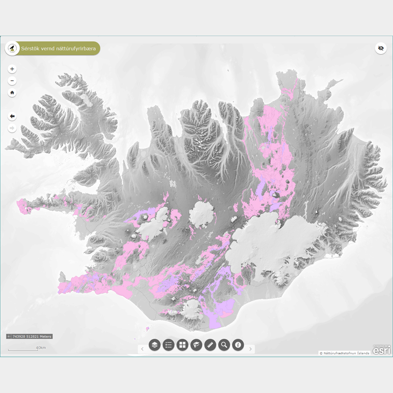
Þekja (layer) n25v_hraunNutima_fl: Eldhraun (hraun) sem myndast hafa eftir að jökull hvarf af landinu á síðjökultíma. (Postglacial lavas in Iceland.) Eldhraun sem myndast hafa eftir að jökull hvarf af landinu á síðjökultíma njóta sérstakrar verndar samkvæmt 61 gr. í lögum um náttúruvernd. Náttúrufræðistofnun Íslands heldur skrá yfir þessi náttúrufyrirbæri og birtir í kortasjá sem jafnframt er viðauki við náttúruminjaskrá. Hraun frá nútíma eru flokkuð í forsöguleg og söguleg hraun og í gögnunum eru upplýsingar um aldur, eldstöðvakerfi og heiti hrauna. Heimildaskrá fylgir (n25v_gigarOgHraunNutima_heimildir).