 Arctic SDI catalogue
Energy and resources
Type of resources
Available actions
Topics
Keywords
Contact for the resource
Provided by
Formats
Representation types
Update frequencies
status
Scale
-
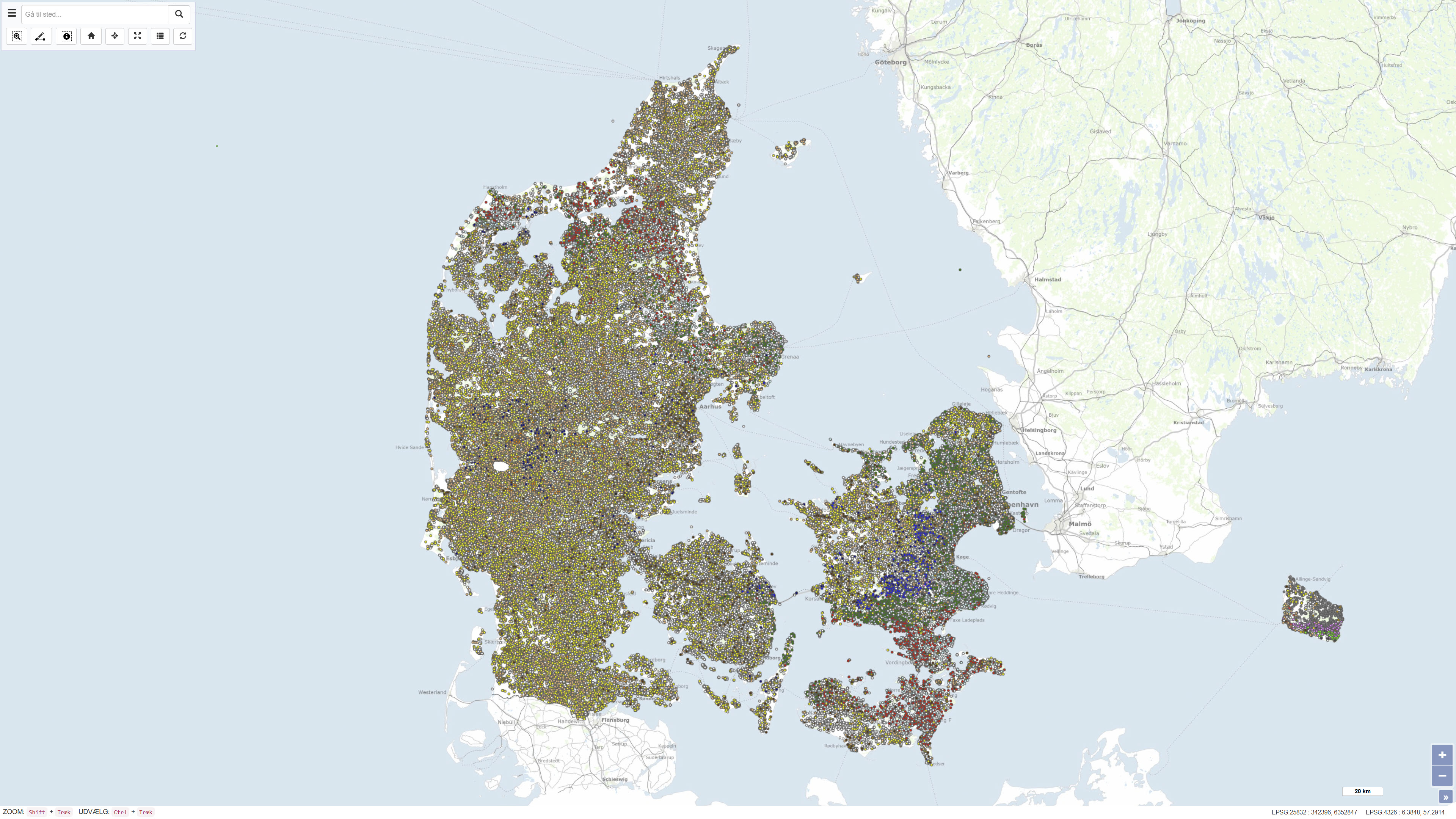
The National well database (Jupiter) among other things contains water level measurements from Danish wells. The database contains water level measurements from the municipalities, the groundwater-monitoring program, the regions soil pollution investigations and from the establishment of new wells.
-
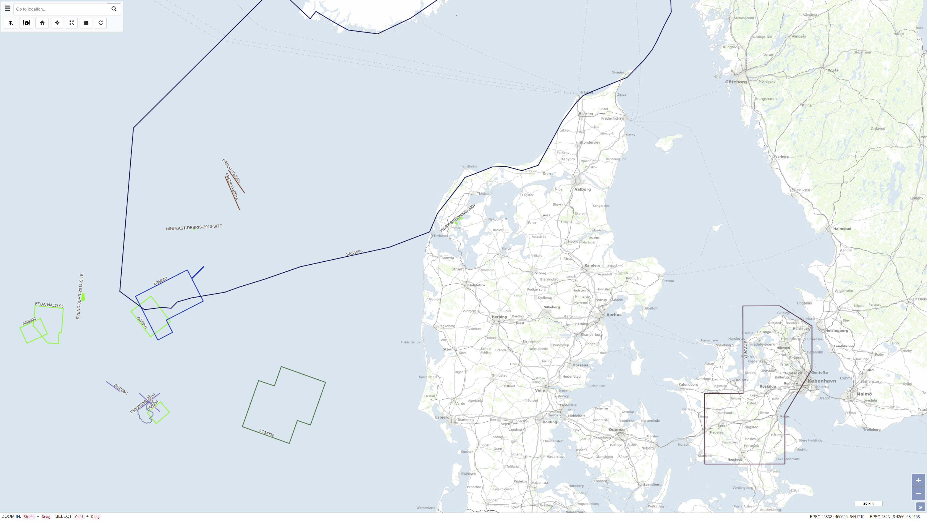
The Samba database contains information about geophysical investigations made in the Danish sector, acquired according to the Danish Act on the Use of the Subsoil. The data is acquired in relation to investigation for oil/gas, geothermal energy, the storage of gas or salt. That is: Seismic (2D & 3D) acquisitions, CSEM as well as other magnetic and gravity acquisitions shipborne as well as airborne. The dataset also contains geophysical measurement performed in the deep wells and meta data about the seismic surveys. The data has been submitted by the licensees. The database is updated on an ongoing basis.
-
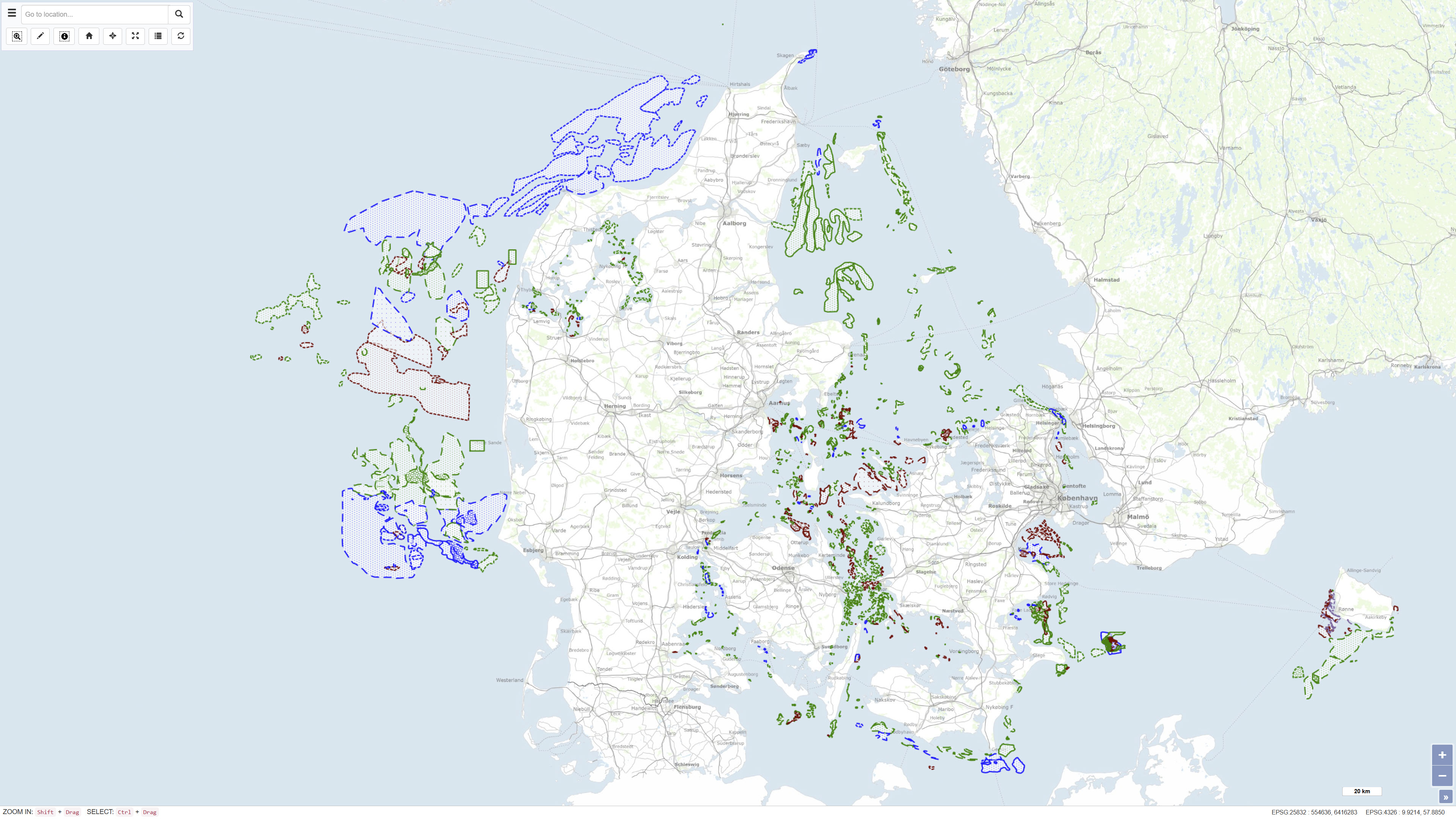
The MARTA database contains shallow seismic and acoustic data, information and geological samples. MATRA shows the distribution of marine sand and gravel resources and gives access to reports on raw material surveys. MARTA shows the distribution of marine sand and gravel resources and gives access to reports on raw material surveys. Data has primarily been acquired by GEUS and our partners., MARTA is the official Danish marine raw material database for data reported in accordance with the Danish Raw Material Act. MARTA is used by the raw materials industry and authorities and as a planning tool in connection with raw material extraction and marine construction projects including beach nourishment.
-
This dataset describes the intrusions and magmatic complexes of Greenland, forming a dedicated information layer within the GEUS GMOMDB2 database, displayed via the Greenland Mineral Occurrence Map (GMOM2). It includes 194 registered intrusions and complexes grouped into 23 magmatic provinces. The data are compiled from GEUS geological maps, published sources, and company reports. The Palaeogene intrusions and complexes of East Greenland (66–75°N) are related to the opening of the North Atlantic and the influence of the ancestral Icelandic mantle plume. The magmatic evolution includes flood basalts, dyke swarms, and intrusive activity from 61 to 13 Ma. Economic mineralisation is documented in several complexes, including the Skaergaard palladium deposit and the Malmbjerg porphyry molybdenum deposit, representing classic examples of rift- and post-rift-related mineral systems. The dataset provides harmonised, quality-controlled geological information to support exploration and research activities in Greenland.
-
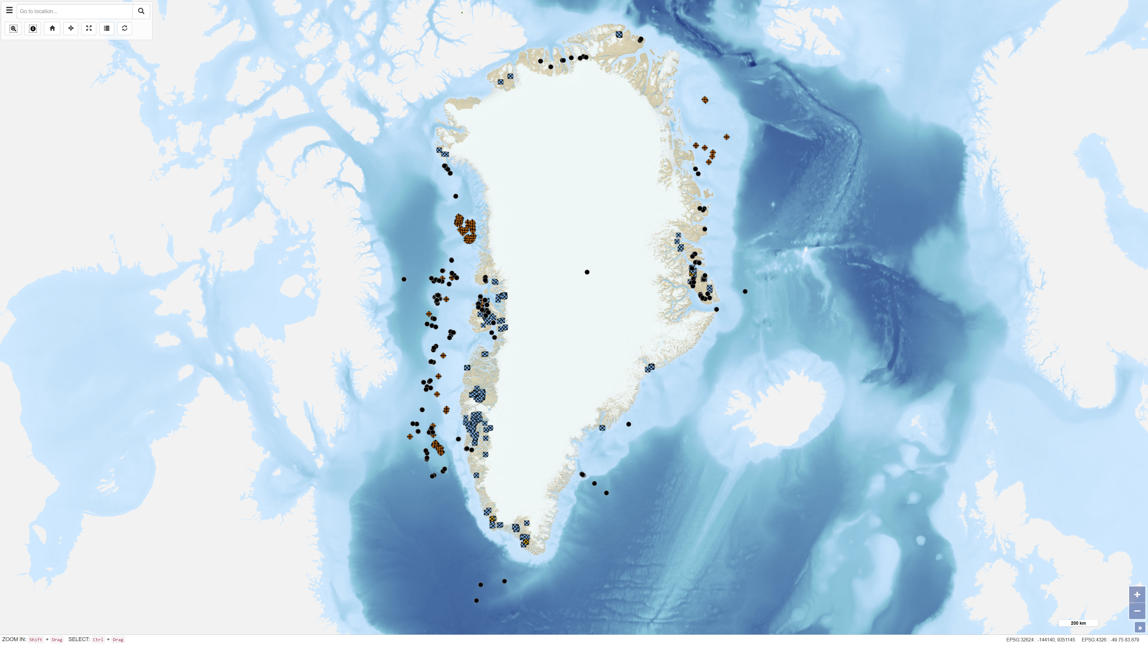
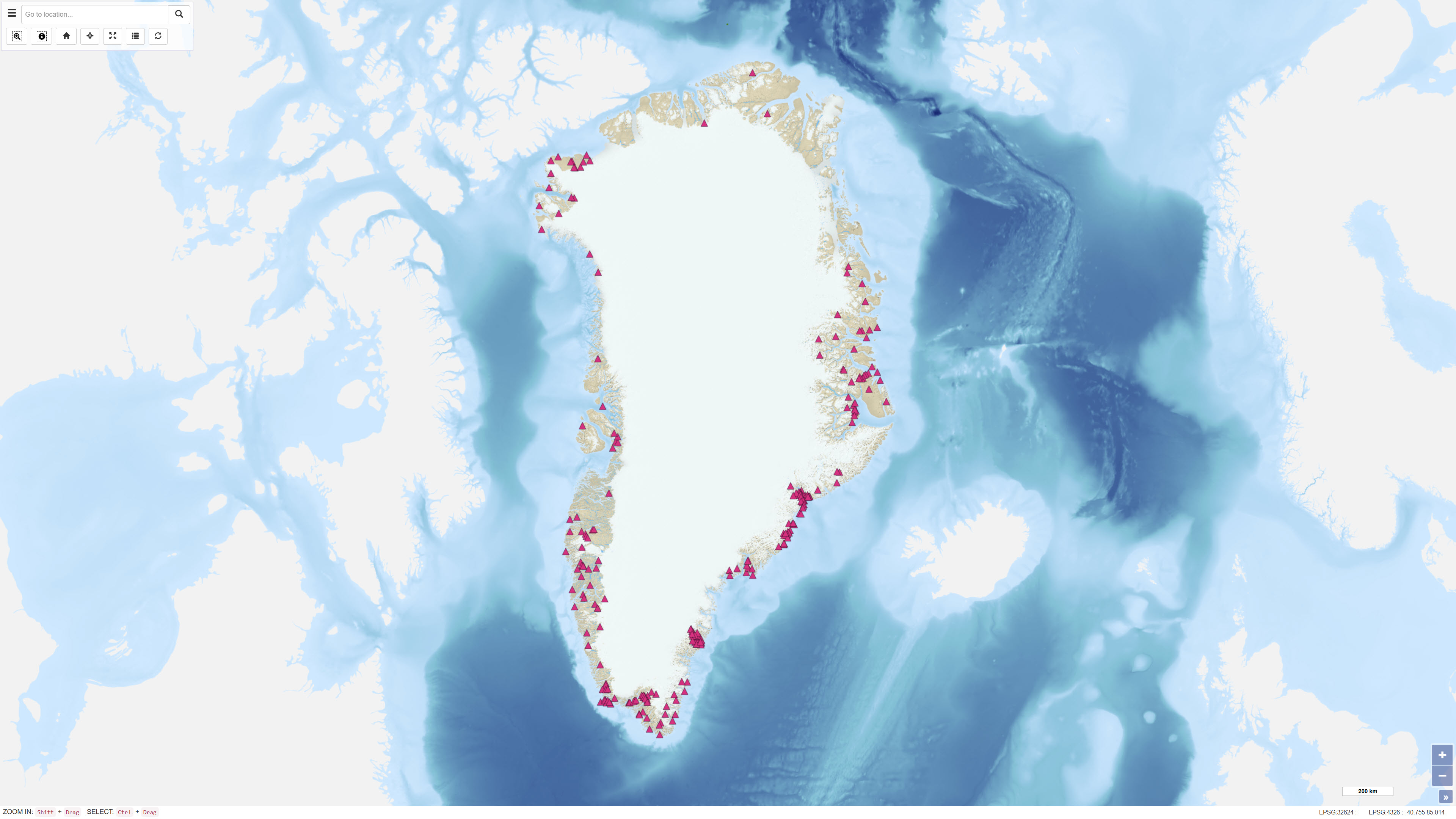
The dataset contains basic information on the location of onshore and offshore drillholes in Greenland established for scientific research as well as mineral, oil and gas exploration. The dataset functions as a geographic reference layer and, where available, includes links to reports or summary sheets representing the original source of information. The dataset covers drillholes established between 1948 and 2019 and is subject to continuous updates as new information becomes available through scientific publications, press releases and company documentation.
-
%20-%20datas%C3%A6t.jpg)
The database contains information on deep drilling, carried out under a permit, cf. the Subsoil Act, as well as geophysics (especially seismic), licenses and reports. These are exploration, estimation, delineation and production drillings concerning oil/gas, geothermal energy, gas storage and salt, as well as scientific drillings. The dataset contains technical, administrative and geological information from the drillings and about geophysical measurements in the drillings.
-
This dataset contains an overview of all active exploitation licences in Greenland. The data are hosted and maintained by the Ministry of Mineral Resources (MMR), Government of Greenland. GEUS harvests the data through a WFS service provided by MMR and makes them available for visualisation through GEUS map services. The dataset represents the geographic extent of valid exploitation licences and functions as an administrative reference dataset.
-
%20-%20datas%C3%A6t.jpg)
The dataset comprises airborne electromagnetic (AEM) measurements acquired in Greenland during 1994–1998 as part of GEUS’ regional geophysical mapping programme. The surveys were conducted using helicopter- and fixed-wing electromagnetic systems and include electromagnetic response measurements as well as magnetic data. The dataset is used for regional mapping of subsurface electrical conductivity and for identifying structural and lithological variations relevant to geological interpretation and mineral exploration.
-
%20-%20datas%C3%A6t.jpg)
The Greenland Mineral Occurrences Map (GMOM) dataset contains a compilation of geological information on known mineral occurrences in Greenland. For each occurrence, information includes geographic location, size, mineral commodities, mineralisation type, exploration history and a geological description. The data have been collected and compiled from published scientific articles, exploration reports submitted to the authorities in Greenland, and direct geological observations made during fieldwork conducted by geological surveys, academic researchers and mineral exploration companies. The dataset represents a synthesis of existing knowledge on mineral occurrences in Greenland.
-
%20-%20datas%C3%A6t.jpg)
The dataset contains aeromagnetic measurements acquired during 1993–1996 in East and North-East Greenland as part of the AWI-AEROMAG project conducted by the Alfred Wegener Institute (AWI). The measurements represent regional airborne magnetometry and include total magnetic field intensity corrected for diurnal variations and the main geomagnetic field. The survey was carried out to support geological mapping and tectonic analysis of eastern Greenland. The dataset constitutes an important geophysical reference for studies of crystalline basement rocks, sedimentary basins and structural features in the region.