 Arctic SDI catalogue
geology
Type of resources
Available actions
Topics
Keywords
Contact for the resource
Provided by
Years
Formats
Representation types
Update frequencies
status
Service types
Scale
Resolution
-
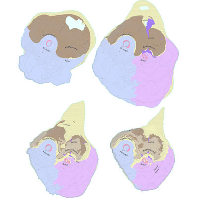
Gagnasafn (GDB) NI_J5v_Surtsey_jardsaga1963-2006: Surtsey Jarðfræðikort jarðsaga 1963-2006 1:5.000 [Surtsey Geological time 1963-2006 1:5.000]. Sýning Náttúrufræðistofnunar í Þjóðmenningarhúsinu – SURTSEY 1963-2130, 7. maí 2007 til mars 2009. Náttúrufræðistofnun Íslands stóð fyrir sýningunni, með stuðningi fjölda stofnana, fyrirtækja og ráðuneyta umhverfis- og menntamála. Tilefnið var að 40 ár voru liðin frá því eldgosi lauk í Surtsey og eyjan var í tilnefningarferli sem heimsminjasvæði UNESCO. Fyrir þessa sýningu var útbúin tímaröð sem sýnir breytingar í jarðfræði Surtseyjar frá upphafi til ársins 2006, eða samtals 15 jarðfræðikort sem sýna eyjuna 16. nóv. 1963, 17. feb. og 25. ág. 1964, 1965, 1966, 1967, 1972, 1977, 1983, 1988, 1992, 1998, 2002, 2004 og 2006. Gagnaserían inniheldur upplýsingar um hraun, móberg, gjósku, gjall, strandset, foksand (flákalag) og gíga (fláka- og línulag). Jarðfræðikortin sýna myndun eyjarinnar 1963-1967, myndun móbergs og sjávarrof eftir að gosi lauk.
-

An interpretation of bedrock geology, topography and other sources of information that shows the potential for karst formations. This is a reconnaissance level map for all of British Columbia
-
A polygon coverage showing the location of coalfields with coalbed methane (cbm) potential in BC
-
The Kentucky Geological Survey (KGS), as part of the United States Geoscience Information Network (USGIN), provides a compilation of geologic maps from the NGCMP-09 database (http://ngcmp.usgs.gov/) covering the United States of America including Hawaii and Alaska. This Service was published by the KGS as part of the USGIN initiative to “create and facilitate discovery and access to geoscience information provided by state and federal geological surveys of the United States”. These data were compiled by the Kentucky Geological Survey. Three (3) layers included in this service are as follows: 1. GeologicUnitView is a compilation datasets containing geologic units covering the Commonwealth of Kentucky at 1:24,000 scale. The data table includes geologic name, description, lithology, and geologic history. 2. ContactView is a compilation dataset containing geologic contacts covering the Commonwealth of Kentucky at a scale of 1:24,000. The table includes contact type, positional accuracy and generic symbolizer (FGDC). Citations are included in the data set. 3. ShearDisplacementStructureView is a compilation dataset containing shear displacement structures covering the Commonwealth of Kentucky at a scale of 1:24,000. The table includes fault type, positional accuracy, and generic symbolizer (FGDC). Citations are included in the dataset.
-
The bedrock map of Laos
-

The Yukon Territory is underlain by a great variety of rock types ranging in age from Early Proterozoic to Recent and representing diverse environments including epicratonic basins, subsiding shelves, foreland basins, island arcs and deep ocean basins. Episodes of compressional and extensional deformation, transcurrent faulting, metamorphism and plutonism further complicate the map pattern. This complex geological record has been described in terms of the interactions of several terranes (large parts of the earth's crust which preserve a common geological record) with each other and with the margin of ancestral North America. Distributed from [GeoYukon](https://yukon.ca/geoyukon) by the [Government of Yukon](https://yukon.ca/maps) . Discover more digital map data and interactive maps from Yukon's digital map data collection. For more information: [geomatics.help@yukon.ca](mailto:geomatics.help@yukon.ca)
-
A Yukon-wide compilation of map footprints and associated citation data for 191 published bedrock geology maps that were incorporated into the Yukon bedrock geology compilation. The maps were originally produced by the GSC, YGS, Yukon Government and various universities at various scales ranging from 1:10,000 to 1:500,000. Attribute data for each map footprint includes: year, scale, author, publisher, map number, NTS sheet and title. Distributed from [GeoYukon](https://yukon.ca/en/geoyukon) by the [Government of Yukon](https://yukon.ca/maps) . Discover more digital map data and interactive maps from Yukon's digital map data collection. For more information: [geomatics.help@yukon.ca](mailto:geomatics.help@yukon.ca)
-
Yukon Territory has been glaciated by Cordilleran and montane glaciers at various times throughout the Pleistocene, as well as by continental ice, the Laurentine Ice Sheet in the Late Pleistocene. Throughout the Late Cenozoic, each successive glaciation appears to have been less extensive than the previous one. In west-central Yukon the earliest glaciation occurred between 2.6 and 2.9 Ma. ago (Duk-Rodkin and Barendregt, 1997). This glaciation was the most extensive and formed a continuous carapace of ice covering all the mountain ranges, except for a small area of Dawson Range and a more extensive area in northern Yukon. The Mid Pleistocene Cordilleran glaciation was less extensive than older glaciations but it formed an extensive ice sheet covering most of the northern Cordillera. The Late Pleistocene glaciation was the most restrictive and formed a continuous carapace of ice from the continental divide to the Saint Elias Mountains, but only restricted ice caps formed on the Ogilvie Mountains. During the last glaciation, the Laurentide Ice Sheet, flowing from the east, reached the northeast part of the Yukon Territory ca. 30 ka ago. Distributed from [GeoYukon](https://yukon.ca/geoyukon) by the [Government of Yukon](https://yukon.ca/maps) . Discover more digital map data and interactive maps from Yukon's digital map data collection. For more information: [geomatics.help@yukon.ca](mailto:geomatics.help@yukon.ca)
-
The THERMAL SPRINGS layer represents a compilation of available data from thermal springs throughout the Yukon and near the Yukon border. Spring data points include information on the name of the thermal springs, the measured temperature, the water chemistry, geothermometer results and references where more data may be found.
-
Core viewing and rock sawing facilities are available Monday - Friday, 8:30 a.m. to 4:30 p.m. To see information on the status of our drill core program and download forms for accessing the collection, visit [https://yukon.ca/en/yukon-geological-survey-core-library](https://yukon.ca/en/yukon-geological-survey-core-library) . To reserve the core library facilities, please contact [YGS-Minerals@yukon.ca](mailto:YGS-Minerals@yukon.ca) For comments or feedback on the dataset, please contact [ygstech@yukon.ca](mailto:ygstech@yukon.ca) Distributed from [GeoYukon](https://yukon.ca/geoyukon) by the [Government of Yukon](https://yukon.ca/maps) . Discover more digital map data and interactive maps from Yukon's digital map data collection. For more information: [geomatics.help@yukon.ca](mailto:geomatics.help@yukon.ca)