 Arctic SDI catalogue
Soils and biogeochemistry
Type of resources
Available actions
Topics
Keywords
Contact for the resource
Provided by
Formats
Representation types
Update frequencies
status
Scale
-
Areas of special drinking water interest (OSD) are assigned the highest priority for drinking water supply. They are delineated according to criteria including future water demand, groundwater quality, natural protection, and the preservation of existing abstraction infrastructure. The spatial extent of OSD areas may be adjusted as new knowledge becomes available through fee-financed groundwater mapping under the Environmental Objectives Act § 8a. Within these areas and abstraction catchments for public waterworks, action plans are developed under Chapter 3 of the Water Supply Act. Areas of drinking water interest (OD) represent regions with groundwater of suitable quality for drinking water, primarily relevant for smaller utilities and local abstraction. The data are provided as a vector Dataset and are accessible via OGC web services. Source data are obtained from the Danish Environmental Protection Agency’s groundwater delineations (as of November 2022) and reflect the state of knowledge at publication time.
-
Results from laboratory analyses of related to monitoring the quality of water wells and drinking water taps in household. This dataset is part of GEUS' nation-wide database for shallow boreholes, the common public database and is part of Denmarks Environmental Portal. The database is publicly available and is continually updated.
-
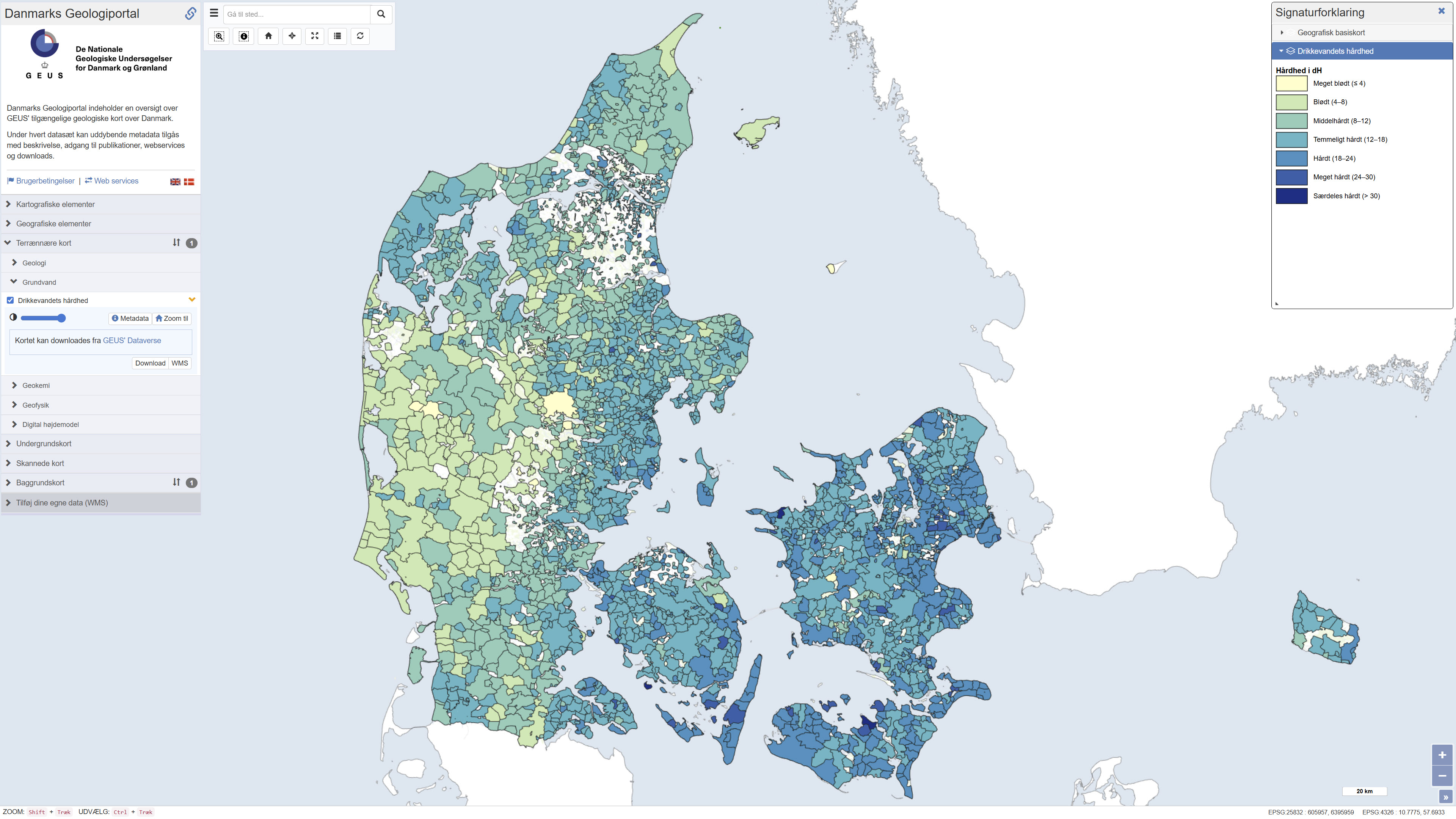
Map showing information about drinking water hardness (dH) at the level of water supply areas of public waterworks in Denmark based on quality-assured data, extracted from the national well-database Jupiter in September 2023. The hardness degree is based on the concentration of calcium and magnesium in the drinking water and has importance, for example, for the soap dosage when washing clothes: hard water requires more soap than soft water. Drinking water hardness may vary considerably from location to location and in time. Contact your water utility company to get the updated and precise figures.
-
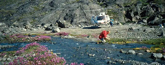
The dataset comprises geochemical analyses of 1,269 soil samples collected in Greenland from 1974 onwards as part of systematic geochemical mapping and mineral exploration programmes. Soil samples were primarily collected in areas lacking developed stream channels where stream sediment sampling was not feasible. The samples represent surface material and have been analysed for major and trace elements using various laboratory methods including X-ray Fluorescence Spectrometry (XRF), Instrumental Neutron Activation Analysis (INA), Inductively Coupled Plasma Emission Spectrometry (ICP), and Atomic Absorption Spectrometry (AAS). The dataset contains the original analytical results as received from the laboratories together with administrative information on sample location and analysed grain-size fraction. The data form part of the analytical basis for the Geochemical Atlas of West and South Greenland.
-
The dataset shows the depth to the redox interface in metres below ground level across Denmark at a spatial resolution of 100 metres. The redox interface represents the transition between oxidised and reduced sediment layers and is a key hydrogeological parameter influencing processes such as nitrate reduction and groundwater chemistry. The map is based on a statistical model developed from approximately 13.000 observations of colour changes in sediment samples and represents the best estimate of the depth to the redox interface nationwide. The dataset also includes an associated uncertainty estimate describing the variability and robustness of the model results.
-
The dataset contains geochemical analyses of 49 scree (talus) samples collected in Greenland as part of regional geochemical mapping programmes conducted by the Geological Survey of Greenland (GGU), later GEUS, between 1977 and 1997. Scree samples were collected in areas where neither stream sediment nor soil sampling was feasible. The samples represent near-surface material derived from local bedrock and were analysed for major and trace elements using laboratory methods available at the time of collection. The dataset supplements regional geochemical data from stream sediment and soil samples and forms part of the overall basis for geochemical mapping in Greenland.
-
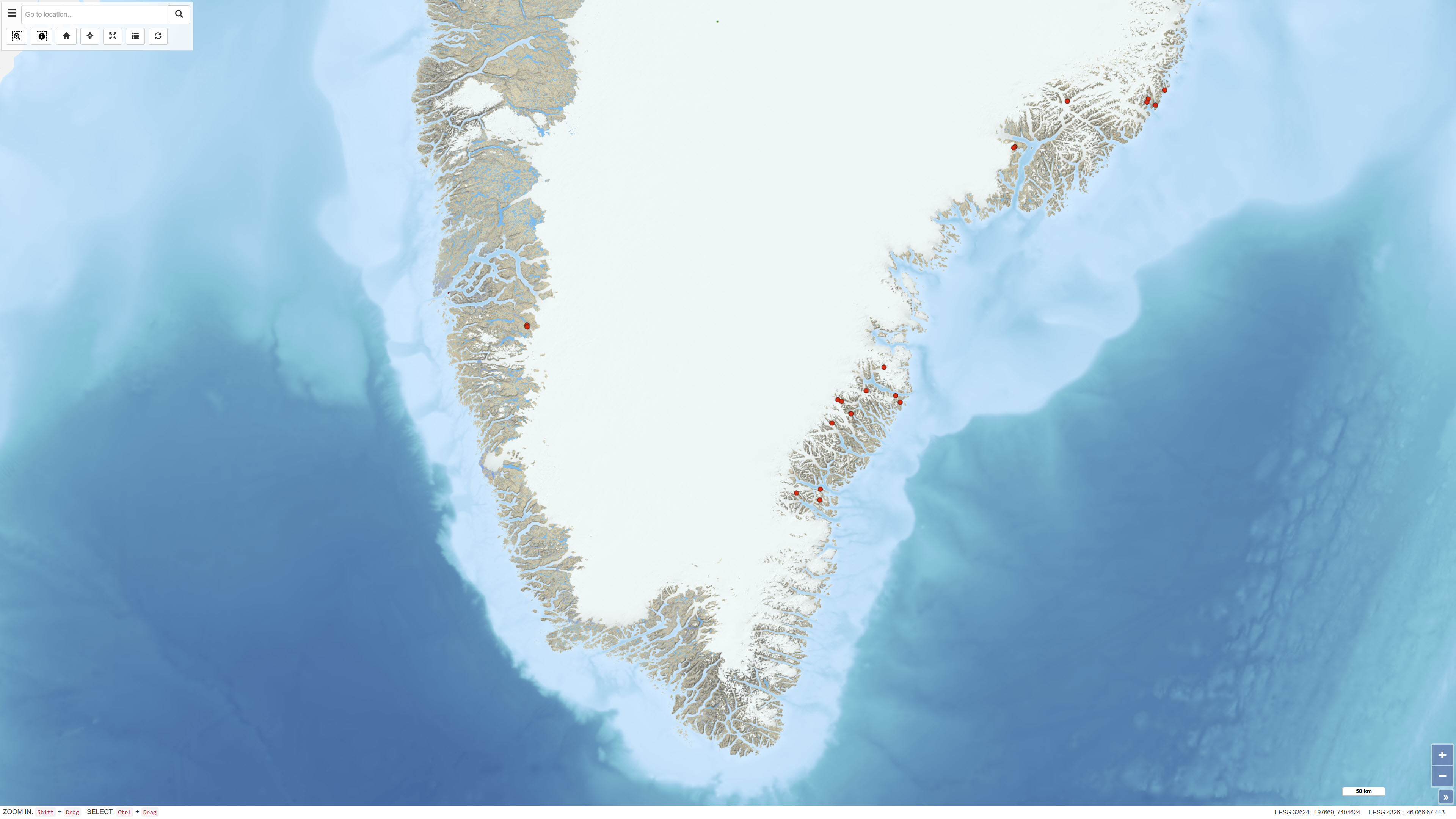
This dataset comprises regional geochemical stream sediment data from West and South Greenland and forms the basis of the Geochemical Atlas of West and South Greenland (Steenfelt, 2001). The Geochemical Atlas of West and South Greenland presents the results of a regional stream sediment geochemical mapping programme conducted between 1979 and 1998. A total of 7,122 stream sediment samples were collected from low-order streams with near-uniform spatial coverage across West and South Greenland. The <0.1 mm grain-size fraction of 500 g samples was analysed for major and trace elements using X-ray fluorescence spectrometry (XRF), instrumental neutron activation analysis (INAA), delayed neutron counting (DNC) and loss on ignition (LOI). After systematic calibration and quality control to eliminate analytical bias between different methods and time periods, a harmonised and internally consistent dataset was established containing up to 43 elements per sample. The atlas provides a regional overview of the geochemical composition of the minerogenic fraction of stream sediments and constitutes a geochemical baseline dataset for geological mapping and mineral exploration in Greenland.
-
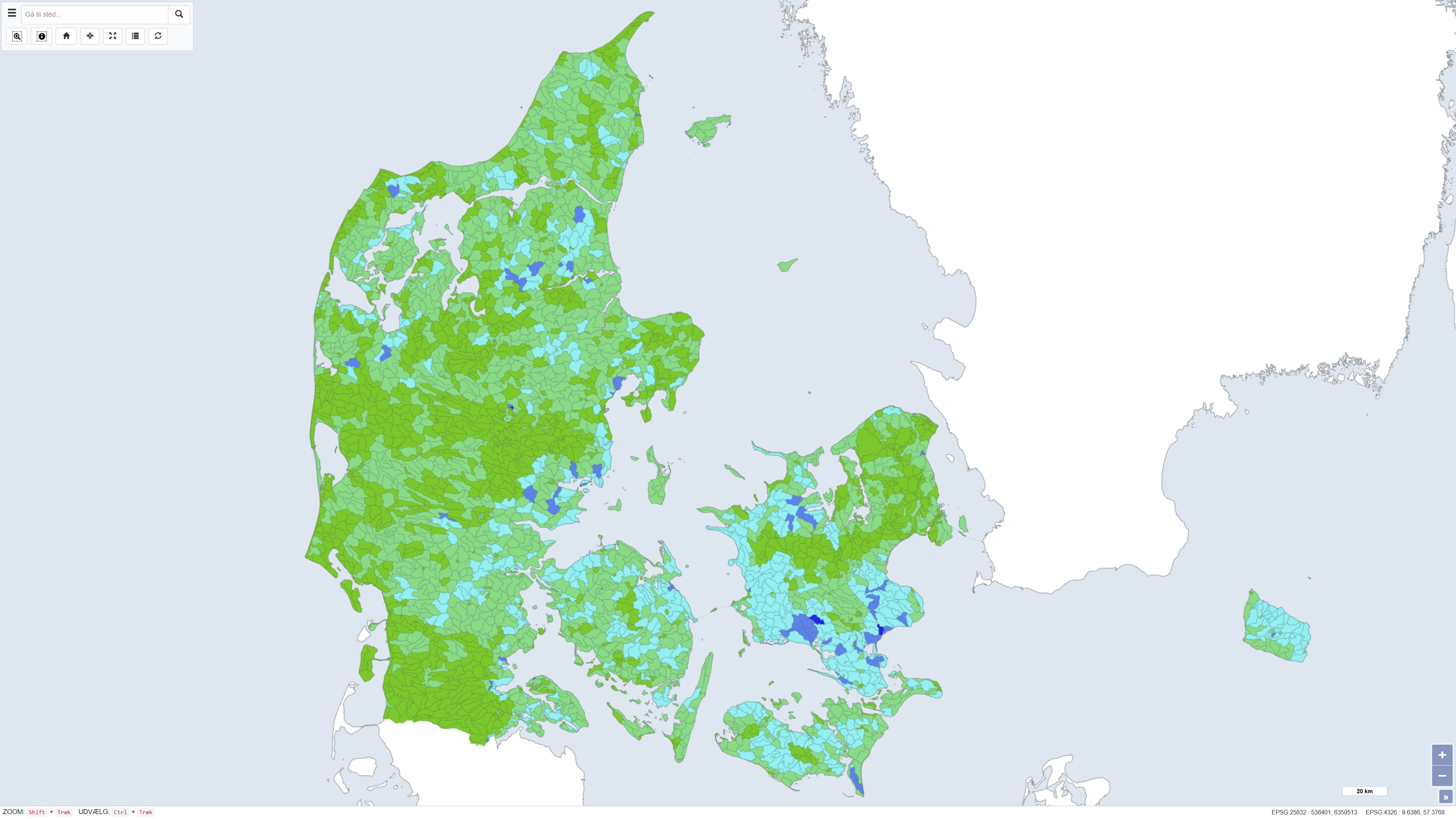
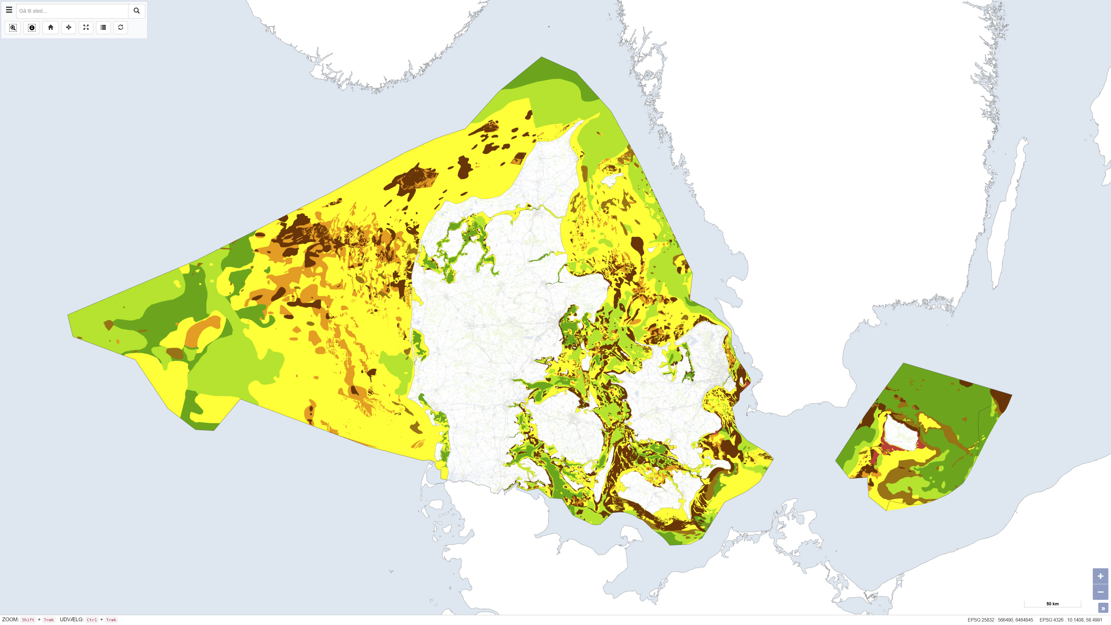
This dataset shows the percentage nitrogen retention in Denmark, i.e. the proportion of nitrogen leached from the root zone that is transformed or retained in the subsurface and surface waters before reaching the coast. Nitrogen retention is calculated using the National Nitrogen Model and represents an average retention for the period 1990–2010. The dataset provides nationwide coverage of spatial variations in nitrogen retention and is used as a basis for assessing nitrogen transport and coastal nutrient loading. The National Nitrogen Model version 2020 is documented in National Nitrogen Model – version 2020, a GEUS special report, including a method report (ISBN 978-87-7871-551-7) and an appendix (ISBN 978-87-7871-552-4), both available from GEUS (in danish).
-
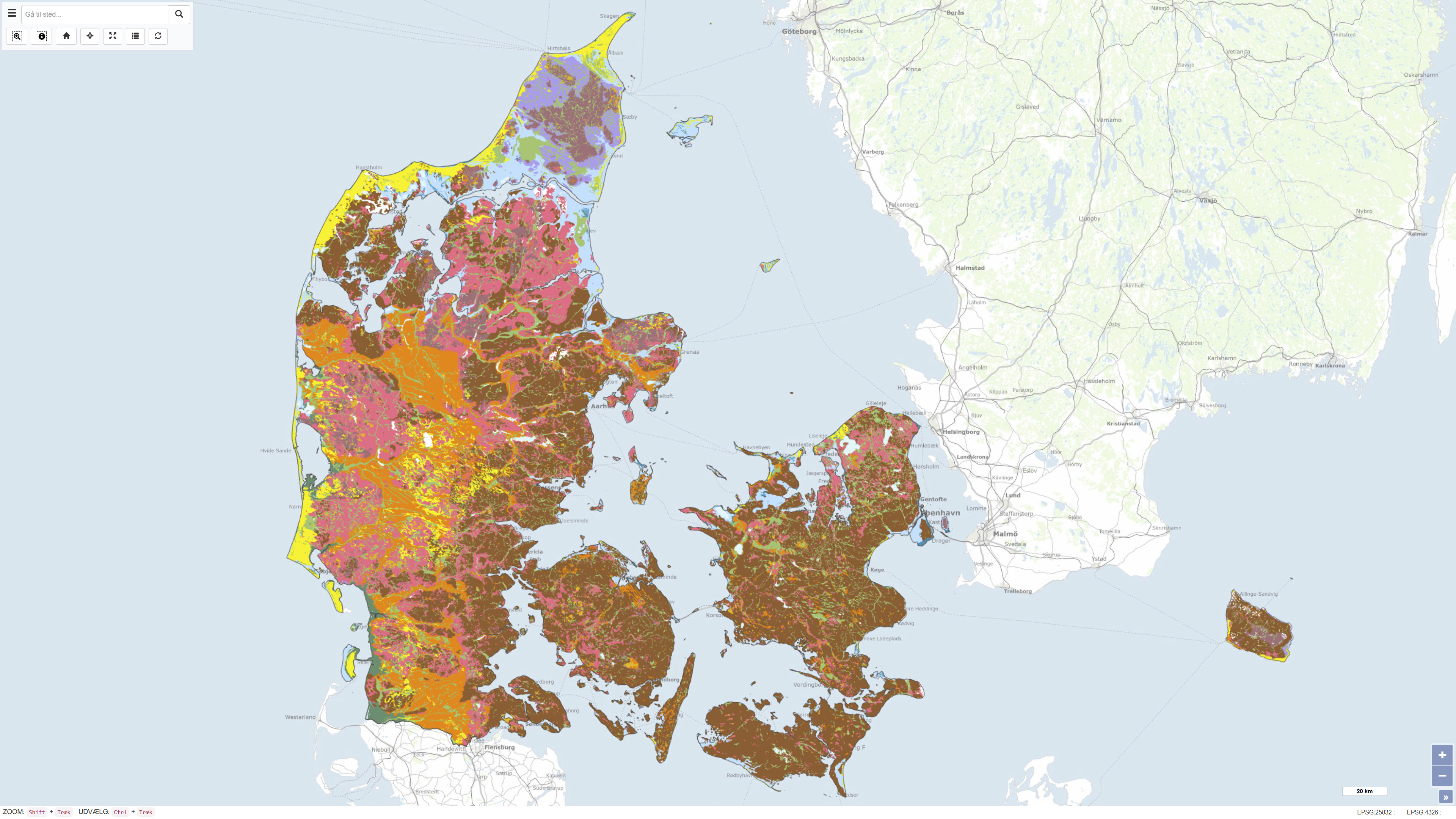
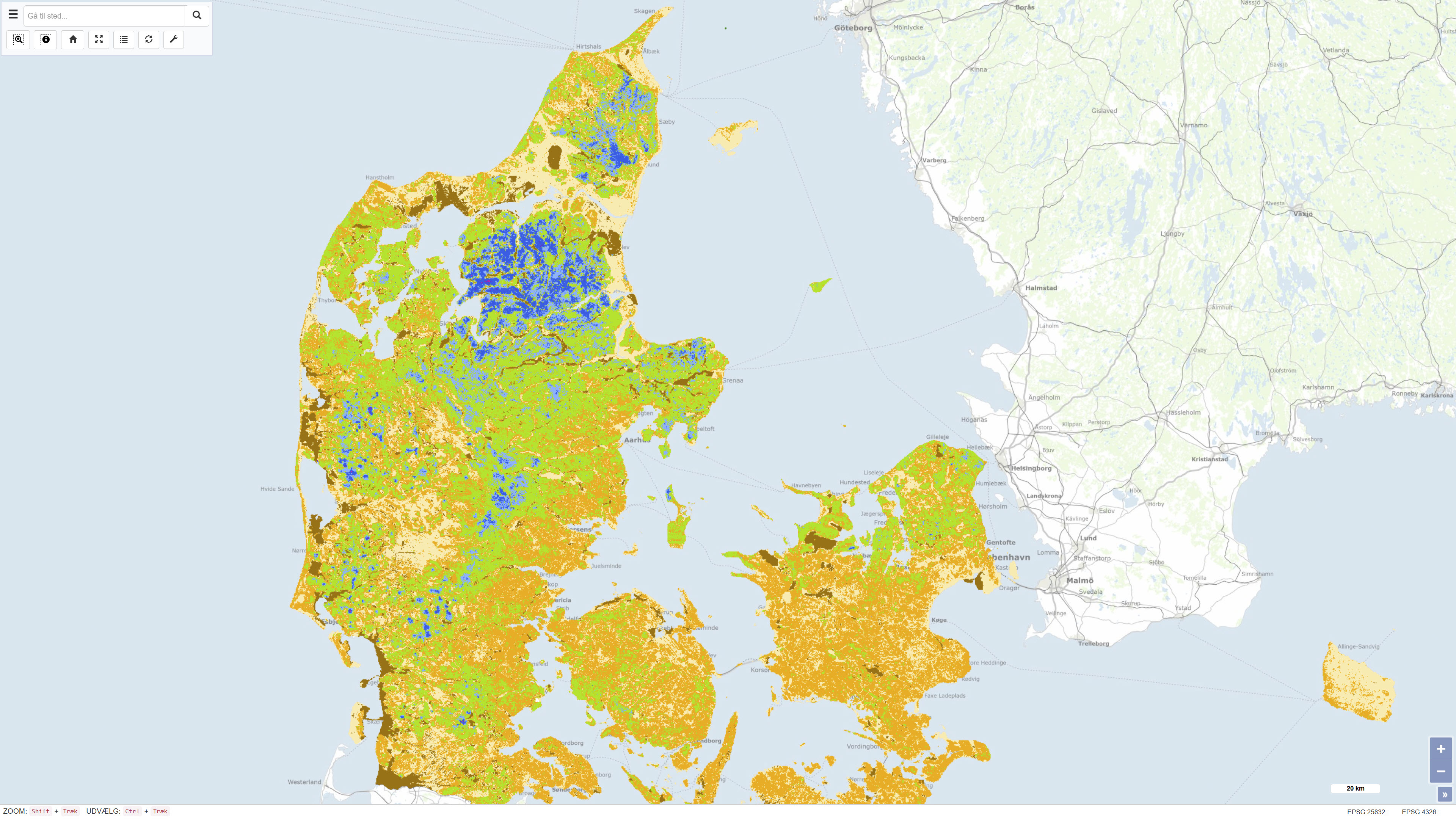
This dataset represents a nationwide digital geological map of superficial deposits in Denmark at a scale of 1:200.000. The map shows the classification and distribution of near-surface deposits, primarily glacial and post-glacial sediments. The dataset is based on the Digital Soil and Sediment Map of Denmark at 1:25.000 in areas where detailed mapping is available. In other areas, the distribution of deposits has been interpreted based on borehole data, landscape analysis and other available geological information. The deposits are classified into 12 generalised types, making the dataset a simplified and generalised version of the detailed 1:25.000 map. The dataset provides a national overview of superficial deposits and serves as a reference for regional and national applications.
-
The seabed sediment map shows the distribution of seabed sediments in Danish waters and represents an integrated interpretation of sediment types within the upper approximately 0.5 metres of the seabed. Sediment classes are defined based on grain-size composition and reflect an average of the surface sediments. Glacial till is classified as a mixed sediment, while sedimentary bedrock indicates areas where deposits several million years old are exposed on the seabed. The map was updated in 2020 and builds upon the previous version from 2014, with newly mapped areas added at full level of detail. The dataset provides a nationwide overview of seabed sedimentary conditions and is used, among other purposes, for raw material mapping, marine spatial planning, and environmental assessments.