 Arctic SDI catalogue
Stratigraphy and correlation
Type of resources
Available actions
Topics
Keywords
Contact for the resource
Provided by
Formats
Representation types
Update frequencies
status
Scale
-
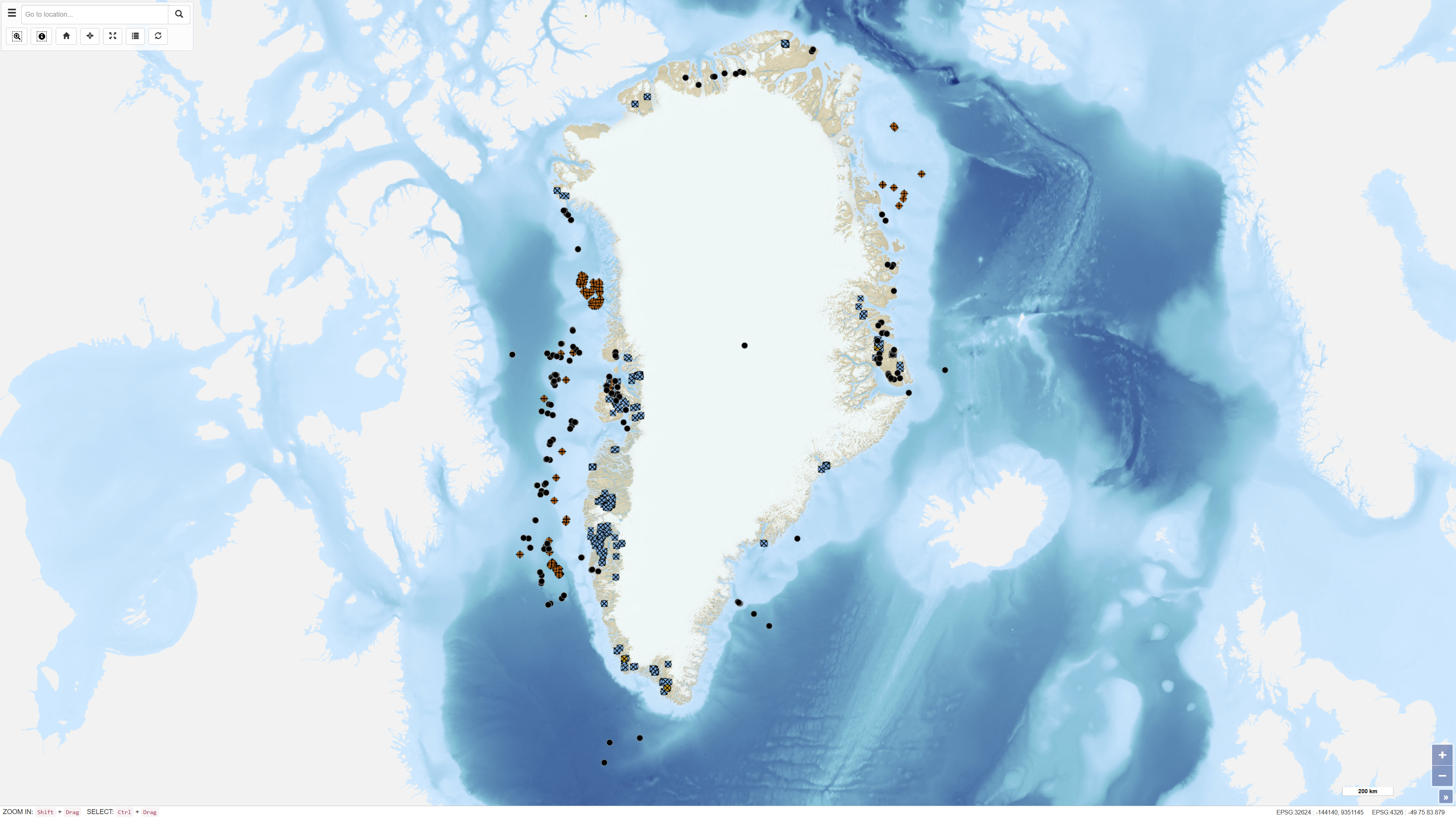
The dataset contains basic information on the location of onshore and offshore drillholes in Greenland established for scientific research as well as mineral, oil and gas exploration. The dataset functions as a geographic reference layer and, where available, includes links to reports or summary sheets representing the original source of information. The dataset covers drillholes established between 1948 and 2019 and is subject to continuous updates as new information becomes available through scientific publications, press releases and company documentation.
-
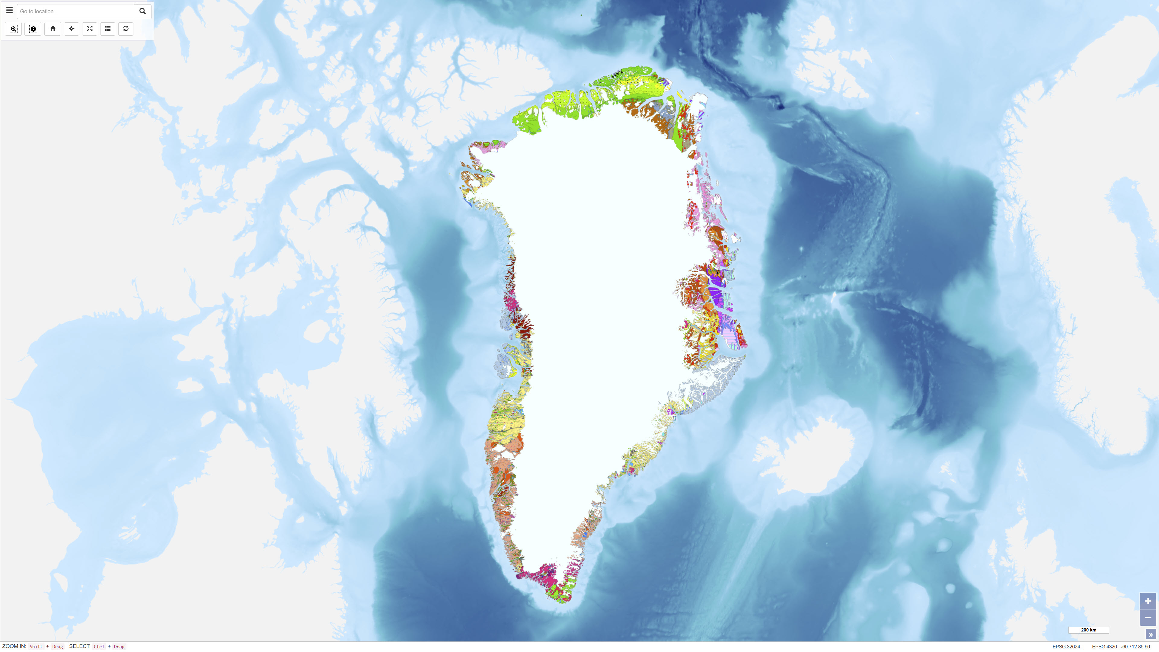
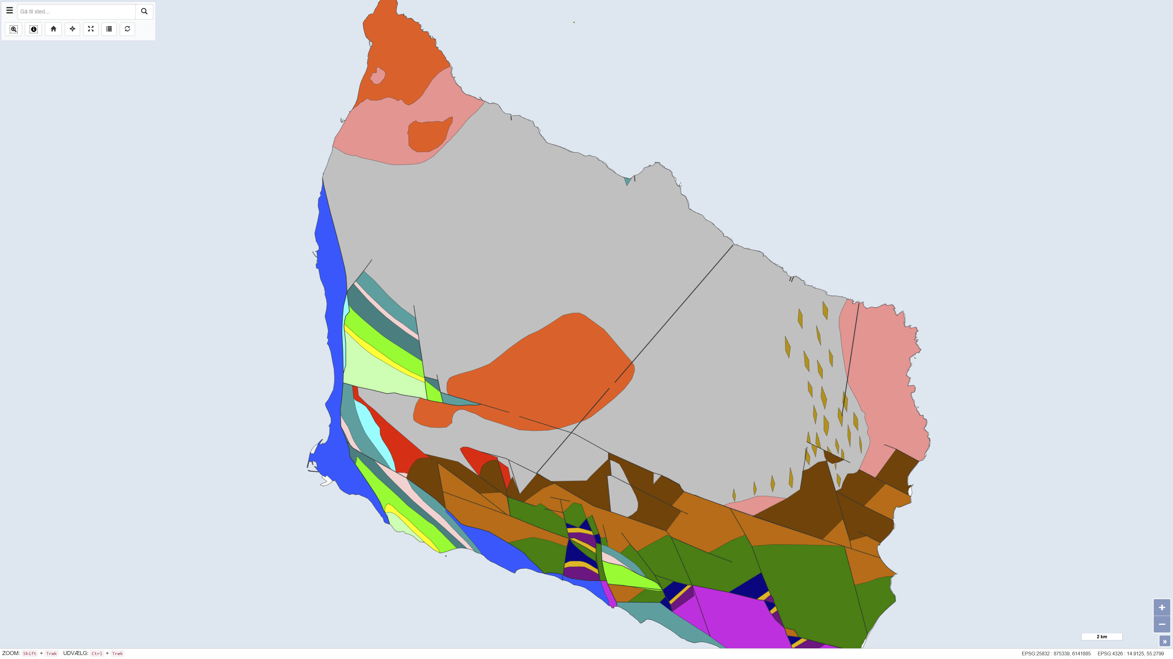
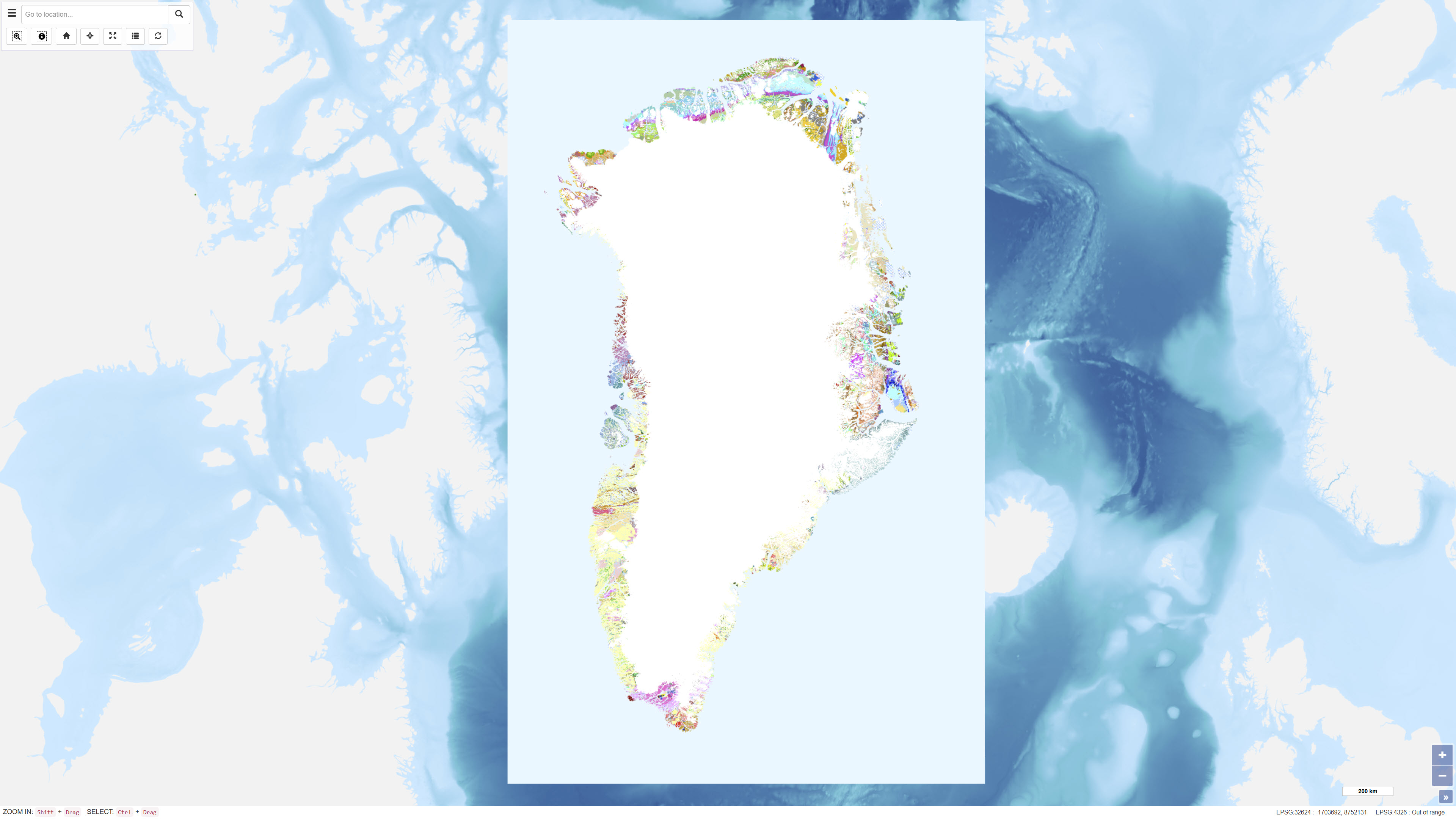
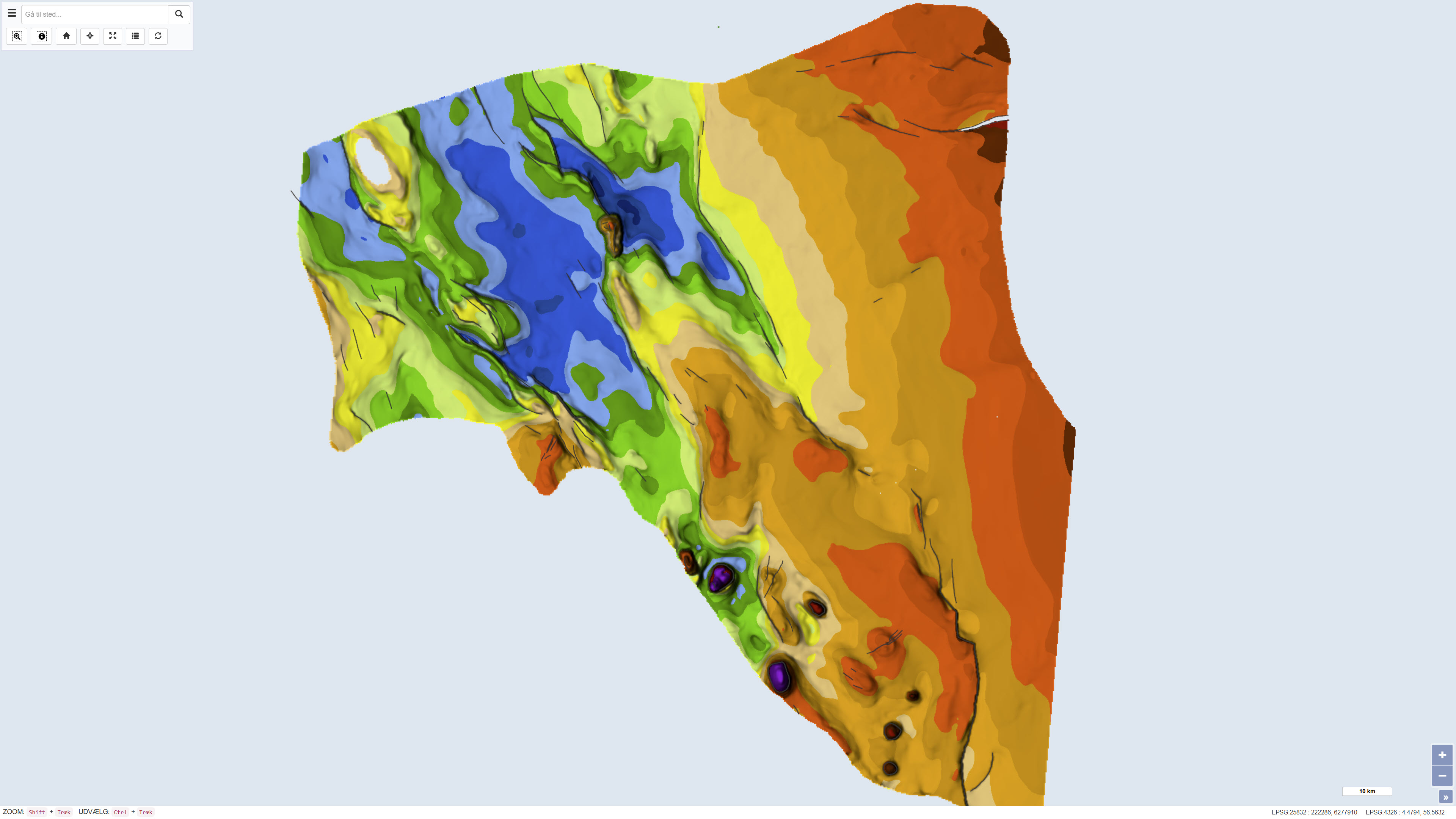
The Geological Map of Greenland at scale 1:2.500.000 provides a comprehensive regional synthesis of the geological evolution of Greenland from the earliest Archaean to the Quaternary. The map presents an integrated overview of Greenland’s geological framework, including Precambrian crystalline basement provinces, major orogenic belts, Phanerozoic sedimentary basins and widespread volcanic provinces. Greenland is characterised by large exposures of continental crust dominated by Archaean and early Proterozoic shield rocks that stabilised as part of the Laurentian shield. Younger geological elements are mainly developed along the margins of the shield, where sedimentation, deformation and magmatic activity reflect successive tectonic regimes through time. The map illustrates the distribution and relationships of these geological units and highlights the structural and stratigraphic architecture of Greenland and adjacent offshore areas. The map integrates onshore and offshore geological information and serves as a regional reference for geological interpretation, research, education and resource-related studies in Greenland.
-
The Greenland Geochronology Database is a systematic compilation of published U-Pb geochronological data from Greenland. The dataset integrates age determinations from a wide range of scientific publications and normalises isotopic ratios and uncertainties into a consistent format, with all analytical errors reported at the 1 sigma level. Ratios have been verified against reported ages and corrected where necessary to ensure internal consistency. The database is structured to enable efficient querying and cross-comparison of geochronological information derived using different analytical standards.
-
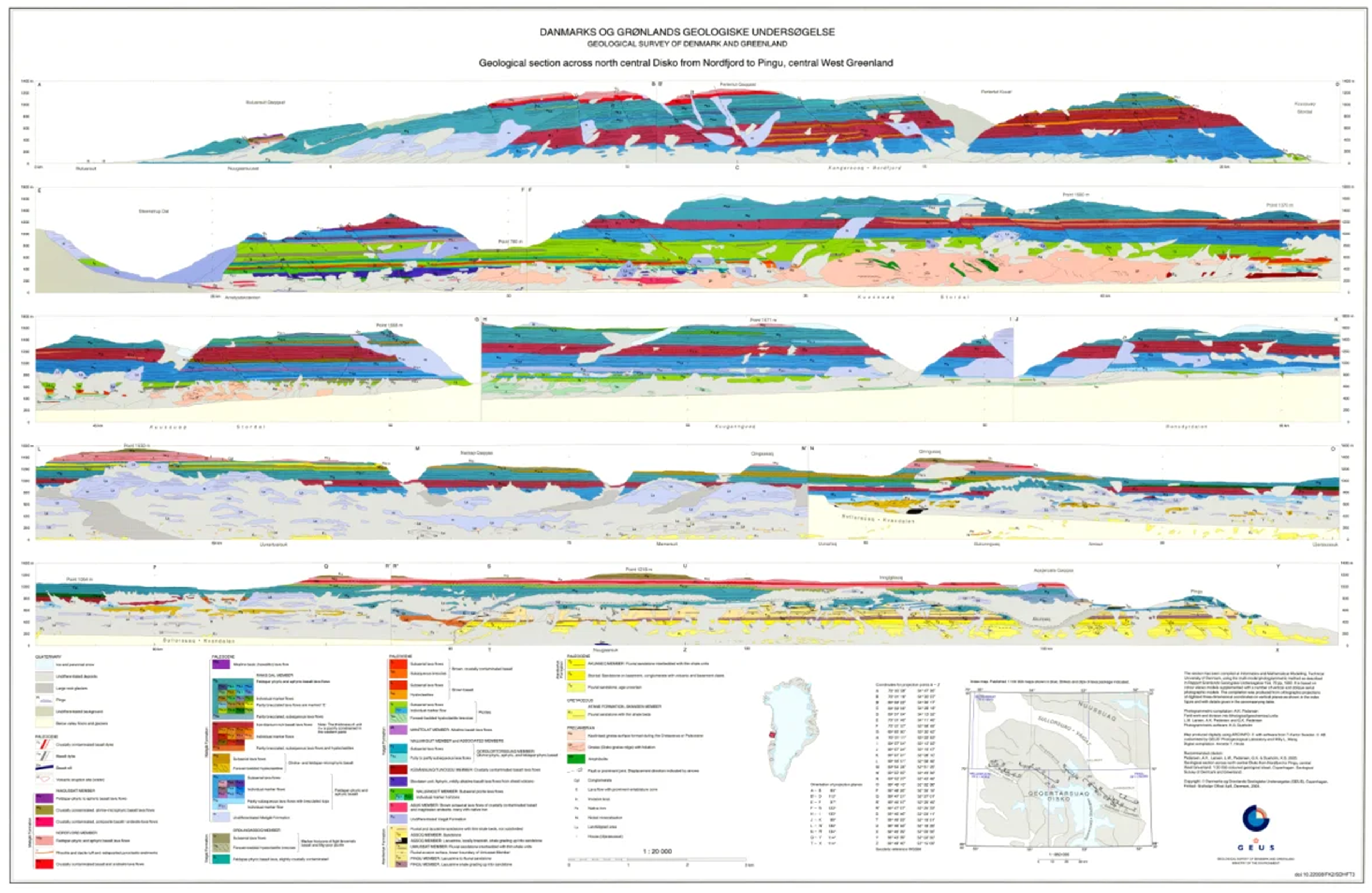
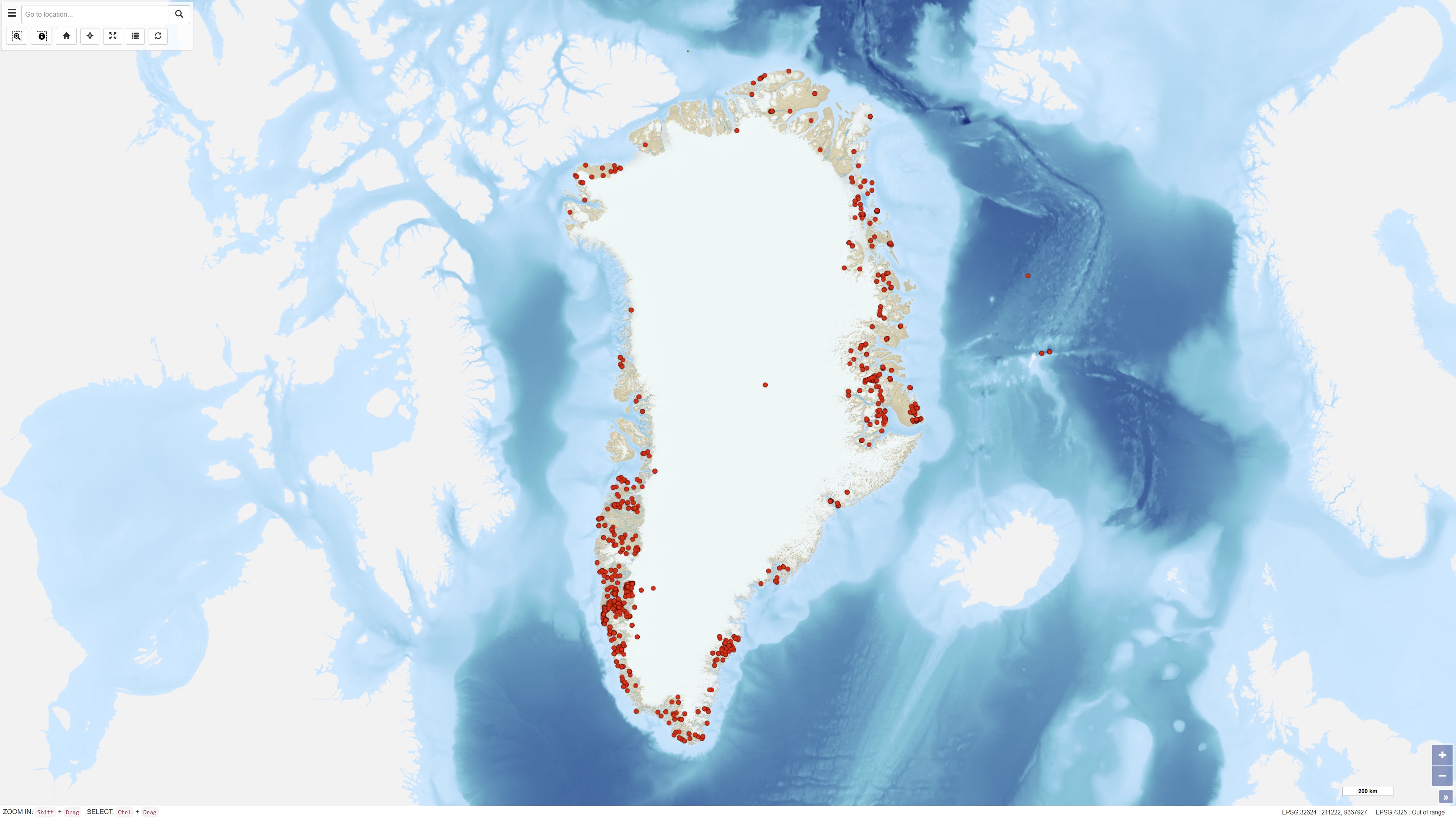
The dataset comprises a collection of geological cross sections from Greenland derived from multiple geological mapping projects and publications. The cross sections represent interpretations of subsurface geological structures and stratigraphy across selected regions and are associated with published geological maps and reports. Profile lines have been georeferenced, and the corresponding cross-section images have been digitised and stored as separate PDF files. Each profile is linked to the geological map or publication from which it originates. Due to the diverse origins of the profiles, the level of detail, scale and geological interpretation vary between individual cross sections.
-
The dataset shows the pre-Quaternary surface of Bornholm and illustrates the distribution of pre-Quaternary rock units and geological structures beneath the Quaternary deposits. The map is based on geological interpretations carried out by Helge Gry in 1960 and 1969 and was published in the journal VARV in 1977. The pre-Quaternary geology of Bornholm differs significantly from the rest of Denmark and is characterised by complex fault systems and a combination of crystalline basement and sedimentary rocks. The map represents a historical, synthesised overview of the pre-Quaternary surface and remains an important reference in geological studies.
-
The geological map of Greenland at a scale of 1:500 000 is based on 14 digitised map sheets covering the whole of Greenland, with amendments in specific areas (Pedersen et al. 2013, GEUS Bulletin, DOI: 10.34194/geusb.v28.4727). The original digital version of the map was released through the Greenland Portal in 2012. Continued advances in geological knowledge have necessitated successive revisions in order to keep the map up to date. During the most recent update, a number of geographical areas were revised based on new geological data and interpretations, including parts of West Greenland, North Greenland, North-East Greenland, East Greenland and South-East Greenland. The updated map incorporates revised stratigraphic interpretations and improved representation of geological units and structures. The map has undergone extensive quality control, including complete harmonisation of lineaments and structural elements across map-sheet boundaries. The geological legend is dynamic and reflects the content of the current map view. Geological units are supported by descriptive information, and for most map polygons links are provided to a geological unit database containing further descriptions.
-
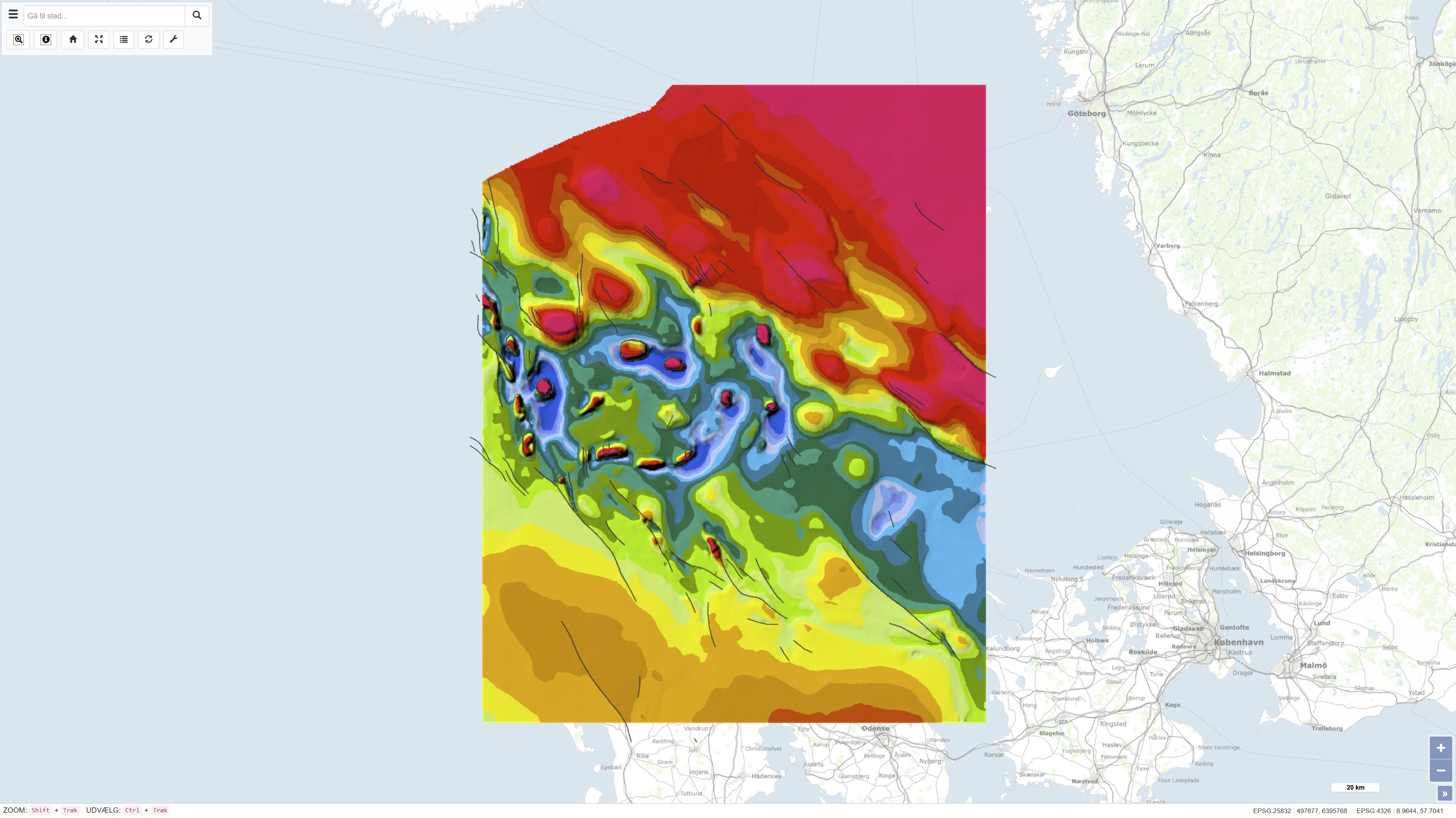
The dataset comprises a geological structural map of the Danish Basin at a scale of 1:500,000 showing the structure of the chalk surface (Top Chalk). The map was published in 1991 as part of the DGU Map Series no. 7 and is based on regional geological interpretation of borehole data and seismic data. The data basis includes deep onshore boreholes, seismic profiles from hydrocarbon exploration, and seismic surveys from the inner Danish waters. The map covers Denmark and adjacent marine areas and was produced to support regional geological understanding of the structure of the chalk surface in the Danish Basin.
-

The dataset contains geochemical sample data from four company reports submitted to the Ministry of Mineral Resources (MMR) and previously to the Geological Survey of Denmark and Greenland (GEUS). The reports were originally delivered in paper format and later scanned. The geochemical data have been digitally restored through optical character recognition of scanned documents and georeferencing of sample locations. The dataset has been uploaded to the GEUS sample database with necessary adjustments to sample names and metadata. The dataset includes samples with coordinates but without geochemical analyses, as well as samples with analyses lacking unambiguous coordinates.
-

The main geological environments in Greenland and their mineral resources have been described and divided into four main geological environments: infracrustal regions, supracrustal regions, magmatic provinces and sedimentary basin regions. Within the various geological environments, characteristic mineral deposits are outlined. Within the infracrustal environment, relatively few mineral occurrences are recorded in Greenland, but three types are described: gold in gneiss, nickel and copper in mafic intrusions, and olivine in ultramafic rocks. For more detailed information, reference is made to the report Greenland geological environments and mineral resources.
-
The dataset comprises a geological map of the Danish Central Graben at a scale of 1:200,000 presenting regional maps of ‘Base Cretaceous’ and the Cromer Knoll Group. The map was published in 1995 as part of the DGU Map Series no. 49 and was produced as part of a comprehensive geological mapping of the Danish Central Graben. The mapping is based on regional interpretation of seismic data supplemented by information from boreholes. The map covers the Danish part of the Central Graben and parts of the eastern North Sea, and adjacent areas in the Norwegian, British and German sectors are included in order to define regional structural relationships. The map sheet consists of several thematic sub-maps that together describe the structure and stratigraphy of the area.