 Arctic SDI catalogue
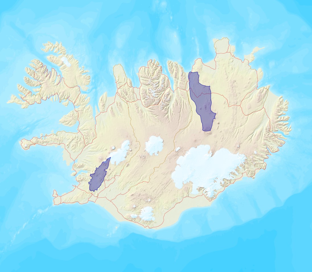
Protected sites
Type of resources
Available actions
Topics
Keywords
Contact for the resource
Provided by
Years
Formats
Update frequencies
status
Service types
Scale
Resolution
-
Service for making available INSPIRE themes
-
This services provides INSPIRE Data.
-

The service returns the dataset "Protected Sites" provided as GML according to the WFS-standard. The dataset includes area designated or managed within a framework of international, Community and Member States' legislation to achieve specific conservation objectives. According to IUCN and adopted for the INSPIRE context a protected site is: An area of land and/or sea especially dedicated to the protection and maintenance of biological diversity, and of natural and associated cultural resources, and managed through legal or other effective means.
-

The dataset includes area designated or managed within a framework of international, Community and Member States' legislation to achieve specific conservation objectives. According to IUCN and adopted for the INSPIRE context a protected site is: An area of land and/or sea especially dedicated to the protection and maintenance of biological diversity, and of natural and associated cultural resources, and managed through legal or other effective means.
-
Vinsamlega hafið samband við Umhverfisstofnun vegna nánari upplýsinga.
-

Niðurhalsþjónustur fyrir INSPIRE tilskipunina og grunngerð landupplýsinga. Vefþjónn fyrir landfræðileg gögn Umhverfisstofnunar. Vefþjónnin er byggður á opnum staðli OGC og hægt er að nálgast gögnin á vefþjóninum í gegnum ýmsar tegundir þjónusta, s.s. WFS, WMS.
-

Skoðunarþjónustur fyrir INSPIRE tilskipunina
-
Þekja ni_tillogur_a_Bhluta_allt_fl: Tillögur að svæðum á framkvæmdaáætlun (B-hluta) náttúruminjaskrár út frá verndun vistgerða, fugla, sela, jarðminja og fossa. Innan stærri verndarsvæða voru í sumum tilfellum afmörkuð smærri svæði sem draga fram forgangsvistgerðir eða fuglategundir sem eru ekki einkennandi fyrir heildarsvæðið. Mörk eru ekki alltaf nákvæmlega skilgreind. Náttúruminjaskrá skiptist í þrjá hluta sem auðkenndir eru sem A, B og C-hluti. B-hluti er framkvæmdaáætlun náttúruminjaskrár þ.e. skrá yfir þær náttúruminjar sem Alþingi hefur ákveðið að setja í forgang um friðlýsingu eða friðun á næstu fimm árum. Í lögunum er lögð áhersla á að byggja upp skipulegt net verndarsvæða til að stuðla að vernd líffræðilegrar fjölbreytni, jarðbreytileika og fjölbreytni landslags. Náttúrufræðistofnun Íslands gerir tillögur um minjar sem ástæða þykir til að setja á framkvæmdaáætlun, þ.e. B-hluta. Að loknu því vali felur ráðherra Umhverfisstofnun að meta nauðsynlegar verndarráðstafanir á svæðum sem til greina kemur að setja á framkvæmdaáætlun og kostnað við þær. Í því ferli koma fram ýmsir aðrir hagsmunir sem geta haft áhrif á endanlegt val svæða en eru sem slíkir ekki grunnþættir í vali á svæðum til að viðhalda ákjósanlegri verndarstöðu vistgerða, vistkerfa eða tegunda. Að lokum mun Umhverfis-, orku- og loftslagsráðuneytið í samráði við ráðgjafanefnd leggja fram þingsályktunartillögu um verndun svæða. Tillögurnar eru enn í úrvinnslu hjá Umhverfisstofnun og umhverfis-, orku- og loftslagsráðherra (staða 23. febrúar 2022). Afmörkun svæða í tillögum Náttúrufræðistofnunar er ekki alltaf nákvæmlega skilgreind og getur tekið breytingum við áframhaldandi undirbúning framkvæmdaáætlunar.
-
This service provides INSPIRE Data.
-

For the background of data production and data interpretation we refer to the PAME report “Modelling Arctic oceanographic connectivity to further develop PAME’s MPA toolbox”. The uploaded data consist of two main types: 1. Connectivity matrices describing the seascape connectivity in the model domain consisting of 40893 model grid cells. The connectivity matrices describe the probability of dispersal between any two selected model grid cells. 2. GIS shape files of dispersal distance (km) from each model grid cell within the model domain.