 Arctic SDI catalogue
Tectonics and structural geology
Type of resources
Available actions
Topics
Keywords
Contact for the resource
Provided by
Formats
Representation types
Update frequencies
status
Scale
-
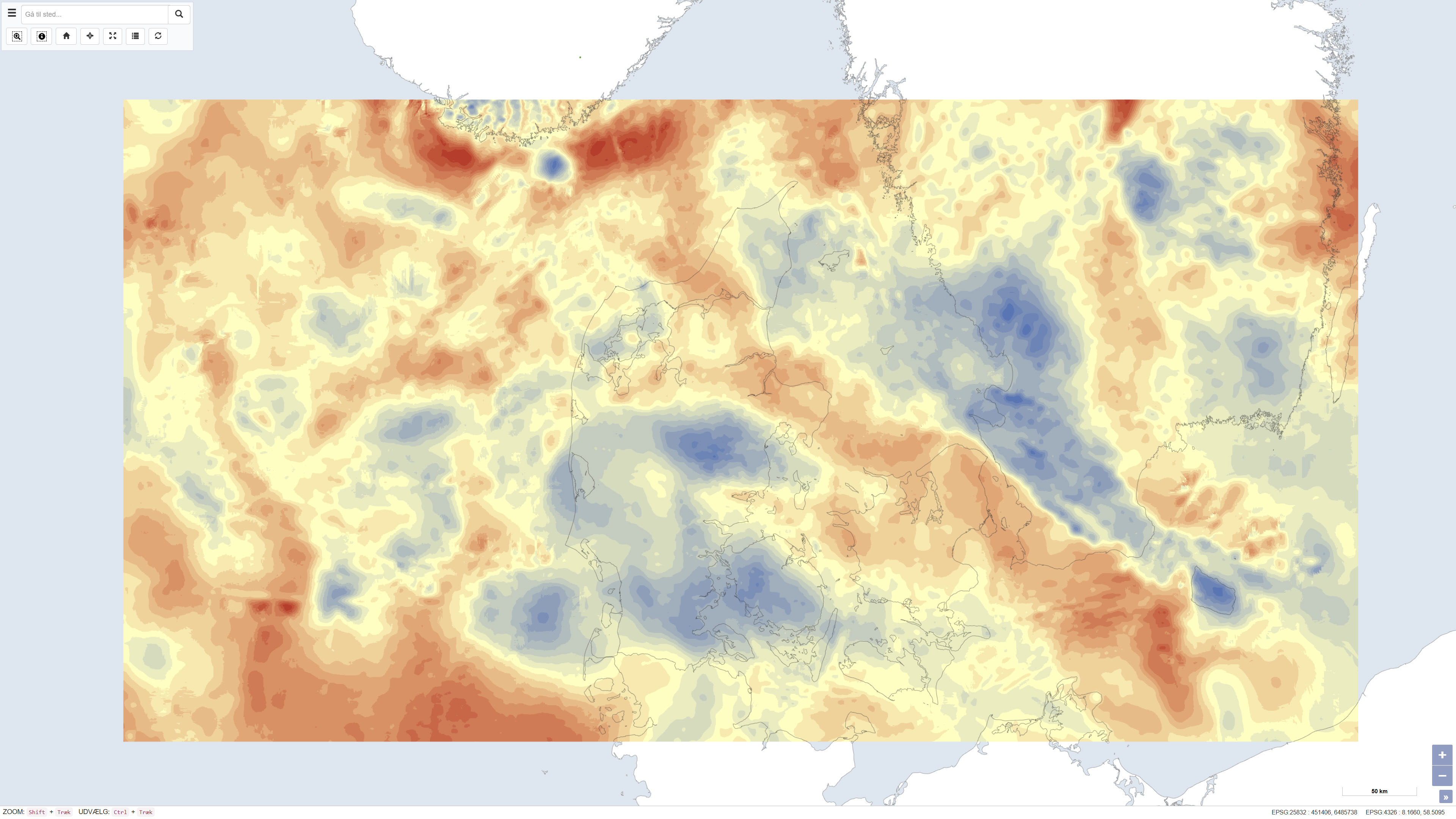
The dataset presents Bouguer gravity anomalies on land and free-air gravity anomalies in Danish marine areas based on gravity measurements from the national gravity database. The Bouguer anomaly is terrain corrected and is used to investigate variations in subsurface mass distribution, while the free-air anomaly at sea reflects variations in the gravity field without full terrain correction. Gravity anomalies are expressed in milligals (mGal). The dataset was produced by DTU Space and represents a consolidated gravimetric foundation for geological and geophysical analyses in Denmark.
-
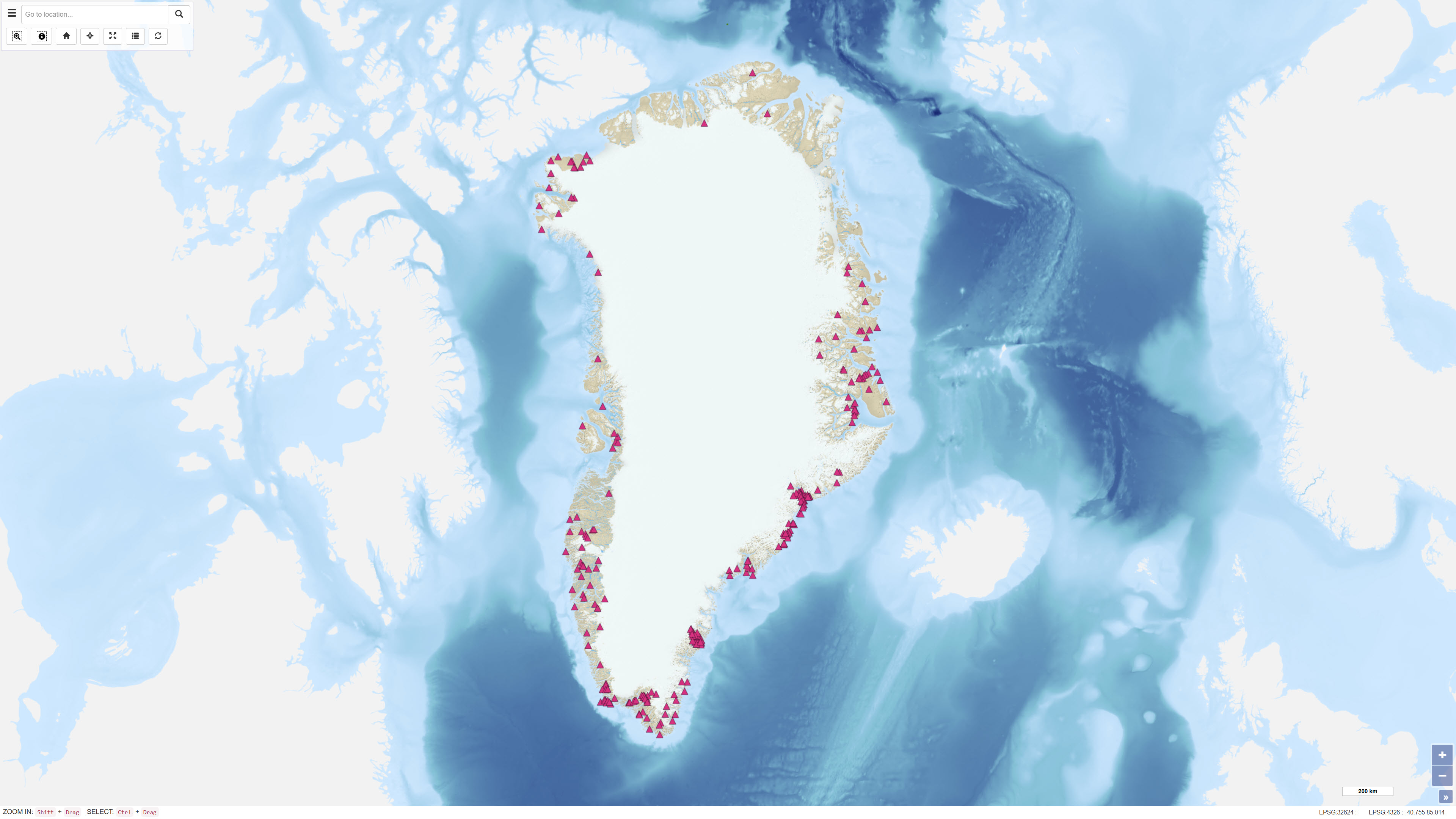
This dataset describes the intrusions and magmatic complexes of Greenland, forming a dedicated information layer within the GEUS GMOMDB2 database, displayed via the Greenland Mineral Occurrence Map (GMOM2). It includes 194 registered intrusions and complexes grouped into 23 magmatic provinces. The data are compiled from GEUS geological maps, published sources, and company reports. The Palaeogene intrusions and complexes of East Greenland (66–75°N) are related to the opening of the North Atlantic and the influence of the ancestral Icelandic mantle plume. The magmatic evolution includes flood basalts, dyke swarms, and intrusive activity from 61 to 13 Ma. Economic mineralisation is documented in several complexes, including the Skaergaard palladium deposit and the Malmbjerg porphyry molybdenum deposit, representing classic examples of rift- and post-rift-related mineral systems. The dataset provides harmonised, quality-controlled geological information to support exploration and research activities in Greenland.
-
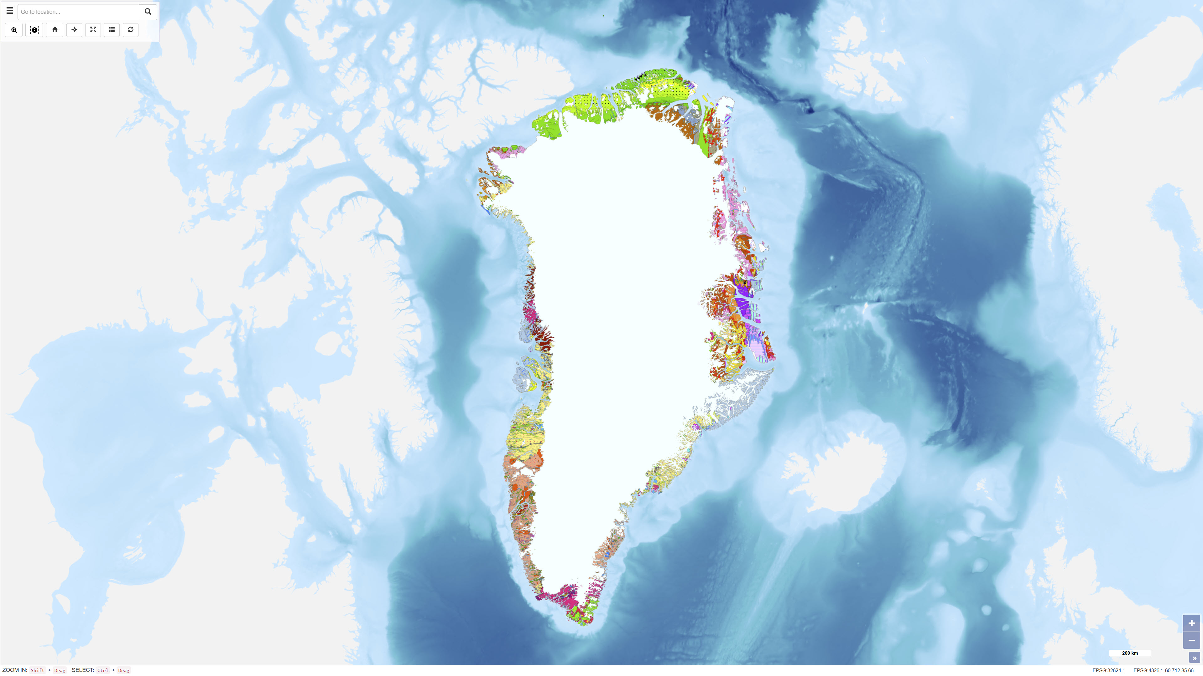
The Geological Map of Greenland at scale 1:2.500.000 provides a comprehensive regional synthesis of the geological evolution of Greenland from the earliest Archaean to the Quaternary. The map presents an integrated overview of Greenland’s geological framework, including Precambrian crystalline basement provinces, major orogenic belts, Phanerozoic sedimentary basins and widespread volcanic provinces. Greenland is characterised by large exposures of continental crust dominated by Archaean and early Proterozoic shield rocks that stabilised as part of the Laurentian shield. Younger geological elements are mainly developed along the margins of the shield, where sedimentation, deformation and magmatic activity reflect successive tectonic regimes through time. The map illustrates the distribution and relationships of these geological units and highlights the structural and stratigraphic architecture of Greenland and adjacent offshore areas. The map integrates onshore and offshore geological information and serves as a regional reference for geological interpretation, research, education and resource-related studies in Greenland.
-
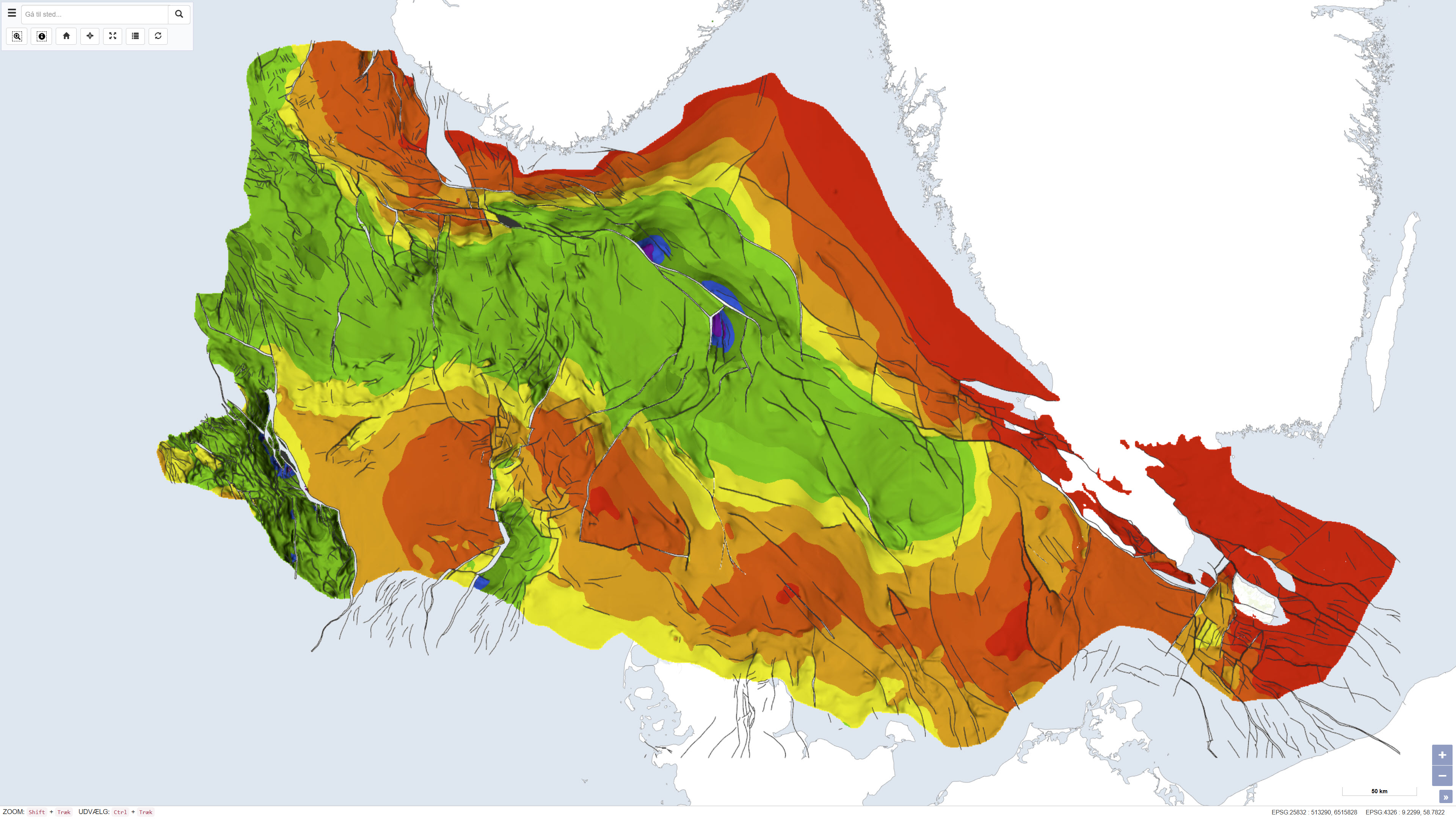
This dataset depicts the depth to the top of the pre-Zechstein succession in the Danish subsurface. The map represents the structural surface beneath the Zechstein evaporites and provides a regional overview of the geological framework of the subsurface. The dataset is based on interpretation of seismic data, deep boreholes and previous geological mapping and was produced as part of the Geological Survey of Denmark map series no. 45. The map is used as a reference for regional structural geology and subsurface modelling.
-
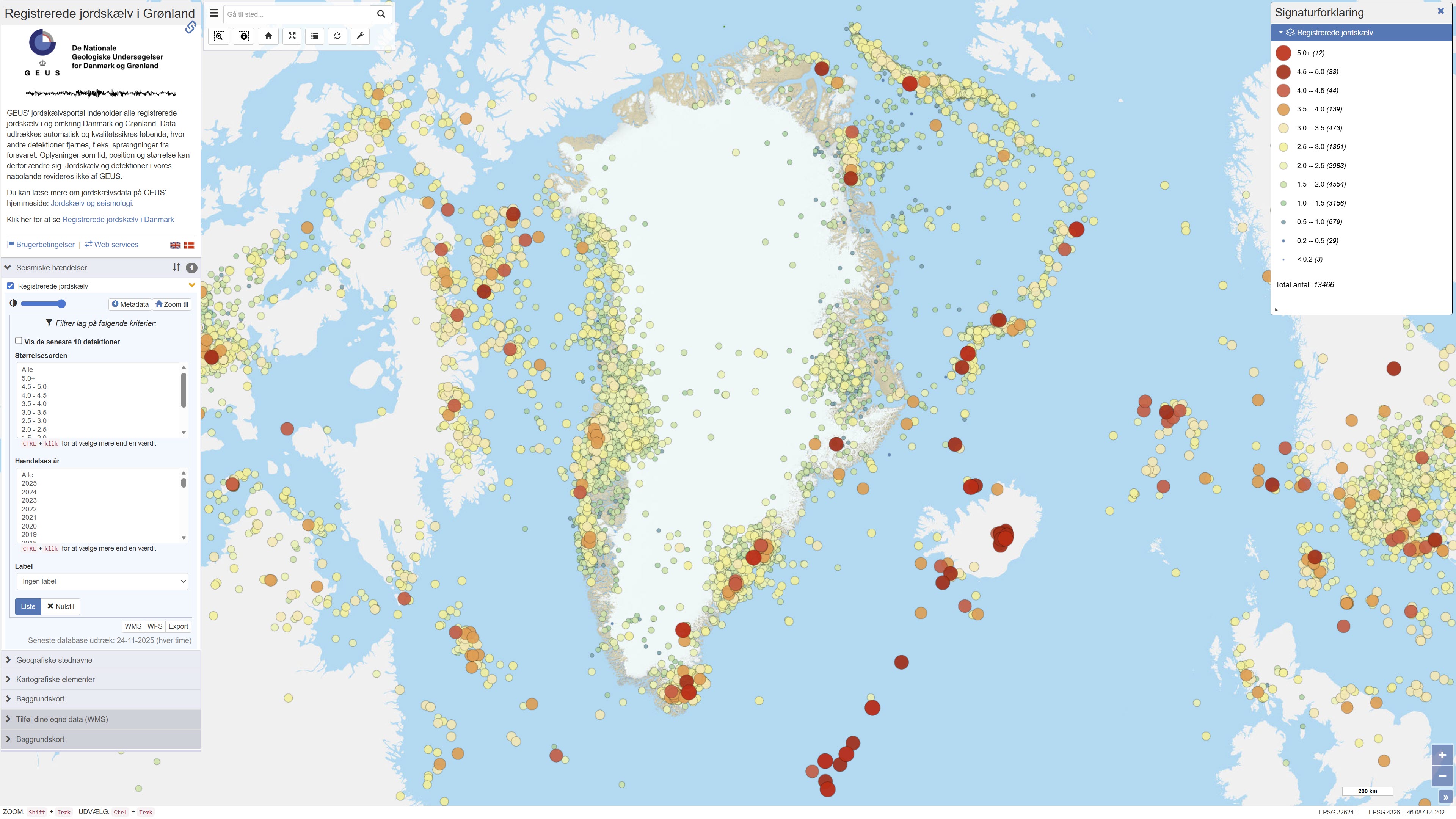
The dataset contains recorded earthquakes and seismic events in Greenland. The data include information on event time, geographic location (epicentre), depth and magnitude for confirmed and suspected earthquakes. The dataset is based on observations from GEUS’ seismic monitoring network and is used for monitoring, research and dissemination of seismic activity in Greenland.
-
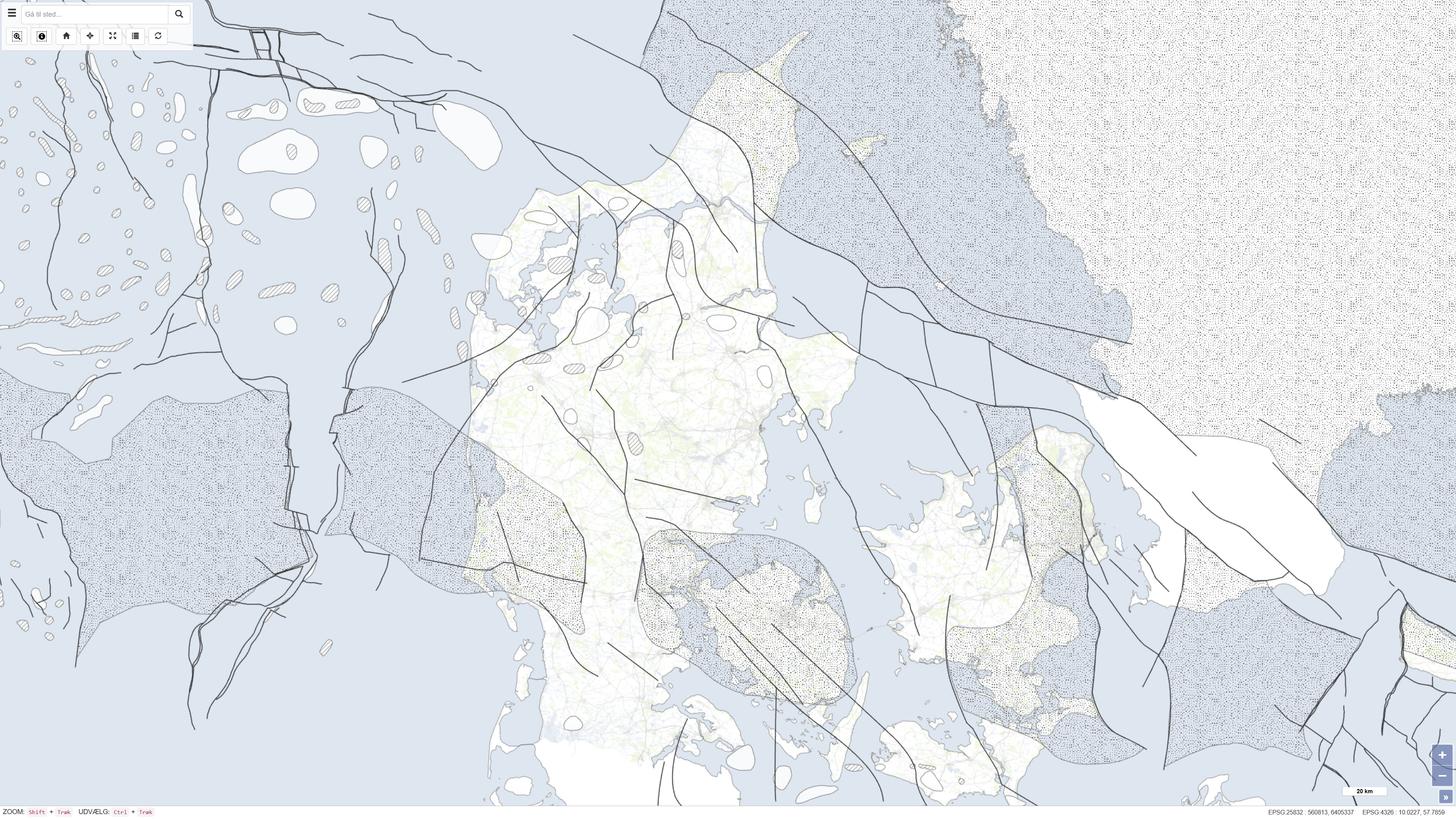
This dataset is based on the Geological Survey of Denmark map series no. 45 and represents a compiled geological map product produced in the early 1990s. The map is based on existing geological maps, seismic surveys, and previous interpretations, providing a regional overview of the geological conditions within the mapped area. The dataset forms part of the national mapping activities of the Geological Survey of Denmark and was published in 1994.
-
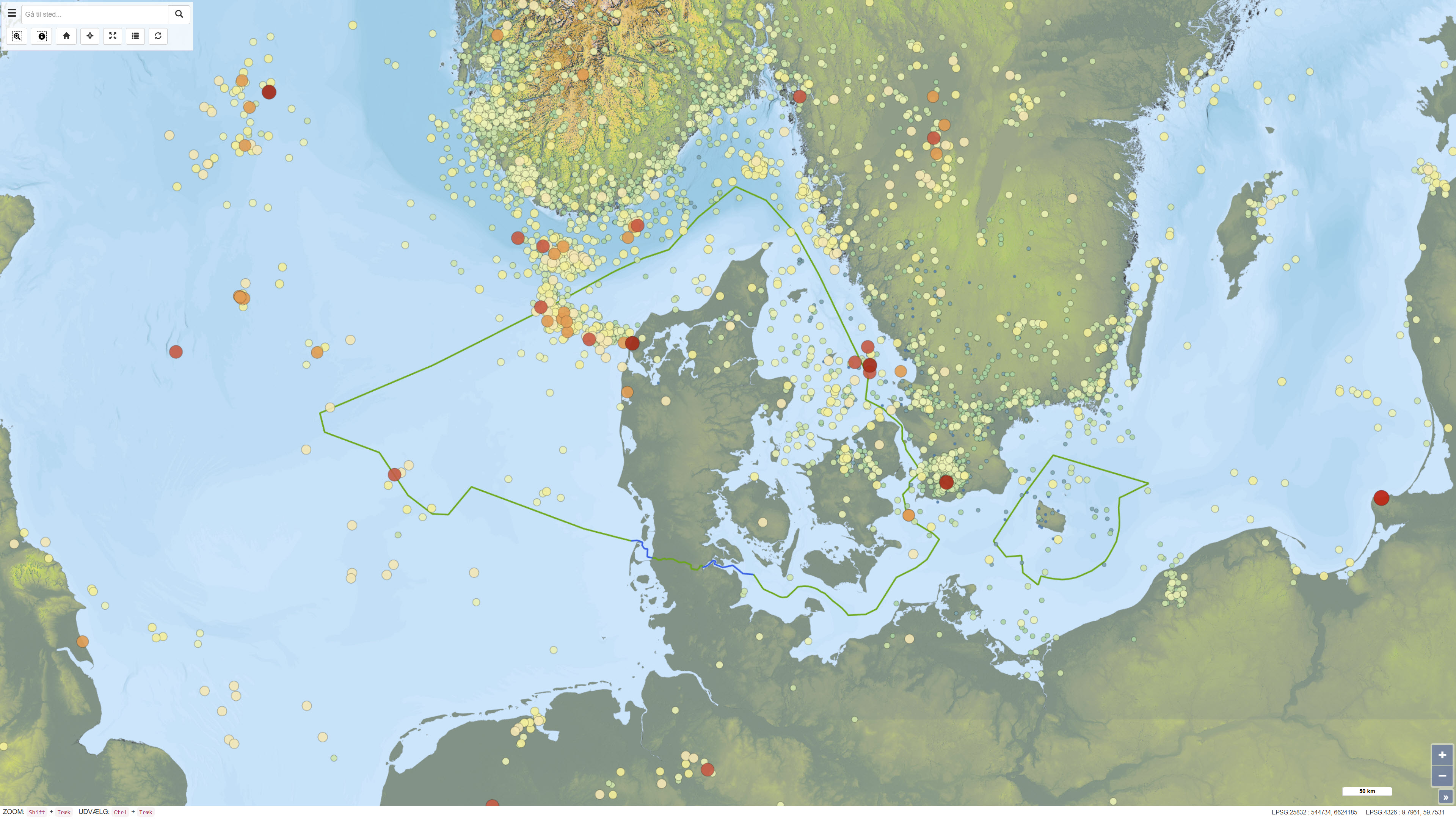
This dataset provides a national overview of all registered earthquakes in Denmark, including time, location, depth and magnitude. The recordings are based on data from GEUS’ national seismic network and comprise both measured earthquakes and subsequently quality-assured observations. The dataset is continuously updated and reflects the best scientific assessment of seismic activity in Denmark, where improved instrumentation and analysis today allow detection of much weaker tremors than historically.
-
%20-%20datas%C3%A6t.jpg)
The development of the new magnetic compilation for Greenland (GREENMAG) was initiated in 2021 by the Satellite and Aerogeophysics group at Christian-Albrechts-University (CAU) in Kiel, Germany, in collaboration with GEUS as part of the ESA project GOCE+Greenland. The presented magnetic anomaly map covers all of Greenland, including the Inland Ice and adjacent shelf areas. The map is based on all available modern regional aeromagnetic surveys from Greenland and also includes satellite-based magnetic data where airborne data are not available. The purpose of the compilation is to provide a consistent regional magnetic anomaly map for use in geological interpretation and geoscientific analyses.
-
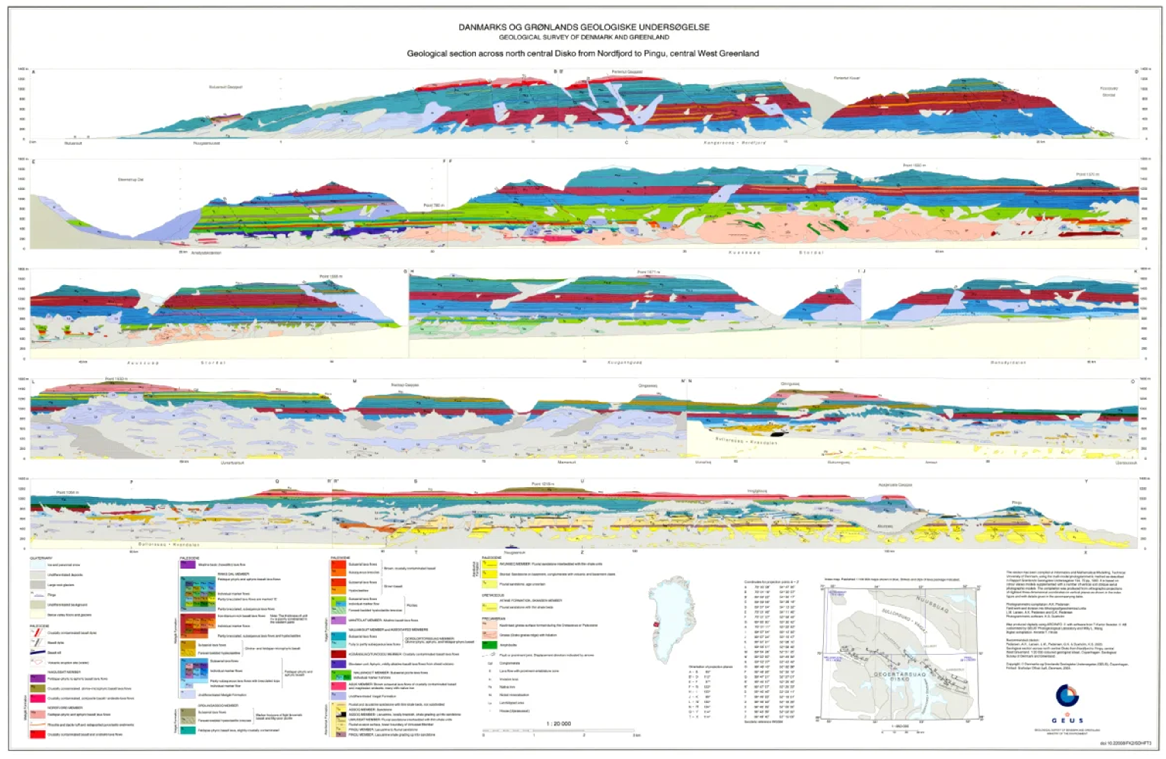
The dataset comprises a collection of geological cross sections from Greenland derived from multiple geological mapping projects and publications. The cross sections represent interpretations of subsurface geological structures and stratigraphy across selected regions and are associated with published geological maps and reports. Profile lines have been georeferenced, and the corresponding cross-section images have been digitised and stored as separate PDF files. Each profile is linked to the geological map or publication from which it originates. Due to the diverse origins of the profiles, the level of detail, scale and geological interpretation vary between individual cross sections.
-
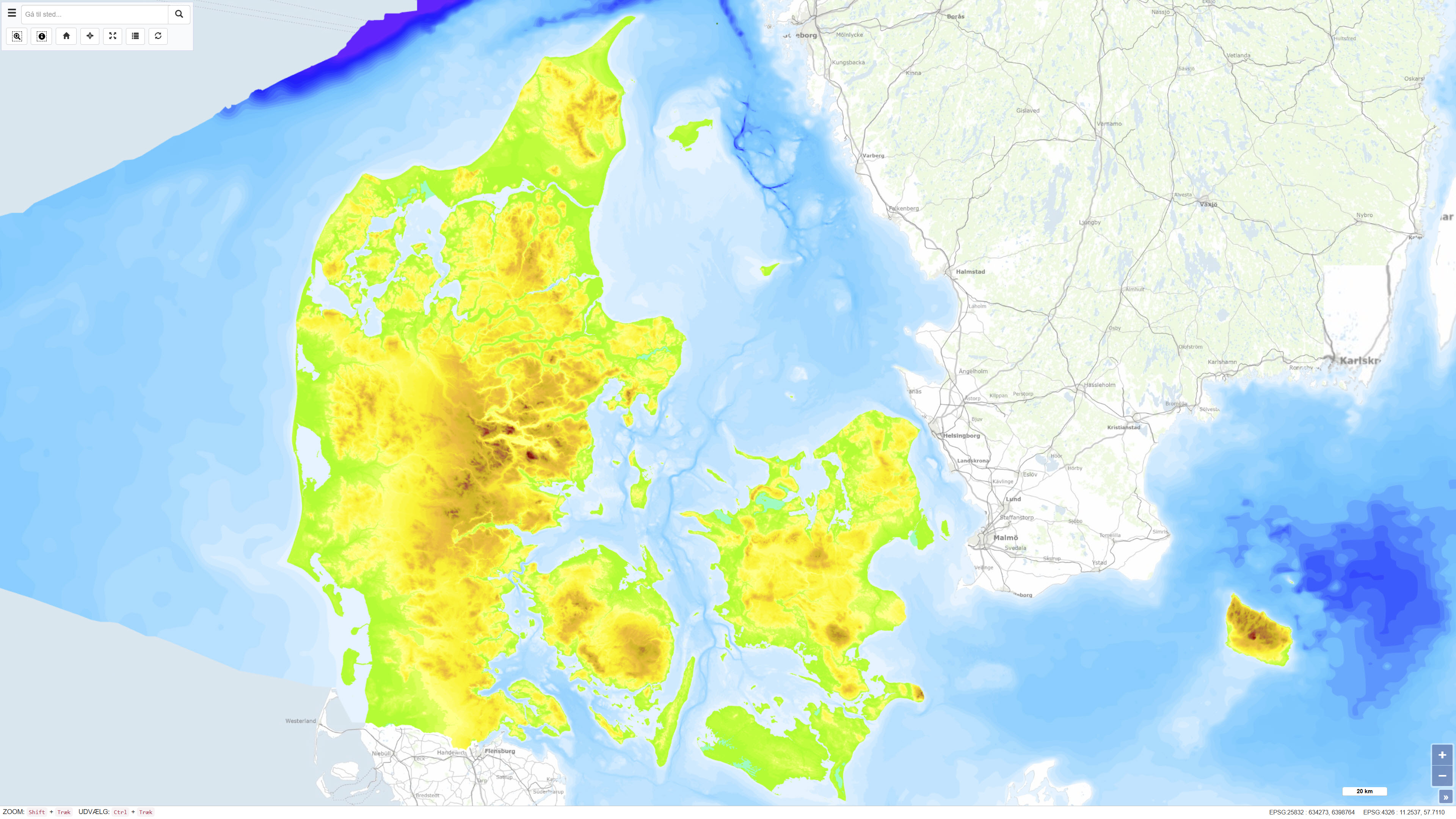
The Height and Depth Map of Denmark is a coherent map showing both land elevation above sea level and sea depth within the Danish area. The map is based on elevation and bathymetric data represented by 5-metre contour intervals closed to polygons and provides continuous coverage across the land–sea boundary. The dataset offers an integrated overview of terrain and bathymetry in Denmark and surrounding waters. The terrestrial elevation component is derived from topographic data suitable for use at scales down to approximately 1:25.000, while the bathymetric component is compiled from datasets of varying origin and resolution. The map was originally assembled around 1997, with subsequent updates to the Danish land areas carried out during 2005–2006. The dataset is primarily intended for regional visualisation and analysis.