 Arctic SDI catalogue
Remote sensing
Type of resources
Available actions
Topics
Keywords
Contact for the resource
Provided by
Years
Formats
Representation types
Update frequencies
status
Service types
Scale
Resolution
-
In the "Weekly Best-Quality Maximum-NDVI anomalies" dataset series, each pixel value corresponds to the difference (anomaly) between the mean n-year "Best-Quality" Max-NDVI of the week specified (e.g. Week 18, 2000-2014) and the "Best-Quality" Max-NDVI of the same week in a specific year (e.g. Week 18, 2014). Max-NDVI anomalies < 0 indicate where weekly Max-NDVI is lower than normal. Anomalies > 0 indicate where weekly Max-NDVI is higher than normal. Anomalies close to 0 indicate where weekly Max-NDVI is similar to normal. For more information, visit: http://open.canada.ca/data/en/dataset/ea6b4be2-9826-47f3-a387-33ddf02592f4
-

The AAFC Infrastructure Flood Mapping in Saskatchewan 20 centimeter colour orthophotos is a collection of georeferenced color digital orthophotos with 20 cm pixel size. The imagery was delivered in GeoTIF and ECW formats. The TIF and ECW mosaics were delivered in the same 1 km x 1 km tiles as the LiDAR data, and complete mosaics for each area in MrSID format were also provided. The digital photos were orthorectified using the ground model created from the DTM Key Points. With orthorectification, only features on the surface of the ground are correctly positioned in the orthophotos. Objects above the surface of the ground, such as building rooftops and trees, may contain horizontal displacement due to image parallax experienced when the photos were captured. This is sometimes apparent along the cut lines between photos. For positioning of above-ground structures it is recommended to use the LiDAR point clouds for accurate horizontal placement.
-

The maps show a multiyear ground deformation rate caused by small-scale deformation processes in Canada, measured in meters per year. Horizontal-east and vertical deformation components were computed from data acquired on ascending and descending orbits. This horizontal-east/vertical 2D decomposition is approximate and assumes constant viewing geometry and the absence of horizontal-north deformation. In the line-of-sight (LOS) map computed from ascending orbit data, a negative signal approximately corresponds to either subsidence or eastward motion, while a positive signal corresponds to uplift or westward motion. In the LOS map computed from descending orbit data, a negative signal approximately corresponds to either subsidence or westward motion, while a positive signal corresponds to uplift or eastward motion. In the horizontal-east map, a negative signal corresponds to westward motion, while a positive signal corresponds to eastward motion. In the vertical map, a negative signal indicates subsidence, while a positive signal indicates uplift. The maps were calculated from Sentinel-1 Synthetic Aperture Radar data collected between 2017 and 2024 during the snow-free season. Interferometric analysis of Sentinel-1 data was performed using GAMMA Software (https://www.gamma-rs.ch), and the long-term deformation rate was computed with the Multidimensional Small Baseline Subset (MSBAS) Software Version 10 (https://doi.org/10.1080/07038992.2024.2424753) at the Canada Centre for Mapping and Earth Observation, Natural Resources Canada. Long-wavelength signals caused by postglacial rebound and tectonic motion were filtered to enhance the visibility of small-scale deformation processes, such as those originating from landslides and mining. Field studies have confirmed only a few of these processes to date. The maps are expected to contain processing artifacts, which will be addressed in future work. References: Samsonov, S. V., & Feng, W. (2023). Deformation Retrievals for North America and Eurasia from Sentinel-1 DInSAR: Big Data Approach, Processing Methodology and Challenges. Canadian Journal of Remote Sensing, 49(1). https://doi.org/10.1080/07038992.2023.2247095 Samsonov, S. V. (2024). Multidimensional Small Baseline Subset (MSBAS) Software for Constrained and Unconstrained Deformation Analysis of Partially Coherent DInSAR and Speckle Offset Data. Canadian Journal of Remote Sensing, 50(1). https://doi.org/10.1080/07038992.2024.2424753 Limitation of Liability : The information contained on this website is provided on an “as is” basis and Natural Resources Canada makes no representations or warranties respecting the information, either expressed or implied, arising by law or otherwise, including but not limited to, effectiveness, completeness, accuracy or fitness for a particular purpose. Natural Resources Canada does not assume any liability in respect of any damage or loss based on the use of this website. In no event shall Natural Resources Canada be liable in any way for any direct, indirect, special, incidental, consequential, or other damages based on any use of this website or any other website to which this site is linked, including, without limitation, any lost profits or revenue or business interruption.
-
The “Land Cover for Agricultural Regions of Canada (circa 2000), Date Index” dataset is a geospatial data layer containing polygon features representing the Landsat scene number, associated dates and other products that were incorporated into the thematic land cover classification which is contained within the AAFC Landcover (circa 2000) product.
-

This land cover data set was derived from the Advanced Very High Resolution Radiometer (AVHRR) sensor operating on board the United States National Oceanic and Atmospheric Administration (NOAA) satellites. Information on the NOAA series of satellites can be found at www.noaa.gov/satellites.html The vegetation and land cover information set has been classified into twelve categories. Information on the classification of the vegetation and land cover, raster to vector conversion, generalization for cartographic presentations is included in the paper "The Canada Vegetation and Land Cover: A Raster and Vector Data Set for GIS Applications - Uses in Agriculture" (https://geogratis.cgdi.gc.ca/download/landcover/scale/gis95ppr.pdf). A soil quality evaluation was obtained by cross-referencing the AVHRR information with Census of Agriculture records and biophysical (Soil Landscapes of Canada) data and is also included in the above paper. AVHRR Land Cover Data approximates a 1:2M scale and was done originally for Agriculture Canada. The projection used is Lambert Conformal Conic (LCC) 49/77 with origin at 49N 95W.
-

The “Land Cover for Agricultural Regions of Canada, circa 2000” is a thematic land cover classification representative of Circa 2000 conditions for agricultural regions of Canada. Land cover is derived from Landsat5-TM and/or 7-ETM+ multi-spectral imagery by inputting imagery and ground reference training data into a Decision-Tree or Supervised image classification process. Object segmentation, pixel filtering, and/or post editing is applied as part of the image classification. Mapping is corrected to the GeoBase Data Alignment Layer. National Road Network (1:50,000) features and other select existing land cover products are integrated into the product. UTM Zone mosaics are generated from individual 30 meter resolution classified scenes. A spatial index is available indicating the Landsat imagery scenes and dates input in the classification. This product is published and compiled by Agriculture and Agri-Food Canada (AAFC), but also integrates products mapped by other provincial and federal agencies; with appropriate legend adaptations. This release includes UTM Zones 9, 10, 11, 12, 13, 14, 15, 16, 17, 18, 19, 20, 21, and 22 for corresponding agricultural regions in Newfoundland, Prince Edward Island, Nova Scotia, New Brunswick, Québec, Ontario, Manitoba, Saskatchewan, Alberta and British Columbia covering approximately 370,000,000 hectares of mapped area. Mapped classes include: Water, Exposed, Built-up, Shrubland, Wetland, Grassland, Annual Crops, Perennial Crops and Pasture, Coniferous, Deciduous and Mixed forests. However, emphasis is placed on accurately delineating agricultural classes, including: annual crops (cropland and specialty crops like vineyards and orchards), perennial crops (including pastures and forages), and grasslands.
-

The MODIS Surface Albedo and Surface Reflectance Dataset (or simply Albedo) includes times series of 10-day composite products derived at 250-m spatial resolution over Canadian territory and neighboring areas produced at the Canada Centre for Remote Sensing (CCRS) since February 2000.The datasets contain spectral and broadband reflectance’s and albedo for MODIS bands B1-B7 designed primarily for land applications. The imagery for all spectral bands was downscaled and re-projected into the Lambert Conformal Conic (LCC) projection at 250-m spatial resolution. The area size is 5,700 km × 4,800 km. The specialized MODIS processing system was developed at CCRS to fully utilize the high quality of MODIS L2 swath imagery over the northern latitudes. As such, the CCRS Albedo product is different from the standard NASA product. The differences are related to temporal and spatial scaling, shape of kernel functions employed to fit data, as well as details of scene identification, atmospheric correction, and data fitting methodology. The data is hosted on AWS; users can follow the tutorial (https://github.com/OpsCCRS/AWS-Open-Data-Registry-Preparation/blob/main/CCRSMODISAlbedo/get-to-know-adataset-CCRSMODISAlbedo.ipynb) to access the data or via the URL in Data Resources for each year.
-

The Canada Centre for Mapping and Earth Observation (CCMEO) has created a 30m resolution radar mosaic of Canada's landmass from the RADARSAT Constellation Mission (RCM). This product highlights different types of radar interaction with the surface, which can assist the interpretation and study of land cover on a national scale. The national mosaic is made up of 3222 RCM images acquired between August 2023 and February 2024. (Credit: RADARSAT Constellation Mission imagery © Government of Canada [2024]. RADARSAT is an official mark of the CSA.)
-

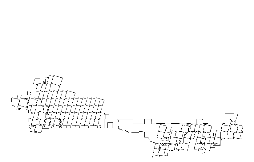
McElhanney Consulting Services Ltd (MCSL) has performed a LiDAR and Imagery survey in southern Saskatchewan. The acquisition was completed between the 16th and 25th of October, 2009. The survey consisted of approximately 790 square kilometers of coverage. While collecting the LiDAR data, we also acquired aerial photo in RGB and NIR modes consisting of 1649 frames each.