 Arctic SDI catalogue
The Geological Survey of Denmark and Greenland (GEUS)
Type of resources
Available actions
Topics
Keywords
Contact for the resource
Provided by
Formats
Representation types
Update frequencies
status
Scale
-
%20-%20datas%C3%A6t.jpg)
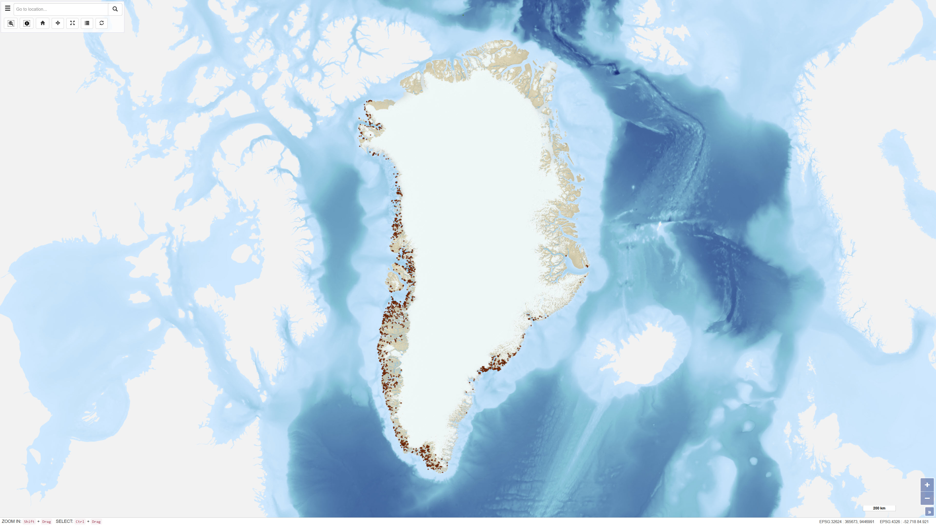
The topographic map of Greenland at a scale of 1:250.000 is based on data collected from the 1930s through the 1970s and 1980s. These data formed the basis for the production of a series of 1:250.000 scale topographic map sheets, which continue to serve as the primary topographic reference for large parts of Greenland. Mapping of areas prior to 1970 was based on several historical map series, including 18 map sheets at a scale of 1:300.000 covering North Greenland produced by Lauge Koch between 1932 and 1940, 1:250,000 scale mapping of parts of Northeast Greenland conducted by the Geodetic Institute in the 1930s, and complete national coverage at 1:250.000 produced by the American Army Map Service in the 1950s. The digital topographic map of North and Northeast Greenland has been produced by the Geological Survey of Denmark and Greenland (GEUS) since 1977, based on high-precision digital photogrammetry using aerial photographs. The dataset has primarily been used as a topographic reference for geological mapping at scales of 1:100.000 and 1:500.000.
-
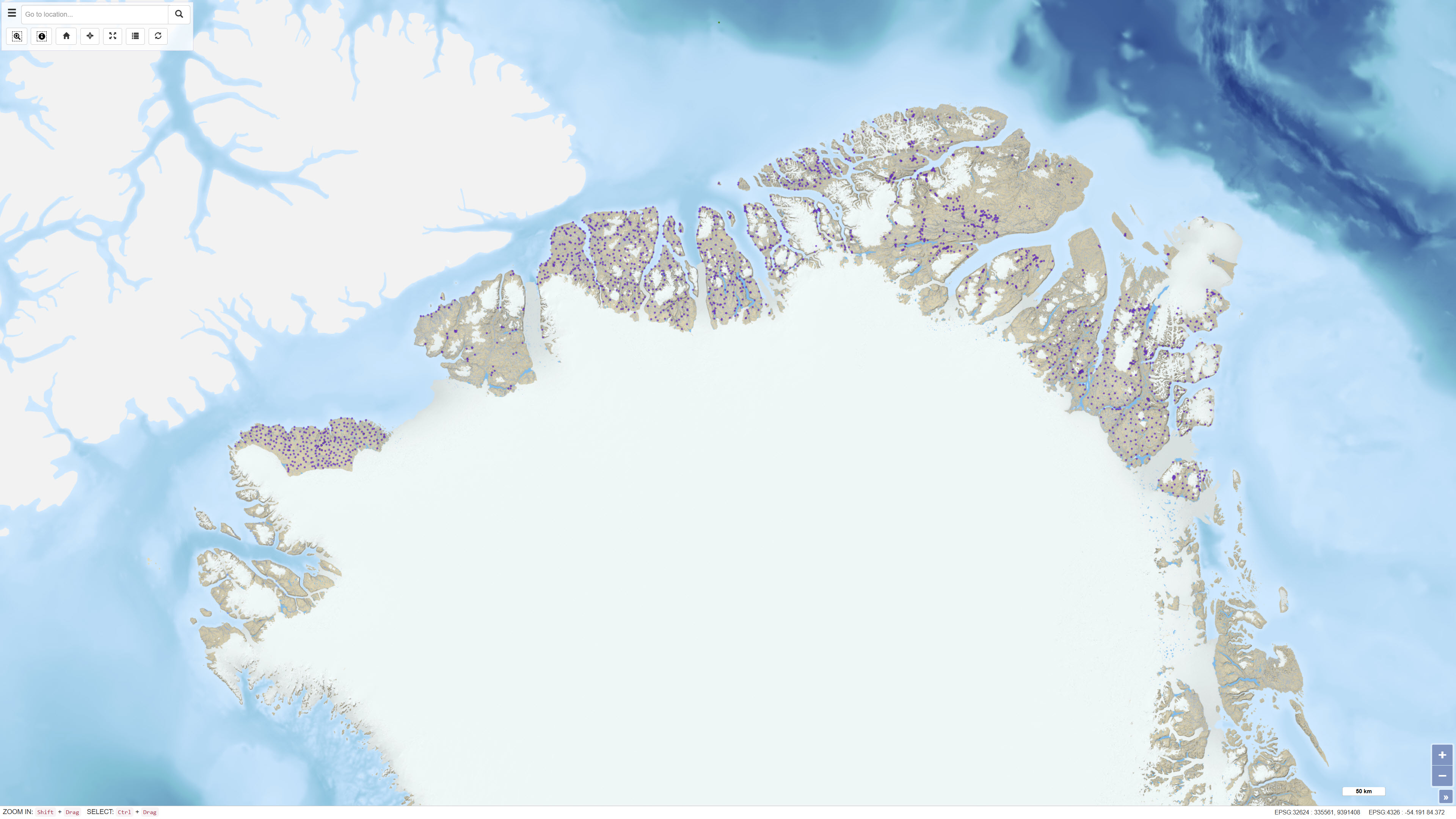
Ujarassiorit is Greenland’s national mineral hunt, a public competition open to residents of Greenland. The initiative encourages participants to collect and submit rock samples from anywhere in Greenland to the Ministry of Mineral Resources for geological evaluation. Submitted samples are assessed by geologists, and selected participants may be awarded prizes. The purpose of Ujarassiorit is to increase public awareness of Greenland’s mineral resources and to support mineral exploration by identifying areas of geological interest through public participation. The initiative contributes to the collection of geological information and promotes engagement with geoscience among the population.
-
The seabed sediment map shows the distribution of seabed sediments in Danish waters and represents an integrated interpretation of sediment types within the upper approximately 0.5 metres of the seabed. Sediment classes are defined based on grain-size composition and reflect an average of the surface sediments. Glacial till is classified as a mixed sediment, while sedimentary bedrock indicates areas where deposits several million years old are exposed on the seabed. The map was updated in 2020 and builds upon the previous version from 2014, with newly mapped areas added at full level of detail. The dataset provides a nationwide overview of seabed sedimentary conditions and is used, among other purposes, for raw material mapping, marine spatial planning, and environmental assessments.
-
This dataset comprises calibrated geochemical data from stream sediment and soil samples collected in North Greenland between 1978 and 1999, supplemented by extensive reanalyses in 2011. The dataset includes selected elements relevant for the evaluation of zinc mineralisation: CaO, K₂O, Ba, Cu, Sr and Zn. A total of 2,469 stream sediment samples and 204 soil samples were included. The analytical values represent the most reliable results following systematic quality control and calibration procedures designed to eliminate bias between analytical methods and analytical periods, as described in Thrane et al. (2011). All values below detection limit are coded as 0 in the dataset. The dataset supports regional assessment of geochemical patterns and mineral potential in North Greenland.
-
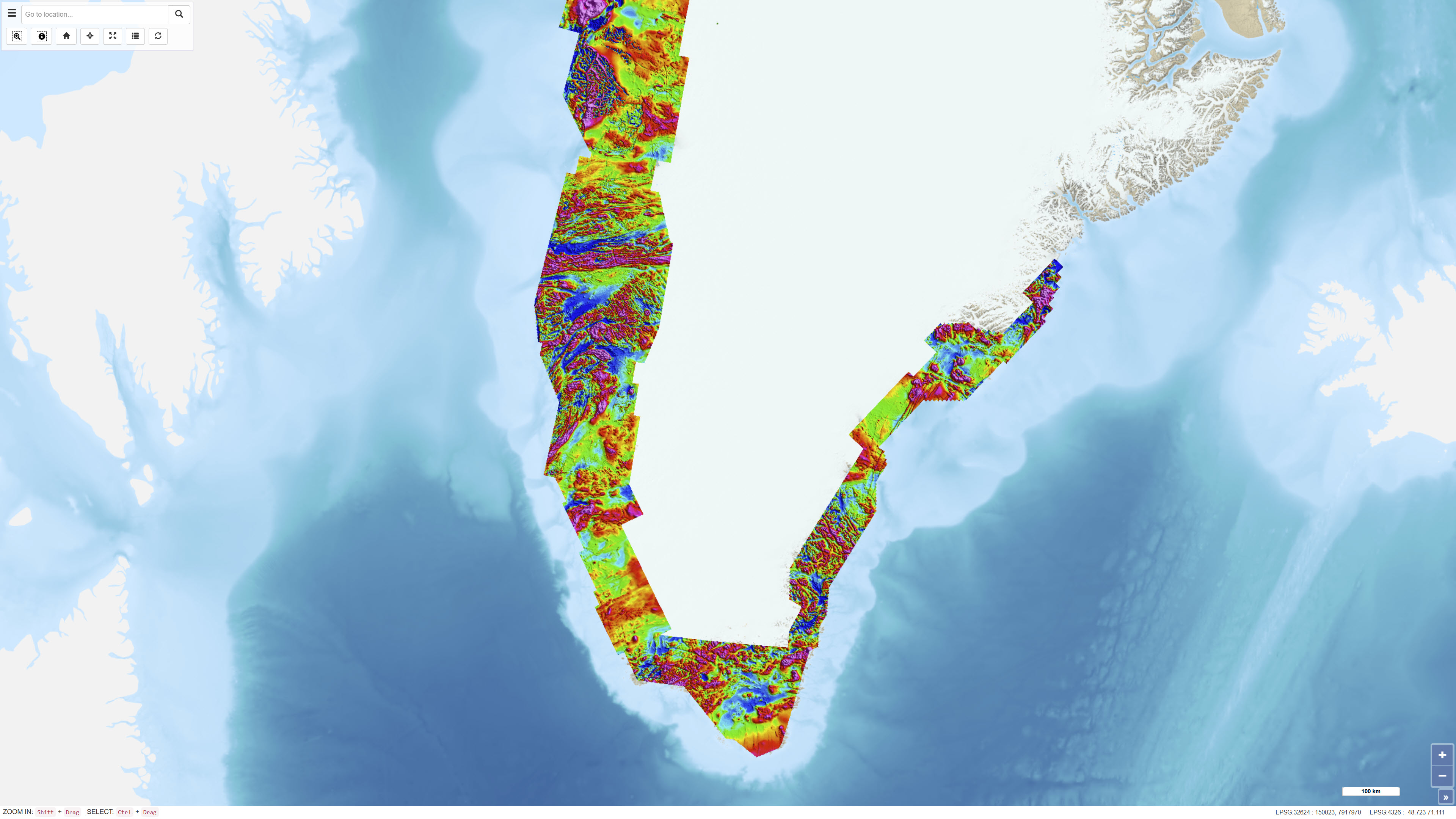
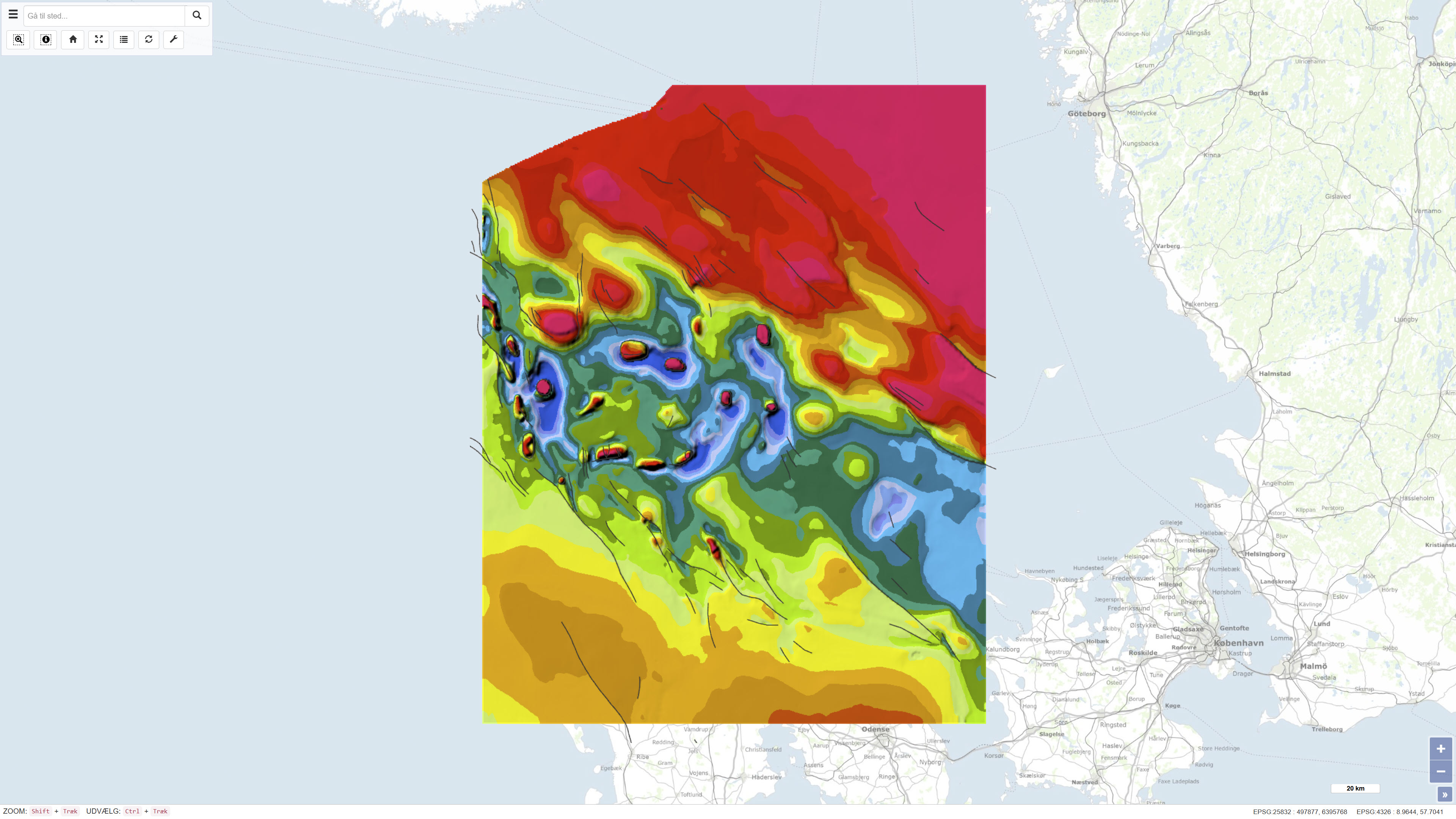
The Regional AEROMAG 1992–2013 Surveys comprise a compilation of high-resolution airborne magnetic surveys acquired by GGU/GEUS between 1993 and 2013 and financed by the Government of Greenland. The overlapping surveys cover approximately 300,000 km² and include the total ice-free onshore areas and near-coastal offshore regions of West Greenland, South Greenland and southern East Greenland. All surveys were acquired using aircraft with similar flight parameters, including line spacings of 500–1,000 m and cross-line spacing of approximately 5,000 m, and with flight altitudes of about 300 m above ground level or seafloor along gently draped surfaces. These consistent acquisition parameters allow the individual surveys to be integrated into a coherent, high-quality regional magnetic data compilation. The total magnetic anomaly map was generated by merging grids from separately processed datasets using the grid-knitting module in Oasis Montaj. The data are IGRF-corrected but not reduced to the pole, and the crustal magnetic field model MF7 was used as a regional reference grid during compilation.
-
%20-%20datas%C3%A6t.jpg)
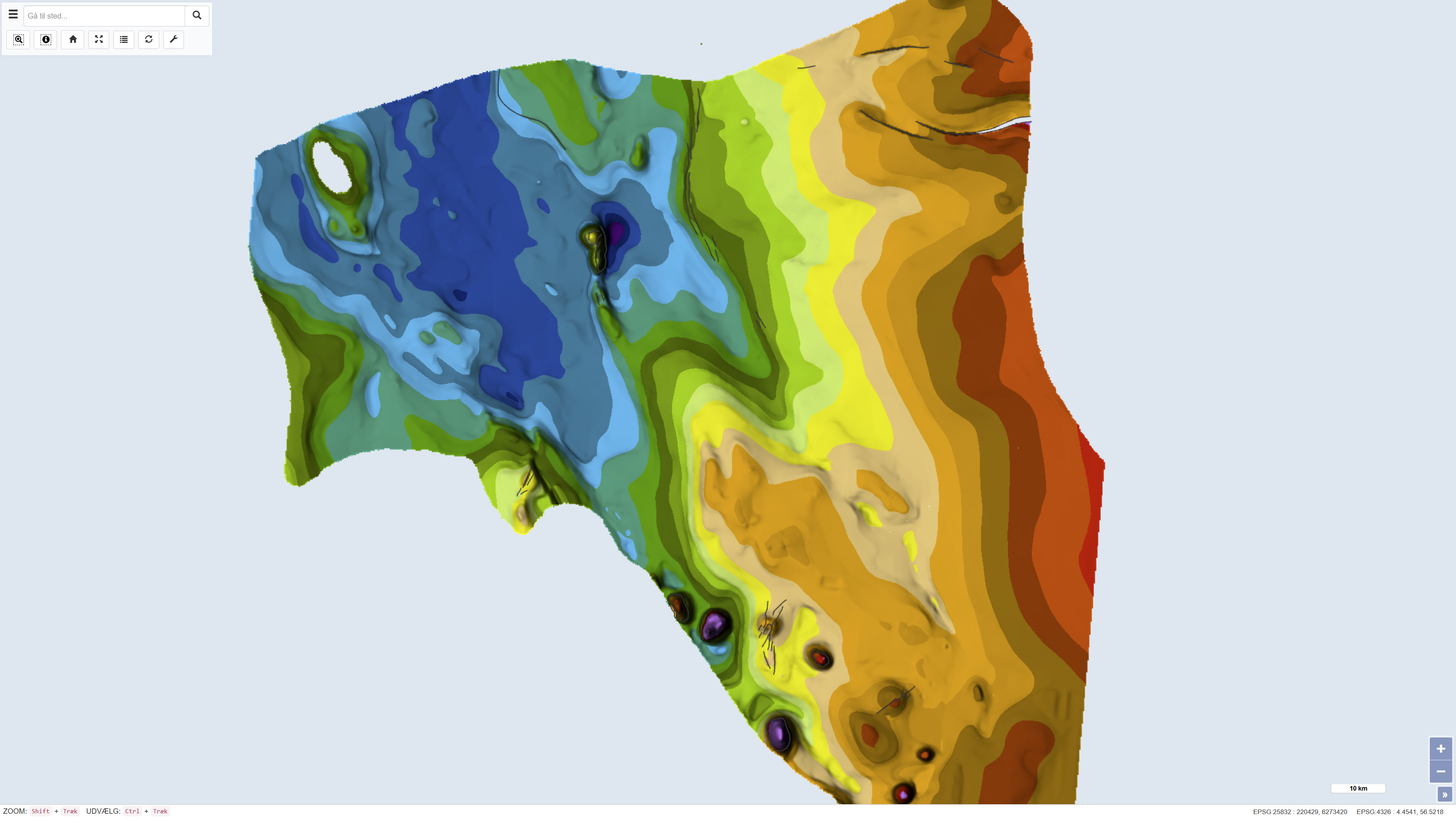
The dataset comprises airborne electromagnetic (AEM) measurements acquired in Greenland during 1994–1998 as part of GEUS’ regional geophysical mapping programme. The surveys were conducted using helicopter- and fixed-wing electromagnetic systems and include electromagnetic response measurements as well as magnetic data. The dataset is used for regional mapping of subsurface electrical conductivity and for identifying structural and lithological variations relevant to geological interpretation and mineral exploration.
-
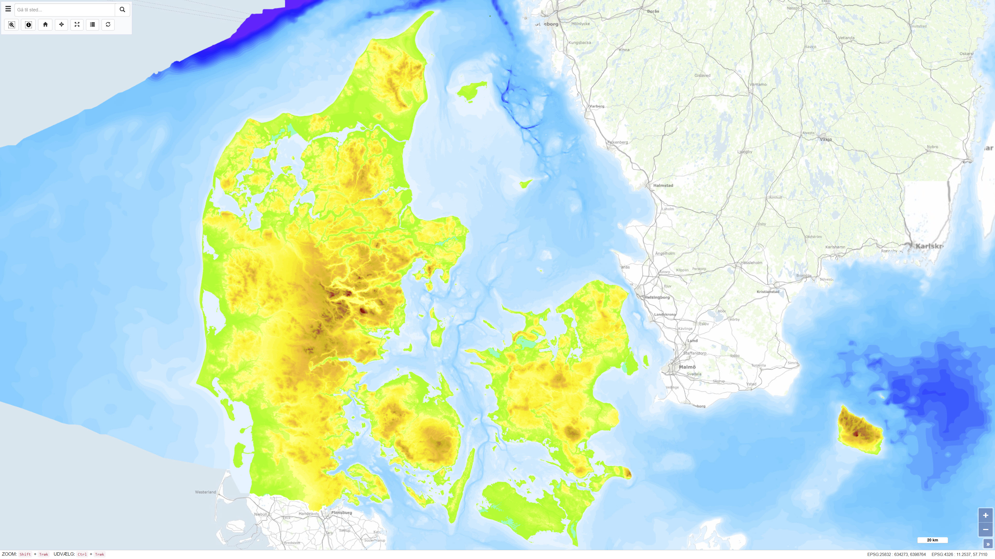
The Height and Depth Map of Denmark is a coherent map showing both land elevation above sea level and sea depth within the Danish area. The map is based on elevation and bathymetric data represented by 5-metre contour intervals closed to polygons and provides continuous coverage across the land–sea boundary. The dataset offers an integrated overview of terrain and bathymetry in Denmark and surrounding waters. The terrestrial elevation component is derived from topographic data suitable for use at scales down to approximately 1:25.000, while the bathymetric component is compiled from datasets of varying origin and resolution. The map was originally assembled around 1997, with subsequent updates to the Danish land areas carried out during 2005–2006. The dataset is primarily intended for regional visualisation and analysis.
-
The dataset comprises a geological map of the Danish Basin at a scale of 1:400,000 presenting regional thematic maps of the Base Chalk and the Chalk Group. The map was published in 1993 as part of the DGU Map Series no. 29 and was produced as part of regional geological mapping of the basin. The mapping is based on interpretation of seismic data supplemented by information from deep onshore and offshore boreholes. The dataset consists of several thematic sub-maps that together show the depth to the Base Chalk and the vertical thickness (isochore) of the Chalk Group. The map covers the Danish Basin and adjacent areas and was produced to support regional structural and stratigraphic interpretation.
-
The dataset comprises a geological map of the Danish Central Graben at a scale of 1:200,000 presenting regional maps of ‘Top Chalk’ and the Post-Chalk Group in terms of two-way travel time, depth and interval velocity. The map was published in 1995 as part of the DGU Map Series no. 47 and was produced as part of a comprehensive geological mapping of the Danish Central Graben. The mapping is based on interpretation of seismic data supplemented by information from boreholes. The map covers the Danish part of the Central Graben and parts of the eastern North Sea block, and adjacent areas in the Norwegian, British and German sectors are included where data were available in order to define regional structural relationships. The map sheet comprises several thematic sub-maps that together describe regional variations in structure and stratigraphy.
-
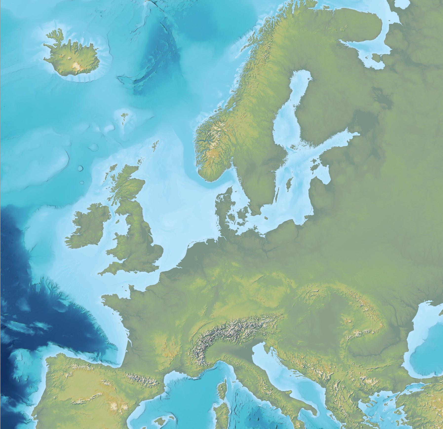
The dataset is an Imhof-inspired cartographic base map combining topography and bathymetry, covering European countries and adjacent marine areas. The map has been constructed by merging several existing digital elevation models, with topography primarily based on EU-DEM v1.1 and the Shuttle Radar Topography Mission (SRTM), and bathymetry derived from the General Bathymetric Chart of the Oceans (GEBCO). The dataset provides a continuous surface integrating land and marine areas and has been developed with a focus on visual quality and regional applications.