 Arctic SDI catalogue
inlandWaters
Type of resources
Available actions
Keywords
Contact for the resource
Provided by
Years
Formats
Representation types
Update frequencies
status
Service types
Scale
Resolution
-
Datamängd innehållande strandlinje, vattenytor, vattendrag, sankmark, glaciär, vattenfall, fors, sluss, damm, brygga, pir och kaj från grunddata anpassat till skalområde 1:10 000. Datamängden kan inte beställas separat utan ingår endast i befintliga tjänster: Basemap Visning, Inspire
-
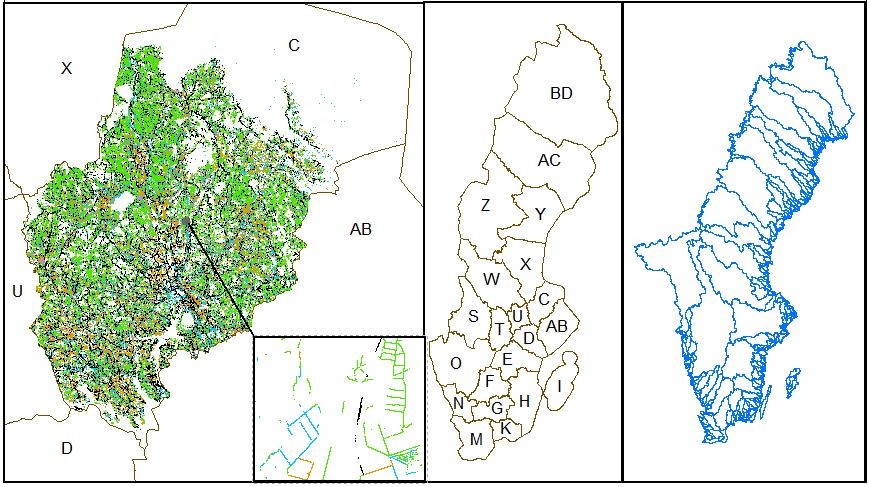
Skogsstyrelsens rikstäckande dikeskartering från november 2021 (rasterformat i 1 × 1 m upplösning) har attributsatts och är nu tillgänglig för nedladdning i vektorformat länsvis och per huvudavrinningsområde. Dikena har kategoriserats i följande fem klasser: vägdike, skogsdike, dike på öppen våtmark, dike på åkermark och övrigt dike med hjälp av buffrade vägytor (bearbetade av SCB 2020, ursprungligen från Trafikverket) och Nationella Marktäckedata (NMD) v1.1. Dikeskarteringen finns även som en bearbetad version, där bearbetningen har syftat till att öka konnektiviteten i analysen och felaktiga diken i hav och sjöar har rensats bort. Data finns tillgängligt för nedladdning i vektorformat nationellt, skiktet är ej attributsatt. Det har konstaterats att många naturliga vattendrag fallit ut som diken i den ursprungliga dikesmodellen och att skiktet därför inte enbart ska antas innehålla antropogena diken. Detta är särskilt ett problem i fjällen men förekommer även frekvent i resten av Sverige. Rensning av dessa diken har inte ingått i bearbetningarna. Dikeskartan är heller inte komplett då diken som inte fångats upp av laserskanningen inte kunnat karteras. Täckdiken och vägtrummor ingår inte i skiktet.
-

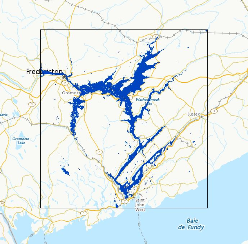
The “Non-contributing Portions of the Incremental Gross Drainage Areas of the AAFC Watersheds Project – 2013” dataset is a geospatial data layer containing polygon features representing the areas within each incremental gross drainage area of the Agriculture and Agri-Food Canada (AAFC) Watersheds Project that DO NOT contribute to average runoff. The Project is subdivided by hydrometric gauging station. The maximum area that could contribute runoff to each gauging station, less that of its upstream neighbour(s) is called an “incremental gross drainage area”. The “incremental gross drainage” areas can be subdivided into portions that either supply surface runoff to an average runoff, or do not. Those portions that are NOT part of the effective drainage area are called ‘non-contributing'.
-
Hydrography in the context of this data specification is involved with the description of the sea, lakes, rivers and other waters, with their phenomena and all hydrographic-related elements. For mapping purposes, it includes a representation of physical elements – both natural and artificial. For reporting requirements of EC water-related directives it includes WFD surface water bodies. For spatial analysis and modelling, it includes a topologically-sound network of rivers and canals.
-

Täckning över hela svenska kusten. Korten används vid angöring och navigering i kustnära farvatten samt som underlag vid planering. Skalan är vanligtvis 1:250 000.
-

Korten täcker stora delar av Sveriges sjöterritorium. De används för navigering i öppen sjö samt för översiktlig planering. Skalan är vanligtvis 1:500 000. Dessutom finns ett sjökort som täcker hela Sverige i skala 1:1 600 000.
-

River ice roughness products from the current calendar year in selected Canadian regions that have been designated for observation, monitored by Natural Resources Canada using satellite imagery for emergency response. Coverage is not comprehensive nationwide. In order to mitigate ice jam induced floods risks, Natural Resources Canada emergency geomatics service (EGS) may be activated by Canada’s emergency management authorities. As new satellite imagery becomes available, NRCan will produce river ice roughness maps and update the dataset in near real time (4 hours). This item contains record of the river ice roughness products generated in the current year. For the complete archive, please refer to the [River Ice in Canada - Archive](https://open.canada.ca/data/en/dataset/5e6b40bf-299f-4e05-87c8-d10b9c8210f9) entry. The river ice product is generated and validated on a best effort basis. Various factors may affect the quality of the river ice roughness maps. Those factors include but are not limited to: environmental condition at the time of acquisition, image resolution or the limitations of the methodology used. To view a specific product, filter the data by date (UTC Date) and area of interest (AOI). Links to download specific EGS product are available in the Resources section. Disclaimer: Emergency response authorities are the primary users of these satellite-derived river ice roughness map products. These products are generated to provide analysis and emergency response situational awareness and to facilitate decision-making during major flood events. The river ice roughness products are generated rapidly and limited time is available for editing and validation. The river ice roughness products reflect the river ice surface roughness conditions at the date/time of acquisition. While efforts are made to produce high quality products, near-real time products may contain errors due to the limited time available for validation and the limited availability of ground truthing data. Limitation of Liability: Accordingly, the information contained on this website is provided on an “as is” basis and Natural Resources Canada makes no representations or warranties respecting the information, either expressed or implied, arising by law or otherwise, including but not limited to, effectiveness, completeness, accuracy or fitness for a particular purpose. Natural Resources Canada does not assume any liability in respect of any damage or loss based on the use of this website. In no event shall Natural Resources Canada be liable in any way for any direct, indirect, special, incidental, consequential, or other damages based on any use of this website or any other website to which this site is linked, including, without limitation, any lost profits or revenue or business interruption. Parent Collection: - **[River Ice State in Canada - Cartographic Product Collection](https://open.canada.ca/data/en/dataset/d1fcb44f-5f86-4957-bdb4-e6fd1aa69283)**
-
Flood extent polygons from the current calendar year in selected Canadian regions that have been designated for observation, monitored by Natural Resources Canada using satellite imagery for emergency response. Coverage is not comprehensive nationwide. In response to large flood events, Natural Resources Canada (NRCan), for the provision of emergency geomatics services, may be activated by Canada’s emergency management protocols. As new satellite imagery becomes available, NRCan will extract flood extent polygons and update the dataset in near real time (4 hours). This item contains the flood products generated in the past year. For any data relating to previous years, please refer to the [Floods in Canada – Archive]( https://open.canada.ca/data/en/dataset/74144824-206e-4cea-9fb9-72925a128189) entry. Please note that the web mapping service may not display data if flood polygons have not been published by the EGS for the current year. The flood products generated are validated on a best effort basis. Various factors may affect the quality of the flood polygons. These factors include, but are not limited to, sensor type, image resolution, cloud cover or limitations of the flood polygon extraction method. In this layer, where possible, a symbology is applied to the flood polygons based on the underlying land use classification, or is simply unclassified and shows the raw flood extent. When using Web mapping services, to display a specific product, filter by date (UTC Date) and area of interest (AOI). Also, a link to download each product is available in the Resources section. This prepackaged and compressed product contains a Shape file, a PDF file and a KMZ file. Disclaimer : Emergency response authorities are the primary users of these satellite-derived open water flood extent map products. These products are generated to provide analysis and emergency response situational awareness and to facilitate decision-making during major flood events. The open water flood extent products are generated rapidly and limited time is available for editing and validation. The flood products reflect the open water flood conditions at the date/time of acquisition. While efforts are made to produce high quality products, near-real time products may contain errors due to the limited time available for vector editing and validation. Please note that current algorithms do not map flooded areas under the forest canopy and are not optimized for urban flood mapping. Limitation of Liability : Accordingly, the information contained on this website is provided on an “as is” basis and Natural Resources Canada makes no representations or warranties respecting the information, either expressed or implied, arising by law or otherwise, including but not limited to, effectiveness, completeness, accuracy or fitness for a particular purpose. Natural Resources Canada does not assume any liability in respect of any damage or loss based on the use of this website. In no event shall Natural Resources Canada be liable in any way for any direct, indirect, special, incidental, consequential, or other damages based on any use of this website or any other website to which this site is linked, including, without limitation, any lost profits or revenue or business interruption. Parent Collection: - **[Floods in Canada - Cartographic Product Collection](https://open.canada.ca/data/en/dataset/08b810c2-7c81-40f1-adb1-c32c8a2c9f50)**
-

Zones that represent areas of homogeneous hydrologic and geomorphological characteristics