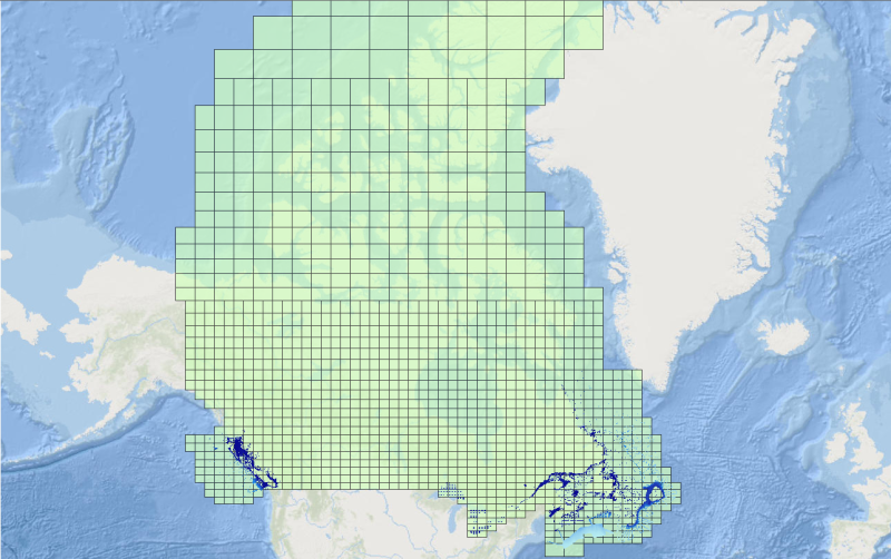
 Arctic SDI catalogue
Imagery base maps earth cover
Type of resources
Available actions
Topics
Keywords
Contact for the resource
Provided by
Years
Formats
Representation types
Update frequencies
status
Service types
Scale
Resolution
-

The “Soils of Canada, Derived” national scale thematic datasets display the distribution and areal extent of soil attributes such as drainage, texture of parent material, kind of material, and classification of soils in terms of provincial Detailed Soil Surveys (DDS) polygons, Soil Landscape Polygons (SLCs), Soil Order and Great Group. The relief and associated slopes of the Canadian landscape are depicted on the local surface form thematic dataset. The purpose of the “Soils of Canada, Derived” series is to facilitate the cartographic display and basic queries of the Soil Landscapes of Canada at a national scale. For more detailed or sophisticated analysis, users should investigate the full “Soil Landscapes of Canada” product.
-

This is a Mosaic of Canada which is made from 121 images captured by Canadian satellite RADARSAT-2. These images were acquired from May 1, 2013 to June 1, 2013. The color variation represents the changes in soil texture, roughness and the level of soil moisture. (Credit: RADARSAT-2 Data and Products © MacDonald, Dettwiler and Associates Ltd. (2013) - All Rights Reserved. RADARSAT is an official mark of the Canadian Space Agency.)
-

Portions of Universal Transverse Mercator Zones 7 - 12 which cover British Columbia, Northern Hemisphere only, formed into polygons, in BC Albers projection
-

McElhanney Consulting Services Ltd (MCSL) has performed a LiDAR and Imagery survey in southern Saskatchewan. The purpose was to generate DEMs for hydraulic modeling of floodplain, digital terrain maps, and other products for portions of the Swift Current Creek valley and other miscellaneous tributaries and related water course valleys in and around the City of Swift Current. The acquisition was completed between the 16th and 25th of October, 2009. The survey consisted of approximately 790 square kilometers of coverage. While collecting the LiDAR data, we also acquired aerial photo in RGB and NIR modes consisting of 1649 frames each. In addition to the main area of interest, McElhanney has acquired some LiDAR and photo of low lying areas adjacent to the project area. This additional area was acquired on speculation that the data may be required in the future. The 3Dimensional laser returns (point cloud) were classified using Microstation (v8), Terrascan and TerraModeler. A series of algorithms based on topography were created to separate laser returns that hit the ground from the ones that hit objects above the ground. Steps taken are: Classified LiDAR surface as Bare earth, Classified other features as non-bare earth or default, Formatted to ASPRS .LAS V1.1 (Class 1 - Default (non-bare earth), Class 2 – Ground points (bare earth)), 239 tiles each 2km x2km generated for LiDAR data, File prefix FF – Classified (Non-Bare Earth and Bare Earth), File Prefix BE – Bare Earth only, Bare Earth Model Key Point (MKPts) surface files are thinned Bare earth LiDAR points. MKPts files generate a virtually identical surface without the large file size, MKPts file format is ASCII (Easting Northing Z-elevation) xyz and LAS format.
-

Data include a collection of annual land cover maps derived from MODIS 250 m spatial resolution remotely sensed imagery for the period 2000 to 2011. Processing of the time series was designed to reduce the occurrence of false change between maps. The method was based on change updating as described in Pouliot et al. (2011, 2013). Change detection accounted for both abrupt changes such as forest harvesting and more gradual changes such as recurrent insect defoliation. To determine the new label for a pixel identified as change, an evidential reasoning approach was used to combine spectral and contextual information. The 2005 MODIS land cover of Canada at 250 m spatial resolution described in Latifovic et al. (2012) was used as the base map. It contains 39 land cover classes, which for time series development was considered too detailed and was reduced to 25 and 19 class versions. The 19 class version corresponds to the North America Land Change Monitoring System (NALCMS) Level 2 legend as described in Latifovic et al. (2012). Accuracy assessment of time series is difficult due to the need to assess many maps. For areas of change in the time series accuracy was found to be 70% based on the 19 class thematic legend. This time series captures the spatial distribution of dominant land cover transitions. It is intended for use in modeling, development of remote sensing products such as leaf area index or land cover based albedo retrievals, and other exploratory analysis. It is not appropriate for use in any rigorous reporting or inventory assessments due to the accuracy of the land cover classification and uncertainty as to the capture of all relevant changes for an application. NOTE: To see this entire product in the map viewer, use a base map in the "World" section (EPSG: 3857).
-
This layer represents Land use polygons as determined by a combination of analytic techniques, mostly using Landsat 5 image mosaics . BTM 1 was done on a federal satellite image base that was only accurate to about 250m. The images were geo-corrected, not ortho-corrected, so there is distortion in areas of high relief. This is not a multipart feature
-
CHS offers 500-metre bathymetric gridded data for users interested in the topography of the seafloor. This data provides seafloor depth in metres and is accessible for download as predefined areas.
-

Data include a collection of annual land cover maps derived from MODIS 250 m spatial resolution remotely sensed imagery for the period 2000 to 2011. Processing of the time series was designed to reduce the occurrence of false change between maps. The method was based on change updating as described in Pouliot et al. (2011, 2013). Change detection accounted for both abrupt changes such as forest harvesting and more gradual changes such as recurrent insect defoliation. To determine the new label for a pixel identified as change, an evidential reasoning approach was used to combine spectral and contextual information. The 2005 MODIS land cover of Canada at 250 m spatial resolution described in Latifovic et al. (2012) was used as the base map. It contains 39 land cover classes, which for time series development was considered too detailed and was reduced to 25 and 19 class versions. The 19 class version corresponds to the North America Land Change Monitoring System (NALCMS) Level 2 legend as described in Latifovic et al. (2012). Accuracy assessment of time series is difficult due to the need to assess many maps. For areas of change in the time series accuracy was found to be 70% based on the 19 class thematic legend. This time series captures the spatial distribution of dominant land cover transitions. It is intended for use in modeling, development of remote sensing products such as leaf area index or land cover based albedo retrievals, and other exploratory analysis. It is not appropriate for use in any rigorous reporting or inventory assessments due to the accuracy of the land cover classification and uncertainty as to the capture of all relevant changes for an application.
-

The MODIS Surface Albedo and Surface Reflectance Dataset (or simply Albedo) includes times series of 10-day composite products derived at 250-m spatial resolution over Canadian territory and neighboring areas produced at the Canada Centre for Remote Sensing (CCRS) since February 2000.The datasets contain spectral and broadband reflectance’s and albedo for MODIS bands B1-B7 designed primarily for land applications. The imagery for all spectral bands was downscaled and re-projected into the Lambert Conformal Conic (LCC) projection at 250-m spatial resolution. The area size is 5,700 km × 4,800 km. The specialized MODIS processing system was developed at CCRS to fully utilize the high quality of MODIS L2 swath imagery over the northern latitudes. As such, the CCRS Albedo product is different from the standard NASA product. The differences are related to temporal and spatial scaling, shape of kernel functions employed to fit data, as well as details of scene identification, atmospheric correction, and data fitting methodology.
-

This land cover data set was derived from the Advanced Very High Resolution Radiometer (AVHRR) sensor operating on board the United States National Oceanic and Atmospheric Administration (NOAA) satellites. Information on the NOAA series of satellites can be found at www.noaa.gov/satellites.html The vegetation and land cover information set has been classified into twelve categories. Information on the classification of the vegetation and land cover, raster to vector conversion, generalization for cartographic presentations is included in the paper "The Canada Vegetation and Land Cover: A Raster and Vector Data Set for GIS Applications - Uses in Agriculture" (https://geogratis.cgdi.gc.ca/download/landcover/scale/gis95ppr.pdf). A soil quality evaluation was obtained by cross-referencing the AVHRR information with Census of Agriculture records and biophysical (Soil Landscapes of Canada) data and is also included in the above paper. AVHRR Land Cover Data approximates a 1:2M scale and was done originally for Agriculture Canada. The projection used is Lambert Conformal Conic (LCC) 49/77 with origin at 49N 95W.