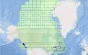
 Arctic SDI catalogue
Imagery base maps earth cover
Type of resources
Available actions
Topics
Keywords
Contact for the resource
Provided by
Years
Formats
Representation types
Update frequencies
status
Service types
Scale
Resolution
-

-

-

-

This is a Mosaic of Canada which is made from 121 images captured by Canadian satellite RADARSAT-2. These images were acquired from May 1, 2013 to June 1, 2013. The color variation represents the changes in soil texture, roughness and the level of soil moisture. (Credit: RADARSAT-2 Data and Products © MacDonald, Dettwiler and Associates Ltd. (2013) - All Rights Reserved. RADARSAT is an official mark of the Canadian Space Agency.)
-

-

The “Soils of Canada, Derived” national scale thematic datasets display the distribution and areal extent of soil attributes such as drainage, texture of parent material, kind of material, and classification of soils in terms of provincial Detailed Soil Surveys (DDS) polygons, Soil Landscape Polygons (SLCs), Soil Order and Great Group. The relief and associated slopes of the Canadian landscape are depicted on the local surface form thematic dataset. The purpose of the “Soils of Canada, Derived” series is to facilitate the cartographic display and basic queries of the Soil Landscapes of Canada at a national scale. For more detailed or sophisticated analysis, users should investigate the full “Soil Landscapes of Canada” product.
-
CHS offers 500-metre bathymetric gridded data for users interested in the topography of the seafloor. This data provides seafloor depth in metres and is accessible for download as predefined areas.
-

Mackenzie Valley Air Photo Digital Orthotiles
-
IBL - Imagery, basemaps, and land cover (imageryBaseMapsEarthCover) Basemaps. For example, resources describing land cover, topographic maps, and classified and unclassified images
-

The “Land Cover for Agricultural Regions of Canada, circa 2000” is a thematic land cover classification representative of Circa 2000 conditions for agricultural regions of Canada. Land cover is derived from Landsat5-TM and/or 7-ETM+ multi-spectral imagery by inputting imagery and ground reference training data into a Decision-Tree or Supervised image classification process. Object segmentation, pixel filtering, and/or post editing is applied as part of the image classification. Mapping is corrected to the GeoBase Data Alignment Layer. National Road Network (1:50,000) features and other select existing land cover products are integrated into the product. UTM Zone mosaics are generated from individual 30 meter resolution classified scenes. A spatial index is available indicating the Landsat imagery scenes and dates input in the classification. This product is published and compiled by Agriculture and Agri-Food Canada (AAFC), but also integrates products mapped by other provincial and federal agencies; with appropriate legend adaptations. This release includes UTM Zones 9, 10, 11, 12, 13, 14, 15, 16, 17, 18, 19, 20, 21, and 22 for corresponding agricultural regions in Newfoundland, Prince Edward Island, Nova Scotia, New Brunswick, Québec, Ontario, Manitoba, Saskatchewan, Alberta and British Columbia covering approximately 370,000,000 hectares of mapped area. Mapped classes include: Water, Exposed, Built-up, Shrubland, Wetland, Grassland, Annual Crops, Perennial Crops and Pasture, Coniferous, Deciduous and Mixed forests. However, emphasis is placed on accurately delineating agricultural classes, including: annual crops (cropland and specialty crops like vineyards and orchards), perennial crops (including pastures and forages), and grasslands.