 Arctic SDI catalogue
Type of resources
Categories
Available actions
Topics
Keywords
Contact for the resource
Provided by
Years
Formats
Representation types
Update frequencies
status
Service types
Scale
Resolution
-
The National Ecological Framework for Canada provides a consistent, national spatial framework that allows various ecosystems to be described, monitored and reported on. It provides standard ecological units that allow different jurisdictions and disciplines to use common communication and reporting, and a common ground to report on the state of the environment and the sustainability of ecosystems in Canada. The framework was developed between 1991 and 1999 by the Ecosystems Science Directorate, Environment Canada and the Center for Land and Biological Resources Research, Agriculture and Agri-Food Canada. Over 100 federal and provincial agencies, non-governmental organizations and private sector companies contributed to its development.
-
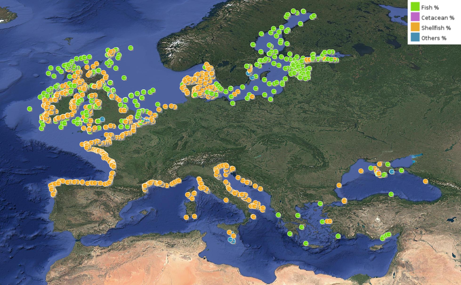
This product displays for Mercury, positions with percentages of all available data values per group of animals that are present in EMODnet regional contaminants aggregated datasets, v2024. The product displays positions for all available years.
-

Vegagerðin annast rekstur landsvitakerfisins og hefur umsjón og eftirlit með uppbyggingu hafnarvita og innsiglingarmerkja. Landsvitar eru til leiðbeiningar á almennum siglingaleiðum og eru í eigu og umsjá ríkisins en hafnarvitar, sem vísa leið inn til hafnar eða eru innan hafnsögu hafnar, eru í eigu og umsjá sveitarfélaga. Landsvitakerfið samanstendur af 104 ljósvitum, 11 siglingaduflum og 16 radarsvörum sem er komið fyrir þar sem landslagi er þannig háttað að erfitt er að ná fram endurvarpi á ratsjá skipa. Hafnarvitakerfið er byggt upp af tæplega 20 ljósvitum, um 90 innsiglingarljósum á garðsendum og bryggjum, rúmlega 80 leiðarljósalínum og tæplega 50 baujum er vísa leið í innsiglingum að höfnum. Viðhald og eftirlit Vegagerðarinnar með vitum landsins skiptist í stórum dráttum í eftirlit með ljósabúnaði og viðhald á vitabyggingum.
-

This dataset provides 1/36-degree monthly-mean ocean current climatology (April - September) in the Northeast Pacific. The climatological fields are derived from hourly ocean currents for the period from 1993 to 2020, simulated using a high-resolution Northeast Pacific Ocean Model (NEPOM).
-
Thermal Conductivity Observations provided by the Canadian Geothermal Data Compilation for Canada
-
Grense for marka rundt Oslo
-
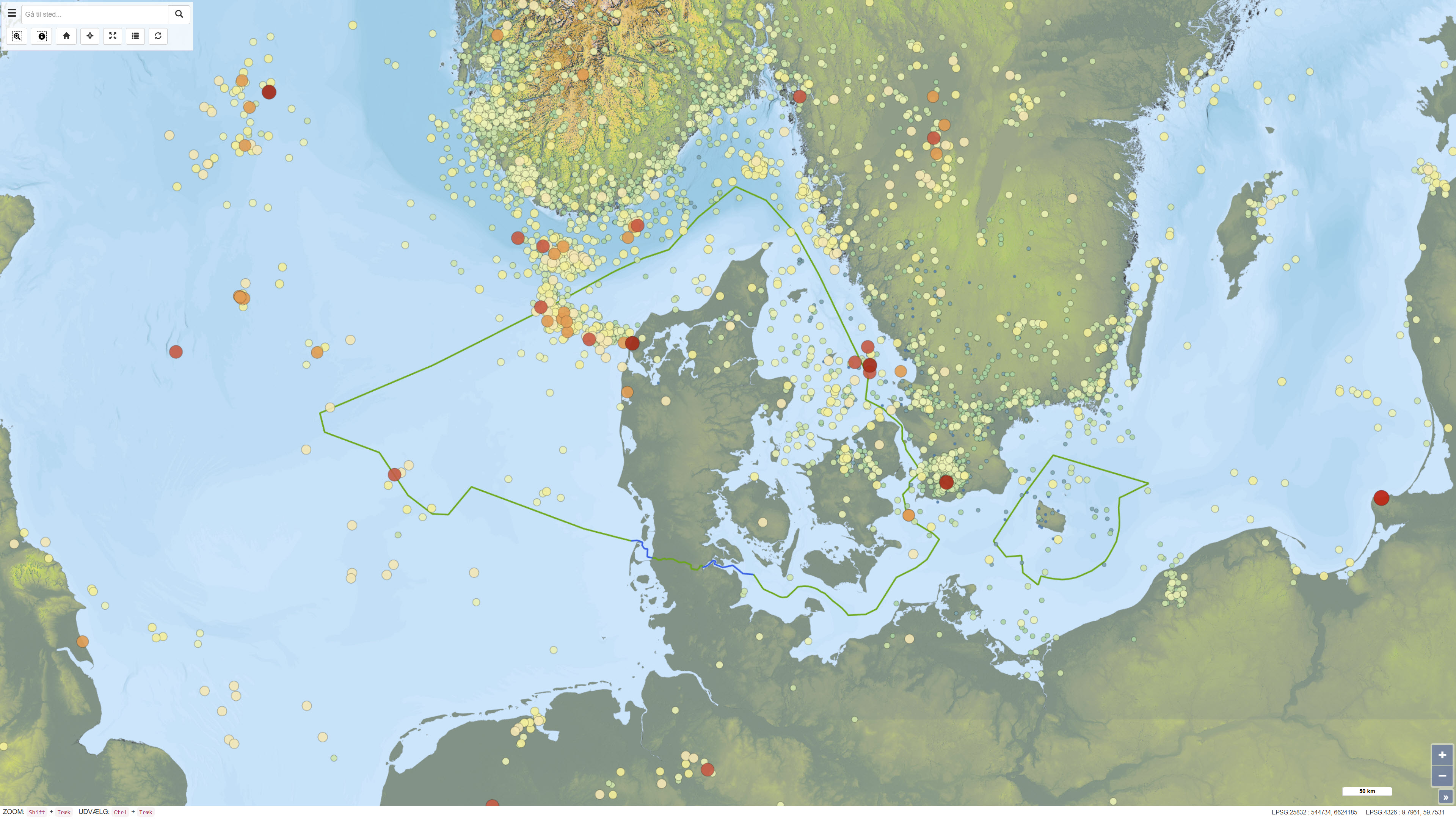
This dataset provides a national overview of all registered earthquakes in Denmark, including time, location, depth and magnitude. The recordings are based on data from GEUS’ national seismic network and comprise both measured earthquakes and subsequently quality-assured observations. The dataset is continuously updated and reflects the best scientific assessment of seismic activity in Denmark, where improved instrumentation and analysis today allow detection of much weaker tremors than historically.
-

The Share of Built-Up Change (SBUC) 2018-2021 layer is part of the High Resolution Layer (HRL) Imperviousness and contains the change of built-up per pixel (increase or decrease in percentage) as derived from the difference between the Impervious Built-Up (IBU) status layers for the reference years 2018 and 2021, in an aggregated version of 100m spatial resolution. The production of the HRL Imperviousness is coordinated by EEA in the frame of Copernicus, the Earth observation component of the European Union’s Space programme. The product is a raster dataset with 100-meter grid spacing (spatial resolution) that covers the 38 Eionet member and cooperating countries as well as the United Kingdom (i.e. EEA38+UK). It is distributed as 100 x 100 km tiles that are fully conformant with the EEA reference grid.
-

The Imperviousness Density (IMD) 2021 with a 100m pixel resolution, is part of the High Resolution Layer (HRL) Imperviousness and contains the approximate density of artificial sealing per pixel (range: 0-100%) for the reference year 2021 as derived from a pixel aggregation of the Imperviousness Density (IMD) 2021 (10m) layer. The production of the HRL Imperviousness is coordinated by EEA in the frame of Copernicus, the Earth observation component of the European Union’s Space programme. The product is a raster dataset with 100-meter grid spacing (spatial resolution) that covers the 38 Eionet member and cooperating countries as well as the United Kingdom (i.e. EEA38+UK). It is distributed as 100 x 100 km tiles that are fully conformant with the EEA reference grid.
-

The Remote Communities Energy Database is a public resource that provides pertinent factual information about the generation and use of electricity and other energy sources for all remote communities in Canada. Communities are identified as remote communities if they are not currently connected to the North-American electrical grid nor to the piped natural gas network; and is a permanent or long-term (5 years or more) settlement with at least 10 dwellings. The Remote Communities Energy Database is the only national data source on energy in remote communities that is publically available on one centralized site. The Remote Communities Energy Database allows users to search and conduct analyses of remote communities and their energy context. Users are also able download the data from the Remote Communities Energy Database dataset in CSV (i.e., excel compatible) format. This data is collected from a number of sources including the remote communities themselves, local utilities, provincial and territorial government’s, Indigenous and Northern Affairs Canada (INAC), Statistics Canada, Natural Resources Canada (NRCan) and various other stakeholders.